close
-
Layers w
- Weather Layers
- Pro
- Pro
- Pro
- Pro
- Pro
- Pro
- More Layers
- Pro
- Pro
- Pro
- Pro
-
Upgrade to

3D
Trail Conditions
- Unknown
- Snow Groomed
- Snow Packed
- Snow Covered
- Snow Cover Partial
- Freeze/thaw Cycle
- Icy
- Prevalent Mud
- Wet
- Variable
- Ideal
- Dry
- Very Dry
Trail Flow (Ridden Direction)
Trailforks scans users ridelogs to determine the most popular direction each trail is ridden. A good flowing trail network will have most trails flowing in a single direction according to their intension.
The colour categories are based on what percentage of riders are riding a trail in its intended direction.
The colour categories are based on what percentage of riders are riding a trail in its intended direction.
- > 96%
- > 90%
- > 80%
- > 70%
- > 50%
- < 50%
- bi-directional trail
- no data
Trail Last Ridden
Trailforks scans ridelogs to determine the last time a trail was ridden.
- < 2 days
- < 1 week
- < 2 weeks
- < 1 month
- < 6 months
- > 6 months
Trail Ridden Direction
The intended direction a trail should be ridden.
- Downhill Only
- Downhill Primary
- Both Directions
- Uphill Primary
- Uphill Only
- One Direction
Contribute Details
Colors indicate trail is missing specified detail.
- Description
- Photos
- Description & Photos
- Videos
Trail Popularity ?
Trailforks scans ridelogs to determine which trails are ridden the most in the last 9 months.
Trails are compared with nearby trails in the same city region with a possible 25 colour shades.
Think of this as a heatmap, more rides = more kinetic energy = warmer colors.
- most popular
- popular
- less popular
- not popular
ATV/ORV/OHV Filter
Max Vehicle Width
inches
US Cell Coverage
Legend

Radar Time
Activity Recordings
Trailforks uses anonymized public activity data.
?
Activity Recordings
Trailforks uses anonymized public activity data.
?
Personal Heatmap
▶
Activity Types
all
/
none
▶
Options
2
Date range
month
–
Winter Trails
Warning
A routing network for winter maps does not exist. Selecting trails using the winter trails layer has been disabled.
Missing Trails
Most Popular
Least Popular
Trails are colored based on popularity. The more popular a trail is, the more red. Less popular trails trend towards green.
Jump Magnitude Heatmap
Heatmap of where riders jump on trails. Zoom in to see individual jumps, click circles to view jump details.
BC Backroad Status
![map legend]()
Service Road Atlas is a free to use, community-driven service for viewing and creating reports on the numerous back-country service roads around B.C. and Alberta.

Slope Aspect
Direction the slope faces
Trails Deemphasized
Trails are shown in grey.
Only show trails with no bike usage.
Suggested Layers
Based on selected activity type
Save the current map location and zoom level as your default home location whenever this page is loaded.
SaveVaqarri lies southwest of Tirana about 6 km away. The Vaqarr territory is bordered by Kashar to the north, Ndroq to the west, Peza and Baldushk to the south, and Farka to the east. The inhabitants of the area are mainly engaged in agriculture and livestock and a minority of handicrafts such as wood carving, embroidery, etc. The villages are plain, where the inhabitants in their properties cultivate different agricultural crops such as fodder, cereals, vegetables of different types. A good part of the inhabitants are also engaged in animal husbandry with cattle breeding and the sale of milk and its by-products. The geographical position of the villages is plain and hilly where the average altitude is about 150 m above sea level
Primary Trail Type: All-Mountain & Downhill
eBikes Allowed:
Yes
Activities Click to view
- Mountain Bike
40 trails
- E-Bike
39 trails
- Horse
25 trails
- Hike
40 trails
- Trail Running
41 trails
- Dirtbike/Moto
19 trails
- Observed Trials
5 trails
- ATV/ORV/OHV
13 trails
Region Details
- 8
- 3
- 7
- 22
Region Status
Caution as of Jun 5, 2026Stats
- Avg Trail Rating
- Trails (view details)
- 41
- Trails Mountain Bike
- 40
- Trails E-Bike
- 39
- Trails Horse
- 25
- Trails Hike
- 40
- Trails Trail Running
- 41
- Trails Dirtbike/Moto
- 19
- Trails Observed Trials
- 5
- Trails ATV/ORV/OHV
- 13
- Total Distance
- 58 miles
- Total Descent Distance
- 28 miles
- Total Descent
- 12,614 ft
- Total Vertical
- 1,246 ft
- Highest Trailhead
- 1,415 ft
- Reports
- 7
- Photos
- 317
- Ridden Counter
- 23
Popular Vaqarr Mountain Biking Trails
• 5 ★ 4.0 • 4,521 ft • 253 ft • 2 •
Less popular blue difficulty singletrack. This mountain bike primary trail can be used both directions and has a moderate overall physical rating with a 253 ft blue climb. It features berm. Trail visibility is always easy to follow.
• 5 ★ 5.0 • 2,238 ft • 15 ft • 2 •
Classic single-track descent with loose rock, gravel and high probability of four-legged obstacles climbing towards you as you drop.
• 5 ★ 5.0 • 4,993 ft • 55 ft • 2 •
Less popular blue difficulty alpine primitive. This mountain bike primary trail can be used downhill only and has a moderate overall physical rating. It features a-frame, berm, drop, jump and other. Trail visibility is always easy to follow. On average it takes 7 minutes to complete this trail.
• 5 ★ 0.0 • 2 miles • 576 ft • 2 •
Less popular white difficulty mixed. This multi-use trail can be used both directions and has a moderate overall physical rating with a 576 ft blue climb. It features berm and other. Trail visibility is always easy to follow. On average it takes 56 minutes to complete this trail.
• 5 ★ 0.0 • 2,867 ft • 24 ft • 2 •
Less popular blue difficulty singletrack. This multi-use trail can be used downhill primary and has a moderate overall physical rating. It features berm. Trail visibility is always easy to follow. On average it takes 9 minutes to complete this trail.
• 5 ★ 4.0 • 1,099 ft • 0 ft • 1 •
Less popular blue difficulty alpine primitive. This mountain bike primary trail can be used downhill only and has a moderate overall physical rating. It features a-frame, berm, bridge, drop, jump, rock face and other. Trail visibility is no clear path. On average it takes 6 minutes to complete this trail.
• 5 ★ 4.0 • 2,946 ft • 0 ft • 1 •
Less popular blue difficulty alpine wilderness trail. This multi-use trail can be used downhill only and has a moderate overall physical rating. It features a-frame, berm, drop, jump and other. Trail visibility is sometimes hard to follow.
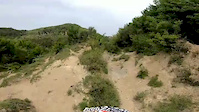
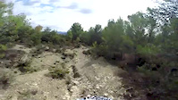
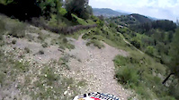
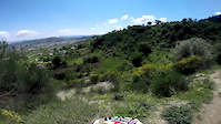
Photos of Vaqarr Mountain Bike
Videos of Vaqarr Mountain Bike
trail: Kodra e Kulës trail
0:37 |
33 |
Jun 8, 2020
trail: Boga Trail
0:57 |
35 |
Mar 15, 2019
trail: Prush trail
0:56 |
29 |
Mar 13, 2019
trail: Prush Trail
0:01 |
40 |
Mar 6, 2019
Current Trail Warnings
| status | trail | date | condition | user | info |
|---|---|---|---|---|---|
| Rezervuari i Sharrës Trail | Jun 5, 2026 @ 1:23pm (Europe/Tirane) Jun 5, 2026 | Unknown | SiggiMTB95 | Overgrown. |
Recent Trail Reports
| status | trail | date | condition | info | user |
|---|---|---|---|---|---|
| Lower Picallë Trail | Jun 17, 2022 @ 1:05pm Jun 17, 2022 | Unknown | andiqyqja TRAILFORKS | ||
| Bunker Trail | Nov 26, 2021 @ 12:34am Nov 26, 2021 | Unknown | andiqyqja TRAILFORKS | ||
| Bërzeze-Allgjatë | Oct 28, 2021 @ 10:45am Oct 28, 2021 | Dry | andiqyqja TRAILFORKS | ||
| Prush trail | Jun 2, 2021 @ 11:42pm Jun 2, 2021 | Unknown | andiqyqja TRAILFORKS | ||
| Prush Trail | Jun 2, 2021 @ 11:36pm Jun 2, 2021 | Dry | andiqyqja TRAILFORKS |
Activity Feed
| username | action | type | title | date |
|---|---|---|---|---|
| SiggiMTB95 | add | report | activity #96285641 | Jun 5, 2026 @ 4:23am Jun 5, 2026 |
| AlphaGolfIndia1kNYLc | wishlist | trail | activity #91711353 and 3 more | Apr 1, 2026 @ 9:15am Apr 1, 2026 |
| Schoppaaa | wishlist | region | activity #66788299 | Feb 25, 2025 @ 1:29pm Feb 25, 2025 |
| chrishimself | wishlist | trail | activity #58967337 | Sep 16, 2024 @ 6:57am Sep 16, 2024 |
| andiqyqja | update | trail | activity #55746813 | Jul 16, 2024 @ 3:20pm Jul 16, 2024 |
Recent Comments
| username | type | title | comment | date |
|---|---|---|---|---|
| trail | Not suitable for any kind of mountain biking. | Jun 9, 2024 @ 12:33pm Jun 9, 2024 | ||
| trail | Beautiful Hiked in winter- good for bike when dry | Jan 1, 2021 @ 4:41am Jan 1, 2021 |
Nearby Areas
| name | distance | ||||
|---|---|---|---|---|---|
| Selita e Vogel | 1 | 1 km | |||
| Grand Park of Tirana | 12 | 9 | 2.9 km | ||
| Lalm | 6 | 9 | 3 km | ||
| Farkë | 13 | 9 | 3.2 km | ||
| Baldushk | 1 | 9 | 3.6 km |
Local Badges
-

Completionist0 awarded
Activity Type Stats
| activitytype | trails | distance | descent | descent distance | total vertical | rating | global rank | state rank | photos | reports | routes | ridelogs |
|---|---|---|---|---|---|---|---|---|---|---|---|---|
| Mountain Bike | 40 | 56 miles | 12,323 ft | 27 miles | 1,247 ft | #1,497 | #3 | 317 | 7 | 22 | ||
| E-Bike | 39 | 56 miles | 12,018 ft | 27 miles | 1,247 ft | #715 | #7 | 7 | ||||
| Horse | 25 | 45 miles | 9,603 ft | 22 miles | 1,247 ft | #108 | #6 | 2 | ||||
| Hike | 40 | 51 miles | 12,018 ft | 26 miles | 1,086 ft | #1,119 | #7 | 7 | 1 | |||
| Trail Running | 41 | 58 miles | 12,615 ft | 28 miles | 1,247 ft | #553 | #5 | 7 | ||||
| Dirtbike/Moto | 19 | 36 miles | 6,319 ft | 16 miles | 1,247 ft | #135 | #6 | |||||
| Observed Trials | 5 | 10 miles | 2,139 ft | 6 miles | 1,004 ft | #80 | #11 | 1 | ||||
| ATV/ORV/OHV | 13 | 24 miles | 2,680 ft | 9 miles | 1,247 ft | #93 | #8 |
Frequently Asked Questions About Vaqarr
▼
What are the highest rated mountain biking trails in Vaqarr?
The highest rated mountain biking trails in Vaqarr are:
- Boga Trail (4.1/5)
- Bulticë-Damjan (4.1/5)
- Revenge of the Donkey (4.1/5)
- Prush trail (4/5)
- Prush Trail (4/5)
▼
Where can I park to ride in Vaqarr?
Check the Vaqarr trail map for trailhead and parking information. Community members regularly update access and parking details for trails in the area.
▼
What is the longest trail in Vaqarr?
The longest trail in Vaqarr is Bulticë-Damjan at 4.8 miles. View all trails sorted by distance.
▼
What are the best & highest rated hiking trails in Vaqarr?
The best hiking trails in Vaqarr are: View all hiking trails sorted by popularity score.
Activities
- By andiqyqja
 TRAILFORKS & contributors
 - Admins: BCT
- #37745 - 1,991 views
- vaqarr activity log | embed map of Vaqarr mountain bike trails |
Downloading of trail gps tracks in kml & gpx formats is enabled for Vaqarr.
You must login to download files.