close
-
Layers w
- Weather Layers
- Pro
- Pro
- Pro
- Pro
- Pro
- Pro
- More Layers
- Pro
- Pro
- Pro
- Pro
-
Upgrade to

3D
Trail Conditions
- Unknown
- Snow Groomed
- Snow Packed
- Snow Covered
- Snow Cover Partial
- Freeze/thaw Cycle
- Icy
- Prevalent Mud
- Wet
- Variable
- Ideal
- Dry
- Very Dry
Trail Flow (Ridden Direction)
Trailforks scans users ridelogs to determine the most popular direction each trail is ridden. A good flowing trail network will have most trails flowing in a single direction according to their intension.
The colour categories are based on what percentage of riders are riding a trail in its intended direction.
The colour categories are based on what percentage of riders are riding a trail in its intended direction.
- > 96%
- > 90%
- > 80%
- > 70%
- > 50%
- < 50%
- bi-directional trail
- no data
Trail Last Ridden
Trailforks scans ridelogs to determine the last time a trail was ridden.
- < 2 days
- < 1 week
- < 2 weeks
- < 1 month
- < 6 months
- > 6 months
Trail Ridden Direction
The intended direction a trail should be ridden.
- Downhill Only
- Downhill Primary
- Both Directions
- Uphill Primary
- Uphill Only
- One Direction
Contribute Details
Colors indicate trail is missing specified detail.
- Description
- Photos
- Description & Photos
- Videos
Trail Popularity ?
Trailforks scans ridelogs to determine which trails are ridden the most in the last 9 months.
Trails are compared with nearby trails in the same city region with a possible 25 colour shades.
Think of this as a heatmap, more rides = more kinetic energy = warmer colors.
- most popular
- popular
- less popular
- not popular
ATV/ORV/OHV Filter
Max Vehicle Width
inches
US Cell Coverage
Legend

Radar Time
Activity Recordings
Trailforks uses anonymized public activity data.
?
Activity Recordings
Trailforks uses anonymized public activity data.
?
Personal Heatmap
▶
Activity Types
all
/
none
▶
Options
2
Date range
month
–
Winter Trails
Warning
A routing network for winter maps does not exist. Selecting trails using the winter trails layer has been disabled.
Missing Trails
Most Popular
Least Popular
Trails are colored based on popularity. The more popular a trail is, the more red. Less popular trails trend towards green.
Jump Magnitude Heatmap
Heatmap of where riders jump on trails. Zoom in to see individual jumps, click circles to view jump details.
BC Backroad Status
![map legend]()
Service Road Atlas is a free to use, community-driven service for viewing and creating reports on the numerous back-country service roads around B.C. and Alberta.

Slope Aspect
Direction the slope faces
Trails Deemphasized
Trails are shown in grey.
Only show trails with no bike usage.
Suggested Layers
Based on selected activity type
Save the current map location and zoom level as your default home location whenever this page is loaded.
Save
No description for Vara has been added yet!
Login or register to submit one.
This region uses the Uk/Euro style trail grading system.
Activities Click to view
- Mountain Bike
21 trails
- Gravel Bike
0 trails
- Adaptive Bike
0 trails
- Hike
21 trails
- Trail Running
21 trails
Region Details
- 7
- 5
- 8
Region Status
Open as of May 17, 2026Stats
- Avg Trail Rating
- Trails (view details)
- 20
- Trails Mountain Bike
- 21
- Trails E-Bike
- 1
- Trails Hike
- 21
- Trails Trail Running
- 21
- Total Distance
- 13 miles
- Total Descent
- 637 ft
- Total Vertical
- 111 ft
- Highest Trailhead
- 385 ft
- Reports
- 18
- Ridden Counter
- 130
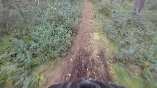
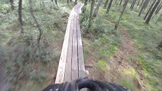
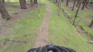
Popular Vara Mountain Biking Trails
• 100 ★ 0.0 • 991 ft • 5 ft • 19 •
Popular blue difficulty singletrack. This mountain bike primary trail can be used one direction. On average it takes minutes to complete this trail.
• 70 ★ 0.0 • 2,789 ft • 9 ft • 5 •
Kan bli lerig vid våt väderlek. Hittad via Strava, finns dock inget segment.
• 5 ★ 3.0 • 4,190 ft • 66 ft • 5 •
Less popular blue difficulty singletrack. This mountain bike primary trail can be used both directions and has a moderate overall physical rating with a 66 ft blue climb. On average it takes 10 minutes to complete this trail.
• 55 ★ 0.0 • 2,300 ft • 12 ft • 4 •
Moderately popular green difficulty singletrack. This mountain bike primary trail can be used both directions and has a easy overall physical rating with a 12 ft green climb. On average it takes 2 minutes to complete this trail.
Videos of Vara Mountain Bike
trail: Tumleberg Blå
5:52 |
391 |
Feb 9, 2021 , Vara
trail: Tumleberg Röd
10:16 |
209 |
Feb 9, 2021 , Vara
trail: Tumleberg 1
4:52 |
156 |
Feb 9, 2021 , Vara
Recent Trail Reports
| status | trail | date | condition | info | user |
|---|---|---|---|---|---|
| Ryda - Teknikbanan North Extension 2.1 | Jul 1, 2020 @ 12:56pm Jul 1, 2020 | Dry | Alexdddf | ||
| Ryda - Trail 1 | May 25, 2019 @ 8:33am May 25, 2019 | Dry | mesphito |
Activity Feed
| username | action | type | title | date |
|---|---|---|---|---|
| OrjanX | add | trail | activity #80474121 | Sep 16, 2025 @ 9:55am Sep 16, 2025 |
| Cykeljohan | add | trail | activity #80473211 and 3 more | Sep 16, 2025 @ 9:41am Sep 16, 2025 |
| Cykeljohan | add | trail | activity #46721107 and 3 more | Nov 27, 2023 @ 1:47am Nov 27, 2023 |
| alexhell | vote | trail | activity #30766037 | Jun 26, 2022 @ 3:58am Jun 26, 2022 |
| marcusdk | wishlist | trail | activity #29309971 and 1 more | May 14, 2022 @ 10:43am May 14, 2022 |
Local Badges
-

Epic Mountain Bike Climb 2k0 awarded -

Climbing 10k Badge2 awarded -

Mountain Biking 100k Badge0 awarded -

Epic Ride Descent 2k0 awarded -

Descent 10k Badge2 awarded -

Descent 100k Badge0 awarded
Activity Type Stats
| activitytype | trails | distance | descent | descent distance | total vertical | rating | global rank | state rank | photos | reports | routes | ridelogs |
|---|---|---|---|---|---|---|---|---|---|---|---|---|
| Mountain Bike | 21 | 13 miles | 636 ft | 5 miles | 112 ft | #8,868 | #202 | 18 | 824 | |||
| E-Bike | 1 | 991 ft | 16 ft | 659 ft | 20 ft | 17 | 1 | |||||
| Hike | 21 | 13 miles | 636 ft | 5 miles | 112 ft | #9,131 | #251 | 18 | 9 | |||
| Trail Running | 21 | 13 miles | 636 ft | 5 miles | 112 ft | #8,616 | #251 | 18 | 14 |
Frequently Asked Questions About Vara
▼
What are the best places to ride in Vara?
▼
What are the highest rated mountain biking trails in Vara?
The highest rated mountain biking trails in Vara are:
- Ryda - Teknikbanan Loop (4.2/5)
- Ryda - Teknikbanan In/Ut (4/5)
- Ryda - Teknikbanan South Extension (3.7/5)
- Majloppet Kvänum Start (0/5)
- Majloppet Kvänum (0/5)
▼
What is the best time of the year to ride in Vara?
Based on ride log data, the most popular months to ride in Vara are:
- June (9 activities)
- July (7 activities)
- August (2 activities)
▼
Where can I park to ride in Vara?
Check the Vara trail map for trailhead and parking information. Community members regularly update access and parking details for trails in the area.
- By nivis
 & contributors
 - Admins: ollesvenskonthetrail, JALLE, OrjanX, martinlindstr, nivis, Marleey, wikisara, JBohden
- #17895 - 1,259 views
- vara activity log | embed map of Vara mountain bike trails |
Downloading of trail gps tracks in kml & gpx formats is enabled for Vara.
You must login to download files.