close
-
Layers w
- Weather Layers
- Pro
- Pro
- Pro
- Pro
- Pro
- Pro
- More Layers
- Pro
- Pro
- Pro
- Pro
-
Upgrade to

3D
Trail Conditions
- Unknown
- Snow Groomed
- Snow Packed
- Snow Covered
- Snow Cover Partial
- Freeze/thaw Cycle
- Icy
- Prevalent Mud
- Wet
- Variable
- Ideal
- Dry
- Very Dry
Trail Flow (Ridden Direction)
Trailforks scans users ridelogs to determine the most popular direction each trail is ridden. A good flowing trail network will have most trails flowing in a single direction according to their intension.
The colour categories are based on what percentage of riders are riding a trail in its intended direction.
The colour categories are based on what percentage of riders are riding a trail in its intended direction.
- > 96%
- > 90%
- > 80%
- > 70%
- > 50%
- < 50%
- bi-directional trail
- no data
Trail Last Ridden
Trailforks scans ridelogs to determine the last time a trail was ridden.
- < 2 days
- < 1 week
- < 2 weeks
- < 1 month
- < 6 months
- > 6 months
Trail Ridden Direction
The intended direction a trail should be ridden.
- Downhill Only
- Downhill Primary
- Both Directions
- Uphill Primary
- Uphill Only
- One Direction
Contribute Details
Colors indicate trail is missing specified detail.
- Description
- Photos
- Description & Photos
- Videos
Trail Popularity ?
Trailforks scans ridelogs to determine which trails are ridden the most in the last 9 months.
Trails are compared with nearby trails in the same city region with a possible 25 colour shades.
Think of this as a heatmap, more rides = more kinetic energy = warmer colors.
- most popular
- popular
- less popular
- not popular
ATV/ORV/OHV Filter
Max Vehicle Width
inches
US Cell Coverage
Legend

Radar Time
Activity Recordings
Trailforks uses anonymized public activity data.
?
Activity Recordings
Trailforks uses anonymized public activity data.
?
Personal Heatmap
▶
Activity Types
all
/
none
▶
Options
2
Date range
month
–
Winter Trails
Warning
A routing network for winter maps does not exist. Selecting trails using the winter trails layer has been disabled.
Missing Trails
Most Popular
Least Popular
Trails are colored based on popularity. The more popular a trail is, the more red. Less popular trails trend towards green.
Jump Magnitude Heatmap
Heatmap of where riders jump on trails. Zoom in to see individual jumps, click circles to view jump details.
BC Backroad Status
![map legend]()
Service Road Atlas is a free to use, community-driven service for viewing and creating reports on the numerous back-country service roads around B.C. and Alberta.

Slope Aspect
Direction the slope faces
Trails Deemphasized
Trails are shown in grey.
Only show trails with no bike usage.
Suggested Layers
Based on selected activity type
Save the current map location and zoom level as your default home location whenever this page is loaded.
Save
No description for Varazze has been added yet!
Login or register to submit one.
This region uses the Uk/Euro style trail grading system.
Activities Click to view
- Mountain Bike
107 trails
- E-Bike
88 trails
- Gravel Bike
0 trails
- Adaptive Bike
0 trails
- Winter Fat Bike
0 trails
- Hike
82 trails
- Trail Running
78 trails
Region Details
- 17
- 12
- 41
- 2
Region Status
Caution as of Jun 13, 2026Stats
- Avg Trail Rating
- Trails (view details)
- 84
- Trails Mountain Bike
- 108
- Trails E-Bike
- 88
- Trails Hike
- 82
- Trails Trail Running
- 78
- Total Distance
- 106 miles
- Total Descent
- 36,870 ft
- Total Vertical
- 4,183 ft
- Highest Trailhead
- 4,193 ft
- Reports
- 3,172
- Photos
- 429
- Ridden Counter
- 12,652
Sub Regions
-
Varazze Trail Area
- 8
- 28
- 2
Popular Varazze Mountain Biking Trails
• 90 ★ 4.1 • 2 miles • 485 ft • 261 •
Highly rated popular green difficulty singletrack. This mountain bike primary trail can be used both directions and has a easy overall physical rating with a 485 ft green climb. On average it takes 12 minutes to complete this trail.
• 70 ★ 4.4 • 4,550 ft • 14 ft • 254 •
Highly rated popular blue difficulty singletrack. This mountain bike primary trail can be used downhill only and has a moderate overall physical rating. On average it takes 8 minutes to complete this trail.
• 100 ★ 4.5 • 5,157 ft • 0 ft • 246 •
Highly rated popular blue difficulty singletrack. This mountain bike primary trail can be used downhill primary. On average it takes 5 minutes to complete this trail.
• 65 ★ 4.5 • 1 mile • 0 ft • 245 •
Highly rated moderately popular blue difficulty singletrack. This mountain bike primary trail can be used downhill primary and has a moderate overall physical rating. It features berm and drop. On average it takes 10 minutes to complete this trail.
• 55 ★ 2.9 • 2,313 ft • 186 ft • 224 •
Moderately popular blue difficulty singletrack. This mountain bike primary trail can be used uphill only and has a hard overall physical rating with a 186 ft blue climb. On average it takes 11 minutes to complete this trail.
• 80 ★ 4.0 • 5,039 ft • 35 ft • 220 •
Highly rated popular red difficulty singletrack. This mountain bike primary trail can be used downhill primary. On average it takes 13 minutes to complete this trail.
• 95 ★ 4.4 • 4,354 ft • 76 ft • 219 •
Highly rated popular blue difficulty singletrack. This mountain bike primary trail can be used downhill only and has a moderate overall physical rating. It features rock garden. Adaptive MTB rating: amtb blue. Trail visibility is always easy to follow. On average it takes 7 minutes to complete this trail.
Varazze Mountain Bike Routes
★ 5.0 • 30 miles • 5,553 ft • 16 • Loop •
Salita via Le Faie su sentiero sterrato e single track. Dalla vetta si scende prima su sentiero...
★ 4.0 • 13 miles • 2,832 ft • 9 • Loop •
Anello che comprende tutti i sentieri di Castagnabuona. Loop including all the trails of Castagnabuona
21 miles • 3,720 ft • 5 • Loop •
Come arrivare In auto: Autostrada A10 (uscita Varazze), proseguire su SP1 in direzione Varazze (km....
★ 2.5 • 17 miles • 3,416 ft • 7 • Out & Back •
Percorso classico a Varazze che unisce i trails più conosciuti. Madonna della Guardia Uphill sarebbe non...
14 miles • 3,428 ft • 5 • Loop •
Salita al Beigua percorrendo la classica sterrata, a tratti un po' smossa. panorami incantevoli tengono...
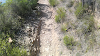
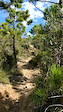
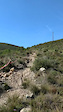
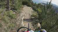
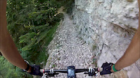
Photos of Varazze Mountain Bike
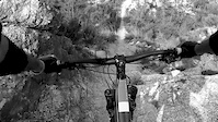
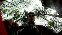
Videos of Varazze Mountain Bike
trail: Ghiglia
7:51 |
71 |
Jan 13, 2025
trail: New Generation
0:34 |
150 |
May 28, 2022
trail: JoDa
6:07 |
315 |
Oct 13, 2019
trail: New Generation
0:06 |
394 |
Oct 9, 2019
trail: JoDa
0:09 |
112 |
Oct 9, 2019
trail: Capre
4:10 |
611 |
May 1, 2014
trail: Neviera
6:22 |
449 |
Aug 16, 2012
trail: Neviera
4:10 |
179 |
Apr 28, 2012
Current Trail Warnings
| status | trail | date | condition | user | info |
|---|---|---|---|---|---|
| Varazze (PS2) | Jun 6, 2026 @ 11:43pm (Europe/Rome) Jun 6, 2026 | Unknown | Leio | Al momento è chiuso |
Recent Trail Reports
| status | trail | date | condition | info | user |
|---|---|---|---|---|---|
| Local | Jun 14, 2026 @ 7:59am (Europe/Rome) Jun 13, 2026 | Ideal | Gabrigoride | ||
| T1 to Madonnina | Jun 14, 2026 @ 7:59am (Europe/Rome) Jun 13, 2026 | Ideal | Gabrigoride | ||
| T1 | Jun 14, 2026 @ 7:59am (Europe/Rome) Jun 13, 2026 | Ideal | Gabrigoride | ||
| Alternate Climb to Monte Beigua | Jun 14, 2026 @ 7:59am (Europe/Rome) Jun 13, 2026 | Ideal | Gabrigoride | ||
| Ramognina Singletrack | Jun 14, 2026 @ 7:59am (Europe/Rome) Jun 13, 2026 | Ideal | Gabrigoride | ||
| SpaccaDario | Jun 13, 2026 @ 7:49am (Europe/Monaco) Jun 12, 2026 | Ideal | Marcors125 | ||
| Motocross Sanda | Jun 13, 2026 @ 7:49am (Europe/Monaco) Jun 12, 2026 | Ideal | Marcors125 | ||
| Le Faie via Alpicella | Jun 13, 2026 @ 7:49am (Europe/Monaco) Jun 12, 2026 | Ideal | Marcors125 | ||
| Chiuso Tuo (Madonnina) | Jun 13, 2026 @ 4:39pm (Europe/Rome) Jun 13, 2026 | Unknown | Panetz | ||
| Vecchia Alpicella | Jun 13, 2026 @ 4:37pm (Europe/Rome) Jun 13, 2026 | Unknown | Panetz |
Activity Feed
| username | action | type | title | date |
|---|---|---|---|---|
| MarcoYXizf7 | wishlist | route | activity #97242836 | Jun 18, 2026 @ 4:28am Jun 18, 2026 |
| Gabrigoride | comment | trail | activity #96953527 | Jun 14, 2026 @ 4:14am Jun 14, 2026 |
| Gabrigoride | add | report | activity #96953440 and 4 more | Jun 14, 2026 @ 4:12am Jun 14, 2026 |
| Zunno | ridden | trail | activity #96913540 | Jun 13, 2026 @ 1:51pm Jun 13, 2026 |
| Marcors125 | add | report | activity #96881767 and 1 more | Jun 13, 2026 @ 8:38am Jun 13, 2026 |
Recent Comments
| username | type | title | comment | date |
|---|---|---|---|---|
| trail | Abbastanza tecnico...tutto naturale! | Jun 14, 2026 @ 4:14am Jun 14, 2026 | ||
| report | fattibile a Tratti, molti pezzi pietroni smossi | Jun 9, 2026 @ 5:16am Jun 9, 2026 | ||
| trail | Finalmente pulito, e percorribile. Uno dei... | May 3, 2026 @ 8:05am May 3, 2026 | ||
| trail | In alcuni tratti avrebbe bisogno di una sistemata | Apr 3, 2026 @ 1:41am Apr 3, 2026 | ||
| report | Herrliche, anspruchsvolle Abfahrt | Mar 20, 2026 @ 8:41am Mar 20, 2026 |
Local Badges
-

10 Green Trails62 awarded -

10 Blue Trails142 awarded -

Epic Ride Climb 2k823 awarded -

Climbing 10k Badge138 awarded -

Climbing 100k Badge16 awarded -

Epic Ride Descent 2k883 awarded
Local Trail Supporters
- Kaprazozza
Activity Type Stats
| activitytype | trails | distance | descent | descent distance | total vertical | rating | global rank | state rank | photos | reports | routes | ridelogs |
|---|---|---|---|---|---|---|---|---|---|---|---|---|
| Mountain Bike | 107 | 106 miles | 36,870 ft | 55 miles | 4,183 ft | #1,056 | #22 | 351 | 3,181 | 7 | 11,252 | |
| E-Bike | 88 | 85 miles | 25,892 ft | 41 miles | 4,183 ft | #294 | #25 | 78 | 2,879 | 2 | 3,089 | |
| Hike | 82 | 94 miles | 29,718 ft | 45 miles | 4,183 ft | #1,878 | #64 | 2,935 | 1 | 276 | ||
| Trail Running | 78 | 89 miles | 28,622 ft | 43 miles | 4,183 ft | #1,480 | #48 | 2,927 | 1 | 292 |
Frequently Asked Questions About Varazze
▼
What are the best places to ride in Varazze?
Varazze has 1 areas to explore for mountain biking. The top rated areas are:
▼
What are the highest rated mountain biking trails in Varazze?
The highest rated mountain biking trails in Varazze are:
- Ghiglia (4.4/5)
- SpaccaDario (4.4/5)
- J Line (4.3/5)
- Chiuso Tuo (Madonnina) (4.3/5)
- Lustrascarpe (4.3/5)
▼
What is the best time of the year to ride in Varazze?
Based on ride log data, the most popular months to ride in Varazze are:
- May (71 activities)
- April (68 activities)
- July (66 activities)
▼
Where can I park to ride in Varazze?
Activities
Trails
Points of Interest
- By cheorch
 & contributors
 - Admins: denitopia
- #14255 - 21,920 views
- varazze activity log | embed map of Varazze mountain bike trails | varazze mountain biking points of interest
Downloading of trail gps tracks in kml & gpx formats is enabled for Varazze.
You must login to download files.