close
-
Layers w
- Weather Layers
- Pro
- Pro
- Pro
- Pro
- Pro
- Pro
- More Layers
- Pro
- Pro
- Pro
- Pro
-
Upgrade to

3D
Trail Conditions
- Unknown
- Snow Groomed
- Snow Packed
- Snow Covered
- Snow Cover Partial
- Freeze/thaw Cycle
- Icy
- Prevalent Mud
- Wet
- Variable
- Ideal
- Dry
- Very Dry
Trail Flow (Ridden Direction)
Trailforks scans users ridelogs to determine the most popular direction each trail is ridden. A good flowing trail network will have most trails flowing in a single direction according to their intension.
The colour categories are based on what percentage of riders are riding a trail in its intended direction.
The colour categories are based on what percentage of riders are riding a trail in its intended direction.
- > 96%
- > 90%
- > 80%
- > 70%
- > 50%
- < 50%
- bi-directional trail
- no data
Trail Last Ridden
Trailforks scans ridelogs to determine the last time a trail was ridden.
- < 2 days
- < 1 week
- < 2 weeks
- < 1 month
- < 6 months
- > 6 months
Trail Ridden Direction
The intended direction a trail should be ridden.
- Downhill Only
- Downhill Primary
- Both Directions
- Uphill Primary
- Uphill Only
- One Direction
Contribute Details
Colors indicate trail is missing specified detail.
- Description
- Photos
- Description & Photos
- Videos
Trail Popularity ?
Trailforks scans ridelogs to determine which trails are ridden the most in the last 9 months.
Trails are compared with nearby trails in the same city region with a possible 25 colour shades.
Think of this as a heatmap, more rides = more kinetic energy = warmer colors.
- most popular
- popular
- less popular
- not popular
ATV/ORV/OHV Filter
Max Vehicle Width
inches
US Cell Coverage
Legend

Radar Time
Activity Recordings
Trailforks uses anonymized public activity data.
?
Activity Recordings
Trailforks uses anonymized public activity data.
?
Personal Heatmap
▶
Activity Types
all
/
none
▶
Options
2
Date range
month
–
Winter Trails
Warning
A routing network for winter maps does not exist. Selecting trails using the winter trails layer has been disabled.
Missing Trails
Most Popular
Least Popular
Trails are colored based on popularity. The more popular a trail is, the more red. Less popular trails trend towards green.
Jump Magnitude Heatmap
Heatmap of where riders jump on trails. Zoom in to see individual jumps, click circles to view jump details.
BC Backroad Status
![map legend]()
Service Road Atlas is a free to use, community-driven service for viewing and creating reports on the numerous back-country service roads around B.C. and Alberta.

Slope Aspect
Direction the slope faces
Trails Deemphasized
Trails are shown in grey.
Only show trails with no bike usage.
Suggested Layers
Based on selected activity type
Save the current map location and zoom level as your default home location whenever this page is loaded.
Save
No description for Varese has been added yet!
Login or register to submit one.
This region uses the Uk/Euro style trail grading system.
Activities Click to view
- Mountain Bike
181 trails
- E-Bike
173 trails
- Gravel Bike
0 trails
- Adaptive Bike
0 trails
- Winter Fat Bike
1 trails
- Hike
179 trails
- Trail Running
179 trails
- Snowshoe
12 trails
- Nordic Ski
10 trails
Region Details
- 14
- 17
- 71
- 52
- 4
- 5
Region Status
Caution as of May 23, 2026Stats
- Avg Trail Rating
- Trails (view details)
- 171
- Trails Mountain Bike
- 181
- Trails E-Bike
- 173
- Trails Winter Fat Bike
- 1
- Trails Hike
- 179
- Trails Trail Running
- 179
- Trails Snowshoe
- 12
- Trails Nordic Ski
- 10
- Total Distance
- 148 miles
- Total Descent
- 44,230 ft
- Total Vertical
- 3,339 ft
- Highest Trailhead
- 3,992 ft
- Reports
- 4,710
- Photos
- 462
- Ridden Counter
- 18,562
Sub Regions
-
Parco Naturale Regionale Campo dei Fiori
- 53
- 48
- 5
- 5
-
PLIS Cintura Verde Sud Varese
- 4
- 8
- 3
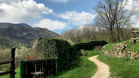
Popular Varese Mountain Biking Trails
• 100 ★ 3.7 • 4,213 ft • 78 ft • 389 •
trail connecting Poggio to Velate as a continuation of Sentiero 310a
• 100 ★ 3.7 • 5 miles • 1,933 ft • 366 •
Ascent on dirt road with some rocks, typical mountain climb.
• 100 ★ 3.5 • 1 mile • 33 ft • 304 •
porzione della ciclo-pedonale del lago di Varese tra Voltorre e Gavirate
• 100 ★ 4.0 • 2 miles • 70 ft • 291 •
porzione della ciclabile del Lago di Varese tra Capolago e Bodio Lomnago
• 95 ★ 4.0 • 2 miles • 433 ft • 283 •
This is a part of track number 10 inside this trail area; it will leads you to many other trails (down-hill or up-hill) this trail (in theory) goes all around the mountain, which is a natural "enduro mtb area" all around!!!
• 95 ★ 4.3 • 3 miles • 71 ft • 276 •
porzione della ciclo-pedonale del lago di Varese tra Schiranna e Groppello
• 95 ★ 4.3 • 1 mile • 56 ft • 270 •
porzione della ciclo-pedonale del lago di Varese tra Groppello e Voltorre (visitate il chiostro)
• 100 ★ 5.0 • 2 miles • 193 ft • 259 •
Porzione di pista ciclabile del Lago di Varese tra Biandronno e Gavirate
Varese Mountain Bike Routes
★ 5.0 • 16 miles • 3,099 ft • 4 • Loop •
Giro di media durata e intensità che affronta una delle più belle discese del Parco di Campo dei Fiori,...
★ 4.5 • 10 miles • 1,805 ft • 6 • Loop •
Veloce giro "up & down" che può essere completato in circa due ore o anche meno. Si inizia dal parcheggio...
★ 5.0 • 17 miles • 3,370 ft • 23 • Loop •
Partendo da Gavirate, sarà possibile salire su asfalto fino all'inizio del Sentiero 1, e da qui in...
8 miles • 1,030 ft • 4 • Out & Back •
Una facile escursione quasi ad anello, perfetta per chi vuole fare un giro veloce in "pausa pranzo" oppure...
17 miles • 1,699 ft • 13 • Loop •
One of the classics in the area "il giro del 10", perfect in all seasons and to start explore the riding...
16 miles • 1,561 ft • 5 • Loop •
Giro ad anello del 0, evitando la parte più difficile della discesa dalle 4 strade a Orino, passando...
Photos of Varese Mountain Bike
Videos of Varese Mountain Bike
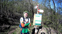
trail: Tabellone
0:54 |
7 |
Feb 14, 2026
trail: Tabellone
0:44 |
4 |
Feb 14, 2026
trail: Tabellone
2:38 |
7 |
Feb 14, 2026
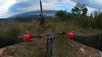
trail: Sentiero 17
0:23 |
|
Sep 14, 2024
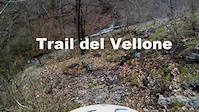
trail: Vellone - Velate
3:46 |
268 |
May 2, 2018
trail: Passo Pizzelle - Brinzio
8:21 |
405 |
Apr 12, 2017
trail: Passo Pizzelle - Brinzio
0:24 |
157 |
Apr 6, 2017
trail: Passo Pizzelle - Brinzio
0:50 |
77 |
Apr 3, 2017
Recent Trail Reports
| status | trail | date | condition | info | user |
|---|---|---|---|---|---|
| Ciclabile della Valcuvia, Grantola-Cantevria | May 23, 2026 @ 10:46am (Europe/Vaduz) May 23, 2026 | Ideal | Giorgio1973 | ||
| Bolli Arancio | May 22, 2026 @ 12:49pm (Europe/Rome) May 22, 2026 | Unknown | Roberto60 | ||
| Variante Curvette | May 22, 2026 @ 12:45pm (Europe/Rome) May 22, 2026 | Unknown | Roberto60 | ||
| Sentiero 17 | May 17, 2026 @ 12:25pm (Europe/Rome) May 17, 2026 | Ideal | Rickyk75 | ||
| Garibaldi Singletrack | May 9, 2026 @ 9:58pm (Europe/Rome) May 9, 2026 | Ideal | MontesiDani | ||
| "Clean" sinistro | May 9, 2026 @ 9:58pm (Europe/Rome) May 9, 2026 | Ideal | MontesiDani | ||
| Roccette | May 9, 2026 @ 9:56pm (Europe/Rome) May 9, 2026 | Ideal | MontesiDani | ||
| Cascina Caddè - 4 strade | May 9, 2026 @ 1:59pm (Europe/Rome) May 9, 2026 | Ideal | Jolf73 | ||
| Poggio - Cascina Caddè | May 9, 2026 @ 1:59pm (Europe/Rome) May 9, 2026 | Ideal | Jolf73 | ||
| Prima Cappella - Velate | May 9, 2026 @ 1:59pm (Europe/Rome) May 9, 2026 | Ideal | Jolf73 |
Activity Feed
| username | action | type | title | date |
|---|---|---|---|---|
| jamesbrook | wishlist | route | activity #97053400 | Jun 15, 2026 @ 11:01am Jun 15, 2026 |
| vf9Qye | wishlist | route | activity #96756812 and 2 more | Jun 11, 2026 @ 12:54pm Jun 11, 2026 |
| alpinemattiyt | add | video | activity #96287551 and 1 more | Jun 5, 2026 @ 5:11am Jun 5, 2026 |
| Giorgio1973 | add | report | activity #95306792 | May 23, 2026 @ 5:13am May 23, 2026 |
| Kakifruit123 | ridden | trail | activity #95243926 | May 22, 2026 @ 8:19am May 22, 2026 |
Recent Comments
| username | type | title | comment | date |
|---|---|---|---|---|
| report | Cioè ci sei andato apposta per fare le foto,... | Apr 18, 2026 @ 3:12pm Apr 18, 2026 | ||
| report | avevo letto il post e ho aggiunto solo le foto | Apr 18, 2026 @ 9:16am Apr 18, 2026 | ||
| report | Certo che anche te… non avevi letto il... | Apr 18, 2026 @ 2:38am Apr 18, 2026 | ||
| report | @adessoomaipiu: non ero io, prima o poi ci... | Apr 14, 2026 @ 12:15pm Apr 14, 2026 | ||
| report | @euvanet: allora non eri tu colui che ho visto... | Apr 14, 2026 @ 10:50am Apr 14, 2026 |
Local Badges
-

10 Green Trails180 awarded -

10 Blue Trails137 awarded -

Epic Ride Climb 2k525 awarded -

Climbing 10k Badge181 awarded -

Climbing 100k Badge28 awarded -

Epic Ride Descent 2k535 awarded
Activity Type Stats
| activitytype | trails | distance | descent | descent distance | total vertical | rating | global rank | state rank | photos | reports | routes | ridelogs |
|---|---|---|---|---|---|---|---|---|---|---|---|---|
| Mountain Bike | 181 | 144 miles | 43,222 ft | 78 miles | 3,317 ft | #777 | #13 | 419 | 4,730 | 11 | 22,061 | |
| E-Bike | 173 | 138 miles | 41,795 ft | 75 miles | 3,317 ft | #196 | #18 | 31 | 4,630 | 7 | 4,859 | |
| Winter Fat Bike | 1 | #159 | #245 | 22 | ||||||||
| Hike | 179 | 140 miles | 40,741 ft | 74 miles | 3,340 ft | #543 | #13 | 7 | 4,653 | 2 | 1,016 | |
| Trail Running | 179 | 138 miles | 39,777 ft | 72 miles | 3,340 ft | #734 | #20 | 4,657 | 2 | 2,445 | ||
| Snowshoe | 12 | 3 miles | 577 ft | 1 mile | 423 ft | #262 | #13 | 13 | 6 | |||
| Nordic Ski | 10 | #343 | #12 | 34 |
Frequently Asked Questions About Varese
▼
What are the best places to ride in Varese?
Varese has 2 areas to explore for mountain biking. The top rated areas are:
▼
What are the highest rated mountain biking trails in Varese?
The highest rated mountain biking trails in Varese are:
- Variante Caddè - Lago Motta d'Oro (4.4/5)
- Roccette (4.3/5)
- Lago Motta d'Oro - Parco Morselli (4.3/5)
- Belvedere - Forte di Orino (4.2/5)
- Tabellone (4.2/5)
▼
What is the best time of the year to ride in Varese?
Based on ride log data, the most popular months to ride in Varese are:
- February (75 activities)
- May (71 activities)
- June (57 activities)
▼
Where can I park to ride in Varese?
There are 20 parking locations listed in Varese. The most popular parking spots are: View all parking and trailhead locations on the map to plan your visit.
Activities
Trails
Points of Interest
- Chiesa di San Cassiano Sight
- Monte Morto Summit
- MASSO ERRATICO “SASSO NERO” Sight
- Monte Chiusarella Summit
- Roccette TTF
- Root garden TTF
- Monte Legnone (Varese) Summit
- Torre di Velate Sight
- Monte Pizzelle Summit
- Laghetto della Motta d'Oro Sight
- Punta Paradiso (4,003 ft)
- Punta di Mezzo (3,924 ft)
- Punta Merigetto (3,789 ft)
- By BianchiMichele & contributors
- Admins: dellock6, marcoangeletti, adessoomaipiu, micheletraversi, adessoomaipiu
- #5777 - 16,618 views
- varese activity log | embed map of Varese mountain bike trails | varese mountain biking points of interest polygons
Downloading of trail gps tracks in kml & gpx formats is enabled for Varese.
You must login to download files.