close
-
Layers w
- Weather Layers
- Pro
- Pro
- Pro
- Pro
- Pro
- Pro
- More Layers
- Pro
- Pro
- Pro
- Pro
-
Upgrade to

3D
Trail Conditions
- Unknown
- Snow Groomed
- Snow Packed
- Snow Covered
- Snow Cover Partial
- Freeze/thaw Cycle
- Icy
- Prevalent Mud
- Wet
- Variable
- Ideal
- Dry
- Very Dry
Trail Flow (Ridden Direction)
Trailforks scans users ridelogs to determine the most popular direction each trail is ridden. A good flowing trail network will have most trails flowing in a single direction according to their intension.
The colour categories are based on what percentage of riders are riding a trail in its intended direction.
The colour categories are based on what percentage of riders are riding a trail in its intended direction.
- > 96%
- > 90%
- > 80%
- > 70%
- > 50%
- < 50%
- bi-directional trail
- no data
Trail Last Ridden
Trailforks scans ridelogs to determine the last time a trail was ridden.
- < 2 days
- < 1 week
- < 2 weeks
- < 1 month
- < 6 months
- > 6 months
Trail Ridden Direction
The intended direction a trail should be ridden.
- Downhill Only
- Downhill Primary
- Both Directions
- Uphill Primary
- Uphill Only
- One Direction
Contribute Details
Colors indicate trail is missing specified detail.
- Description
- Photos
- Description & Photos
- Videos
Trail Popularity ?
Trailforks scans ridelogs to determine which trails are ridden the most in the last 9 months.
Trails are compared with nearby trails in the same city region with a possible 25 colour shades.
Think of this as a heatmap, more rides = more kinetic energy = warmer colors.
- most popular
- popular
- less popular
- not popular
ATV/ORV/OHV Filter
Max Vehicle Width
inches
US Cell Coverage
Legend

Radar Time
Activity Recordings
Trailforks uses anonymized public activity data.
?
Activity Recordings
Trailforks uses anonymized public activity data.
?
Personal Heatmap
▶
Activity Types
all
/
none
▶
Options
2
Date range
month
–
Winter Trails
Warning
A routing network for winter maps does not exist. Selecting trails using the winter trails layer has been disabled.
Missing Trails
Most Popular
Least Popular
Trails are colored based on popularity. The more popular a trail is, the more red. Less popular trails trend towards green.
Jump Magnitude Heatmap
Heatmap of where riders jump on trails. Zoom in to see individual jumps, click circles to view jump details.
BC Backroad Status
![map legend]()
Service Road Atlas is a free to use, community-driven service for viewing and creating reports on the numerous back-country service roads around B.C. and Alberta.

Slope Aspect
Direction the slope faces
Trails Deemphasized
Trails are shown in grey.
Only show trails with no bike usage.
Suggested Layers
Based on selected activity type
Save the current map location and zoom level as your default home location whenever this page is loaded.
Save
No description for Vaud Canton has been added yet!
Login or register to submit one.
This region uses the Uk/Euro style trail grading system.
Region Details
- 35
- 68
- 189
- 58
- 16
- 1
Stats
- Avg Trail Rating
- Trails (view details)
- 372
- Trails Mountain Bike
- 367
- Trails E-Bike
- 275
- Trails Gravel Bike
- 5
- Trails Adaptive Bike
- 11
- Trails Hike
- 346
- Trails Trail Running
- 346
- Trails Backcountry Ski
- 4
- Total Distance
- 290 miles
- Total Descent
- 135,178 ft
- Total Vertical
- 6,248 ft
- Highest Trailhead
- 7,470 ft
- Reports
- 685
- Photos
- 248
- Ridden Counter
- 8,328
Sub Regions
- District Aigle (66)
- District Gros-de-Vaud (4)
- Cugy VD (4)
- Cugy VD (4)
- District Jura Nord-Vaudois (123)
- Arnex-sur-Orbe (1)
- Baulmes (51)
- Aiguilles de Baulmes (44)
- Bullet (16)
- Concise (2)
- Croy (2)
- L'Abbaye (6)
- Le Chenit (7)
- Orbe (21)
- Fôret d'Agiez (7)
- Provence (1)
- Romainmôtier-Envy (4)
- Sainte-Croix (7)
- Tévenon (1)
- Yverdon-les-Bains (15)
- Arnex-sur-Orbe (1)
- District Morges (26)
- Aubonne (7)
- Eclépens (2)
- L'Isle (5)
- La Sarraz (5)
- Montricher (7)
- Aubonne (7)
- District Nyon (101)
- Arzier-Le Muids (23)
- Le Vaud (1)
- Marchissy (3)
- Nyon (67)
- La Dôle (67)
- Saint-Cergue (7)
- Arzier-Le Muids (23)
- District Riviera-Pays-d’Enhaut (30)
- Blonay - Saint-Légier (3)
- Les Pléiades (2)
- Montreux (18)
- Rougemont (9)
- Blonay - Saint-Légier (3)
- Lausanne (27)
Popular Vaud Canton Mountain Biking Trails
• 100 ★ 5.0 • 1,736 ft • 0 ft • 148 •
Last section of the infamous "Nérine" track, fast and jumpy this last section is here to put even more smile on your face at the end of your run. If you are out of breath during your run, just stop and enjoy the magnificent view on the...
• 80 ★ 4.0 • 3,904 ft • 0 ft • 141 •
2,2km of pure flow, big berms, jumps, highspeed and naturals sections. This track has everything you could ask for even a 12m table jump. If you are out of breath during your run, just stop and enjoy the magnificent view on the...
• 85 ★ 0.0 • 2,224 ft • 43 ft • 111 •
This is the final section of the trail, you will find more a more natural flow and steeper grade.
• 80 ★ 0.0 • 1,309 ft • 0 ft • 110 •
This sections is fast and flowy. It contains some gap jump as well as table jump
• 70 ★ 0.0 • 2,454 ft • 13 ft • 107 •
part This sections is more natural and contains some short uphill punch.
• 100 ★ 0.0 • 2,700 ft • 111 ft • 106 •
Popular green difficulty singletrack. This multi-use trail can be used both directions and has a moderate overall physical rating with a 111 ft blue climb. Trail visibility is always easy to follow. On average it takes 43 minutes to complete this trail.
• 95 ★ 0.0 • 1,004 ft • 0 ft • 103 •
. This sections contain some medium sized table jump and fast berms, have fun !
• 65 ★ 0.0 • 4,042 ft • 3 ft • 98 •
. The trail is nice and flowy. This sections contains berm, jump and switchbacks. Please be carful this ection cross a road at two different location, adapt your speed.
Vaud Canton Mountain Bike Routes
★ 5.0 • 7 miles • 1,242 ft • 4 • Loop •
Staet with the Trail , than take this route from the Shooting stand in Pully and uphill to Le Bois de La...
19 miles • 2,117 ft • 2 • Loop •
Paved: 11km Forest Track: 13km SingleTrail: 7km
24 miles • 4,198 ft • 5 • Loop •
Paved: 12km Forest Track: 21km SingleTrail: 5km
21 miles • 3,668 ft • 7 • Loop •
Paved: 12km Forest Track: 12km SingleTrail: 10km
★ 4.0 • 2 miles • 0 • Point to Point •
***English after the french part*** Prenez le télécabine à Villars-sur-Ollon pour rejoindre le Roc...
11 miles • 2,147 ft • 0 •
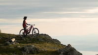
Photos of Vaud Canton Mountain Bike
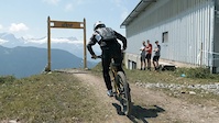
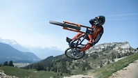
Videos of Vaud Canton Mountain Bike
3:12 |
97 |
Nov 27, 2023

trail: BlackMetaul DH
0:31 |
1379 |
Aug 11, 2021
trail: BlackMetaul DH
0:31 |
45 |
Aug 11, 2021
trail: Nérine - Upper section
2:05 |
491 |
Jul 26, 2021
trail: Nérine - Upper section
0:50 |
151 |
Jun 29, 2021

trail: Nérine - Upper section
4:16 |
118 |
Jul 10, 2020
trail: Nérine - Upper section
2:07 |
71 |
Aug 14, 2018
trail: Nérine - Upper section
4:57 |
64 |
Feb 15, 2017
Current Trail Warnings
| status | trail | date | condition | user | info |
|---|---|---|---|---|---|
| Jumpline L'Isle L'Isle | May 26, 2026 @ 2:12pm (Europe/Zurich) May 26, 2026 | Unknown | armailli | I could not find any sign of a trail at... |
Recent Trail Reports
Activity Feed
| username | action | type | title | date |
|---|---|---|---|---|
| DanielZTEtmW | ridden | trail | activity #97237687 | Jun 18, 2026 @ 1:12am 11 hours |
| Lepoulpe | add | report | activity #97025327 | Jun 14, 2026 @ 11:39pm Jun 14, 2026 |
| mouchsi | add | report | activity #96904617 and 6 more | Jun 13, 2026 @ 12:17pm Jun 13, 2026 |
| mouchsi | add | report | activity #96718166 | Jun 10, 2026 @ 9:45pm Jun 10, 2026 |
| franceleduc | wishlist | trail | activity #95916075 | May 31, 2026 @ 1:47am May 31, 2026 |
Recent Comments
| username | type | title | comment | date |
|---|---|---|---|---|
| trail | Blocked by cut trees | Apr 20, 2026 @ 10:11am Apr 20, 2026 | ||
| trail | Not a black trail but rather a green with a... | Apr 20, 2026 @ 10:09am Apr 20, 2026 | ||
| trail | please report where the cycling ban signals... | Mar 26, 2026 @ 12:25pm Mar 26, 2026 | ||
| trail | Un grand tronc coupe la chemin vers la moitié... | Oct 6, 2025 @ 12:24pm Oct 6, 2025 | ||
| trail | Chemin sans interet, tout droit. | Sep 29, 2025 @ 2:44am Sep 29, 2025 |
Local Badges
-

Epic Ride Descent 2k0 awarded -
Epic Ride Descent 2k7 awarded -
Epic Ride Descent 2k3 awarded -
Epic Ride Descent 2k1 awarded -
Epic Ride Descent 2k0 awarded -
Epic Ride Descent 2k0 awarded
Bike & Skill Parks
| name | type | city | rating |
|---|---|---|---|
| Leysin Bike Park | bike park | Leysin |
Activity Type Stats
| activitytype | trails | distance | descent | descent distance | total vertical | rating | global rank | state rank | photos | reports | routes | ridelogs |
|---|---|---|---|---|---|---|---|---|---|---|---|---|
| Mountain Bike | 367 | 284 miles | 133,501 ft | 189 miles | 5,587 ft | 241 | 685 | 6 | 30,570 | |||
| E-Bike | 275 | 212 miles | 103,563 ft | 145 miles | 5,587 ft | 4 | 644 | 6 | 4,876 | |||
| Gravel Bike | 5 | 9 miles | 719 ft | 2 miles | 2,651 ft | 15 | 1 | 354 | ||||
| Adaptive Bike | 11 | 17 miles | 1,273 ft | 4 miles | 3,537 ft | 27 | ||||||
| Hike | 346 | 268 miles | 123,419 ft | 176 miles | 5,587 ft | 3 | 655 | 1 | 2,693 | |||
| Trail Running | 346 | 268 miles | 123,419 ft | 176 miles | 5,587 ft | 652 | 1 | 1,008 | ||||
| Backcountry Ski | 4 | 5 miles | 1,388 ft | 2 miles | 3,330 ft | 1 | 1,096 |
Activities
Trails
- By brenthillier
 NSMBA TRAILFORKS & contributors
 - Admins: swiss, trailpapst
- #8969 - 7,643 views
- vaud canton activity log | embed map of Vaud Canton mountain bike trails | vaud canton mountain biking points of interest polygons
Downloading of trail gps tracks in kml & gpx formats is enabled for Vaud Canton.
You must login to download files.