close
-
Layers w
- Weather Layers
- Pro
- Pro
- Pro
- Pro
- Pro
- Pro
- More Layers
- Pro
- Pro
- Pro
- Pro
-
Upgrade to

3D
Trail Conditions
- Unknown
- Snow Groomed
- Snow Packed
- Snow Covered
- Snow Cover Partial
- Freeze/thaw Cycle
- Icy
- Prevalent Mud
- Wet
- Variable
- Ideal
- Dry
- Very Dry
Trail Flow (Ridden Direction)
Trailforks scans users ridelogs to determine the most popular direction each trail is ridden. A good flowing trail network will have most trails flowing in a single direction according to their intension.
The colour categories are based on what percentage of riders are riding a trail in its intended direction.
The colour categories are based on what percentage of riders are riding a trail in its intended direction.
- > 96%
- > 90%
- > 80%
- > 70%
- > 50%
- < 50%
- bi-directional trail
- no data
Trail Last Ridden
Trailforks scans ridelogs to determine the last time a trail was ridden.
- < 2 days
- < 1 week
- < 2 weeks
- < 1 month
- < 6 months
- > 6 months
Trail Ridden Direction
The intended direction a trail should be ridden.
- Downhill Only
- Downhill Primary
- Both Directions
- Uphill Primary
- Uphill Only
- One Direction
Contribute Details
Colors indicate trail is missing specified detail.
- Description
- Photos
- Description & Photos
- Videos
Trail Popularity ?
Trailforks scans ridelogs to determine which trails are ridden the most in the last 9 months.
Trails are compared with nearby trails in the same city region with a possible 25 colour shades.
Think of this as a heatmap, more rides = more kinetic energy = warmer colors.
- most popular
- popular
- less popular
- not popular
ATV/ORV/OHV Filter
Max Vehicle Width
inches
US Cell Coverage
Legend

Radar Time
Activity Recordings
Trailforks uses anonymized public activity data.
?
Activity Recordings
Trailforks uses anonymized public activity data.
?
Personal Heatmap
▶
Activity Types
all
/
none
▶
Options
2
Date range
month
–
Winter Trails
Warning
A routing network for winter maps does not exist. Selecting trails using the winter trails layer has been disabled.
Missing Trails
Most Popular
Least Popular
Trails are colored based on popularity. The more popular a trail is, the more red. Less popular trails trend towards green.
Jump Magnitude Heatmap
Heatmap of where riders jump on trails. Zoom in to see individual jumps, click circles to view jump details.
BC Backroad Status
![map legend]()
Service Road Atlas is a free to use, community-driven service for viewing and creating reports on the numerous back-country service roads around B.C. and Alberta.

Slope Aspect
Direction the slope faces
Trails Deemphasized
Trails are shown in grey.
Only show trails with no bike usage.
Suggested Layers
Based on selected activity type
Save the current map location and zoom level as your default home location whenever this page is loaded.
SaveVäxjö is a city and the seat of Växjö Municipality, Kronoberg County, Sweden. It had 71 282 inhabitants as of 2023, out of a municipal population of 97 574.
source: Wikipedia
Links
This region uses the Uk/Euro style trail grading system.
Activities Click to view
- Mountain Bike
329 trails
- Gravel Bike
0 trails
- Adaptive Bike
0 trails
- Hike
339 trails
- Trail Running
340 trails
- Nordic Ski
12 trails
Region Details
- 43
- 33
- 202
- 39
- 10
Region Status
Open as of Jun 2, 2026Local Trail Association
Stats
- Avg Trail Rating
- Trails (view details)
- 342
- Trails Mountain Bike
- 330
- Trails Hike
- 339
- Trails Trail Running
- 340
- Trails Nordic Ski
- 12
- Total Distance
- 170 miles
- Total Descent
- 11,100 ft
- Total Vertical
- 265 ft
- Highest Trailhead
- 768 ft
- Reports
- 461
- Photos
- 106
- Ridden Counter
- 7,386
Sub Regions
-
Ängarna
- 5
- 13
- 2
-
Bokhultet
- 2
- 11
- 3
-
Ekeberg
- 2
- 20
- 10
- 4
-
Fylleryd
- 24
- 3
-
Gemla
- 2
- 2
-
Helgö
- 5
- 1
-
Hovshaga
- 3
- 34
- 4
-
Notteryd
- 6
- 20
- 11
- 6
-
Öjaby
- 4
- 8
-
Teleborg
- 8
- 16
- 3
Popular Växjö Mountain Biking Trails
• 100 ★ 4.2 • 4,961 ft • 23 ft • 103 •
Swe: XC-stig byggd av Växjö Stigcyklister. Några kortare flowiga delar kombinerat med skogsstigar. Eng: XC trail built by Växjö Stigcyklister. Some short flowy parts combined with forest trails.
• 100 ★ 5.0 • 607 ft • 0 ft • 84 •
VSC hoppled som är bredare och slätare än övriga leder i Ekeberg. Leden innehåller olika varianter av hopp och har fokus på hög fart.
• 70 ★ 0.0 • 1,699 ft • 104 ft • 79 •
Popular red difficulty singletrack. This mountain bike primary trail can be used uphill primary. On average it takes 10 minutes to complete this trail.
• 90 ★ 5.0 • 1 mile • 29 ft • 79 •
Popular blue difficulty singletrack. This mountain bike primary trail can be used downhill primary. On average it takes 6 minutes to complete this trail.
• 5 ★ 0.0 • 1,280 ft • 17 ft • 72 •
Less popular green difficulty singletrack. This mountain bike primary trail can be used both directions. On average it takes 1 minutes to complete this trail.
• 100 ★ 4.0 • 1,043 ft • 0 ft • 65 •
Fokus för leden är kul åkning utan större svårigheter. Innehåller parti med flowiga svängar såväl som tekniska utmaningar som dropp och steniga partier.
• 70 ★ 5.0 • 2,854 ft • 52 ft • 65 •
Popular red difficulty singletrack. This mountain bike primary trail can be used downhill primary. It features drop. On average it takes 8 minutes to complete this trail.
• 95 ★ 4.0 • 978 ft • 0 ft • 63 •
Led med mycket sten, smala passager och partier med hög fart. Ett lite knixigt gaphopp finns i mitten på leden som bör kollas in.
Växjö Mountain Bike Routes
2 miles • 162 ft • 13 •
Utmanande XCO loop och är både fysiskt jobbig och tekniskt utmanande. Det finns ännu inga markeringar i...
★ 5.0 • 4 miles • 185 ft • 9 • Loop •
Trevlig men platt tur på Helgö, några trixiga bitar och en riktigt lång (800 meter) spång.
22 miles • 919 ft • 0 • Loop •
Banan går i två loopar om totalt ca 34 km. Första loopen är 18 km, med måttlig kupering, viss...
11 miles • 447 ft • 0 • Loop •
Omväxlande cykling på grusvägar och stigar. Sista biten cyklar man på Sigfridsleden, fin utsikt över...
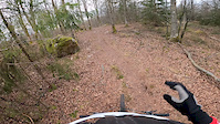
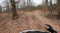
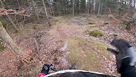
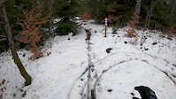
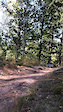
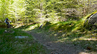
Photos of Växjö Mountain Bike
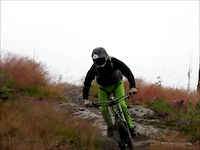
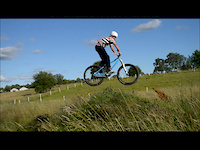
Videos of Växjö Mountain Bike
trail: Enduro
0:56 |
145 |
Apr 1, 2020
trail: Preacherman
0:54 |
59 |
Apr 1, 2020
trail: Archangel
0:22 |
113 |
Apr 1, 2020
trail: Djungelvrål
0:08 |
100 |
Mar 1, 2020
trail: Bergunda Röd
0:07 |
205 |
Oct 3, 2019
trail: Hope
0:40 |
104 |
Aug 31, 2016
trail: Divine
2:32 |
209 |
May 16, 2015
trail: Hope
2:51 |
2102 |
Aug 18, 2012
Recent Trail Reports
| status | trail | date | condition | info | user |
|---|---|---|---|---|---|
| Ernie | Nov 21, 2024 @ 2:02pm Nov 21, 2024 | Dry | Vincent6gEzgA | ||
| Slottsstigen | May 16, 2024 @ 7:02am May 16, 2024 | Wet | QGGmkH | ||
| Hissö Västra | May 16, 2024 @ 7:02am May 16, 2024 | Variable | QGGmkH | ||
| Salta Patronen | Mar 26, 2024 @ 1:12pm Mar 26, 2024 | Variable | stewen VSC | ||
| Rollo | Mar 26, 2024 @ 1:05pm Mar 26, 2024 | Variable | stewen VSC | ||
| Bypass Surgery | May 25, 2023 @ 9:32am May 25, 2023 | Dry | MateuszxOa9fl | ||
| El Plomo | May 21, 2023 @ 7:06am May 21, 2023 | Ideal | MateuszxOa9fl | ||
| Evedalsåsen | Jul 18, 2022 @ 12:03pm Jul 18, 2022 | Ideal | Dennispopps | ||
| Påskägg | Jan 23, 2022 @ 9:28am Jan 23, 2022 | Variable | stewen VSC | ||
| Shorty | Jan 23, 2022 @ 9:28am Jan 23, 2022 | Variable | stewen VSC |
Activity Feed
| username | action | type | title | date |
|---|---|---|---|---|
| trailforks | add | video | activity #95521486 | May 25, 2026 @ 2:00pm May 25, 2026 |
| Bjorre822 | wishlist | trail | activity #94492758 | May 11, 2026 @ 7:11am May 11, 2026 |
| Bjorre822 | wishlist | trail | activity #94492553 and 1 more | May 11, 2026 @ 7:06am May 11, 2026 |
| Mazzer88 | wishlist | trail | activity #91988656 and 1 more | Apr 5, 2026 @ 10:06am Apr 5, 2026 |
| fJSlmg | wishlist | trail | activity #91761784 | Apr 2, 2026 @ 7:53am Apr 2, 2026 |
Recent Comments
| username | type | title | comment | date |
|---|---|---|---|---|
| trail | Den kanske borde vara röd? Rösta gärna om... | Jul 25, 2024 @ 12:19pm Jul 25, 2024 | ||
| trail | svårcyklad och stenig | Jul 25, 2024 @ 10:22am Jul 25, 2024 | ||
| trail | Skola har byggts över stigen. Allmänt igenväxt. | Jul 26, 2022 @ 1:29pm Jul 26, 2022 | ||
| trail | This trail is totally overgrown and unridable.... | Jul 15, 2021 @ 8:48am Jul 15, 2021 | ||
| trail | Overgrown. Suitable for walking. | Jul 7, 2021 @ 6:26am Jul 7, 2021 |
Local Badges
-

Completionist0 awarded -
Completionist0 awarded -
Completionist0 awarded -
Completionist0 awarded -
Completionist0 awarded -
Completionist0 awarded
Bike & Skill Parks
| name | type | city | rating |
|---|---|---|---|
| Braås Bike Park / Aktivitetspark | skill park | Växjö | |
| Pumptrack | skill park | Växjö |
Activity Type Stats
| activitytype | trails | distance | descent | descent distance | total vertical | rating | global rank | state rank | photos | reports | routes | ridelogs |
|---|---|---|---|---|---|---|---|---|---|---|---|---|
| Mountain Bike | 329 | 162 miles | 10,568 ft | 68 miles | 266 ft | #450 | #37 | 108 | 459 | 5 | 13,927 | |
| Hike | 339 | 169 miles | 10,850 ft | 70 miles | 266 ft | #584 | #42 | 457 | 550 | |||
| Trail Running | 340 | 169 miles | 10,889 ft | 70 miles | 266 ft | #395 | #40 | 457 | 1,764 | |||
| Nordic Ski | 12 | 13 miles | 846 ft | 5 miles | 230 ft | #254 | #30 | 59 |
Frequently Asked Questions About Växjö
▼
What are the best places to ride in Växjö?
▼
What are the highest rated mountain biking trails in Växjö?
The highest rated mountain biking trails in Växjö are:
- Gröna Grodan (4.4/5)
- Bergunda Blå (4.2/5)
- Pista Ciclabile (4.2/5)
- Juleskum (4.2/5)
- Preacherman (4.1/5)
▼
What is the best time of the year to ride in Växjö?
Based on ride log data, the most popular months to ride in Växjö are:
- July (128 activities)
- May (68 activities)
- June (64 activities)
▼
Where can I park to ride in Växjö?
Activities
Trails
- By jbella
 VSC & contributors
 - Admins: ollesvenskonthetrail, JALLE, OrjanX, martinlindstr, VSC, stewen
- #8479 - 19,822 views
- växjö activity log | embed map of Växjö mountain bike trails | växjö mountain biking points of interest polygons
Downloading of trail gps tracks in kml & gpx formats is enabled for Växjö.
You must login to download files.