close
-
Layers w
- Weather Layers
- Pro
- Pro
- Pro
- Pro
- Pro
- Pro
- More Layers
- Pro
- Pro
- Pro
- Pro
-
Upgrade to

3D
Trail Conditions
- Unknown
- Snow Groomed
- Snow Packed
- Snow Covered
- Snow Cover Partial
- Freeze/thaw Cycle
- Icy
- Prevalent Mud
- Wet
- Variable
- Ideal
- Dry
- Very Dry
Trail Flow (Ridden Direction)
Trailforks scans users ridelogs to determine the most popular direction each trail is ridden. A good flowing trail network will have most trails flowing in a single direction according to their intension.
The colour categories are based on what percentage of riders are riding a trail in its intended direction.
The colour categories are based on what percentage of riders are riding a trail in its intended direction.
- > 96%
- > 90%
- > 80%
- > 70%
- > 50%
- < 50%
- bi-directional trail
- no data
Trail Last Ridden
Trailforks scans ridelogs to determine the last time a trail was ridden.
- < 2 days
- < 1 week
- < 2 weeks
- < 1 month
- < 6 months
- > 6 months
Trail Ridden Direction
The intended direction a trail should be ridden.
- Downhill Only
- Downhill Primary
- Both Directions
- Uphill Primary
- Uphill Only
- One Direction
Contribute Details
Colors indicate trail is missing specified detail.
- Description
- Photos
- Description & Photos
- Videos
Trail Popularity ?
Trailforks scans ridelogs to determine which trails are ridden the most in the last 9 months.
Trails are compared with nearby trails in the same city region with a possible 25 colour shades.
Think of this as a heatmap, more rides = more kinetic energy = warmer colors.
- most popular
- popular
- less popular
- not popular
ATV/ORV/OHV Filter
Max Vehicle Width
inches
US Cell Coverage
Legend

Radar Time
Activity Recordings
Trailforks uses anonymized public activity data.
?
Activity Recordings
Trailforks uses anonymized public activity data.
?
Personal Heatmap
▶
Activity Types
all
/
none
▶
Options
2
Date range
month
–
Winter Trails
Warning
A routing network for winter maps does not exist. Selecting trails using the winter trails layer has been disabled.
Missing Trails
Most Popular
Least Popular
Trails are colored based on popularity. The more popular a trail is, the more red. Less popular trails trend towards green.
Jump Magnitude Heatmap
Heatmap of where riders jump on trails. Zoom in to see individual jumps, click circles to view jump details.
BC Backroad Status
![map legend]()
Service Road Atlas is a free to use, community-driven service for viewing and creating reports on the numerous back-country service roads around B.C. and Alberta.

Slope Aspect
Direction the slope faces
Trails Deemphasized
Trails are shown in grey.
Only show trails with no bike usage.
Suggested Layers
Based on selected activity type
Save the current map location and zoom level as your default home location whenever this page is loaded.
SaveFantastica trail area in Poggio Picenze a 10 minuti ad L'Aquila
Primary Trail Type: All-Mountain & Downhill
eBikes Allowed:
Yes
Shuttleable: YES
Access Info:
Piazza Salvatore Massonio
Links
This region uses the Uk/Euro style trail grading system.
Activities Click to view
- Mountain Bike
4 trails
- E-Bike
3 trails
Region Details
- 2
Region Status
Open as of May 10, 2026Stats
- Avg Trail Rating
- Trails (view details)
- 4
- Trails Mountain Bike
- 4
- Trails E-Bike
- 3
- Total Distance
- 4 miles
- Total Descent Distance
- 4 miles
- Total Descent
- 3,175 ft
- Total Vertical
- 1,718 ft
- Highest Trailhead
- 4,226 ft
- Reports
- 19
- Photos
- 4
- Ridden Counter
- 117
Popular VDC Mountain Biking Trails
• 70 ★ 0.0 • 2 miles • 20 ft • 35 •
Popular blue difficulty singletrack. This mountain bike primary trail can be used downhill only and has a moderate overall physical rating. Trail visibility is always easy to follow. On average it takes 12 minutes to complete this trail.
• 80 ★ 4.0 • 4,341 ft • 9 ft • 30 •
Popular red difficulty singletrack. This mountain bike primary trail can be used both directions. On average it takes 4 minutes to complete this trail.
• 45 ★ 0.0 • 4,163 ft • 0 ft • 17 •
Moderately popular blue difficulty singletrack. This mountain bike primary trail can be used both directions. On average it takes 3 minutes to complete this trail.
• 5 ★ 0.0 • 1 mile • 0 ft • 5 •
Less popular red difficulty singletrack. This mountain bike primary trail can be used downhill only and has a hard overall physical rating. Trail visibility is sometimes hard to follow. On average it takes 33 minutes to complete this trail.
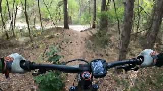
Videos of VDC Mountain Bike
trail: High Way & Traliccio trail
9:26 |
150 |
Sep 27, 2023 , L'Aquila

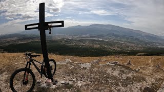
trail: Croce del Poggio
9:26 |
129 |
Sep 27, 2023 , L'Aquila
trail: The First Trail
6:33 |
166 |
Sep 26, 2023 , L'Aquila
Recent Trail Reports
| status | trail | date | condition | info | user |
|---|---|---|---|---|---|
| High Way & Traliccio trail | Oct 26, 2024 @ 10:06am Oct 26, 2024 | Ideal | Carlosdelafuente | ||
| The First Trail | Mar 16, 2024 @ 2:32am Mar 16, 2024 | Ideal | massimoMTB |
Activity Feed
| username | action | type | title | date |
|---|---|---|---|---|
| massimoMTB | ridden | trail | activity #67841218 and 1 more | Mar 16, 2025 @ 1:14am Mar 16, 2025 |
| Carlosdelafuente | add | report | activity #60956200 | Oct 26, 2024 @ 11:09am Oct 26, 2024 |
| trailfellows | wishlist | trail | activity #50408898 | Mar 24, 2024 @ 12:10pm Mar 24, 2024 |
| massimoMTB | add | report | activity #50085065 and 1 more | Mar 16, 2024 @ 12:00pm Mar 16, 2024 |
| Carlosdelafuente | add | report | activity #45228024 and 1 more | Oct 14, 2023 @ 10:03am Oct 14, 2023 |
Nearby Areas
| name | distance | ||||
|---|---|---|---|---|---|
| Parco Nazionale del Gran Sasso | 1 | 1 | 1 | 7 km | |
| Campo Imperatore Gravity | 8 km | ||||
| Roio Bike Park | 2 | 2 | 2 | 8.8 km | |
| Altopiano delle Rocche | 11.8 km | ||||
| Vallone delle Cese | 2 | 2 | 13.4 km |
Activity Type Stats
| activitytype | trails | distance | descent | descent distance | total vertical | rating | global rank | state rank | photos | reports | routes | ridelogs |
|---|---|---|---|---|---|---|---|---|---|---|---|---|
| Mountain Bike | 4 | 4 miles | 3,176 ft | 4 miles | 1,719 ft | #10,944 | #553 | 4 | 19 | 57 | ||
| E-Bike | 3 | 3 miles | 2,090 ft | 3 miles | 1,490 ft | #8,284 | #549 | 18 | 32 |
- By VDC & contributors
- Admins: apply
- #44534 - 1,547 views
- vdc activity log | embed map of VDC mountain bike trails |
Downloading of trail gps tracks in kml & gpx formats is enabled for VDC.
You must login to download files.