close
-
Layers w
- Weather Layers
- Pro
- Pro
- Pro
- Pro
- Pro
- Pro
- More Layers
- Pro
- Pro
- Pro
- Pro
-
Upgrade to

3D
Trail Conditions
- Unknown
- Snow Groomed
- Snow Packed
- Snow Covered
- Snow Cover Partial
- Freeze/thaw Cycle
- Icy
- Prevalent Mud
- Wet
- Variable
- Ideal
- Dry
- Very Dry
Trail Flow (Ridden Direction)
Trailforks scans users ridelogs to determine the most popular direction each trail is ridden. A good flowing trail network will have most trails flowing in a single direction according to their intension.
The colour categories are based on what percentage of riders are riding a trail in its intended direction.
The colour categories are based on what percentage of riders are riding a trail in its intended direction.
- > 96%
- > 90%
- > 80%
- > 70%
- > 50%
- < 50%
- bi-directional trail
- no data
Trail Last Ridden
Trailforks scans ridelogs to determine the last time a trail was ridden.
- < 2 days
- < 1 week
- < 2 weeks
- < 1 month
- < 6 months
- > 6 months
Trail Ridden Direction
The intended direction a trail should be ridden.
- Downhill Only
- Downhill Primary
- Both Directions
- Uphill Primary
- Uphill Only
- One Direction
Contribute Details
Colors indicate trail is missing specified detail.
- Description
- Photos
- Description & Photos
- Videos
Trail Popularity ?
Trailforks scans ridelogs to determine which trails are ridden the most in the last 9 months.
Trails are compared with nearby trails in the same city region with a possible 25 colour shades.
Think of this as a heatmap, more rides = more kinetic energy = warmer colors.
- most popular
- popular
- less popular
- not popular
ATV/ORV/OHV Filter
Max Vehicle Width
inches
US Cell Coverage
Legend

Radar Time
Activity Recordings
Trailforks uses anonymized public activity data.
?
Activity Recordings
Trailforks uses anonymized public activity data.
?
Personal Heatmap
▶
Activity Types
all
/
none
▶
Options
2
Date range
month
–
Winter Trails
Warning
A routing network for winter maps does not exist. Selecting trails using the winter trails layer has been disabled.
Missing Trails
Most Popular
Least Popular
Trails are colored based on popularity. The more popular a trail is, the more red. Less popular trails trend towards green.
Jump Magnitude Heatmap
Heatmap of where riders jump on trails. Zoom in to see individual jumps, click circles to view jump details.
BC Backroad Status
![map legend]()
Service Road Atlas is a free to use, community-driven service for viewing and creating reports on the numerous back-country service roads around B.C. and Alberta.

Slope Aspect
Direction the slope faces
Trails Deemphasized
Trails are shown in grey.
Only show trails with no bike usage.
Suggested Layers
Based on selected activity type
Save the current map location and zoom level as your default home location whenever this page is loaded.
Save
No description for Velenje has been added yet!
Login or register to submit one.
This region uses the Uk/Euro style trail grading system.
Activities Click to view
- Mountain Bike
16 trails
- E-Bike
15 trails
- Hike
5 trails
- Trail Running
4 trails
Region Details
- 4
- 1
- 3
- 1
Region Status
Open as of Jun 1, 2026Stats
- Avg Trail Rating
- Trails (view details)
- 10
- Trails Mountain Bike
- 16
- Trails E-Bike
- 15
- Trails Hike
- 5
- Trails Trail Running
- 4
- Total Distance
- 5 miles
- Total Descent Distance
- 2 miles
- Total Descent
- 1,356 ft
- Total Vertical
- 1,263 ft
- Highest Trailhead
- 2,569 ft
- Reports
- 90
- Photos
- 29
- Ridden Counter
- 453
Sub Regions
-
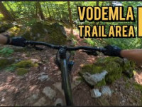
Vodemla Trails
- 1
- 3
- 1
Popular Velenje Mountain Biking Trails
Velenje Mountain Bike Routes
★ 5.0 • 19 miles • 4,419 ft • 0 • Loop •
3h loop route from velenje to dobrna castle
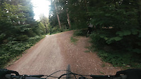
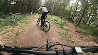
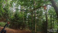
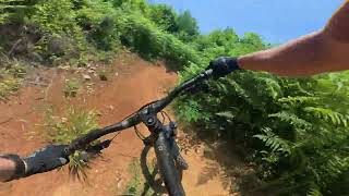
Photos of Velenje Mountain Bike
Videos of Velenje Mountain Bike
trail: Brikcij
2:01 |
218 |
Jul 1, 2022
trail: Turn
0:36 |
156 |
Jul 1, 2022
trail: Volk Ovca
0:50 |
307 |
Jun 23, 2022
trail: Turn
3:57 |
40 |
Oct 6, 2025 , Velenje

trail: Brikcij
3:57 |
36 |
Oct 6, 2025 , Velenje

trail: Volk Ovca
53 |
Jun 25, 2025 , Velenje
trail: Cerkvica
66 |
Jun 25, 2025 , Velenje

trail: Palčkov Gozd
45 |
Jun 21, 2025 , Velenje
Recent Trail Reports
| status | trail | date | condition | info | user |
|---|---|---|---|---|---|
| Turn | Jun 1, 2026 @ 10:41am (Europe/Ljubljana) Jun 1, 2026 | Wet | DejanPozegar | ||
| Brikcij | May 8, 2026 @ 3:32pm (Europe/Ljubljana) May 8, 2026 | Very Dry | andlb | ||
| Zadnji uphill | May 8, 2026 @ 3:32pm (Europe/Ljubljana) May 8, 2026 | Dry | andlb | ||
| Palčkov Gozd | Apr 1, 2026 @ 3:36pm (Europe/Ljubljana) Apr 1, 2026 | Dry | ProfessorTrail | ||
| Zelenica (working title) | Mar 13, 2026 @ 2:22pm (Europe/Ljubljana) Mar 13, 2026 | Ideal | Andrej4321 | ||
| Vodemla gravel access road | Sep 14, 2025 @ 11:35am (Europe/Ljubljana) Sep 14, 2025 | Ideal | BostjanGolez | ||
| Volk Ovca | Jun 21, 2025 @ 11:09pm Jun 21, 2025 | Dry | nizeps | ||
| Cerkvica | Jun 21, 2025 @ 11:08pm Jun 21, 2025 | Dry | nizeps | ||
| Access road | Apr 30, 2025 @ 4:29pm Apr 30, 2025 | Ideal | strozi |
Activity Feed
| username | action | type | title | date |
|---|---|---|---|---|
| DejanPozegar | add | report | activity #96004212 | Jun 1, 2026 @ 1:41am Jun 1, 2026 |
| DejanPozegar | add | report | activity #95586172 and 2 more | May 26, 2026 @ 1:15pm May 26, 2026 |
| vuk1976 | ridden | trail | activity #95507379 and 2 more | May 25, 2026 @ 11:26am May 25, 2026 |
| DejanPozegar | add | report | activity #95395745 | May 24, 2026 @ 4:32am May 24, 2026 |
| andlb | add | report | activity #94308695 and 2 more | May 8, 2026 @ 9:06pm May 8, 2026 |
Recent Comments
| username | type | title | comment | date |
|---|---|---|---|---|
| trail | Although rated black this trail isn't... | Aug 15, 2022 @ 9:54am Aug 15, 2022 | ||
| trail | Natural forest flow with a special middle... | Aug 15, 2022 @ 9:40am Aug 15, 2022 | ||
| trail | Good flow with a continuing berm turns! Watch... | Aug 15, 2022 @ 9:31am Aug 15, 2022 | ||
| trail | Proper enduro line with some technical rocky... | Aug 15, 2022 @ 9:15am Aug 15, 2022 |
Local Badges
-

Epic Mountain Bike Climb 2k0 awarded -

Climbing 10k Badge3 awarded -

Mountain Biking 100k Badge0 awarded -

Big Ride 30k8 awarded -

Epic Ride 50k3 awarded
Local Trail Supporters
- KD Lignit
Activity Type Stats
| activitytype | trails | distance | descent | descent distance | total vertical | rating | global rank | state rank | photos | reports | routes | ridelogs |
|---|---|---|---|---|---|---|---|---|---|---|---|---|
| Mountain Bike | 16 | 5 miles | 1,355 ft | 2 miles | 1,263 ft | #2,624 | #22 | 29 | 90 | 1 | 2,605 | |
| E-Bike | 15 | 5 miles | 1,355 ft | 2 miles | 1,132 ft | #2,443 | #24 | 90 | 1 | 312 | ||
| Hike | 5 | 1 mile | 1,260 ft | #4,470 | #33 | 72 | 1 | 494 | ||||
| Trail Running | 4 | 1 mile | 1,204 ft | #3,877 | #34 | 72 | 167 |
Frequently Asked Questions About Velenje
▼
What are the best places to ride in Velenje?
Velenje has 1 areas to explore for mountain biking. The top rated areas are:
▼
What are the highest rated mountain biking trails in Velenje?
The highest rated mountain biking trails in Velenje are:
- Turn (4.3/5)
- Cerkvica (4.3/5)
- Brikcij (4.2/5)
- Palčkov Gozd (4.2/5)
- Zelenica (working title) (4.1/5)
▼
What is the best time of the year to ride in Velenje?
Based on ride log data, the most popular months to ride in Velenje are:
- June (39 activities)
- April (33 activities)
- May (33 activities)
▼
Where can I park to ride in Velenje?
There are 2 parking locations listed in Velenje. The most popular parking spots are:
- By Vajtos & contributors
- Admins: VjekoslavKrsanac, zocknroll, star69
- #24624 - 4,426 views
- velenje activity log | embed map of Velenje mountain bike trails | velenje mountain biking points of interest
Downloading of trail gps tracks in kml & gpx formats is enabled for Velenje.
You must login to download files.