close
-
Layers w
- Weather Layers
- Pro
- Pro
- Pro
- Pro
- Pro
- Pro
- More Layers
- Pro
- Pro
- Pro
- Pro
-
Upgrade to

3D
Trail Conditions
- Unknown
- Snow Groomed
- Snow Packed
- Snow Covered
- Snow Cover Partial
- Freeze/thaw Cycle
- Icy
- Prevalent Mud
- Wet
- Variable
- Ideal
- Dry
- Very Dry
Trail Flow (Ridden Direction)
Trailforks scans users ridelogs to determine the most popular direction each trail is ridden. A good flowing trail network will have most trails flowing in a single direction according to their intension.
The colour categories are based on what percentage of riders are riding a trail in its intended direction.
The colour categories are based on what percentage of riders are riding a trail in its intended direction.
- > 96%
- > 90%
- > 80%
- > 70%
- > 50%
- < 50%
- bi-directional trail
- no data
Trail Last Ridden
Trailforks scans ridelogs to determine the last time a trail was ridden.
- < 2 days
- < 1 week
- < 2 weeks
- < 1 month
- < 6 months
- > 6 months
Trail Ridden Direction
The intended direction a trail should be ridden.
- Downhill Only
- Downhill Primary
- Both Directions
- Uphill Primary
- Uphill Only
- One Direction
Contribute Details
Colors indicate trail is missing specified detail.
- Description
- Photos
- Description & Photos
- Videos
Trail Popularity ?
Trailforks scans ridelogs to determine which trails are ridden the most in the last 9 months.
Trails are compared with nearby trails in the same city region with a possible 25 colour shades.
Think of this as a heatmap, more rides = more kinetic energy = warmer colors.
- most popular
- popular
- less popular
- not popular
ATV/ORV/OHV Filter
Max Vehicle Width
inches
US Cell Coverage
Legend

Radar Time
Activity Recordings
Trailforks uses anonymized public activity data.
?
Activity Recordings
Trailforks uses anonymized public activity data.
?
Personal Heatmap
▶
Activity Types
all
/
none
▶
Options
2
Date range
month
–
Winter Trails
Warning
A routing network for winter maps does not exist. Selecting trails using the winter trails layer has been disabled.
Missing Trails
Most Popular
Least Popular
Trails are colored based on popularity. The more popular a trail is, the more red. Less popular trails trend towards green.
Jump Magnitude Heatmap
Heatmap of where riders jump on trails. Zoom in to see individual jumps, click circles to view jump details.
BC Backroad Status
![map legend]()
Service Road Atlas is a free to use, community-driven service for viewing and creating reports on the numerous back-country service roads around B.C. and Alberta.

Slope Aspect
Direction the slope faces
Trails Deemphasized
Trails are shown in grey.
Only show trails with no bike usage.
Suggested Layers
Based on selected activity type
Save the current map location and zoom level as your default home location whenever this page is loaded.
SaveIl Veneto è una regione italiana a statuto ordinario di 4 851 507 abitanti situata nell'Italia nord-orientale, istituita nel 1948 e resa operativa nel 1970. Ha come capoluogo la città di Venezia.
Quarta regione per popolazione d'Italia, dopo Lombardia, Lazio e Campania, confinante a nord con l'Austria, a nord-ovest con il Trentino-Alto Adige, a sud con l'Emilia-Romagna, a sud-ovest con la Lombardia, a est con il Friuli-Venezia Giulia e a sud-est con il mare Adriatico, insieme con Trentino-Alto Adige e Friuli-Venezia Giulia costituisce la macroarea del Triveneto o delle Tre Venezie.
Quarta regione per popolazione d'Italia, dopo Lombardia, Lazio e Campania, confinante a nord con l'Austria, a nord-ovest con il Trentino-Alto Adige, a sud con l'Emilia-Romagna, a sud-ovest con la Lombardia, a est con il Friuli-Venezia Giulia e a sud-est con il mare Adriatico, insieme con Trentino-Alto Adige e Friuli-Venezia Giulia costituisce la macroarea del Triveneto o delle Tre Venezie.
source: Wikipedia
This region uses the Uk/Euro style trail grading system.
Region Details
- 178
- 47
- 241
- 556
- 171
- 34
- 3
Stats
- Avg Trail Rating
- Trails (view details)
- 1,461
- Trails Mountain Bike
- 1,246
- Trails E-Bike
- 1,242
- Trails Gravel Bike
- 90
- Trails Adaptive Bike
- 137
- Trails Winter Fat Bike
- 97
- Trails Horse
- 74
- Trails Hike
- 1,023
- Trails Trail Running
- 1,016
- Trails Dirtbike/Moto
- 7
- Trails Observed Trials
- 1
- Trails ATV/ORV/OHV
- 2
- Trails Snowshoe
- 29
- Trails Downhill Ski
- 196
- Trails Backcountry Ski
- 29
- Trails Nordic Ski
- 5
- Total Distance
- 1,638 miles
- Total Descent
- 851,490 ft
- Total Vertical
- 9,501 ft
- Highest Trailhead
- 9,504 ft
- Reports
- 5,177
- Photos
- 2,001
- Ridden Counter
- 88,732
Popular Trail Networks
view all areas »Sub Regions
- Belluno (734)
- Agordo (34)
- Alano di Piave (83)
- Alano (83)
- Alleghe (36)
- Arsiè (44)
- Auronzo di Cadore (13)
- Belluno (58)
- Cadore (3)
- Nevegal (35)
- Serva / Col de Roanza (3)
- Borgo Valbelluna (19)
- Cansiglio (1)
- Cesiomaggiore (2)
- Colle Santa Lucia (23)
- Cortina d'Ampezzo (89)
- 5 Torri (5)
- Cortina Bike Park Dolomiti (65)
- Domegge Di Cadore (3)
- Falcade (15)
- Feltre (42)
- Lamon (8)
- Livinallongo del Col di Lana (23)
- Arabba (19)
- Mel (4)
- Pedavena (6)
- Pieve Di Cadore (5)
- Rocca Pietore (8)
- San Tomaso Agordino (6)
- Santa Giustina Belluno (11)
- SEDICO (2)
- Selva Di Cadore (116)
- Civetta Trail Area (1)
- Val Fiorentina (108)
- Seren del Grappa (4)
- SOIS (1)
- Sospirolo (16)
- Tambre (2)
- Val di Zoldo (125)
- Valle Di Cadore (6)
- Vittorio Veneto (5)
- Alpago (0)
- Cadore (6)
- Ski Civetta (0)
- Agordo (34)
- Padova (162)
- Padova (9)
- Piove Di Sacco (3)
- Colli Euganei (163)
- Padova (9)
- Rovigo (2)
- Castelmassa (1)
- Castelmassa (1)
- Treviso (84)
- Borso del Grappa (6)
- Conegliano (1)
- Crocetta Del Montello (6)
- Pederobba (5)
- Susegana (5)
- Treviso (9)
- Volpago del Montello (26)
- Monte Grappa (15)
- Borso del Grappa (6)
- Venezia (6)
- Caorle (4)
- Fossalta Di Piave (1)
- Venezia (1)
- Caorle (4)
- Verona (181)
- Borghetto (2)
- Bosco Chiesanuova (4)
- Brenzone Sul Garda (6)
- Cavaion (3)
- Fumane (15)
- Garda (3)
- Grezzana (12)
- Lugo Di Grezzana (20)
- Negrar (7)
- Peschiera Del Garda (1)
- San Zeno Di Montagna (40)
- Prada - Monte Baldo (16)
- Sant'ambrogio Di Valpolicella (21)
- Sant'Anna D'Alfaedo (2)
- Soave (2)
- Torretta (2)
- Trezzolano (16)
- Verona (17)
- Borghetto (2)
- Vicenza (120)
- Altavilla (7)
- Monti comunali (7)
- Arzignano (23)
- Montecchio Maggiore (10)
- Asiago (11)
- Mt. Erio (2)
- Barbarano Vicentino (2)
- Bassano Del Grappa (8)
- Monte Di Malo (5)
- Recoaro (7)
- Rotzo (2)
- Schio (3)
- Torrebelvicino (3)
- Vicenza (8)
- Bassano del Grappa (34)
- Colli Berici (13)
- Altavilla (7)
Popular Veneto Mountain Biking Trails
• 95 ★ 3.7 • 1 mile • 0 ft • 1,037 •
Single trail as a part of Sella Ronda Tour clock-wise.
• 90 ★ 2.7 • 4,944 ft • 0 ft • 989 •
Popular blue difficulty singletrack. This mountain bike primary trail can be used downhill only. Trail visibility is always easy to follow. On average it takes 4 minutes to complete this trail.
• 100 ★ 3.6 • 5,085 ft • 20 ft • 719 •
Popular blue difficulty singletrack. This mountain bike primary trail can be used downhill only. It features rock garden. Trail visibility is always easy to follow. On average it takes 6 minutes to complete this trail.
• 70 ★ 3.6 • 3,553 ft • 0 ft • 610 •
Nice well groomed flow trail from Rifugio Burz (Burz-Hütte) to Arabba
• 75 ★ 4.0 • 3 miles • 163 ft • 588 •
Long and nice panoramic trail (easy and relatively boring in the beginning and becoming much better further down). Requires some occasional uphill pedaling.
• 65 ★ 4.1 • 3 miles • 32 ft • 400 •
Long and varied trail with fast / slow, natural / built sections through forest, meadows and rock sections
• 100 ★ 0.0 • 7 miles • 370 ft • 325 •
Pista ideale per raggiungere il Trail
• 100 ★ 4.6 • 2 miles • 156 ft • 320 •
90% of this trail is very tame and easy - fast and flowy singletrack. But there are a couple of technical rocky sections. (90% green / 10% red)
Veneto Mountain Bike Routes
Tra Storia e Malghe Featured
★ 3.5 • 14 miles • 3,093 ft • 3 • Loop •
Paesaggi fantastici sentieri puliti e qualche malga dove fermarsi ad assaggiare prodotti locali (solo da...
Laste / San Daniele Featured
★ 5.0 • 10 miles • 2,587 ft • 10 • Loop •
Giro adatto a bici all mountain / enduro, ma anche a chi ci sa fare con le xc! Si consiglia di partire dal...
★ 4.4 • 27 miles • 9,141 ft • 21 • Loop •
Il Civetta Enduro Tour è un’esperienza imperdibile per gli amanti dell’enduro naturale. Questo...
★ 5.0 • 28 miles • 7,743 ft • 11 • Point to Point •
Dolomites Panoramic Enduro MTB Trail Route from Cortina d'Ampezzo to Alleghe through monte Fertazza, using...
★ 5.0 • 18 miles • 6,984 ft • 10 • Loop •
ENG This All Mountain MTB tour allows you to enjoy the most stunning views of the UNESCO Dolomites,...
★ 5.0 • 15 miles • 3,887 ft • 6 • Loop •
Giro in Mtb panoramico impegnativo dal punto di vista tecnico e fisico, adatto solo a riders esperti. Da...
Photos of Veneto Mountain Bike
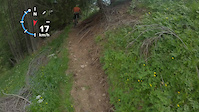
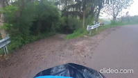
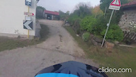
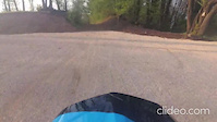
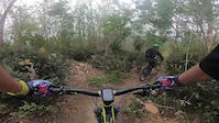
Videos of Veneto Mountain Bike
trail: Dh Giannini
3:13 |
|
Sep 30, 2024
trail: DH Moschini
0:54 |
|
Sep 30, 2024
trail: Triol De I Siori
0:36 |
200 |
Jun 26, 2023
10:22 |
98 |
May 17, 2023
trail: Tonini DH
2:22 |
14 |
May 8, 2023
trail: DH Briccon Tonini
0:50 |
16 |
May 8, 2023
trail: DH Fracca Suan
3:09 |
19 |
May 8, 2023
trail: Panoramic Rave PS1
3:34 |
118 |
May 7, 2023
Current Trail Warnings
| status | trail | date | condition | user | info |
|---|---|---|---|---|---|
| Cri Dream Verona | Jul 3, 2026 @ 8:12pm (Europe/Rome) 1 day | Unknown | apavo75 | non c'è modo di accedere, hanno bloccato... | |
| Vajo di Quinzano Verona | Jul 3, 2026 @ 8:11pm (Europe/Rome) 1 day | Unknown | apavo75 | arrivati in fondo al vajo alberi caduti e... | |
| Casera di Bragarezza - Zoppé Val di Zoldo | Jun 29, 2026 @ 9:50am (Europe/Ljubljana) Jun 29, 2026 | Ideal | il-bradipo | E-Bike Dopo i primi metri sentiero lasciato a... |
Recent Trail Reports
Activity Feed
| username | action | type | title | date |
|---|---|---|---|---|
| bartolomeo902 | ridden | route | activity #98457920 | Jul 4, 2026 @ 3:50pm 6 hours |
| UgIexc | wishlist | trail | activity #98438573 | Jul 4, 2026 @ 11:22am 11 hours |
| Giampix | wishlist | trail | activity #98418187 | Jul 4, 2026 @ 8:05am 14 hours |
| ETYaFAuR | vote | trail | activity #98401687 | Jul 4, 2026 @ 4:34am 18 hours |
| LucaChizzali | add | trail | activity #98361022 | Jul 3, 2026 @ 1:02pm 1 day |
Recent Comments
| username | type | title | comment | date |
|---|---|---|---|---|
| report | la traccia bypassa il tratto impegnativo che... | Jul 2, 2026 @ 6:21am 3 days | ||
| report | Easy Trail in Both directions. A lot of Hikers | Jun 25, 2026 @ 9:55am Jun 25, 2026 | ||
| trail | Not a real trail. Starting at the farm it is a... | Jun 17, 2026 @ 11:13pm Jun 17, 2026 | ||
| trail | Always very nice. | Jun 13, 2026 @ 10:46am Jun 13, 2026 | ||
| trail | This trail was already too difficult to be a... | Jun 13, 2026 @ 9:20am Jun 13, 2026 |
Local Badges
-

Mountain Biking 100k Badge0 awarded -
Mountain Biking 100k Badge0 awarded -
Mountain Biking 100k Badge1 awarded -
Mountain Biking 100k Badge1 awarded -
Mountain Biking 100k Badge0 awarded -
Mountain Biking 100k Badge0 awarded
Bike & Skill Parks
| name | type | city | rating |
|---|---|---|---|
| Val Fiorentina | bike park | Selva Di Cadore | |
| Civetta Trail Area | bike park | Selva Di Cadore | |
| Pump Track - Campo San Martino | skill park | Padua | |
| Motoclub Del Montagnanese | skill park | San Germano | |
| Enduro Lendinara | skill park | Bornio |
Local Trail Supporters
![]()
- Damiano De Biasio
![]()
- Dolomiti Bike Company
- Marco De Col
![]()
Activity Type Stats
| activitytype | trails | distance | descent | descent distance | total vertical | rating | global rank | state rank | photos | reports | routes | ridelogs |
|---|---|---|---|---|---|---|---|---|---|---|---|---|
| Mountain Bike | 1,245 | 1,473 miles | 720,974 ft | 936 miles | 8,425 ft | 1,929 | 5,150 | 83 | 161,039 | |||
| E-Bike | 1,242 | 1,472 miles | 718,199 ft | 933 miles | 8,425 ft | 45 | 4,690 | 33 | 20,071 | |||
| Gravel Bike | 90 | 118 miles | 35,351 ft | 51 miles | 8,753 ft | 239 | 6 | 4,459 | ||||
| Adaptive Bike | 137 | 298 miles | 46,952 ft | 116 miles | 7,913 ft | 561 | 2 | 2 | ||||
| Winter Fat Bike | 97 | 138 miles | 47,920 ft | 73 miles | 6,916 ft | 411 | ||||||
| Horse | 74 | 117 miles | 25,348 ft | 47 miles | 7,359 ft | 559 | 2 | |||||
| Hike | 1,023 | 1,225 miles | 591,066 ft | 752 miles | 8,753 ft | 13 | 4,907 | 11 | 16,999 | |||
| Trail Running | 1,016 | 1,245 miles | 588,986 ft | 760 miles | 8,753 ft | 2 | 4,926 | 10 | 3,193 | |||
| Dirtbike/Moto | 7 | 8 miles | 190 ft | 1 mile | 3,901 ft | 537 | 3 | |||||
| Observed Trials | 1 | 3 miles | 85 ft | 1,342 ft | 1,490 ft | 22 | 2 | |||||
| ATV/ORV/OHV | 2 | 5 miles | 138 ft | 2,753 ft | 2,313 ft | 535 | 7 | |||||
| Snowshoe | 29 | 38 miles | 12,762 ft | 17 miles | 7,110 ft | 51 | 1 | 178 | ||||
| Downhill Ski | 196 | 119 miles | 108,314 ft | 111 miles | 6,257 ft | 1 | 35 | 4,432 | ||||
| Backcountry Ski | 29 | 42 miles | 15,246 ft | 19 miles | 4,537 ft | 49 | 1 | 1,556 | ||||
| Nordic Ski | 5 | 7 miles | 1,519 ft | 2 miles | 1,788 ft | 35 | 1 | 1,003 |
Activities
- Veneto Mountain Biking Trails
- Veneto E-Biking Trails
- Veneto Gravel Biking Trails
- Veneto Adaptive Biking Trails
- Veneto Winter Fat Biking Trails
- Veneto Horseback Trails
- Veneto Hiking Trails
- Veneto Trail Running Trails
- Veneto Dirtbiking Trails
- Veneto Snowshoeing Trails
- Veneto Skiing Trails
- Veneto Backcountry Skiing Trails
- Veneto Nordic Skiing Trails
Trails
Points of Interest
- By brenthillier
 NSMBA TRAILFORKS & contributors
 - Admins: denitopia, marcoangeletti, cemoorelife, micheletraversi
- #9490 - 18,515 views
- veneto activity log | embed map of Veneto mountain bike trails | veneto mountain biking points of interest
Downloading of trail gps tracks in kml & gpx formats is enabled for Veneto.
You must login to download files.