close
-
Layers w
- Weather Layers
- Pro
- Pro
- Pro
- Pro
- Pro
- Pro
- More Layers
- Pro
- Pro
- Pro
- Pro
-
Upgrade to

3D
Trail Conditions
- Unknown
- Snow Groomed
- Snow Packed
- Snow Covered
- Snow Cover Partial
- Freeze/thaw Cycle
- Icy
- Prevalent Mud
- Wet
- Variable
- Ideal
- Dry
- Very Dry
Trail Flow (Ridden Direction)
Trailforks scans users ridelogs to determine the most popular direction each trail is ridden. A good flowing trail network will have most trails flowing in a single direction according to their intension.
The colour categories are based on what percentage of riders are riding a trail in its intended direction.
The colour categories are based on what percentage of riders are riding a trail in its intended direction.
- > 96%
- > 90%
- > 80%
- > 70%
- > 50%
- < 50%
- bi-directional trail
- no data
Trail Last Ridden
Trailforks scans ridelogs to determine the last time a trail was ridden.
- < 2 days
- < 1 week
- < 2 weeks
- < 1 month
- < 6 months
- > 6 months
Trail Ridden Direction
The intended direction a trail should be ridden.
- Downhill Only
- Downhill Primary
- Both Directions
- Uphill Primary
- Uphill Only
- One Direction
Contribute Details
Colors indicate trail is missing specified detail.
- Description
- Photos
- Description & Photos
- Videos
Trail Popularity ?
Trailforks scans ridelogs to determine which trails are ridden the most in the last 9 months.
Trails are compared with nearby trails in the same city region with a possible 25 colour shades.
Think of this as a heatmap, more rides = more kinetic energy = warmer colors.
- most popular
- popular
- less popular
- not popular
ATV/ORV/OHV Filter
Max Vehicle Width
inches
US Cell Coverage
Legend

Radar Time
Activity Recordings
Trailforks uses anonymized public activity data.
?
Activity Recordings
Trailforks uses anonymized public activity data.
?
Personal Heatmap
▶
Activity Types
all
/
none
▶
Options
2
Date range
month
–
Winter Trails
Warning
A routing network for winter maps does not exist. Selecting trails using the winter trails layer has been disabled.
Missing Trails
Most Popular
Least Popular
Trails are colored based on popularity. The more popular a trail is, the more red. Less popular trails trend towards green.
Jump Magnitude Heatmap
Heatmap of where riders jump on trails. Zoom in to see individual jumps, click circles to view jump details.
BC Backroad Status
![map legend]()
Service Road Atlas is a free to use, community-driven service for viewing and creating reports on the numerous back-country service roads around B.C. and Alberta.

Slope Aspect
Direction the slope faces
Trails Deemphasized
Trails are shown in grey.
Only show trails with no bike usage.
Suggested Layers
Based on selected activity type
Save the current map location and zoom level as your default home location whenever this page is loaded.
Save
No description for Venezuela has been added yet!
Login or register to submit one.
Region Details
- 17
- 4
Stats
- Avg Trail Rating
- Trails (view details)
- 21
- Trails Mountain Bike
- 21
- Trails E-Bike
- 6
- Trails Hike
- 24
- Trails Trail Running
- 25
- Total Distance
- 39 miles
- Total Descent
- 18,013 ft
- Total Vertical
- 4,714 ft
- Highest Trailhead
- 6,174 ft
- Reports
- 216
- Photos
- 221
- Ridden Counter
- 144
Sub Regions
- Aragua (2)
- Maracay (2)
- La Placera (1)
- Maracay (2)
- Caracas (7)
- Lecherias (1)
- Miranda (1)
- Green Park (1)
- San Cristóbal (1)
- Trujillo (7)
- Valencia (2)
Popular Venezuela Mountain Biking Trails
• 90 ★ 4.0 • 1 mile • 226 ft • 18 •
Single Track with many step uphills and switchbacks downhill is fun and fast
• 5 ★ 0.0 • 6 miles • 2,397 ft • 11 •
Less popular blue difficulty singletrack. This mountain bike primary trail can be used both directions and has a moderate overall physical rating with a 2,397 ft blue climb. On average it takes 1 hour6 minutes to complete this trail.
• 100 ★ 5.0 • 4,996 ft • 358 ft • 11 •
Popular blue difficulty singletrack. This mountain bike primary trail can be used both directions and has a moderate overall physical rating with a 358 ft blue climb. It features bridge, drop and jump. On average it takes 18 minutes to complete this trail.
• 75 ★ 4.0 • 4 miles • 1,575 ft • 10 •
Single track with long uphill with fast downhill, fun single track with switchbacks inside the pines zone
• 5 ★ 4.0 • 2 miles • 140 ft • 5 •
Less popular black diamond difficulty singletrack. This mountain bike primary trail can be used downhill primary and has a moderate overall physical rating. It features drop and jump. On average it takes 16 minutes to complete this trail.
• 5 ★ 0.0 • 2 miles • 522 ft • 5 •
Less popular blue difficulty singletrack. This mountain bike primary trail can be used both directions and has a moderate overall physical rating with a 522 ft blue climb. It features skinny. On average it takes 1 hour51 minutes to complete this trail.
• 5 ★ 0.0 • 2 miles • 136 ft • 3 •
Less popular blue difficulty singletrack. This mountain bike primary trail can be used downhill primary. On average it takes 2 hours30 minutes to complete this trail.
• 5 ★ 0.0 • 2 miles • 7 ft • 2 •
Less popular black diamond difficulty singletrack. This mountain bike primary trail can be used downhill only and has a extreme overall physical rating. Trail visibility is sometimes hard to follow. On average it takes 11 minutes to complete this trail.
Venezuela Mountain Bike Routes
3 miles • 745 ft • 0 • Loop •
Circuito de un solo sentido, con tramos de carretera de tierra y cortafuegos, seguidos de subida y...
41 miles • 6,448 ft • 0 •
Ruta con buen desnivel acumulado buena para hacer en cualquier epoca del año, si es temporada de llluvia...
10 miles • 2,004 ft • 0 • Loop • Race •
Dudebike Reload Bike Park - Ubicado en el Ovalo de Turmero - Edo.Aragua Bike Park de Crosscountry y All...
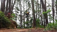
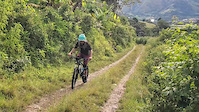
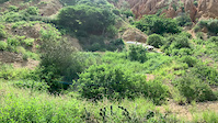
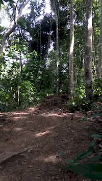
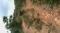
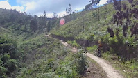
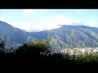
Photos of Venezuela Mountain Bike
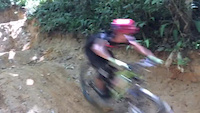
Videos of Venezuela Mountain Bike
trail: Universidad Simon Bolivar
0:54 |
29 |
Jul 27, 2023
trail: Chanda Tower
0:34 |
7 |
Jul 28, 2022
trail: Tumbe Bello-El Morro
0:11 |
72 |
Sep 13, 2020
trail: Parque por la paz
0:11 |
43 |
Sep 27, 2016
trail: Los Paulinos
0:10 |
67 |
Sep 13, 2016
trail: Parque por la paz
0:08 |
57 |
Sep 13, 2016
trail: El Volcan
0:15 |
139 |
Dec 10, 2014
trail: San Luis
4:13 |
252 |
May 2, 2012
Recent Comments
| username | type | title | comment | date |
|---|---|---|---|---|
| report | Bien | Feb 1, 2018 @ 4:42pm Feb 1, 2018 |
Bike & Skill Parks
| name | type | city | rating |
|---|---|---|---|
| circuito RocaDura | skill park | Barquisimeto |
Activity Type Stats
| activitytype | trails | distance | descent | descent distance | total vertical | rating | global rank | state rank | photos | reports | routes | ridelogs |
|---|---|---|---|---|---|---|---|---|---|---|---|---|
| Mountain Bike | 21 | 39 miles | 18,012 ft | 22 miles | 4,715 ft | #101 | 221 | 216 | 2 | 6,786 | ||
| E-Bike | 6 | 11 miles | 4,268 ft | 5 miles | 4,715 ft | #92 | 134 | 3 | 604 | |||
| Hike | 24 | 32 miles | 13,980 ft | 17 miles | 4,715 ft | #99 | 214 | 2 | 293 | |||
| Trail Running | 25 | 33 miles | 14,226 ft | 17 miles | 4,715 ft | #97 | 214 | 1 | 29 |
Activities
Trails
- By canadaka
 Trailforks & contributors
 - Admins: apply
- #3194 - 6,260 views
- venezuela activity log | embed map of Venezuela mountain bike trails | venezuela mountain biking points of interest
Downloading of trail gps tracks in kml & gpx formats is enabled for Venezuela.
You must login to download files.