close
-
Layers w
- Weather Layers
- Pro
- Pro
- Pro
- Pro
- Pro
- Pro
- More Layers
- Pro
- Pro
- Pro
- Pro
-
Upgrade to

3D
Trail Conditions
- Unknown
- Snow Groomed
- Snow Packed
- Snow Covered
- Snow Cover Partial
- Freeze/thaw Cycle
- Icy
- Prevalent Mud
- Wet
- Variable
- Ideal
- Dry
- Very Dry
Trail Flow (Ridden Direction)
Trailforks scans users ridelogs to determine the most popular direction each trail is ridden. A good flowing trail network will have most trails flowing in a single direction according to their intension.
The colour categories are based on what percentage of riders are riding a trail in its intended direction.
The colour categories are based on what percentage of riders are riding a trail in its intended direction.
- > 96%
- > 90%
- > 80%
- > 70%
- > 50%
- < 50%
- bi-directional trail
- no data
Trail Last Ridden
Trailforks scans ridelogs to determine the last time a trail was ridden.
- < 2 days
- < 1 week
- < 2 weeks
- < 1 month
- < 6 months
- > 6 months
Trail Ridden Direction
The intended direction a trail should be ridden.
- Downhill Only
- Downhill Primary
- Both Directions
- Uphill Primary
- Uphill Only
- One Direction
Contribute Details
Colors indicate trail is missing specified detail.
- Description
- Photos
- Description & Photos
- Videos
Trail Popularity ?
Trailforks scans ridelogs to determine which trails are ridden the most in the last 9 months.
Trails are compared with nearby trails in the same city region with a possible 25 colour shades.
Think of this as a heatmap, more rides = more kinetic energy = warmer colors.
- most popular
- popular
- less popular
- not popular
ATV/ORV/OHV Filter
Max Vehicle Width
inches
US Cell Coverage
Legend

Radar Time
Activity Recordings
Trailforks uses anonymized public activity data.
?
Activity Recordings
Trailforks uses anonymized public activity data.
?
Personal Heatmap
▶
Activity Types
all
/
none
▶
Options
2
Date range
month
–
Winter Trails
Warning
A routing network for winter maps does not exist. Selecting trails using the winter trails layer has been disabled.
Missing Trails
Most Popular
Least Popular
Trails are colored based on popularity. The more popular a trail is, the more red. Less popular trails trend towards green.
Jump Magnitude Heatmap
Heatmap of where riders jump on trails. Zoom in to see individual jumps, click circles to view jump details.
BC Backroad Status
![map legend]()
Service Road Atlas is a free to use, community-driven service for viewing and creating reports on the numerous back-country service roads around B.C. and Alberta.

Slope Aspect
Direction the slope faces
Trails Deemphasized
Trails are shown in grey.
Only show trails with no bike usage.
Suggested Layers
Based on selected activity type
Save the current map location and zoom level as your default home location whenever this page is loaded.
Save
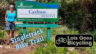
No description for Venice has been added yet!
Login or register to submit one.
Activities Click to view
- Mountain Bike
110 trails
- E-Bike
35 trails
- Gravel Bike
4 trails
- Adaptive Bike
0 trails
- Hike
129 trails
- Trail Running
129 trails
Region Details
- 72
- 16
- 13
Region Status
Open as of Mar 29, 2026Stats
- Avg Trail Rating
- Trails (view details)
- 101
- Trails Mountain Bike
- 110
- Trails E-Bike
- 35
- Trails Gravel Bike
- 4
- Trails Horse
- 1
- Trails Hike
- 129
- Trails Trail Running
- 129
- Total Distance
- 152 miles
- Total Descent Distance
- 14 miles
- Total Descent
- 142 ft
- Total Vertical
- 31 ft
- Highest Trailhead
- 33 ft
- Reports
- 379
- Photos
- 79
- Ridden Counter
- 3,037
Sub Regions
-
Carlton Preserve
- 10
- 8
-
Carlton Ranch
- 3
- 4
-
Deer Prairie Creek
- 1
-
Myakka River State Park
-
Myakka State Forest
- 1
-
Oscar Scherer State Park
Popular Venice Mountain Biking Trails
• 90 ★ 5.0 • 2 miles • 5 ft • 184 •
Popular blue difficulty singletrack. This multi-use trail can be used both directions and has a moderate overall physical rating with a 5 ft blue climb. Trail visibility is always easy to follow. On average it takes 12 minutes to complete this trail.
• 85 ★ 4.2 • 3 miles • 10 ft • 161 •
Over 8 miles of fun, twisty riding make it the center piece of the trail network. There are signs to guide you forward, bail out points along the way, a bypass trail with a bridge and a picnic table for taking a break. Going out on the...
• 100 ★ 5.0 • 2 miles • 0 ft • 127 •
Popular blue difficulty singletrack. This multi-use trail can be used both directions and has a moderate overall physical rating with a 0 ft blue climb. Trail visibility is always easy to follow. On average it takes 10 minutes to complete this trail.
• 95 ★ 5.0 • 3,310 ft • 3 ft • 108 •
Popular blue difficulty singletrack. This multi-use trail can be used both directions and has a moderate overall physical rating with a 3 ft blue climb. Trail visibility is always easy to follow. On average it takes 4 minutes to complete this trail.
• 90 ★ 5.0 • 5 miles • 5 ft • 100 •
Singletrack loop through stands of both pine and oak.
• 80 ★ 5.0 • 3 miles • 0 ft • 97 •
Popular blue difficulty singletrack. This multi-use trail can be used both directions and has a moderate overall physical rating with a 0 ft blue climb. Trail visibility is always easy to follow. On average it takes 19 minutes to complete this trail.
Venice Mountain Bike Routes
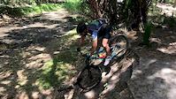
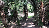
Photos of Venice Mountain Bike
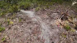
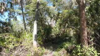
Videos of Venice Mountain Bike
trail: Prosper
0:14 |
193 |
Mar 23, 2020
trail: Prosper
0:13 |
115 |
Mar 23, 2020
trail: Palmetto Trail
33:52 |
2 |
Jun 19, 2026 , Venice

trail: Red Trail
34:49 |
2 |
Jun 19, 2026 , Venice
trail: SOB. (South of Border)
54:30 |
5 |
Jun 19, 2026 , Venice

14:32 |
51 |
May 26, 2025

trail: Rhindoculus Loop
17:10 |
1001 |
Apr 24, 2021 , Venice
trail: Sugar on the Rim (SOTR)
18:49 |
484 |
Apr 24, 2021 , Venice
Recent Trail Reports
| status | trail | date | condition | info | user |
|---|---|---|---|---|---|
| Boldlygo East | Mar 29, 2026 @ 5:48pm (America/New_York) Mar 29, 2026 | Ideal | LoamMountaineer | ||
| SOB. (South of Border) | Mar 29, 2026 @ 5:44pm (America/New_York) Mar 29, 2026 | Ideal | LoamMountaineer | ||
| Sugar on the Rim (SOTR) | Mar 25, 2026 @ 8:45am (America/Havana) Mar 25, 2026 | Variable | sdaugherty | ||
| Boldlygo (West) | Mar 25, 2026 @ 8:45am (America/Havana) Mar 25, 2026 | Unknown | sdaugherty | ||
| SOB Connector | Feb 8, 2026 @ 3:22pm (America/Havana) Feb 8, 2026 | Dry | kyeld | ||
| Myakka Island Trail | Jan 25, 2026 @ 7:36am (America/New_York) Jan 25, 2026 | Ideal | GAZoghby2 | ||
| Powerline Connector | Jan 25, 2026 @ 7:36am (America/New_York) Jan 25, 2026 | Ideal | GAZoghby2 | ||
| Well Field Road | Jan 25, 2026 @ 7:36am (America/New_York) Jan 25, 2026 | Ideal | GAZoghby2 | ||
| Park Access Road (South) | Jan 25, 2026 @ 7:36am (America/New_York) Jan 25, 2026 | Ideal | GAZoghby2 | ||
| Legacy Trail Connector | Nov 10, 2025 @ 11:56am (America/New_York) Nov 10, 2025 | Dry | run4him |
Activity Feed
| username | action | type | title | date |
|---|---|---|---|---|
| AdrianqKjAOn | add | video | activity #97310921 | Jun 19, 2026 @ 5:55am Jun 19, 2026 |
| AdrianqKjAOn | add | video | activity #97310519 and 1 more | Jun 19, 2026 @ 5:46am Jun 19, 2026 |
| jpw1962 | wishlist | trail | activity #97149231 | Jun 16, 2026 @ 5:19pm Jun 16, 2026 |
| Kurt6HmiAi | wishlist | region | activity #91754028 | Apr 2, 2026 @ 4:46am Apr 2, 2026 |
| LoamMountaineer | add | report | activity #91554088 and 1 more | Mar 29, 2026 @ 2:44pm Mar 29, 2026 |
Recent Comments
| username | type | title | comment | date |
|---|---|---|---|---|
| trail | Not worth doing. Deep soft sand churned up... | Jan 31, 2026 @ 1:29pm Jan 31, 2026 | ||
| trail | The last section on the north end is flooded.... | Nov 5, 2023 @ 5:06pm Nov 5, 2023 | ||
| trail | Running great, a bit more "flowy" (it's still... | Jun 6, 2023 @ 12:50pm Jun 6, 2023 | ||
| trail | Running great, fun techy swamp singletrack | Jun 6, 2023 @ 12:48pm Jun 6, 2023 | ||
| trail | Rode down to check it out. It was blocked off... | Mar 15, 2023 @ 5:06am Mar 15, 2023 |
Local Badges
-

Epic Ride Climb 2k0 awarded -

Climbing 10k Badge3 awarded -

Climbing 100k Badge0 awarded -

Epic Ride Descent 2k0 awarded -

Descent 10k Badge3 awarded -

Descent 100k Badge0 awarded
Local Mountain Biking Directory
-
Bicycles International
![Bicycles International]()
-
Sarasota County Off Road Riders (SCORR)Trail Association
![Sarasota County Off Road Riders (SCORR)]()
-
Real Bikes VeniceBike Shop
Activity Type Stats
| activitytype | trails | distance | descent | descent distance | total vertical | rating | global rank | state rank | photos | reports | routes | ridelogs |
|---|---|---|---|---|---|---|---|---|---|---|---|---|
| Mountain Bike | 110 | 152 miles | 141 ft | 14 miles | 30 ft | #1,432 | #543 | 79 | 379 | 1 | 7,553 | |
| E-Bike | 35 | 21 miles | 30 ft | 4 miles | 30 ft | #4,890 | #1,543 | 169 | 1 | 384 | ||
| Gravel Bike | 4 | #656 | #1,177 | 4 | 58 | |||||||
| Horse | 1 | 6 miles | 7 ft | 3,596 ft | 7 ft | 21 | ||||||
| Hike | 129 | 152 miles | 141 ft | 14 miles | 30 ft | #1,508 | #681 | 379 | 193 | |||
| Trail Running | 129 | 152 miles | 141 ft | 14 miles | 30 ft | #1,227 | #444 | 379 | 1 | 101 |
Frequently Asked Questions About Venice
▼
What are the best places to ride in Venice?
Venice has 7 areas to explore for mountain biking. The top rated areas are:
▼
What are the highest rated mountain biking trails in Venice?
The highest rated mountain biking trails in Venice are:
- Prosper Return (4.2/5)
- Blue Trail (4.1/5)
- Boldlygo (West) (4.1/5)
- Boldlygo (South) (4.1/5)
- Powerline Spur (4.1/5)
▼
What is the best time of the year to ride in Venice?
Based on ride log data, the most popular months to ride in Venice are:
- March (43 activities)
- February (35 activities)
- January (31 activities)
▼
Where can I park to ride in Venice?
There are 16 parking locations listed in Venice. The most popular parking spots are: View all parking and trailhead locations on the map to plan your visit.
Activities
Trails
- By brenthillier
 NSMBA TRAILFORKS & contributors
 - Admins: apply
- #9161 - 6,123 views
- venice activity log | embed map of Venice mountain bike trails | venice mountain biking points of interest
Downloading of trail gps tracks in kml & gpx formats is enabled for Venice.
You must login to download files.