close
-
Layers w
- Weather Layers
- Pro
- Pro
- Pro
- Pro
- Pro
- Pro
- More Layers
- Pro
- Pro
- Pro
- Pro
-
Upgrade to

3D
Trail Conditions
- Unknown
- Snow Groomed
- Snow Packed
- Snow Covered
- Snow Cover Partial
- Freeze/thaw Cycle
- Icy
- Prevalent Mud
- Wet
- Variable
- Ideal
- Dry
- Very Dry
Trail Flow (Ridden Direction)
Trailforks scans users ridelogs to determine the most popular direction each trail is ridden. A good flowing trail network will have most trails flowing in a single direction according to their intension.
The colour categories are based on what percentage of riders are riding a trail in its intended direction.
The colour categories are based on what percentage of riders are riding a trail in its intended direction.
- > 96%
- > 90%
- > 80%
- > 70%
- > 50%
- < 50%
- bi-directional trail
- no data
Trail Last Ridden
Trailforks scans ridelogs to determine the last time a trail was ridden.
- < 2 days
- < 1 week
- < 2 weeks
- < 1 month
- < 6 months
- > 6 months
Trail Ridden Direction
The intended direction a trail should be ridden.
- Downhill Only
- Downhill Primary
- Both Directions
- Uphill Primary
- Uphill Only
- One Direction
Contribute Details
Colors indicate trail is missing specified detail.
- Description
- Photos
- Description & Photos
- Videos
Trail Popularity ?
Trailforks scans ridelogs to determine which trails are ridden the most in the last 9 months.
Trails are compared with nearby trails in the same city region with a possible 25 colour shades.
Think of this as a heatmap, more rides = more kinetic energy = warmer colors.
- most popular
- popular
- less popular
- not popular
ATV/ORV/OHV Filter
Max Vehicle Width
inches
US Cell Coverage
Legend

Radar Time
Activity Recordings
Trailforks uses anonymized public activity data.
?
Activity Recordings
Trailforks uses anonymized public activity data.
?
Personal Heatmap
▶
Activity Types
all
/
none
▶
Options
2
Date range
month
–
Winter Trails
Warning
A routing network for winter maps does not exist. Selecting trails using the winter trails layer has been disabled.
Missing Trails
Most Popular
Least Popular
Trails are colored based on popularity. The more popular a trail is, the more red. Less popular trails trend towards green.
Jump Magnitude Heatmap
Heatmap of where riders jump on trails. Zoom in to see individual jumps, click circles to view jump details.
BC Backroad Status
![map legend]()
Service Road Atlas is a free to use, community-driven service for viewing and creating reports on the numerous back-country service roads around B.C. and Alberta.

Slope Aspect
Direction the slope faces
Trails Deemphasized
Trails are shown in grey.
Only show trails with no bike usage.
Suggested Layers
Based on selected activity type
Save the current map location and zoom level as your default home location whenever this page is loaded.
SaveL'area escursionistica del Ventasso perfetta per praticare hiking e mtb. Offre percorsi di vario livello e chilometraggio. Ogni anno si pratica quà l'Ecomaratona del Ventasso, grande evento di trail running dell'Appennino Reggiano.
The Ventasso hiking area is perfect for hiking and mountain biking. It offers routes of various levels and mileages. Every year the Ventasso Ecomarathon is held here, a major trail running event in the Reggio Emilia Apennines.
The Ventasso hiking area is perfect for hiking and mountain biking. It offers routes of various levels and mileages. Every year the Ventasso Ecomarathon is held here, a major trail running event in the Reggio Emilia Apennines.
Primary Trail Type: All-Mountain & Downhill
Shuttleable: YES
Land Status: Managed by Local Riding Association
 google parking directions
This region uses the Uk/Euro style trail grading system.
Activities Click to view
- Mountain Bike
23 trails
- E-Bike
7 trails
- Hike
15 trails
- Trail Running
14 trails
Region Details
- 4
- 3
- 14
Region Status
Caution as of May 26, 2026Stats
- Avg Trail Rating
- Trails (view details)
- 23
- Trails Mountain Bike
- 23
- Trails E-Bike
- 7
- Trails Hike
- 15
- Trails Trail Running
- 14
- Total Distance
- 35 miles
- Total Descent
- 19,805 ft
- Total Vertical
- 3,248 ft
- Highest Trailhead
- 4,939 ft
- Reports
- 83
- Photos
- 25
- Ridden Counter
- 676
Popular Ventasso Mountain Biking Trails
• 100 ★ 0.0 • 2,055 ft • 34 ft • 76 •
Popular blue difficulty singletrack. This mountain bike primary trail can be used downhill only and has a easy overall physical rating. On average it takes 6 minutes to complete this trail.
• 100 ★ 0.0 • 2,235 ft • 51 ft • 69 •
Popular green difficulty doubletrack. This mountain bike primary trail can be used downhill primary with a 51 ft green climb. On average it takes 2 minutes to complete this trail.
• 90 ★ 4.5 • 1 mile • 6 ft • 55 •
Popular blue difficulty singletrack. This mountain bike primary trail can be used downhill only and has a moderate overall physical rating. On average it takes 10 minutes to complete this trail.
• 75 ★ 0.0 • 2 miles • 351 ft • 44 •
Rientro al centro bike dall'arrivo dei sentieri che scendono a nord
• 70 ★ 4.0 • 2 miles • 20 ft • 38 •
Popular blue difficulty singletrack. This mountain bike primary trail can be used downhill only and has a moderate overall physical rating. On average it takes 22 minutes to complete this trail.
• 5 ★ 4.0 • 1 mile • 52 ft • 20 •
"Si inizia con un paio di ostiche rampe in salita. Ma poi la musica cambia...Trail velocissimo con singletrack finale per nulla banale"
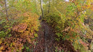
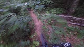
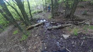
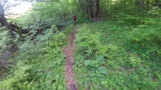
Photos of Ventasso Mountain Bike
Videos of Ventasso Mountain Bike
trail: Arrangiati
7:08 |
52 |
Sep 2, 2025 , Cervarezza
trail: Arrangiati
7:32 |
369 |
Jun 28, 2021 , Cervarezza
trail: CAI 663
16:18 |
313 |
May 31, 2021 , Cervarezza
trail: CAI 661
20:24 |
293 |
May 31, 2021 , Cervarezza
Recent Trail Reports
| status | trail | date | condition | info | user |
|---|---|---|---|---|---|
| Mago di Oz | May 26, 2026 @ 7:04pm (Europe/Rome) May 26, 2026 | Ideal | thebiber | ||
| Sentimenti Contrastanti | May 26, 2026 @ 7:03pm (Europe/Rome) May 26, 2026 | Dry | thebiber | ||
| Arrangiati | May 26, 2026 @ 6:59pm (Europe/Rome) May 26, 2026 | Variable | thebiber | ||
| Ventasso trail | Sep 13, 2025 @ 3:54pm (Europe/Rome) Sep 13, 2025 | Ideal | LucaGuxx | ||
| CAI 663 | Jul 1, 2025 @ 1:28am Jul 1, 2025 | Ideal | FedericoMonta | ||
| I Caprioli | May 25, 2025 @ 4:22am May 25, 2025 | Ideal | andreac4 | ||
| Collegamento | May 25, 2025 @ 4:22am May 25, 2025 | Variable | andreac4 | ||
| Collegamento Rifugio Maddalena | Oct 12, 2024 @ 5:42am Oct 12, 2024 | Wet | andreac4 | ||
| Spirito Freeride | Aug 7, 2024 @ 9:51am Aug 7, 2024 | Dry | SN1328 | ||
| Raccordo 66x | Jul 28, 2024 @ 2:42pm Jul 28, 2024 | Ideal | Patrimon |
Activity Feed
| username | action | type | title | date |
|---|---|---|---|---|
| thebiber | ridden | trail | activity #95572133 and 2 more | May 26, 2026 @ 9:59am May 26, 2026 |
| thebiber | add | report | activity #95572126 and 2 more | May 26, 2026 @ 9:59am May 26, 2026 |
| bohne | wishlist | trail | activity #95127786 | May 20, 2026 @ 12:46pm May 20, 2026 |
| Clod64 | vote | trail | activity #84714429 | Nov 25, 2025 @ 12:10pm Nov 25, 2025 |
| fabioooo | add | report | activity #80401566 and 1 more | Sep 15, 2025 @ 7:08am Sep 15, 2025 |
Recent Comments
| username | type | title | comment | date |
|---|---|---|---|---|
| trail | Il sentiero è stato completamente ripulito da... | Jul 28, 2024 @ 12:27am Jul 28, 2024 | ||
| trail | Destroyed! The Beginning is possible. But den... | Jul 28, 2023 @ 5:51am Jul 28, 2023 | ||
| report | È messo male male? | Aug 12, 2020 @ 4:56am Aug 12, 2020 | ||
| report | Ciao come è la risalita fino a cerwood? Ho la... | Aug 12, 2020 @ 4:50am Aug 12, 2020 |
Nearby Areas
| name | distance | ||||
|---|---|---|---|---|---|
| CuPra Bike Area Ligonchio/Cusna | 7 | 20 | 10 | 1 | 5.6 km |
| Vetto Bike Area | 11 | 18 | 1 | 6.2 km | |
| Monte Fuso | 5 | 16 | 7.1 km | ||
| Torricella Trail Area | 1 | 7 | 4 | 8.4 km | |
| Cerreto Laghi Bike Park | 2 | 2 | 8.4 km |
Local Badges
-

Completionist0 awarded
Activity Type Stats
| activitytype | trails | distance | descent | descent distance | total vertical | rating | global rank | state rank | photos | reports | routes | ridelogs |
|---|---|---|---|---|---|---|---|---|---|---|---|---|
| Mountain Bike | 23 | 35 miles | 19,806 ft | 22 miles | 3,248 ft | #4,384 | #205 | 19 | 83 | 396 | ||
| E-Bike | 7 | 11 miles | 4,114 ft | 5 miles | 3,238 ft | #5,332 | #372 | 6 | 41 | 1 | 76 | |
| Hike | 15 | 26 miles | 10,823 ft | 14 miles | 3,248 ft | #6,373 | #223 | 50 | 52 | |||
| Trail Running | 14 | 25 miles | 10,823 ft | 14 miles | 3,248 ft | #5,684 | #225 | 50 | 11 |
Frequently Asked Questions About Ventasso
▼
What are the highest rated mountain biking trails in Ventasso?
The highest rated mountain biking trails in Ventasso are:
- CAI 663 (4.3/5)
- CAI 661 (4.1/5)
- Arrangiati (4.1/5)
- Mago di Oz (4/5)
- Sentimenti Contrastanti (4/5)
▼
What is the best time of the year to ride in Ventasso?
Based on ride log data, the most popular months to ride in Ventasso are:
- July (9 activities)
- September (5 activities)
- August (4 activities)
▼
Where can I park to ride in Ventasso?
There are 2 parking locations listed in Ventasso. The most popular parking spots are:
▼
What is the longest trail in Ventasso?
The longest trail in Ventasso is Ventasso trail at 2.6 miles. View all trails sorted by distance.
Activities
Trails
Points of Interest
- By superash & contributors
- Admins: apply
- #13102 - 3,887 views
- ventasso activity log | embed map of Ventasso mountain bike trails | ventasso mountain biking points of interest
Downloading of trail gps tracks in kml & gpx formats is enabled for Ventasso.
You must login to download files.