close
-
Layers w
- Weather Layers
- Pro
- Pro
- Pro
- Pro
- Pro
- Pro
- More Layers
- Pro
- Pro
- Pro
- Pro
-
Upgrade to

3D
Trail Conditions
- Unknown
- Snow Groomed
- Snow Packed
- Snow Covered
- Snow Cover Partial
- Freeze/thaw Cycle
- Icy
- Prevalent Mud
- Wet
- Variable
- Ideal
- Dry
- Very Dry
Trail Flow (Ridden Direction)
Trailforks scans users ridelogs to determine the most popular direction each trail is ridden. A good flowing trail network will have most trails flowing in a single direction according to their intension.
The colour categories are based on what percentage of riders are riding a trail in its intended direction.
The colour categories are based on what percentage of riders are riding a trail in its intended direction.
- > 96%
- > 90%
- > 80%
- > 70%
- > 50%
- < 50%
- bi-directional trail
- no data
Trail Last Ridden
Trailforks scans ridelogs to determine the last time a trail was ridden.
- < 2 days
- < 1 week
- < 2 weeks
- < 1 month
- < 6 months
- > 6 months
Trail Ridden Direction
The intended direction a trail should be ridden.
- Downhill Only
- Downhill Primary
- Both Directions
- Uphill Primary
- Uphill Only
- One Direction
Contribute Details
Colors indicate trail is missing specified detail.
- Description
- Photos
- Description & Photos
- Videos
Trail Popularity ?
Trailforks scans ridelogs to determine which trails are ridden the most in the last 9 months.
Trails are compared with nearby trails in the same city region with a possible 25 colour shades.
Think of this as a heatmap, more rides = more kinetic energy = warmer colors.
- most popular
- popular
- less popular
- not popular
ATV/ORV/OHV Filter
Max Vehicle Width
inches
US Cell Coverage
Legend

Radar Time
Activity Recordings
Trailforks uses anonymized public activity data.
?
Activity Recordings
Trailforks uses anonymized public activity data.
?
Personal Heatmap
▶
Activity Types
all
/
none
▶
Options
2
Date range
month
–
Winter Trails
Warning
A routing network for winter maps does not exist. Selecting trails using the winter trails layer has been disabled.
Missing Trails
Most Popular
Least Popular
Trails are colored based on popularity. The more popular a trail is, the more red. Less popular trails trend towards green.
Jump Magnitude Heatmap
Heatmap of where riders jump on trails. Zoom in to see individual jumps, click circles to view jump details.
BC Backroad Status
![map legend]()
Service Road Atlas is a free to use, community-driven service for viewing and creating reports on the numerous back-country service roads around B.C. and Alberta.

Slope Aspect
Direction the slope faces
Trails Deemphasized
Trails are shown in grey.
Only show trails with no bike usage.
Suggested Layers
Based on selected activity type
Save the current map location and zoom level as your default home location whenever this page is loaded.
SaveVeracruz, formally Veracruz de Ignacio de la Llave, officially the Free and Sovereign State of Veracruz de Ignacio de la Llave, is one of the 31 states which, along with Mexico City, comprise the 32 Federal Entities of Mexico. Located in eastern Mexico, Veracruz is bordered by seven states, which are Tamaulipas, San Luis Potosí, Hidalgo, Puebla, Oaxaca, Chiapas, and Tabasco. Veracruz is divided into 212 municipalities, and its capital city is Xalapa-Enríquez.
Veracruz has a significant share of the coastline of the Gulf of Mexico on the east of the state. The state is noted for its mixed ethnic and indigenous populations. Its cuisine reflects the many cultural influences that have come through the state because of the importance of the port of Veracruz. In addition to the capital city, the state's largest cities include Veracruz, Coatzacoalcos, Córdoba, Minatitlán, Poza Rica, Boca Del Río and Orizaba.
Veracruz has a significant share of the coastline of the Gulf of Mexico on the east of the state. The state is noted for its mixed ethnic and indigenous populations. Its cuisine reflects the many cultural influences that have come through the state because of the importance of the port of Veracruz. In addition to the capital city, the state's largest cities include Veracruz, Coatzacoalcos, Córdoba, Minatitlán, Poza Rica, Boca Del Río and Orizaba.
source: Veracruz - Wikipedia
Links
Region Details
- 13
- 14
- 53
- 9
Stats
- Avg Trail Rating
- Trails (view details)
- 89
- Trails Mountain Bike
- 89
- Trails E-Bike
- 26
- Trails Horse
- 23
- Trails Hike
- 82
- Trails Trail Running
- 83
- Trails Dirtbike/Moto
- 7
- Trails Observed Trials
- 5
- Trails ATV/ORV/OHV
- 4
- Total Distance
- 209 miles
- Total Descent
- 67,567 ft
- Total Vertical
- 13,106 ft
- Highest Trailhead
- 13,625 ft
- Reports
- 58
- Photos
- 86
- Ridden Counter
- 376
Sub Regions
- Xalapa (Municipality) (78)
- Altotonga (2)
- Las Vigas De Ramírez (1)
- Perote (4)
- Veracruz (1)
Popular Veracruz (State) Mountain Biking Trails
• 95 ★ 5.0 • 1 mile • 0 ft • 19 •
Popular blue difficulty alpine singletrack. This mountain bike primary trail can be used downhill primary. It features berm, drop, jump, rock garden and roller coaster. Trail visibility is always easy to follow. On average it takes 21 minutes to complete this trail.
• 100 ★ 5.0 • 3 miles • 36 ft • 14 •
Popular blue difficulty singletrack. This multi-use trail can be used downhill primary and has a moderate overall physical rating with a 36 ft green climb. Trail visibility is always easy to follow. On average it takes 24 minutes to complete this trail.
• 100 ★ 5.0 • 3 miles • 84 ft • 12 •
La pista esta en muy buenas condiciones la dificultad del descenso depende de cada ciclista y su nivel técnico. tomen precauciones ya que la pista también se usa para practicar motocross
• 100 ★ 5.0 • 3 miles • 28 ft • 9 •
Buena bajadita de llegando a Briones por el Colegio de las Hayas, es un camino amplio de grava, muy pocos carros justo a la mitad del camino se encuentra la Policía Montada. El camino es fácil cil de seguir, al llegar a un restaurante...
• 65 ★ 5.0 • 3,694 ft • 0 ft • 9 •
Los toboganes es una de las veredas mas rápidas de coralillos se puede rodar sin problema pero tienes algunas curvas cerradas que hay que practicar para disfrutarlo de principio a fin.
• 5 ★ 0.0 • 2,253 ft • 14 ft • 9 •
Es una ruta algo dificil se recomienda tener cuidado.
• 75 ★ 0.0 • 5 miles • 260 ft • 8 •
es una pista para cualquier ciclista, la mayoria es una vereda amplia y algunas partes se singletrack. se puede rodar en cualquier epoca de año.
• 85 ★ 0.0 • 4 miles • 90 ft • 6 • • horse
Popular blue difficulty singletrack. This horse primary trail can be used both directions and has a hard overall physical rating with a 90 ft black diamond climb. Trail visibility is sometimes hard to follow.
Veracruz (State) Mountain Bike Routes
★ 4.0 • 15 miles • 453 ft • 0 •
s una fragmento de la pista de "Maratón " que se celebra cada año en este municipio, a pista esta en...
★ 5.0 • 15 miles • 3,058 ft • 0 • Point to Point •
Ruta en buenas condiciones con un descenso muy divertido en temporada seca.
4 miles • 352 ft • 3 • Loop •
Es el trazado de la pista en color verde, todo esta bien marcado y limpio para la carrera.
15 miles • 2,886 ft • 0 • Loop •
Quetzal Bike Marathon 2019. Empezando desde el zócalo del pueblo magico Cuetzalan del Progreso y...
31 miles • 2,252 ft • 0 • Out & Back •
Jicacal- Peña Hermosa, Ruta panoramica los primero 13 Km pavimento de subida, para ir agarrando calor, al...
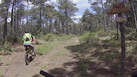
Photos of Veracruz (State) Mountain Bike
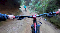
Videos of Veracruz (State) Mountain Bike
trail: Truchas Max
0:07 |
17 |
Jul 2, 2025

trail: Truchas Max
0:07 |
2 |
Jul 2, 2025
trail: Los Mapaches
0:23 |
48 |
Oct 22, 2022

trail: Perote to Los Conejos road
0:16 |
19 |
Apr 19, 2022
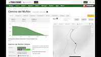
trail: Camino del Muflón
3:56 |
11 |
Sep 22, 2020
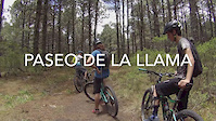
trail: Paseo de la LLama
3:13 |
22 |
Feb 19, 2020
trail: Sendero del Elk
7:41 |
18 |
Feb 19, 2020
5:06 |
121 |
Jan 7, 2020
Recent Trail Reports
Activity Feed
| username | action | type | title | date |
|---|---|---|---|---|
| Johnnbir | add | trail | activity #91376273 | Mar 27, 2026 @ 8:26am Mar 27, 2026 |
| Ivo59alra | checkin | trail | activity #89750525 | Feb 28, 2026 @ 11:56pm Feb 28, 2026 |
| Ivo59alra | ridden | trail | activity #89750524 | Feb 28, 2026 @ 11:56pm Feb 28, 2026 |
| Johnnbir | add | report | activity #89208881 and 2 more | Feb 19, 2026 @ 9:16pm Feb 19, 2026 |
| BlackbeardRider | wishlist | trail | activity #87899680 | Jan 27, 2026 @ 10:32am Jan 27, 2026 |
Recent Comments
| username | type | title | comment | date |
|---|---|---|---|---|
| trail | Es esta pista se están haciendo... | Sep 7, 2022 @ 7:19am Sep 7, 2022 | ||
| report | Wet | Sep 2, 2021 @ 4:24am Sep 2, 2021 |
Local Badges
-

10 Blue Trails4 awarded -

Epic Ride Climb 2k30 awarded -

Climbing 10k Badge11 awarded -

Climbing 100k Badge3 awarded -

Epic Ride Descent 2k36 awarded -

Descent 10k Badge12 awarded
Local Trail Supporters
- www.facebook.com/mexicomtb
Activity Type Stats
| activitytype | trails | distance | descent | descent distance | total vertical | rating | global rank | state rank | photos | reports | routes | ridelogs |
|---|---|---|---|---|---|---|---|---|---|---|---|---|
| Mountain Bike | 89 | 209 miles | 67,566 ft | 126 miles | 13,107 ft | 86 | 58 | 23 | 5,598 | |||
| E-Bike | 26 | 49 miles | 24,419 ft | 35 miles | 11,778 ft | 39 | 7 | 99 | ||||
| Horse | 23 | 43 miles | 16,932 ft | 29 miles | 11,998 ft | 12 | 2 | |||||
| Hike | 82 | 204 miles | 65,220 ft | 122 miles | 13,107 ft | 56 | 2 | 234 | ||||
| Trail Running | 83 | 204 miles | 65,413 ft | 122 miles | 13,107 ft | 56 | 2 | 19 | ||||
| Dirtbike/Moto | 7 | 9 miles | 2,513 ft | 6 miles | 3,757 ft | 8 | 2 | |||||
| Observed Trials | 5 | 9 miles | 4,659 ft | 6 miles | 8,655 ft | 1 | 1 | |||||
| ATV/ORV/OHV | 4 | 2 miles | 335 ft | 3,655 ft | 269 ft | 7 | 1 | 1 |
Activities
Trails
- By denitopia
 TRAILFORKS VTA & contributors
 - Admins: MAG
- #12696 - 5,041 views
- veracruz (state) activity log | embed map of Veracruz (State) mountain bike trails | veracruz (state) mountain biking points of interest
Downloading of trail gps tracks in kml & gpx formats is enabled for Veracruz (State).
You must login to download files.