close
-
Layers w
- Weather Layers
- Pro
- Pro
- Pro
- Pro
- Pro
- Pro
- More Layers
- Pro
- Pro
- Pro
- Pro
-
Upgrade to

3D
Trail Conditions
- Unknown
- Snow Groomed
- Snow Packed
- Snow Covered
- Snow Cover Partial
- Freeze/thaw Cycle
- Icy
- Prevalent Mud
- Wet
- Variable
- Ideal
- Dry
- Very Dry
Trail Flow (Ridden Direction)
Trailforks scans users ridelogs to determine the most popular direction each trail is ridden. A good flowing trail network will have most trails flowing in a single direction according to their intension.
The colour categories are based on what percentage of riders are riding a trail in its intended direction.
The colour categories are based on what percentage of riders are riding a trail in its intended direction.
- > 96%
- > 90%
- > 80%
- > 70%
- > 50%
- < 50%
- bi-directional trail
- no data
Trail Last Ridden
Trailforks scans ridelogs to determine the last time a trail was ridden.
- < 2 days
- < 1 week
- < 2 weeks
- < 1 month
- < 6 months
- > 6 months
Trail Ridden Direction
The intended direction a trail should be ridden.
- Downhill Only
- Downhill Primary
- Both Directions
- Uphill Primary
- Uphill Only
- One Direction
Contribute Details
Colors indicate trail is missing specified detail.
- Description
- Photos
- Description & Photos
- Videos
Trail Popularity ?
Trailforks scans ridelogs to determine which trails are ridden the most in the last 9 months.
Trails are compared with nearby trails in the same city region with a possible 25 colour shades.
Think of this as a heatmap, more rides = more kinetic energy = warmer colors.
- most popular
- popular
- less popular
- not popular
ATV/ORV/OHV Filter
Max Vehicle Width
inches
US Cell Coverage
Legend

Radar Time
Activity Recordings
Trailforks uses anonymized public activity data.
?
Activity Recordings
Trailforks uses anonymized public activity data.
?
Personal Heatmap
▶
Activity Types
all
/
none
▶
Options
2
Date range
month
–
Winter Trails
Warning
A routing network for winter maps does not exist. Selecting trails using the winter trails layer has been disabled.
Missing Trails
Most Popular
Least Popular
Trails are colored based on popularity. The more popular a trail is, the more red. Less popular trails trend towards green.
Jump Magnitude Heatmap
Heatmap of where riders jump on trails. Zoom in to see individual jumps, click circles to view jump details.
BC Backroad Status
![map legend]()
Service Road Atlas is a free to use, community-driven service for viewing and creating reports on the numerous back-country service roads around B.C. and Alberta.

Slope Aspect
Direction the slope faces
Trails Deemphasized
Trails are shown in grey.
Only show trails with no bike usage.
Suggested Layers
Based on selected activity type
Save the current map location and zoom level as your default home location whenever this page is loaded.
Save
No description for Verona has been added yet!
Login or register to submit one.
This region uses the Uk/Euro style trail grading system.
Activities Click to view
- Mountain Bike
181 trails
- E-Bike
174 trails
- Horse
6 trails
- Hike
132 trails
- Trail Running
132 trails
Region Details
- 8
- 4
- 33
- 78
- 1
Stats
- Avg Trail Rating
- Trails (view details)
- 175
- Trails Mountain Bike
- 181
- Trails E-Bike
- 174
- Trails Winter Fat Bike
- 3
- Trails Horse
- 6
- Trails Hike
- 132
- Trails Trail Running
- 132
- Trails Dirtbike/Moto
- 2
- Total Distance
- 257 miles
- Total Descent
- 106,609 ft
- Total Vertical
- 5,463 ft
- Highest Trailhead
- 5,474 ft
- Reports
- 784
- Photos
- 191
- Ridden Counter
- 7,043
Sub Regions
- Borghetto (2)
- Bosco Chiesanuova (4)
- Brenzone Sul Garda (6)
- Cavaion (3)
- Fumane (15)
- Garda (3)
- Grezzana (12)
- Lugo Di Grezzana (20)
- Negrar (7)
- Peschiera Del Garda (1)
- San Zeno Di Montagna (40)
- Prada - Monte Baldo (16)
- Sant'ambrogio Di Valpolicella (21)
- Sant'Anna D'Alfaedo (2)
- Soave (2)
- Torretta (2)
- Trezzolano (16)
- Verona (17)
Popular Verona Mountain Biking Trails
• 100 ★ 0.0 • 7 miles • 370 ft • 318 •
Pista ideale per raggiungere il Trail
• 100 ★ 4.0 • 26 miles • 420 ft • 179 •
Popular white difficulty family friendly other. This mountain bike primary trail can be used both directions and has a easy overall physical rating with a 420 ft green climb. Trail visibility is always easy to follow. On average it takes 3 hours17 minutes to complete this trail.
• 100 ★ 4.5 • 2 miles • 34 ft • 168 •
Discesa inserita come PS4 nella Special Enduro del Benaco del 2013.
• 100 ★ 5.0 • 1,650 ft • 0 ft • 149 •
Trails di collegamento per arrivare al Bivio Trugolo - Spelughe
• 95 ★ 4.7 • 2 miles • 80 ft • 137 •
Discesa inserita come PS1 nella Special Enduro del Benaco del 2013
• 95 ★ 5.0 • 5,068 ft • 68 ft • 132 •
La Ps più Tecnica e più guidata della #Capitale, Lugo di Grezzana! Un sentiero pieno di storia, una traccia SPETTACOLARE sulle creste del "Maiocon" che sorveglia il Vajo dell' Anguilla e che punta verso Lugo!!! Una Ps veramante tosta...
• 85 ★ 3.6 • 2 miles • 31 ft • 125 •
La discesa perfetta!!! Salti, sponde, rocce, radici...La Ps attraversa anche lìormai famigerato PISTIN BIKE PARK...Tutto in un'unica e lunga discesa da Arzerè a Lugo di Grezzana!!!
Verona Mountain Bike Routes
★ 4.0 • 27 miles • 4,966 ft • 5 • Loop •
start in the village of Garda, we climb mostly on gravel/single track up to san zeno di montagna. From...
20 miles • 2,892 ft • 1 • Loop •
Departure from Affi: Ascent of Monte Moscal: Take on the challenge of ascending Monte Moscal to be...
★ 4.0 • 13 miles • 2,970 ft • 0 •
Con partenza a Prada paesino a 1000mt di altitudine si sale lungo una strada sterrata verso il Rifugio...
3 miles • 68 ft • 0 •
Sentiero impegnativo dedicato ad esperti e a chi ha già una buona esperienza su terreni sconnessi e...
7 miles • 1,362 ft • 0 •
Pedalata in mountainbike alla scoperta di vecchi sentieri e vie di collegamento attraverso uliveti che...
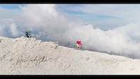
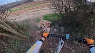
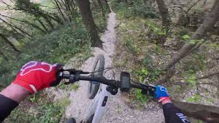
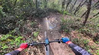
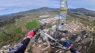
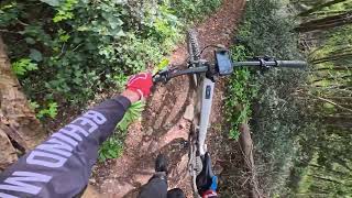
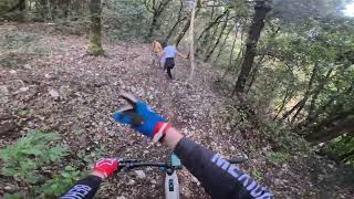
Photos of Verona Mountain Bike
Videos of Verona Mountain Bike
trail: Rocky
3:25 |
224 |
Nov 14, 2017

trail: Rock
3:13 |
200 |
Apr 22, 2016
trail: Albys
6:45 |
70 |
Apr 2, 2026 , Trezzolano
trail: DH del Moscal
7:08 |
98 |
Apr 2, 2026 , Cavaion
trail: Discesa Moscal DH-GOSE
3:57 |
109 |
Apr 2, 2026 , Cavaion
trail: Val Sorda
9:58 |
86 |
Apr 2, 2026 , Cavaion
trail: Eremo Rocca Trail
6:07 |
58 |
Apr 2, 2026 , Garda
trail: parcTrail
5:24 |
35 |
Apr 2, 2026 , San Zeno di Montagna
Current Trail Warnings
| status | trail | date | condition | user | info |
|---|---|---|---|---|---|
| Casa Maffei Negrar | Jun 7, 2026 @ 5:45pm (Europe/Rome) Jun 7, 2026 | Ideal | vegawheel | Vegetazione fuori controllo. Rovi... |
Recent Trail Reports
Activity Feed
| username | action | type | title | date |
|---|---|---|---|---|
| CrispySenpai | ridden | trail | activity #97236082 | Jun 18, 2026 @ 12:19am Jun 18, 2026 |
| flodo1112 | comment | trail | activity #97234325 | Jun 17, 2026 @ 11:13pm Jun 17, 2026 |
| AndreaGkY4xQ | ridden | trail | activity #96914097 | Jun 13, 2026 @ 1:57pm Jun 13, 2026 |
| morsa39 | add | report | activity #96869145 | Jun 13, 2026 @ 6:21am Jun 13, 2026 |
| morsa39 | add | report | activity #96869144 and 2 more | Jun 13, 2026 @ 6:21am Jun 13, 2026 |
Recent Comments
| username | type | title | comment | date |
|---|---|---|---|---|
| trail | Not a real trail. Starting at the farm it is a... | Jun 17, 2026 @ 11:13pm Jun 17, 2026 | ||
| report | It is not official closed, but not able to drive. | May 17, 2026 @ 11:15pm May 17, 2026 | ||
| report | Is it open or is it closed? You just posted... | May 12, 2026 @ 11:45pm May 12, 2026 | ||
| trail | this is nice but not for xc bike. For about,... | Apr 26, 2026 @ 1:35pm Apr 26, 2026 | ||
| report | @micheletraversi: no, direi che è... | Feb 28, 2026 @ 2:57am Feb 28, 2026 |
Local Badges
-

Descent 10k Badge23 awarded -

Descent 100k Badge0 awarded -
Descent 100k Badge1 awarded -
Descent 10k Badge12 awarded -
Descent 10k Badge32 awarded -

Epic Ride Descent 2k139 awarded
Bike & Skill Parks
| name | type | city | rating |
|---|---|---|---|
| medole | skill park | Peschiera del Garda | |
| bergantino | skill park | Torretta | |
| Crossdromo Bovolone | skill park | Verona |
Activity Type Stats
| activitytype | trails | distance | descent | descent distance | total vertical | rating | global rank | state rank | photos | reports | routes | ridelogs |
|---|---|---|---|---|---|---|---|---|---|---|---|---|
| Mountain Bike | 181 | 249 miles | 105,581 ft | 170 miles | 5,410 ft | 171 | 784 | 15 | 33,727 | |||
| E-Bike | 174 | 181 miles | 68,281 ft | 113 miles | 5,463 ft | 8 | 735 | 4 | 4,395 | |||
| Winter Fat Bike | 2 | |||||||||||
| Horse | 6 | 11 miles | 1,447 ft | 3 miles | 1,847 ft | 30 | 1 | |||||
| Hike | 132 | 171 miles | 79,869 ft | 125 miles | 5,410 ft | 761 | 1 | 1,203 | ||||
| Trail Running | 132 | 200 miles | 81,598 ft | 138 miles | 5,410 ft | 757 | 195 | |||||
| Dirtbike/Moto | 2 | 2 miles | 33 ft | 3,100 ft | 13 ft | 29 | 1 |
Frequently Asked Questions About Verona
▼
What are the best places to ride in Verona?
Verona has 2 areas to explore for mountain biking. The top rated areas are:
▼
What are the highest rated mountain biking trails in Verona?
The highest rated mountain biking trails in Verona are:
- Discesa Moscal DH-GOSE (4.4/5)
- Graffiti (4.3/5)
- J-One (4.3/5)
- Portello-Trugolo-Cavraroi (4.3/5)
- Maiconi (4.2/5)
▼
What is the best time of the year to ride in Verona?
Based on ride log data, the most popular months to ride in Verona are:
- February (76 activities)
- October (72 activities)
- August (70 activities)
▼
What is the longest trail in Verona?
The longest trail in Verona is Borghetto - Peschiera (Ciclovia dell'Adige) at 29.4 miles. View all trails sorted by distance.
Activities
Trails
- By denitopia
 TRAILFORKS VTA & contributors
 - Admins: denitopia, marcoangeletti, cemoorelife, micheletraversi
- #11750 - 8,941 views
- verona activity log | embed map of Verona mountain bike trails | verona mountain biking points of interest
Downloading of trail gps tracks in kml & gpx formats is enabled for Verona.
You must login to download files.