close
-
Layers w
- Weather Layers
- Pro
- Pro
- Pro
- Pro
- Pro
- Pro
- More Layers
- Pro
- Pro
- Pro
- Pro
-
Upgrade to

3D
Trail Conditions
- Unknown
- Snow Groomed
- Snow Packed
- Snow Covered
- Snow Cover Partial
- Freeze/thaw Cycle
- Icy
- Prevalent Mud
- Wet
- Variable
- Ideal
- Dry
- Very Dry
Trail Flow (Ridden Direction)
Trailforks scans users ridelogs to determine the most popular direction each trail is ridden. A good flowing trail network will have most trails flowing in a single direction according to their intension.
The colour categories are based on what percentage of riders are riding a trail in its intended direction.
The colour categories are based on what percentage of riders are riding a trail in its intended direction.
- > 96%
- > 90%
- > 80%
- > 70%
- > 50%
- < 50%
- bi-directional trail
- no data
Trail Last Ridden
Trailforks scans ridelogs to determine the last time a trail was ridden.
- < 2 days
- < 1 week
- < 2 weeks
- < 1 month
- < 6 months
- > 6 months
Trail Ridden Direction
The intended direction a trail should be ridden.
- Downhill Only
- Downhill Primary
- Both Directions
- Uphill Primary
- Uphill Only
- One Direction
Contribute Details
Colors indicate trail is missing specified detail.
- Description
- Photos
- Description & Photos
- Videos
Trail Popularity ?
Trailforks scans ridelogs to determine which trails are ridden the most in the last 9 months.
Trails are compared with nearby trails in the same city region with a possible 25 colour shades.
Think of this as a heatmap, more rides = more kinetic energy = warmer colors.
- most popular
- popular
- less popular
- not popular
ATV/ORV/OHV Filter
Max Vehicle Width
inches
US Cell Coverage
Legend

Radar Time
Activity Recordings
Trailforks uses anonymized public activity data.
?
Activity Recordings
Trailforks uses anonymized public activity data.
?
Personal Heatmap
▶
Activity Types
all
/
none
▶
Options
2
Date range
month
–
Winter Trails
Warning
A routing network for winter maps does not exist. Selecting trails using the winter trails layer has been disabled.
Missing Trails
Most Popular
Least Popular
Trails are colored based on popularity. The more popular a trail is, the more red. Less popular trails trend towards green.
Jump Magnitude Heatmap
Heatmap of where riders jump on trails. Zoom in to see individual jumps, click circles to view jump details.
BC Backroad Status
![map legend]()
Service Road Atlas is a free to use, community-driven service for viewing and creating reports on the numerous back-country service roads around B.C. and Alberta.

Slope Aspect
Direction the slope faces
Trails Deemphasized
Trails are shown in grey.
Only show trails with no bike usage.
Suggested Layers
Based on selected activity type
Save the current map location and zoom level as your default home location whenever this page is loaded.
SaveSporet i Vesterskoven er helt unikt, idet det slynger sig gennem et område præget af Danmarks største marksystemer fra yngre bronzealder og ældre jernalder (ca. 700 f.Kr.-200 e.Kr.). For at sikre en autentisk og respektfuld integration af disse historiske elementer er sporet udviklet i tæt samarbejde med Silkeborg Museum, hvilket gør oplevelsen både kulturhistorisk forankret og rekreativt berigende.
 google parking directions
This region uses the Uk/Euro style trail grading system.
Activities Click to view
- Mountain Bike
25 trails
- E-Bike
24 trails
- Horse
4 trails
- Hike
5 trails
- Trail Running
5 trails
Stats
- Avg Trail Rating
- Trails (view details)
- 29
- Trails Mountain Bike
- 25
- Trails E-Bike
- 24
- Trails Adaptive Bike
- 1
- Trails Winter Fat Bike
- 3
- Trails Horse
- 4
- Trails Hike
- 5
- Trails Trail Running
- 5
- Total Distance
- 14 miles
- Total Descent Distance
- 5 miles
- Total Descent
- 2,071 ft
- Total Vertical
- 334 ft
- Highest Trailhead
- 429 ft
- Reports
- 902
- Photos
- 204
- Ridden Counter
- 7,776
Popular Vesterskoven Mountain Biking Trails
• 100 ★ 3.0 • 1 mile • 77 ft • 303 •
Popular blue difficulty singletrack. This multi-use trail can be used one direction. It features berm and jump. Trail visibility is always easy to follow. On average it takes 5 minutes to complete this trail.
• 100 ★ 2.5 • 2,087 ft • 50 ft • 298 •
Popular blue difficulty singletrack. This multi-use trail can be used one direction and has a easy overall physical rating with a 50 ft green climb. It features berm and jump. Trail visibility is always easy to follow. On average it takes 1 minutes to complete this trail.
• 100 ★ 3.0 • 3,635 ft • 123 ft • 297 •
Popular blue difficulty singletrack. This multi-use trail can be used one direction and has a easy overall physical rating with a 123 ft blue climb. It features berm and bridge. Trail visibility is always easy to follow. On average it takes 5 minutes to complete this trail.
• 95 ★ 4.0 • 4,377 ft • 112 ft • 292 •
Popular blue difficulty singletrack. This multi-use trail can be used one direction and has a easy overall physical rating with a 112 ft green climb. It features berm. Trail visibility is always easy to follow. On average it takes 5 minutes to complete this trail.
• 100 ★ 2.5 • 1,965 ft • 73 ft • 289 •
Popular blue difficulty singletrack. This multi-use trail can be used one direction and has a easy overall physical rating with a 73 ft green climb. It features berm. Trail visibility is always easy to follow. On average it takes 5 minutes to complete this trail.
• 95 ★ 3.0 • 3,681 ft • 49 ft • 288 •
Popular blue difficulty singletrack. This multi-use trail can be used one direction and has a easy overall physical rating with a 49 ft green climb. It features berm. Trail visibility is always easy to follow. On average it takes 3 minutes to complete this trail.
• 95 ★ 2.0 • 2,208 ft • 39 ft • 288 •
Popular blue difficulty singletrack. This multi-use trail can be used one direction and has a easy overall physical rating with a 39 ft green climb. It features berm. Trail visibility is always easy to follow. On average it takes 2 minutes to complete this trail.
• 90 ★ 2.0 • 2,484 ft • 140 ft • 286 •
Popular blue difficulty singletrack. This multi-use trail can be used one direction and has a easy overall physical rating with a 140 ft green climb. It features berm. Trail visibility is always easy to follow. On average it takes 6 minutes to complete this trail.
Vesterskoven Mountain Bike Routes
Vesterskoven Blå Spor Featured
★ 5.0 • 11 miles • 1,279 ft • 21 •
Vesterskovens blå spor hele vejen rundt.
Vesterskoven Rød Spor Featured
11 miles • 1,330 ft • 19 • Out & Back •
Rød route I versterskoven, består mest af blå spor
Photos of Vesterskoven Mountain Bike
Videos of Vesterskoven Mountain Bike
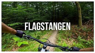
trail: Missing linkin park
0:56 |
178 |
Aug 23, 2023 , Silkeborg

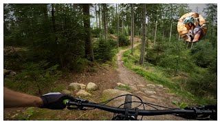
trail: Rød trail Almindsø
0:50 |
108 |
Aug 18, 2023 , Silkeborg

trail: Den røde tråd
6:16 |
193 |
Aug 17, 2023 , Silkeborg
trail: Den røde tråd
6:16 |
161 |
Aug 17, 2023 , Silkeborg
Recent Trail Reports
| status | trail | date | condition | info | user |
|---|---|---|---|---|---|
| Hjorte flow | May 14, 2026 @ 2:20pm (Europe/Copenhagen) May 14, 2026 | Wet | Evel-Peter-knievel | ||
| Rød trail Almindsø | Apr 28, 2026 @ 9:37pm (Europe/Copenhagen) Apr 28, 2026 | Unknown | NiccoNordborg GR-TB-NSKOV | ||
| Øster titty twister | Apr 9, 2026 @ 2:44pm (Europe/Copenhagen) Apr 9, 2026 | Unknown | fisker33 SSSL | ||
| Den røde tråd | Apr 4, 2026 @ 3:01pm (Europe/Copenhagen) Apr 4, 2026 | Ideal | mortendamsgaard SSSL | ||
| Nedtur | Mar 20, 2026 @ 10:18am (Europe/Copenhagen) Mar 20, 2026 | Ideal | martinhoegh SSSL | ||
| Vesterheaven | Mar 20, 2026 @ 10:16am (Europe/Copenhagen) Mar 20, 2026 | Ideal | martinhoegh SSSL | ||
| Urania | Mar 20, 2026 @ 10:16am (Europe/Copenhagen) Mar 20, 2026 | Ideal | martinhoegh SSSL | ||
| Uran stykket | Mar 20, 2026 @ 10:16am (Europe/Copenhagen) Mar 20, 2026 | Ideal | martinhoegh SSSL | ||
| Thorsøskrænten | Mar 20, 2026 @ 10:16am (Europe/Copenhagen) Mar 20, 2026 | Ideal | martinhoegh SSSL | ||
| Store Mark | Mar 20, 2026 @ 10:16am (Europe/Copenhagen) Mar 20, 2026 | Ideal | martinhoegh SSSL |
Activity Feed
| username | action | type | title | date |
|---|---|---|---|---|
| DanielV | wishlist | route | activity #96525550 and 1 more | Jun 8, 2026 @ 12:54am Jun 8, 2026 |
| benjaminhoegh | update | trail | activity #96008109 and 4 more | Jun 1, 2026 @ 4:15am Jun 1, 2026 |
| benjaminhoegh | update | trail | activity #95918230 | May 31, 2026 @ 2:31am May 31, 2026 |
| Evel-Peter-knievel | add | report | activity #94832357 | May 16, 2026 @ 10:36am May 16, 2026 |
| Iltsvend | wishlist | route | activity #94674252 | May 14, 2026 @ 1:19am May 14, 2026 |
Recent Comments
| username | type | title | comment | date |
|---|---|---|---|---|
| report | Thorbjørn Nørgård Lovende... | Oct 6, 2025 @ 1:28pm Oct 6, 2025 | ||
| report | 4 x grus ! | Oct 6, 2025 @ 2:08am Oct 6, 2025 | ||
| trail | Nope. "Ned til Mindestenen" | Sep 22, 2025 @ 4:48am Sep 22, 2025 | ||
| trail | Nope. Ned til Mindestenen :-) | Sep 21, 2025 @ 7:36am Sep 21, 2025 | ||
| trail | Korrekt :-) | Sep 21, 2025 @ 7:28am Sep 21, 2025 |
Nearby Areas
| name | distance | ||||
|---|---|---|---|---|---|
| Gjessø skov, Rustrup Skov, Thorsø og Bødskovgård | 1 | 1.5 km | |||
| Søhøjlandet | 4 | 3 | 1.7 km | ||
| Østerskov | 2 | 2.1 km | |||
| Nordskoven | 15 | 3 km | |||
| Silkeborg Bikepark | 1 | 3 | 4.4 km |
Local Badges
-

Completionist0 awarded
Upcoming Local Events
Local Trail Supporters
- Silkeborg Sti- og Sporbyggerlaug
Local Trail Supporters
- Silkeborg Sti- og Sporbyggerlaug
Activity Type Stats
| activitytype | trails | distance | descent | descent distance | total vertical | rating | global rank | state rank | photos | reports | routes | ridelogs |
|---|---|---|---|---|---|---|---|---|---|---|---|---|
| Mountain Bike | 25 | 12 miles | 1,831 ft | 4 miles | 335 ft | #1,888 | #6 | 203 | 902 | 2 | 3,588 | |
| E-Bike | 24 | 12 miles | 1,804 ft | 4 miles | 335 ft | #971 | #20 | 894 | 2 | 510 | ||
| Adaptive Bike | 1 | 1 mile | 243 ft | 2,434 ft | 102 ft | #4,186 | #16 | 75 | ||||
| Winter Fat Bike | 3 | 1 mile | 338 ft | 4,065 ft | 282 ft | #4,200 | #16 | 22 | ||||
| Horse | 4 | 1 mile | 167 ft | 2,762 ft | 154 ft | #440 | #5 | 161 | ||||
| Hike | 5 | 2 miles | 240 ft | 3,553 ft | 167 ft | #2,351 | #24 | 793 | 59 | |||
| Trail Running | 5 | 2 miles | 240 ft | 3,553 ft | 167 ft | #1,714 | #26 | 793 | 148 |
Frequently Asked Questions About Vesterskoven
▼
What are the highest rated mountain biking trails in Vesterskoven?
The highest rated mountain biking trails in Vesterskoven are:
- Kanel kage (4.2/5)
- Den røde tråd (4.1/5)
- Hjorte flow (4/5)
- Nu skal vi lave jern (3.8/5)
- Pensionist sporet (3.8/5)
▼
What is the best time of the year to ride in Vesterskoven?
Based on ride log data, the most popular months to ride in Vesterskoven are:
- July (13 activities)
- November (13 activities)
- June (12 activities)
▼
Where can I park to ride in Vesterskoven?
There are 7 parking locations listed in Vesterskoven. The most popular parking spots are: View all parking and trailhead locations on the map to plan your visit.
▼
What is the longest trail in Vesterskoven?
The longest trail in Vesterskoven is Den røde tråd at 1.8 km. View all trails sorted by distance.
Activities
Trails
- By markholloway
 Trailforks Map Team & contributors
 - Admins: SSSL, SSSL
- #28446 - 5,256 views
- vesterskoven activity log | embed map of Vesterskoven mountain bike trails | vesterskoven mountain biking points of interest
Downloading of trail gps tracks in kml & gpx formats is enabled for Vesterskoven.
You must login to download files.