close
-
Layers w
- Weather Layers
- Pro
- Pro
- Pro
- Pro
- Pro
- Pro
- More Layers
- Pro
- Pro
- Pro
- Pro
-
Upgrade to

3D
Trail Conditions
- Unknown
- Snow Groomed
- Snow Packed
- Snow Covered
- Snow Cover Partial
- Freeze/thaw Cycle
- Icy
- Prevalent Mud
- Wet
- Variable
- Ideal
- Dry
- Very Dry
Trail Flow (Ridden Direction)
Trailforks scans users ridelogs to determine the most popular direction each trail is ridden. A good flowing trail network will have most trails flowing in a single direction according to their intension.
The colour categories are based on what percentage of riders are riding a trail in its intended direction.
The colour categories are based on what percentage of riders are riding a trail in its intended direction.
- > 96%
- > 90%
- > 80%
- > 70%
- > 50%
- < 50%
- bi-directional trail
- no data
Trail Last Ridden
Trailforks scans ridelogs to determine the last time a trail was ridden.
- < 2 days
- < 1 week
- < 2 weeks
- < 1 month
- < 6 months
- > 6 months
Trail Ridden Direction
The intended direction a trail should be ridden.
- Downhill Only
- Downhill Primary
- Both Directions
- Uphill Primary
- Uphill Only
- One Direction
Contribute Details
Colors indicate trail is missing specified detail.
- Description
- Photos
- Description & Photos
- Videos
Trail Popularity ?
Trailforks scans ridelogs to determine which trails are ridden the most in the last 9 months.
Trails are compared with nearby trails in the same city region with a possible 25 colour shades.
Think of this as a heatmap, more rides = more kinetic energy = warmer colors.
- most popular
- popular
- less popular
- not popular
ATV/ORV/OHV Filter
Max Vehicle Width
inches
US Cell Coverage
Legend

Radar Time
Activity Recordings
Trailforks uses anonymized public activity data.
?
Activity Recordings
Trailforks uses anonymized public activity data.
?
Personal Heatmap
▶
Activity Types
all
/
none
▶
Options
2
Date range
month
–
Winter Trails
Warning
A routing network for winter maps does not exist. Selecting trails using the winter trails layer has been disabled.
Missing Trails
Most Popular
Least Popular
Trails are colored based on popularity. The more popular a trail is, the more red. Less popular trails trend towards green.
Jump Magnitude Heatmap
Heatmap of where riders jump on trails. Zoom in to see individual jumps, click circles to view jump details.
BC Backroad Status
![map legend]()
Service Road Atlas is a free to use, community-driven service for viewing and creating reports on the numerous back-country service roads around B.C. and Alberta.

Slope Aspect
Direction the slope faces
Trails Deemphasized
Trails are shown in grey.
Only show trails with no bike usage.
Suggested Layers
Based on selected activity type
Save the current map location and zoom level as your default home location whenever this page is loaded.
Save
No description for VG Schweich has been added yet!
Login or register to submit one.
This region uses the Uk/Euro style trail grading system.
Activities Click to view
- Mountain Bike
5 trails
- E-Bike
5 trails
- Adaptive Bike
0 trails
- Hike
0 trails
- Trail Running
0 trails
Region Details
- 3
- 1
Region Status
Caution as of Apr 1, 2026Stats
- Avg Trail Rating
- Trails (view details)
- 4
- Trails Mountain Bike
- 5
- Trails E-Bike
- 5
- Total Distance
- 1 mile
- Total Descent
- 661 ft
- Total Vertical
- 429 ft
- Highest Trailhead
- 1,389 ft
- Reports
- 21
- Photos
- 2
- Ridden Counter
- 466
Popular VG Schweich Mountain Biking Trails
• 75 ★ 4.7 • 5,103 ft • 26 ft • 184 •
Popular blue difficulty singletrack. This mountain bike primary trail can be used downhill primary. On average it takes 27 minutes to complete this trail.
• 100 ★ 0.0 • 2,090 ft • 0 ft • 112 •
This trail is called "4" and it is marked Red, not Blue on the official Trail Center map.nIt's has a few steeper looking berms, few shark fins, few small jumps. They added one or two new 'step downs'/drops.nPre-Ride this as trail...
• 50 ★ 5.0 • 3,704 ft • 3 ft • 50 •
Flowy, fast, with table top and gap jumps, shark fins, berms. Bottom part - Moshtrail is very fast, with jumps.
• 25 ★ 5.0 • 1,808 ft • 0 ft • 24 •
Super easy trail suitable for a warmup and family. Has mostly supported berm turns with a few tables and rollers. Climb up to beginning of the trail is not long. Description from website: Blueline Die einfachste unserer 5 Trails und...
Videos of VG Schweich Mountain Bike
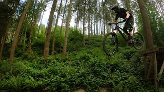
trail: Mehring Enduro Lustgarten
2:37 |
41 |
May 7, 2026 , VG Schweich
youtuber
![Trailpark Mehring. Hoe VET!!!]()
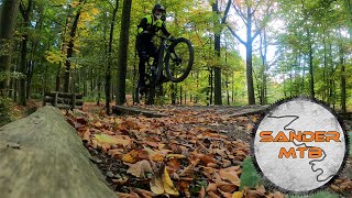
trail: Mehring Enduro Lustgarten
22:02 |
79 |
Mar 12, 2025 , VG Schweich
youtuber
![Dit Trailpark is een verborgen pareltje! //...]()
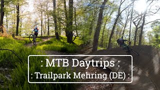
trail: Mehring Enduro Lustgarten
6:12 |
162 |
Jan 2, 2024 , VG Schweich
Recent Trail Reports
| status | trail | date | condition | info | user |
|---|---|---|---|---|---|
| Mehring Enduro Lustgarten | Sep 21, 2024 @ 10:23am Sep 21, 2024 | Dry | HansFaelltFahrrad | ||
| Traverse | Sep 21, 2024 @ 12:35pm Sep 21, 2024 | Ideal | HansFaelltFahrrad |
Activity Feed
| username | action | type | title | date |
|---|---|---|---|---|
| mtbles | add | video | activity #94204780 | May 7, 2026 @ 2:18am May 7, 2026 |
| mtbles | ridden | trail | activity #94202562 and 2 more | May 7, 2026 @ 12:41am May 7, 2026 |
| KilianG | ridden | trail | activity #92928706 and 2 more | Apr 19, 2026 @ 2:49am Apr 19, 2026 |
| surging | wishlist | trail | activity #89130647 | Feb 18, 2026 @ 9:18am Feb 18, 2026 |
| marv5323 | ridden | trail | activity #80323781 and 1 more | Sep 14, 2025 @ 5:58am Sep 14, 2025 |
Bike & Skill Parks
| name | type | city | rating |
|---|---|---|---|
| Klüsselrath motocross | skill park | VG Schweich |
Activity Type Stats
| activitytype | trails | distance | descent | descent distance | total vertical | rating | global rank | state rank | photos | reports | routes | ridelogs |
|---|---|---|---|---|---|---|---|---|---|---|---|---|
| Mountain Bike | 5 | 1 mile | 663 ft | 1 mile | 430 ft | #6,702 | #212 | 2 | 20 | 921 | ||
| E-Bike | 5 | 1 mile | 663 ft | 1 mile | 430 ft | #6,642 | #278 | 20 | 269 |
- By falla08 & contributors
- Admins: PB, Janne88
- #8422 - 2,333 views
- vg schweich activity log | embed map of VG Schweich mountain bike trails |
Downloading of trail gps tracks in kml & gpx formats is enabled for VG Schweich.
You must login to download files.