close
-
Layers w
- Weather Layers
- Pro
- Pro
- Pro
- Pro
- Pro
- Pro
- More Layers
- Pro
- Pro
- Pro
- Pro
-
Upgrade to

3D
Trail Conditions
- Unknown
- Snow Groomed
- Snow Packed
- Snow Covered
- Snow Cover Partial
- Freeze/thaw Cycle
- Icy
- Prevalent Mud
- Wet
- Variable
- Ideal
- Dry
- Very Dry
Trail Flow (Ridden Direction)
Trailforks scans users ridelogs to determine the most popular direction each trail is ridden. A good flowing trail network will have most trails flowing in a single direction according to their intension.
The colour categories are based on what percentage of riders are riding a trail in its intended direction.
The colour categories are based on what percentage of riders are riding a trail in its intended direction.
- > 96%
- > 90%
- > 80%
- > 70%
- > 50%
- < 50%
- bi-directional trail
- no data
Trail Last Ridden
Trailforks scans ridelogs to determine the last time a trail was ridden.
- < 2 days
- < 1 week
- < 2 weeks
- < 1 month
- < 6 months
- > 6 months
Trail Ridden Direction
The intended direction a trail should be ridden.
- Downhill Only
- Downhill Primary
- Both Directions
- Uphill Primary
- Uphill Only
- One Direction
Contribute Details
Colors indicate trail is missing specified detail.
- Description
- Photos
- Description & Photos
- Videos
Trail Popularity ?
Trailforks scans ridelogs to determine which trails are ridden the most in the last 9 months.
Trails are compared with nearby trails in the same city region with a possible 25 colour shades.
Think of this as a heatmap, more rides = more kinetic energy = warmer colors.
- most popular
- popular
- less popular
- not popular
ATV/ORV/OHV Filter
Max Vehicle Width
inches
US Cell Coverage
Legend

Radar Time
Activity Recordings
Trailforks uses anonymized public activity data.
?
Activity Recordings
Trailforks uses anonymized public activity data.
?
Personal Heatmap
▶
Activity Types
all
/
none
▶
Options
2
Date range
month
–
Winter Trails
Warning
A routing network for winter maps does not exist. Selecting trails using the winter trails layer has been disabled.
Missing Trails
Most Popular
Least Popular
Trails are colored based on popularity. The more popular a trail is, the more red. Less popular trails trend towards green.
Jump Magnitude Heatmap
Heatmap of where riders jump on trails. Zoom in to see individual jumps, click circles to view jump details.
BC Backroad Status
![map legend]()
Service Road Atlas is a free to use, community-driven service for viewing and creating reports on the numerous back-country service roads around B.C. and Alberta.

Slope Aspect
Direction the slope faces
Trails Deemphasized
Trails are shown in grey.
Only show trails with no bike usage.
Suggested Layers
Based on selected activity type
Save the current map location and zoom level as your default home location whenever this page is loaded.
Save
No description for Vicenza has been added yet!
Login or register to submit one.
This region uses the Uk/Euro style trail grading system.
Activities Click to view
- Mountain Bike
120 trails
- E-Bike
119 trails
- Horse
6 trails
- Hike
88 trails
- Trail Running
89 trails
- Downhill Ski
29 trails
Region Details
- 11
- 1
- 31
- 55
- 1
Stats
- Avg Trail Rating
- Trails (view details)
- 137
- Trails Mountain Bike
- 120
- Trails E-Bike
- 119
- Trails Horse
- 6
- Trails Hike
- 88
- Trails Trail Running
- 89
- Trails Dirtbike/Moto
- 1
- Trails Downhill Ski
- 29
- Total Distance
- 133 miles
- Total Descent
- 67,291 ft
- Total Vertical
- 6,445 ft
- Highest Trailhead
- 6,565 ft
- Reports
- 342
- Photos
- 160
- Ridden Counter
- 2,672
Sub Regions
- Altavilla (7)
- Monti comunali (7)
- Arzignano (23)
- Montecchio Maggiore (10)
- Asiago (11)
- Mt. Erio (2)
- Barbarano Vicentino (2)
- Bassano Del Grappa (8)
- Monte Di Malo (5)
- Recoaro (7)
- Rotzo (2)
- Schio (3)
- Torrebelvicino (3)
- Vicenza (8)
- Bassano del Grappa (34)
- Colli Berici (13)
Popular Vicenza Mountain Biking Trails
• 100 ★ 5.0 • 6 miles • 3,203 ft • 203 •
Strada agevole, ben tenuta e di elevato valore panoramico
• 90 ★ 0.0 • 6 miles • 3,120 ft • 128 •
Valida alternativa per la discesa, da associare alla salita lungo la
• 95 ★ 4.7 • 5,020 ft • 10 ft • 124 •
Trail divertente, piú tecnico nella prima parte ripida, passata la sbarra e attraversata la strada diventa piú scorrevole, dove non presenta particolari difficoltà se non che per alcuni brevi tratti tecnici, a volte frequentato da...
• 95 ★ 4.0 • 4,367 ft • 45 ft • 114 •
Popular blue difficulty singletrack. This mountain bike primary trail. It features jump, rock face and rock garden. On average it takes 11 minutes to complete this trail.
• 85 ★ 4.0 • 4,885 ft • 13 ft • 99 •
Highly rated popular red difficulty singletrack. This mountain bike primary trail can be used downhill primary. On average it takes 7 minutes to complete this trail.
• 10 ★ 4.8 • 2 miles • 282 ft • 73 •
Long trail with a bit of everything. natural, flow, rock garden and some man made gaps
• 100 ★ 0.0 • 5 miles • 562 ft • 63 •
Popular blue difficulty singletrack. This mountain bike primary trail can be used both directions. On average it takes 53 minutes to complete this trail.
Vicenza Mountain Bike Routes
★ 4.0 • 3 miles • 68 ft • 0 • Shuttled •
Sentiero tecnico con fondo prevalentemente asciutto. Solo il primo tratto il fondo è sassoso.
15 miles • 3,253 ft • 0 • Loop •
Nice AM/XC loop hidden in the woods just outside the city of Asiago. The suggested starting point is the...
★ 1.0 • 45 miles • 7,255 ft • 0 • Loop •
Amazing long route that brings the rider to one of the highest peak of the area, Mt. Ortigara (2106 mt...
22 miles • 4,415 ft • 0 •
Un giro all’insegna della diversità: per la tipologia di sentieri e per le varietà di panorami davvero...
22 miles • 5,131 ft • 0 •
PARTENZA Caltrano Lunghezza 35,3 KM Quota minima 210 mt Quota massima 1.490 mt Dislivello complessivo...
14 miles • 1,790 ft • 0 • Loop •
The realy easy mountain bike route! isn't present drop, jump or tecnical points
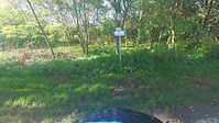
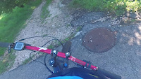
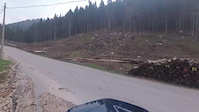
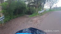
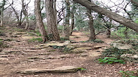
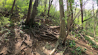
Photos of Vicenza Mountain Bike
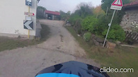
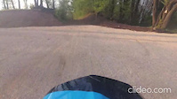
Videos of Vicenza Mountain Bike
trail: Dh Giannini
3:13 |
|
Sep 30, 2024
trail: DH Moschini
0:54 |
|
Sep 30, 2024
10:22 |
98 |
May 17, 2023
trail: Tonini DH
2:22 |
14 |
May 8, 2023
trail: DH Briccon Tonini
0:50 |
16 |
May 8, 2023
trail: DH Fracca Suan
3:09 |
19 |
May 8, 2023
trail: Europeo
0:35 |
115 |
May 8, 2021
trail: Europeo
0:07 |
44 |
May 8, 2021
Recent Trail Reports
Activity Feed
| username | action | type | title | date |
|---|---|---|---|---|
| scio | vote | trail | activity #96947475 and 4 more | Jun 14, 2026 @ 2:37am Jun 14, 2026 |
| scio | ridden | trail | activity #96947468 and 4 more | Jun 14, 2026 @ 2:37am Jun 14, 2026 |
| Sworksanta | ridden | route | activity #96457655 | Jun 7, 2026 @ 7:16am Jun 7, 2026 |
| Luca3Xqtym | ridden | trail | activity #96368994 | Jun 6, 2026 @ 7:37am Jun 6, 2026 |
| Poppylanemtb | wishlist | trail | activity #96118107 | Jun 2, 2026 @ 4:34pm Jun 2, 2026 |
Recent Comments
| username | type | title | comment | date |
|---|---|---|---|---|
| trail | Per rider divertente che riescono trials S3.... | Apr 18, 2026 @ 11:23am Apr 18, 2026 | ||
| trail | Grazie mille | Apr 13, 2026 @ 12:26pm Apr 13, 2026 | ||
| trail | Fatto | Apr 13, 2026 @ 12:06pm Apr 13, 2026 | ||
| trail | Ciao, potresti aggiungerlo come report? La... | Apr 13, 2026 @ 11:46am Apr 13, 2026 | ||
| trail | Passato oggi.. il step down e rotto.. resto... | Apr 10, 2026 @ 9:15am Apr 10, 2026 |
Local Badges
-

Epic Ride 50k183 awarded -

Big Ride 30k492 awarded -
Big Ride 30k408 awarded -
Epic Ride 50k218 awarded -

Descent 10k Badge3 awarded -

Descent 100k Badge0 awarded
Bike & Skill Parks
| name | type | city | rating |
|---|---|---|---|
| Fara Vicentino | skill park |
Activity Type Stats
| activitytype | trails | distance | descent | descent distance | total vertical | rating | global rank | state rank | photos | reports | routes | ridelogs |
|---|---|---|---|---|---|---|---|---|---|---|---|---|
| Mountain Bike | 120 | 117 miles | 57,592 ft | 75 miles | 6,257 ft | 157 | 341 | 13 | 23,543 | |||
| E-Bike | 119 | 117 miles | 57,592 ft | 75 miles | 6,257 ft | 3 | 294 | 8 | 3,205 | |||
| Horse | 6 | 4 miles | 1,388 ft | 2 miles | 587 ft | 14 | ||||||
| Hike | 88 | 84 miles | 43,629 ft | 55 miles | 6,447 ft | 306 | 1 | 1,373 | ||||
| Trail Running | 89 | 85 miles | 44,301 ft | 56 miles | 6,447 ft | 322 | 1 | 157 | ||||
| Dirtbike/Moto | 1 | 1,549 ft | 184 ft | 11 | ||||||||
| Downhill Ski | 29 | 10 miles | 8,409 ft | 10 miles | 2,385 ft | 18 |
Frequently Asked Questions About Vicenza
▼
What are the best places to ride in Vicenza?
Vicenza has 8 areas to explore for mountain biking. The top rated areas are:
▼
What are the highest rated mountain biking trails in Vicenza?
The highest rated mountain biking trails in Vicenza are:
- Europeo (4.4/5)
- DH Caina (4.3/5)
- Redbull (4.3/5)
- Bassetto Trail (4.2/5)
- The Ridge Parte 1 (4.2/5)
▼
What is the best time of the year to ride in Vicenza?
Based on ride log data, the most popular months to ride in Vicenza are:
- September (185 activities)
- July (145 activities)
- August (124 activities)
▼
What is the longest trail in Vicenza?
The longest trail in Vicenza is Fior at 11.4 km. View all trails sorted by distance.
Activities
Trails
Points of Interest
- By denitopia
 TRAILFORKS VTA & contributors
 - Admins: denitopia, marcoangeletti, cemoorelife, micheletraversi
- #11749 - 4,913 views
- vicenza activity log | embed map of Vicenza mountain bike trails | vicenza mountain biking points of interest
Downloading of trail gps tracks in kml & gpx formats is enabled for Vicenza.
You must login to download files.