close
-
Layers w
- Weather Layers
- Pro
- Pro
- Pro
- Pro
- Pro
- Pro
- More Layers
- Pro
- Pro
- Pro
- Pro
-
Upgrade to

3D
Trail Conditions
- Unknown
- Snow Groomed
- Snow Packed
- Snow Covered
- Snow Cover Partial
- Freeze/thaw Cycle
- Icy
- Prevalent Mud
- Wet
- Variable
- Ideal
- Dry
- Very Dry
Trail Flow (Ridden Direction)
Trailforks scans users ridelogs to determine the most popular direction each trail is ridden. A good flowing trail network will have most trails flowing in a single direction according to their intension.
The colour categories are based on what percentage of riders are riding a trail in its intended direction.
The colour categories are based on what percentage of riders are riding a trail in its intended direction.
- > 96%
- > 90%
- > 80%
- > 70%
- > 50%
- < 50%
- bi-directional trail
- no data
Trail Last Ridden
Trailforks scans ridelogs to determine the last time a trail was ridden.
- < 2 days
- < 1 week
- < 2 weeks
- < 1 month
- < 6 months
- > 6 months
Trail Ridden Direction
The intended direction a trail should be ridden.
- Downhill Only
- Downhill Primary
- Both Directions
- Uphill Primary
- Uphill Only
- One Direction
Contribute Details
Colors indicate trail is missing specified detail.
- Description
- Photos
- Description & Photos
- Videos
Trail Popularity ?
Trailforks scans ridelogs to determine which trails are ridden the most in the last 9 months.
Trails are compared with nearby trails in the same city region with a possible 25 colour shades.
Think of this as a heatmap, more rides = more kinetic energy = warmer colors.
- most popular
- popular
- less popular
- not popular
ATV/ORV/OHV Filter
Max Vehicle Width
inches
US Cell Coverage
Legend

Radar Time
Activity Recordings
Trailforks uses anonymized public activity data.
?
Activity Recordings
Trailforks uses anonymized public activity data.
?
Personal Heatmap
▶
Activity Types
all
/
none
▶
Options
2
Date range
month
–
Winter Trails
Warning
A routing network for winter maps does not exist. Selecting trails using the winter trails layer has been disabled.
Missing Trails
Most Popular
Least Popular
Trails are colored based on popularity. The more popular a trail is, the more red. Less popular trails trend towards green.
Jump Magnitude Heatmap
Heatmap of where riders jump on trails. Zoom in to see individual jumps, click circles to view jump details.
BC Backroad Status
![map legend]()
Service Road Atlas is a free to use, community-driven service for viewing and creating reports on the numerous back-country service roads around B.C. and Alberta.

Slope Aspect
Direction the slope faces
Trails Deemphasized
Trails are shown in grey.
Only show trails with no bike usage.
Suggested Layers
Based on selected activity type
Save the current map location and zoom level as your default home location whenever this page is loaded.
Save
No description for Vicopisano has been added yet!
Login or register to submit one.
This region uses the Uk/Euro style trail grading system.
Activities Click to view
- Mountain Bike
10 trails
- E-Bike
10 trails
- Adaptive Bike
0 trails
- Winter Fat Bike
0 trails
- Hike
9 trails
- Trail Running
8 trails
Region Details
- 4
- 4
- 1
Region Status
Caution as of Dec 5, 2025Stats
- Avg Trail Rating
- Trails (view details)
- 9
- Trails Mountain Bike
- 10
- Trails E-Bike
- 10
- Trails Horse
- 1
- Trails Hike
- 9
- Trails Trail Running
- 8
- Total Distance
- 8 miles
- Total Descent Distance
- 3 miles
- Total Descent
- 1,514 ft
- Total Vertical
- 1,233 ft
- Highest Trailhead
- 1,281 ft
- Reports
- 101
- Photos
- 6
- Ridden Counter
- 709
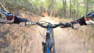
Popular Vicopisano Mountain Biking Trails
• 100 ★ 4.0 • 1 mile • 18 ft • 85 •
bellissimo sentiero in discesa, strada larga ma tecnica. consigliato per bici xc
• 90 ★ 4.0 • 4,997 ft • 0 ft • 76 •
Popular green difficulty singletrack. This mountain bike primary trail can be used both directions and has a easy overall physical rating with a 0 ft green climb. Adaptive MTB rating: amtb green. Trail visibility is always easy to follow. On average it takes 5 minutes to complete this trail.
• 50 ★ 3.4 • 1 mile • 86 ft • 58 •
Trail ben tenuto, vegetazione (morbida non rovi) solo in alcuni punti, terreno asciutto principalmente con roccia smossa e polvere. In un breve tratto il terreno è battuto e terroso. Non sono presenti salti, ma numerosi canali per il...
• 30 ★ 4.0 • 4,009 ft • 228 ft • 51 •
Trail semplice e recentemente pulito dalla vegetazione. Terreno misto: sassi, rocce, terra battuta nell'ultimo tratto. Il sentiero è per gran parte single trail, fattibile con qualsiasi tipo di MTB. Buono in condizioni umide non...
• 20 ★ 4.0 • 1,932 ft • 0 ft • 38 •
Trail Enduro molto roccioso e pendente, recentemente ripulito da pietre smosse
• 60 ★ 0.0 • 3,635 ft • 34 ft • 36 •
Breve single trail di collegamento tra la fine del (aka via dei Molini) e la ciclabile sterrata (ghiaino) di Vicopisano. Tenuto generalmente in buone condizioni, terra battuta, vegetazione sotto controllo.
Recent Trail Reports
| status | trail | date | condition | info | user |
|---|---|---|---|---|---|
| Variante Cani DH | Dec 5, 2025 @ 10:00am (Europe/San_Marino) Dec 5, 2025 | Variable | NickScalpel89 | ||
| via dei molini dh | Dec 3, 2025 @ 1:51pm (Europe/San_Marino) Dec 3, 2025 | Wet | sciurpa | ||
| Vedi nel boschetto | Nov 4, 2025 @ 3:07pm (Europe/San_Marino) Nov 4, 2025 | Ideal | sciurpa | ||
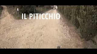
| Piticchio | Nov 4, 2025 @ 3:07pm (Europe/San_Marino) Nov 4, 2025 | Variable | sciurpa | ||
| San Jacopo Climb | Aug 31, 2025 @ 7:09am Aug 31, 2025 | Unknown | Fiore13 | ||
| Campo dei lupi to Castellare | Jun 4, 2025 @ 6:30pm Jun 4, 2025 | Unknown | Fiore13 | ||
| Castellare | Mar 28, 2025 @ 3:44pm Mar 28, 2025 | Ideal | FraV8 | ||
| Via della Verruca | Mar 25, 2024 @ 8:25am Mar 25, 2024 | Wet | Fiore13 | ||
| Castellare base to Campo Dei Lupi | Jan 4, 2024 @ 3:38am Jan 4, 2024 | Dry | Fiore13 | ||
| Tagliata di Noce | Jul 23, 2022 @ 7:38am Jul 23, 2022 | Dry | 31RSXl |
Activity Feed
| username | action | type | title | date |
|---|---|---|---|---|
| NickScalpel89 | add | report | activity #85181350 | Dec 5, 2025 @ 5:58am Dec 5, 2025 |
| sciurpa | add | report | activity #85100554 | Dec 3, 2025 @ 7:33am Dec 3, 2025 |
| sciurpa | add | report | activity #83567948 and 2 more | Nov 4, 2025 @ 9:36am Nov 4, 2025 |
| lo2wmtb | ridden | trail | activity #81752491 | Oct 5, 2025 @ 8:18am Oct 5, 2025 |
| GiulioOaHsGW | add | report | activity #79908111 and 2 more | Sep 8, 2025 @ 4:40am Sep 8, 2025 |
Recent Comments
| username | type | title | comment | date |
|---|---|---|---|---|
| trail | Bel sentiero da fare sia in discesa che... | Jan 12, 2020 @ 10:03pm Jan 12, 2020 |
Activity Type Stats
| activitytype | trails | distance | descent | descent distance | total vertical | rating | global rank | state rank | photos | reports | routes | ridelogs |
|---|---|---|---|---|---|---|---|---|---|---|---|---|
| Mountain Bike | 10 | 8 miles | 1,516 ft | 3 miles | 1,234 ft | #8,536 | #776 | 6 | 101 | 2,256 | ||
| E-Bike | 10 | 8 miles | 1,516 ft | 3 miles | 1,234 ft | #6,857 | #735 | 99 | 188 | |||
| Horse | 1 | 3,635 ft | 141 ft | 2,264 ft | 131 ft | 3 | ||||||
| Hike | 9 | 7 miles | 1,375 ft | 3 miles | 1,230 ft | #11,328 | #829 | 100 | 30 | |||
| Trail Running | 8 | 7 miles | 1,161 ft | 3 miles | 1,234 ft | #10,714 | #806 | 97 | 75 |
Frequently Asked Questions About Vicopisano
▼
What are the highest rated mountain biking trails in Vicopisano?
The highest rated mountain biking trails in Vicopisano are:
- Castellare (4/5)
- via dei molini dh (4/5)
- Piticchio (4/5)
- Castellare base to Campo Dei Lupi (4/5)
- Variante Cani DH (3.8/5)
▼
What is the best time of the year to ride in Vicopisano?
Based on ride log data, the most popular months to ride in Vicopisano are:
- May (16 activities)
- March (14 activities)
- June (10 activities)
▼
Where can I park to ride in Vicopisano?
Check the Vicopisano trail map for trailhead and parking information. Community members regularly update access and parking details for trails in the area.
▼
What is the longest trail in Vicopisano?
The longest trail in Vicopisano is Variante Cani DH at 1.3 miles. View all trails sorted by distance.
- By nasone
 & contributors
 - Admins: DanielePracchia
- #33722 - 1,086 views
- vicopisano activity log | embed map of Vicopisano mountain bike trails | vicopisano mountain biking points of interest
Downloading of trail gps tracks in kml & gpx formats is enabled for Vicopisano.
You must login to download files.