close
-
Layers w
- Weather Layers
- Pro
- Pro
- Pro
- Pro
- Pro
- Pro
- More Layers
- Pro
- Pro
- Pro
- Pro
-
Upgrade to

3D
Trail Conditions
- Unknown
- Snow Groomed
- Snow Packed
- Snow Covered
- Snow Cover Partial
- Freeze/thaw Cycle
- Icy
- Prevalent Mud
- Wet
- Variable
- Ideal
- Dry
- Very Dry
Trail Flow (Ridden Direction)
Trailforks scans users ridelogs to determine the most popular direction each trail is ridden. A good flowing trail network will have most trails flowing in a single direction according to their intension.
The colour categories are based on what percentage of riders are riding a trail in its intended direction.
The colour categories are based on what percentage of riders are riding a trail in its intended direction.
- > 96%
- > 90%
- > 80%
- > 70%
- > 50%
- < 50%
- bi-directional trail
- no data
Trail Last Ridden
Trailforks scans ridelogs to determine the last time a trail was ridden.
- < 2 days
- < 1 week
- < 2 weeks
- < 1 month
- < 6 months
- > 6 months
Trail Ridden Direction
The intended direction a trail should be ridden.
- Downhill Only
- Downhill Primary
- Both Directions
- Uphill Primary
- Uphill Only
- One Direction
Contribute Details
Colors indicate trail is missing specified detail.
- Description
- Photos
- Description & Photos
- Videos
Trail Popularity ?
Trailforks scans ridelogs to determine which trails are ridden the most in the last 9 months.
Trails are compared with nearby trails in the same city region with a possible 25 colour shades.
Think of this as a heatmap, more rides = more kinetic energy = warmer colors.
- most popular
- popular
- less popular
- not popular
ATV/ORV/OHV Filter
Max Vehicle Width
inches
US Cell Coverage
Legend

Radar Time
Activity Recordings
Trailforks uses anonymized public activity data.
?
Activity Recordings
Trailforks uses anonymized public activity data.
?
Personal Heatmap
▶
Activity Types
all
/
none
▶
Options
2
Date range
month
–
Winter Trails
Warning
A routing network for winter maps does not exist. Selecting trails using the winter trails layer has been disabled.
Missing Trails
Most Popular
Least Popular
Trails are colored based on popularity. The more popular a trail is, the more red. Less popular trails trend towards green.
Jump Magnitude Heatmap
Heatmap of where riders jump on trails. Zoom in to see individual jumps, click circles to view jump details.
BC Backroad Status
![map legend]()
Service Road Atlas is a free to use, community-driven service for viewing and creating reports on the numerous back-country service roads around B.C. and Alberta.

Slope Aspect
Direction the slope faces
Trails Deemphasized
Trails are shown in grey.
Only show trails with no bike usage.
Suggested Layers
Based on selected activity type
Save the current map location and zoom level as your default home location whenever this page is loaded.
Save
No description for Victor has been added yet!
Login or register to submit one.

IMBA Ride Center
Teton Region
Activities Click to view
- Mountain Bike
76 trails
- E-Bike
27 trails
- Gravel Bike
0 trails
- Adaptive Bike
0 trails
- Winter Fat Bike
0 trails
- Horse
31 trails
- Hike
76 trails
- Trail Running
77 trails
- Dirtbike/Moto
32 trails
- ATV/ORV/OHV
14 trails
- Snowmobile
5 trails
- Snowshoe
12 trails
- Nordic Ski
11 trails
Region Details
- 13
- 10
- 29
- 24
Region Status
Caution as of Jun 5, 2026Stats
- Avg Trail Rating
- Trails (view details)
- 84
- Trails Mountain Bike
- 76
- Trails E-Bike
- 27
- Trails Horse
- 31
- Trails Hike
- 76
- Trails Trail Running
- 77
- Trails Dirtbike/Moto
- 32
- Trails Observed Trials
- 2
- Trails ATV/ORV/OHV
- 14
- Trails Snowmobile
- 5
- Trails Snowshoe
- 12
- Trails Backcountry Ski
- 2
- Trails Nordic Ski
- 11
- Total Distance
- 246 miles
- Total Descent
- 49,811 ft
- Total Vertical
- 4,641 ft
- Highest Trailhead
- 9,928 ft
- Reports
- 861
- Photos
- 248
- Ridden Counter
- 10,621
Sub Regions
-
Big Holes
- 1
- 12
- 12
-
Mike Harris
- 2
- 11
- 12
-
Southern Valley Trails
- 6
- 4
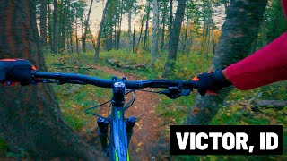
Popular Victor Mountain Biking Trails
• 100 ★ 4.3 • 2 miles • 263 ft • 910 •
This is a fun little trail with some good flowing downhill. Lots of little roots and some low berms, just big enough to keep your speed up. The trail gets to a high point, then descends down to the Gumpy loop. If you just want a quick...
• 100 ★ 4.0 • 682 ft • 43 ft • 811 •
Connects the BPA road and to Ladyslipper and . A short but fun section of trail riding in either direction. Signed trail junctions at southern end, Ladyslipper junction and junction. This trail is groomed for winter fatbiking as snow...
• 100 ★ 4.5 • 2 miles • 502 ft • 678 •
Brand new trail as of June 2020 that follows the hillside between the BPA road and the highway in the Southern Valley Trail System. Excellent, mellow climb to the top of Grumpy's and a super fun, flowy, bermed downhill. Best views from...
• 95 ★ 5.0 • 2 miles • 437 ft • 644 •
This trail is brand new for 2018! The culmination of two years of work between the USFS, Mountain Bike the Tetons and the Teton Valley community. The majority of this trail is machine built with all hand finish-work. It connects the...
• 100 ★ 4.5 • 5,007 ft • 225 ft • 608 •
Upper loop section of the Trail. Constructed along with the complete Trail in summer 2020. Groomed for fatbikes and snowshoes.
• 90 ★ 3.9 • 2 miles • 306 ft • 496 •
A great intermediate loop with some technical sections, root/stump jumps, and tight twists and turns to keep things fun. Mostly dense tree cover. Best ridden in the counter-clockwise direction. This trail is becoming increasingly...
• 95 ★ 5.0 • 2 miles • 250 ft • 460 •
Created in order to connect the Mike Harris trail system to . In the winter, this trail is machine groomed and connects the and to Ladyslipper.
• 90 ★ 3.5 • 2 miles • 45 ft • 348 •
After getting past the initial, very steep doubletrack climb, you’ll be rewarded with a perfect, swooping climbing grade. This trail can be ridden as an out and back; as part of a loop including / (left at junction)/ returning on W...
Victor Mountain Bike Routes
★ 5.0 • 11 miles • 2,135 ft • 3 • Shuttled •
Usually referred to just as "Mail Cabin", this route is usually shuttled to avoid pavement pedaling. It's...
6 miles • 929 ft • 3 •
Teton Dirt Series #4: Mike Harris Mini Enduro! Come out for a 2-stage enduro race at a favorite riding...
12 miles • 2,747 ft • 5 • Loop •
Great backcountry loop into the beautiful Red Creek drainage. Definitely up Grove, down Red, up Corral and...
11 miles • 1,749 ft • 2 • Loop •
A local favorite and great introductory ride to Big Hole Backcountry. Short loop recommended by local...
8 miles • 1,779 ft • 2 • Loop •
Please be respectful of private land when parking near the trailhead.
15 miles • 3,121 ft • 0 • Loop •
Please be respectful of private land when parking near the trailhead.
Photos of Victor Mountain Bike
Videos of Victor Mountain Bike
trail: Drake Creek
0:36 |
359 |
Aug 2, 2020
youtuber
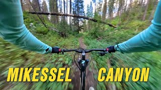
![Mikesell Canyon Loop / Victor, ID (the Idaho...]()
trail: Mikesell Canyon
10:56 |
159 |
Apr 23, 2025 , Victor
trail: Mikesell Canyon
6:02 |
181 |
Sep 17, 2024 , Victor

trail: Happy Hour
5:53 |
128 |
Sep 17, 2024 , Victor
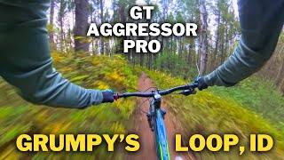
trail: Grumpy's Loop
3:10 |
96 |
Sep 17, 2024 , Victor
trail: Grumpy's Loop
4:49 |
97 |
Jul 3, 2024 , Victor

trail: Upper Hillbender
6:20 |
165 |
Jul 3, 2024 , Victor
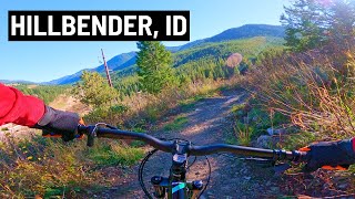
trail: Hillbender
7:01 |
182 |
Jul 3, 2024 , Victor
Recent Trail Reports
| status | trail | date | condition | info | user |
|---|---|---|---|---|---|
| Mikesell Canyon Spur | Jun 5, 2026 @ 3:31pm (America/Boise) Jun 5, 2026 | Ideal | bengavelda | ||
| Pole Canyon | Jun 5, 2026 @ 3:31pm (America/Boise) Jun 5, 2026 | Ideal | bengavelda | ||
| Dry Henderson | May 27, 2026 @ 8:42am (America/Boise) May 27, 2026 | Snow Cover Partial | cremebrule MBT | ||
| Corral Creek | May 27, 2026 @ 8:40am (America/Boise) May 27, 2026 | Variable | cremebrule MBT | ||
| Corral Creek Spur | May 27, 2026 @ 8:40am (America/Boise) May 27, 2026 | Variable | cremebrule MBT | ||
| South Grove Creek | May 27, 2026 @ 8:40am (America/Boise) May 27, 2026 | Variable | cremebrule MBT | ||
| Red Creek | May 27, 2026 @ 8:40am (America/Boise) May 27, 2026 | Variable | cremebrule MBT | ||
| Rocky Peak | May 27, 2026 @ 8:40am (America/Boise) May 27, 2026 | Variable | cremebrule MBT | ||
| Drake Creek | May 27, 2026 @ 8:40am (America/Boise) May 27, 2026 | Variable | cremebrule MBT | ||
| Little Pine (Spooky) | May 27, 2026 @ 8:40am (America/Boise) May 27, 2026 | Variable | cremebrule MBT |
National Scenic Trails & Official Routes
-
Great Western Trail
- Mountain Bike
- E-Bike
- Horse
- Hike
- Trail Running
- Dirtbike/Moto
- ATV/ORV/OHV

Activity Feed
| username | action | type | title | date |
|---|---|---|---|---|
| AndrewE4lOtB | ridden | trail | activity #97270787 and 3 more | Jun 18, 2026 @ 12:45pm Jun 18, 2026 |
| Austinmacey | ridden | trail | activity #97139448 | Jun 16, 2026 @ 2:55pm Jun 16, 2026 |
| scbryan382 | wishlist | trail | activity #96978045 | Jun 14, 2026 @ 9:29am Jun 14, 2026 |
| jabisch | wishlist | trail | activity #96936610 | Jun 13, 2026 @ 8:29pm Jun 13, 2026 |
| kimehall | wishlist | route | activity #96928213 | Jun 13, 2026 @ 5:20pm Jun 13, 2026 |
Recent Comments
| username | type | title | comment | date |
|---|---|---|---|---|
| trail | I | Mar 16, 2026 @ 8:03pm Mar 16, 2026 | ||
| trail | Great downhill some really fun rock gardens,... | Aug 24, 2025 @ 2:21pm Aug 24, 2025 | ||
| trail | Riding great! The work that has been done to... | Aug 16, 2025 @ 8:23am Aug 16, 2025 | ||
| trail | Trail is overgrown and almost impossible to... | Jul 2, 2025 @ 6:01pm Jul 2, 2025 | ||
| trail | Tried to ride on e-mountain bike. Lots of... | Oct 28, 2024 @ 9:51am Oct 28, 2024 |
Local Badges
-

Completionist0 awarded -

Big Ride 30k1,298 awarded -

Epic Ride 50k345 awarded -

Top 10 Trails4 awarded -

Descent 100k Badge3 awarded -
Completionist0 awarded
Bike & Skill Parks
| name | type | city | rating |
|---|---|---|---|
| Victor Bike Park | skill park | Victor |
Activity Type Stats
| activitytype | trails | distance | descent | descent distance | total vertical | rating | global rank | state rank | photos | reports | routes | ridelogs |
|---|---|---|---|---|---|---|---|---|---|---|---|---|
| Mountain Bike | 76 | 231 miles | 48,386 ft | 108 miles | 4,003 ft | #843 | #327 | 234 | 859 | 13 | 15,016 | |
| E-Bike | 27 | 91 miles | 17,073 ft | 33 miles | 3,947 ft | #631 | #737 | 2 | 377 | 2 | 382 | |
| Horse | 31 | 97 miles | 21,332 ft | 38 miles | 3,947 ft | #601 | #527 | 259 | 10 | |||
| Hike | 76 | 232 miles | 48,773 ft | 105 miles | 4,642 ft | #476 | #221 | 6 | 835 | 1 | 966 | |
| Trail Running | 77 | 239 miles | 49,006 ft | 109 miles | 4,642 ft | #633 | #233 | 835 | 1 | 533 | ||
| Dirtbike/Moto | 32 | 102 miles | 20,023 ft | 39 miles | 3,947 ft | #327 | #146 | 5 | 179 | 44 | ||
| Observed Trials | 2 | 7 miles | 942 ft | 2 miles | 472 ft | 1 | 4 | |||||
| ATV/ORV/OHV | 14 | 51 miles | 3,773 ft | 13 miles | 3,947 ft | #459 | #153 | 95 | 11 | |||
| Snowmobile | 5 | 27 miles | 988 ft | 9 miles | 3,212 ft | #162 | #70 | 1 | 19 | |||
| Snowshoe | 12 | 19 miles | 1,050 ft | 4 miles | 3,035 ft | #697 | #297 | 1 | 123 | 37 | ||
| Backcountry Ski | 2 | 7 miles | 75 ft | 3,465 ft | 3,035 ft | 3 | 452 | |||||
| Nordic Ski | 11 | 12 miles | 640 ft | 4 miles | 709 ft | #832 | #331 | 1 | 91 | 641 |
Frequently Asked Questions About Victor
▼
What are the best places to ride in Victor?
Victor has 5 areas to explore for mountain biking.
▼
What are the highest rated mountain biking trails in Victor?
The highest rated mountain biking trails in Victor are:
- Drake Creek (4.3/5)
- Upper Ladyslipper (4.3/5)
- Mikesell Canyon (4.3/5)
- Hillbender (4.3/5)
- Pole Canyon (4.2/5)
▼
What is the best time of the year to ride in Victor?
Based on ride log data, the most popular months to ride in Victor are:
- July (323 activities)
- August (186 activities)
- June (145 activities)
▼
Where can I park to ride in Victor?
There are 20 parking locations listed in Victor. The most popular parking spots are: View all parking and trailhead locations on the map to plan your visit.
Activities
Trails
Points of Interest
- By jakehawkes
 & contributors
 - Admins: SRTA, noplacefamous, TMBA, MBT, TVTP
- #8087 - 14,365 views
- victor activity log | embed map of Victor mountain bike trails | victor mountain biking points of interest
Downloading of trail gps tracks in kml & gpx formats is enabled for Victor.
You must login to download files.