close
-
Layers w
- Weather Layers
- Pro
- Pro
- Pro
- Pro
- Pro
- Pro
- More Layers
- Pro
- Pro
- Pro
- Pro
-
Upgrade to

3D
Trail Conditions
- Unknown
- Snow Groomed
- Snow Packed
- Snow Covered
- Snow Cover Partial
- Freeze/thaw Cycle
- Icy
- Prevalent Mud
- Wet
- Variable
- Ideal
- Dry
- Very Dry
Trail Flow (Ridden Direction)
Trailforks scans users ridelogs to determine the most popular direction each trail is ridden. A good flowing trail network will have most trails flowing in a single direction according to their intension.
The colour categories are based on what percentage of riders are riding a trail in its intended direction.
The colour categories are based on what percentage of riders are riding a trail in its intended direction.
- > 96%
- > 90%
- > 80%
- > 70%
- > 50%
- < 50%
- bi-directional trail
- no data
Trail Last Ridden
Trailforks scans ridelogs to determine the last time a trail was ridden.
- < 2 days
- < 1 week
- < 2 weeks
- < 1 month
- < 6 months
- > 6 months
Trail Ridden Direction
The intended direction a trail should be ridden.
- Downhill Only
- Downhill Primary
- Both Directions
- Uphill Primary
- Uphill Only
- One Direction
Contribute Details
Colors indicate trail is missing specified detail.
- Description
- Photos
- Description & Photos
- Videos
Trail Popularity ?
Trailforks scans ridelogs to determine which trails are ridden the most in the last 9 months.
Trails are compared with nearby trails in the same city region with a possible 25 colour shades.
Think of this as a heatmap, more rides = more kinetic energy = warmer colors.
- most popular
- popular
- less popular
- not popular
ATV/ORV/OHV Filter
Max Vehicle Width
inches
US Cell Coverage
Legend

Radar Time
Activity Recordings
Trailforks uses anonymized public activity data.
?
Activity Recordings
Trailforks uses anonymized public activity data.
?
Personal Heatmap
▶
Activity Types
all
/
none
▶
Options
2
Date range
month
–
Winter Trails
Warning
A routing network for winter maps does not exist. Selecting trails using the winter trails layer has been disabled.
Missing Trails
Most Popular
Least Popular
Trails are colored based on popularity. The more popular a trail is, the more red. Less popular trails trend towards green.
Jump Magnitude Heatmap
Heatmap of where riders jump on trails. Zoom in to see individual jumps, click circles to view jump details.
BC Backroad Status
![map legend]()
Service Road Atlas is a free to use, community-driven service for viewing and creating reports on the numerous back-country service roads around B.C. and Alberta.

Slope Aspect
Direction the slope faces
Trails Deemphasized
Trails are shown in grey.
Only show trails with no bike usage.
Suggested Layers
Based on selected activity type
Save the current map location and zoom level as your default home location whenever this page is loaded.
SaveПарк «Фили». Эндуро-трейлы и мини-дх
Primary Trail Type: All-Mountain & Downhill
eBikes Allowed:
Yes
Land Status: Municipal Park
 google parking directions
 Access Info:
Нижний памп трек
This region uses the Uk/Euro style trail grading system.
Activities Click to view
- Mountain Bike
27 trails
- E-Bike
27 trails
- Hike
24 trails
- Trail Running
24 trails
Region Details
- 13
- 2
- 6
- 5
Region Status
Caution as of Jul 6, 2025Local Trail Association
Stats
- Avg Trail Rating
- Trails (view details)
- 27
- Trails Mountain Bike
- 27
- Trails E-Bike
- 27
- Trails Hike
- 24
- Trails Trail Running
- 24
- Total Distance
- 5 miles
- Total Descent
- 1,283 ft
- Total Vertical
- 192 ft
- Highest Trailhead
- 606 ft
- Reports
- 137
- Photos
- 8
- Ridden Counter
- 1,827
Popular Филёвский парк Trails
• 95 ★ 5.0 • 1,017 ft • 0 ft • 123 •
Popular red difficulty singletrack. This mountain bike primary trail can be used downhill only. It features drop, jump and gap jump. On average it takes 5 minutes to complete this trail.
• 65 ★ 3.0 • 1,083 ft • 0 ft • 98 •
The classic route MiniDH with a large number of trajectories, jumps and root sections.
• 50 ★ 3.0 • 1,188 ft • 0 ft • 81 •
Moderately popular blue difficulty singletrack. This mountain bike primary trail can be used downhill primary. It features jump, gap jump and skinny. On average it takes 2 minutes to complete this trail.
• 70 ★ 0.0 • 1,014 ft • 0 ft • 63 •
Popular red difficulty singletrack. This mountain bike primary trail can be used downhill only and has a easy overall physical rating with a 0 ft green climb. Trail visibility is always easy to follow. On average it takes 2 minutes to complete this trail.
• 50 ★ 4.5 • 1,188 ft • 0 ft • 61 •
Moderately popular green difficulty singletrack. This mountain bike primary trail can be used downhill primary. On average it takes 2 minutes to complete this trail.
• 60 ★ 0.0 • 472 ft • 0 ft • 46 •
Moderately popular blue difficulty singletrack. This mountain bike primary trail can be used downhill primary with a 0 ft green climb. On average it takes 1 minutes to complete this trail.
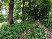
Photos of Филёвский парк Mountain Bike


Recent Trail Reports
| status | trail | date | condition | info | user |
|---|---|---|---|---|---|
| Барби | Oct 28, 2024 @ 2:32pm Oct 28, 2024 | Ideal | pixel8848 | ||
| Подъём к Горнолыжке | Oct 28, 2024 @ 2:32pm Oct 28, 2024 | Dry | pixel8848 | ||
| Дача Кунаева | Oct 28, 2024 @ 2:32pm Oct 28, 2024 | Ideal | pixel8848 | ||
| Правый | Oct 28, 2024 @ 2:32pm Oct 28, 2024 | Wet | pixel8848 | ||
| Трансфер к подъёму на Эндурку | Oct 28, 2024 @ 2:32pm Oct 28, 2024 | Variable | pixel8848 | ||
| Подъём к Эндурке | Oct 28, 2024 @ 2:32pm Oct 28, 2024 | Wet | pixel8848 | ||
| Сахарок | Oct 28, 2024 @ 2:32pm Oct 28, 2024 | Ideal | pixel8848 | ||
| Слив | Oct 28, 2024 @ 2:32pm Oct 28, 2024 | Ideal | pixel8848 | ||
| Трансфер к выкату Дача Кунаева | Oct 28, 2024 @ 2:32pm Oct 28, 2024 | Variable | pixel8848 | ||
| Кайф | Sep 26, 2024 @ 1:28pm Sep 26, 2024 | Very Dry | pixel8848 |
Activity Feed
| username | action | type | title | date |
|---|---|---|---|---|
| l2Yrsv | wishlist | trail | activity #96597522 | Jun 9, 2026 @ 5:02am Jun 9, 2026 |
| RhOFOR | difficultyvote | trail | activity #90939097 | Mar 20, 2026 @ 1:12pm Mar 20, 2026 |
| RhOFOR | vote | trail | activity #90939032 | Mar 20, 2026 @ 1:11pm Mar 20, 2026 |
| gH6VNI | vote | trail | activity #79131320 | Aug 28, 2025 @ 12:24pm Aug 28, 2025 |
| gH6VNI | add | photo | activity #79131217 and 1 more | Aug 28, 2025 @ 12:23pm Aug 28, 2025 |
Nearby Areas
| name | distance | ||||
|---|---|---|---|---|---|
| Крылатские Холмы | 4 | 1.5 km | |||
| THEUPPERDIRT | 1.6 km | ||||
| Серебряный Бор | 5 | 13 | 2.7 km | ||
| Ромашково | 1 | 3 | 3.5 km | ||
| Щукинский Полуостров | 1 | 3.6 km |
Local Badges
-

Completionist1 awarded
Bike & Skill Parks
| name | type | city | rating |
|---|---|---|---|
| moto jump | skill park | Moscow |
Activity Type Stats
| activitytype | trails | distance | descent | descent distance | total vertical | rating | global rank | state rank | photos | reports | routes | ridelogs |
|---|---|---|---|---|---|---|---|---|---|---|---|---|
| Mountain Bike | 27 | 5 miles | 1,283 ft | 2 miles | 194 ft | #1,968 | #11 | 8 | 137 | 3,573 | ||
| E-Bike | 27 | 5 miles | 1,283 ft | 2 miles | 194 ft | #1,049 | #8 | 135 | 63 | |||
| Hike | 24 | 4 miles | 991 ft | 2 miles | 194 ft | #1,752 | #17 | 133 | 5 | |||
| Trail Running | 24 | 4 miles | 991 ft | 2 miles | 194 ft | #1,075 | #16 | 133 | 78 |
Frequently Asked Questions About Филёвский парк
▼
What are the highest rated mountain biking trails in Филёвский парк?
▼
What is the best time of the year to ride in Филёвский парк?
Based on ride log data, the most popular months to ride in Филёвский парк are:
- July (5 activities)
- August (5 activities)
- June (4 activities)
▼
Where can I park to ride in Филёвский парк?
There are 1 parking locations listed in Филёвский парк. The most popular parking spots are:
▼
What is the longest trail in Филёвский парк?
The longest trail in Филёвский парк is Рамазан at 427.0 m. View all trails sorted by distance.
Activities
- By madmaxxx999 & contributors
- Admins: TBRU, DrumminMan, askras, DmitryA, Jahtaka
- #18956 - 11,837 views
- Филёвский парк activity log | embed map of Филёвский парк mountain bike trails | Филёвский парк mountain biking points of interest
Downloading of trail gps tracks in kml & gpx formats is enabled for Филёвский парк.
You must login to download files.