close
-
Layers w
- Weather Layers
- Pro
- Pro
- Pro
- Pro
- Pro
- Pro
- More Layers
- Pro
- Pro
- Pro
- Pro
-
Upgrade to

3D
Trail Conditions
- Unknown
- Snow Groomed
- Snow Packed
- Snow Covered
- Snow Cover Partial
- Freeze/thaw Cycle
- Icy
- Prevalent Mud
- Wet
- Variable
- Ideal
- Dry
- Very Dry
Trail Flow (Ridden Direction)
Trailforks scans users ridelogs to determine the most popular direction each trail is ridden. A good flowing trail network will have most trails flowing in a single direction according to their intension.
The colour categories are based on what percentage of riders are riding a trail in its intended direction.
The colour categories are based on what percentage of riders are riding a trail in its intended direction.
- > 96%
- > 90%
- > 80%
- > 70%
- > 50%
- < 50%
- bi-directional trail
- no data
Trail Last Ridden
Trailforks scans ridelogs to determine the last time a trail was ridden.
- < 2 days
- < 1 week
- < 2 weeks
- < 1 month
- < 6 months
- > 6 months
Trail Ridden Direction
The intended direction a trail should be ridden.
- Downhill Only
- Downhill Primary
- Both Directions
- Uphill Primary
- Uphill Only
- One Direction
Contribute Details
Colors indicate trail is missing specified detail.
- Description
- Photos
- Description & Photos
- Videos
Trail Popularity ?
Trailforks scans ridelogs to determine which trails are ridden the most in the last 9 months.
Trails are compared with nearby trails in the same city region with a possible 25 colour shades.
Think of this as a heatmap, more rides = more kinetic energy = warmer colors.
- most popular
- popular
- less popular
- not popular
ATV/ORV/OHV Filter
Max Vehicle Width
inches
US Cell Coverage
Legend

Radar Time
Activity Recordings
Trailforks uses anonymized public activity data.
?
Activity Recordings
Trailforks uses anonymized public activity data.
?
Personal Heatmap
▶
Activity Types
all
/
none
▶
Options
2
Date range
month
–
Winter Trails
Warning
A routing network for winter maps does not exist. Selecting trails using the winter trails layer has been disabled.
Missing Trails
Most Popular
Least Popular
Trails are colored based on popularity. The more popular a trail is, the more red. Less popular trails trend towards green.
Jump Magnitude Heatmap
Heatmap of where riders jump on trails. Zoom in to see individual jumps, click circles to view jump details.
BC Backroad Status
![map legend]()
Service Road Atlas is a free to use, community-driven service for viewing and creating reports on the numerous back-country service roads around B.C. and Alberta.

Slope Aspect
Direction the slope faces
Trails Deemphasized
Trails are shown in grey.
Only show trails with no bike usage.
Suggested Layers
Based on selected activity type
Save the current map location and zoom level as your default home location whenever this page is loaded.
SaveBitsevski Park - is one of the largest natural parks (forests) in Moscow, Russia. The park, traversed by the Chertanovka River and the Bitsa River, sprawls for some 10 km from north to south and covers the area of 18 square kilometres. The park is elongated from the north to the south and is bounded by Balaklavsky Avenue from the north.
The vast space and an extensive network of trails allows for time to roll over 50 without repeating the route. There are more technical trails, interesting climbs. Pump track "Fukushima" Mini-dh trails on a Krasnuy mayak..
Природно-исторический парк «Би́тцевский лес» — особо охраняемая природная территория, второй по величине парк Москвы (2208,4 га), уступающий по размерам только парку Лосиный Остров. Протяжённость парка: с севера на юг — 10 км, с запада на восток — 1,5—4 км.
Огромное пространство и разветвленная сеть тропинок позволяет за раз накатать более 50 не повторяя маршрута. Есть техничные тропинки, интересные съезжалки. Памп-трек "Фукусима", Мини-дх трасса на красном маяке.
Primary Trail Type: Cross-Country
eBikes Allowed:
Yes
AKA: Битца
Land Status: Municipal Park
 google parking directions
Links
This region uses the Uk/Euro style trail grading system.
Activities Click to view
- Mountain Bike
85 trails
- E-Bike
85 trails
- Hike
39 trails
- Trail Running
39 trails
- Nordic Ski
13 trails
Region Details
- 20
- 21
- 15
- 8
- 1
Region Status
Open as of Jun 6, 2026Local Trail Association
Stats
- Avg Trail Rating
- Trails (view details)
- 66
- Trails Mountain Bike
- 85
- Trails E-Bike
- 85
- Trails Winter Fat Bike
- 2
- Trails Hike
- 39
- Trails Trail Running
- 39
- Trails Nordic Ski
- 13
- Total Distance
- 43 miles
- Total Descent
- 4,204 ft
- Total Vertical
- 316 ft
- Highest Trailhead
- 843 ft
- Reports
- 503
- Photos
- 231
- Ridden Counter
- 4,676
Popular Битцевский парк Trails
• 90 ★ 4.5 • 3,868 ft • 3 ft • 242 •
Fairly narrow, hilly trail and fidgety. The main attraction of the bridge with a very technically a stop to it. Достаточно узкий, холмистый и вертлявый трейл. Главное...
• 90 ★ 5.0 • 1,414 ft • 3 ft • 237 •
Popular blue difficulty singletrack. This mountain bike primary trail can be used downhill primary and has a easy overall physical rating. It features pump track. On average it takes 1 minutes to complete this trail.
• 85 ★ 5.0 • 3,045 ft • 18 ft • 184 •
Popular green difficulty singletrack. This mountain bike primary trail can be used both directions and has a moderate overall physical rating with a 18 ft green climb. It features pump track and roller coaster. On average it takes 5 minutes to complete this trail.
• 90 ★ 4.4 • 3,074 ft • 16 ft • 178 •
Popular red difficulty singletrack. This mountain bike primary trail can be used downhill primary and has a moderate overall physical rating with a 16 ft green climb. On average it takes 4 minutes to complete this trail.
• 80 ★ 4.7 • 2,503 ft • 0 ft • 175 •
Popular blue difficulty singletrack. This mountain bike primary trail can be used downhill primary and has a moderate overall physical rating with a 0 ft green climb. It features pump track. On average it takes 4 minutes to complete this trail.
• 90 ★ 5.0 • 1,959 ft • 2 ft • 160 •
Popular blue difficulty singletrack. This mountain bike primary trail can be used downhill primary and has a moderate overall physical rating. On average it takes 3 minutes to complete this trail.
Mountain Bike Routes
★ 5.0 • 18 miles • 1,139 ft • 12 •
Проезд по всем основным трейлам Битцы для бодрячка
• 4 miles • 45 ft • 0 •
• 1 mile • 1 •
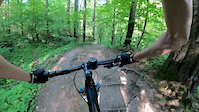
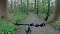
Photos of Битцевский парк Mountain Bike
Videos of Битцевский парк Mountain Bike

trail: Жигули
0:18 |
139 |
Jan 6, 2022
trail: Жигули
0:13 |
|
Apr 28, 2021
trail: Жигули
0:23 |
167 |
Jan 19, 2021
trail: Жигули
0:13 |
351 |
Nov 5, 2020
trail: Романтичка
4:00 |
392 |
Jul 11, 2020
trail: Фееричный
0:34 |
242 |
Jul 11, 2020
trail: Кленовый
3:06 |
303 |
Jul 11, 2020
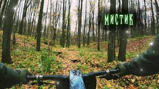
trail: Лотос.
5:07 |
23 |
Nov 16, 2025 , Moscow
Recent Trail Reports
| status | trail | date | condition | info | user |
|---|---|---|---|---|---|
| Лесник: Купорос | Jun 5, 2026 @ 3:17pm (Europe/Moscow) Jun 5, 2026 | Dry | danhandl | ||
| barbados | Jun 5, 2026 @ 2:07pm (Europe/Moscow) Jun 5, 2026 | Dry | danhandl | ||
| Spagyric | Jun 5, 2026 @ 1:59pm (Europe/Moscow) Jun 5, 2026 | Dry | danhandl | ||
| Алхимик | Jun 5, 2026 @ 1:59pm (Europe/Moscow) Jun 5, 2026 | Dry | danhandl | ||
| LAOS | Oct 3, 2025 @ 2:07am (Europe/Moscow) Oct 2, 2025 | Dry | danhandl | ||
| Лесник: Зелье | Sep 11, 2025 @ 12:02pm Sep 11, 2025 | Dry | danhandl | ||
| Фокс | Sep 9, 2025 @ 4:29am Sep 9, 2025 | Variable | qu-an | ||
| Фееричный | Sep 9, 2025 @ 4:29am Sep 9, 2025 | Variable | qu-an | ||
| Трансфер 6 | Sep 9, 2025 @ 4:29am Sep 9, 2025 | Variable | qu-an | ||
| Севастопольский | Sep 9, 2025 @ 4:29am Sep 9, 2025 | Variable | qu-an |
Activity Feed
| username | action | type | title | date |
|---|---|---|---|---|
| DmitryA | update | trail | activity #96990069 and 1 more | Jun 14, 2026 @ 11:30am Jun 14, 2026 |
| IvanYSelcw | ridden | trail | activity #96856674 | Jun 13, 2026 @ 2:41am Jun 13, 2026 |
| IvanYSelcw | vote | trail | activity #96856593 and 1 more | Jun 13, 2026 @ 2:39am Jun 13, 2026 |
| Fbx | wishlist | trail | activity #96387275 | Jun 6, 2026 @ 10:46am Jun 6, 2026 |
| danhandl | add | report | activity #96284741 and 3 more | Jun 5, 2026 @ 3:59am Jun 5, 2026 |
Recent Comments
| username | type | title | comment | date |
|---|---|---|---|---|
| report | В смысле, от мусора... | May 22, 2026 @ 1:55pm May 22, 2026 | ||
| report | Все высохло, местами... | May 22, 2026 @ 5:27am May 22, 2026 | ||
| trail | Подробное описание всех 6... | Oct 4, 2025 @ 5:33pm Oct 4, 2025 | ||
| report | На всех сегментах... | Oct 4, 2025 @ 5:22pm Oct 4, 2025 | ||
| report | Чисто! Листвы нет почти... | Apr 21, 2025 @ 1:47pm Apr 21, 2025 |
Nearby Areas
| name | distance | ||||
|---|---|---|---|---|---|
| Chess Park | 12 | 12 | 3.7 km | ||
| Butovo Riders Village | 1 | 1 | 3.7 km | ||
| Байк-парк Нагорная | 4.6 km | ||||
| Коломенское | 1 | 1 | 4.7 km | ||
| Воробьёвы Горы | 3 | 7.2 km |
Local Badges
-

Completionist0 awarded
Bike & Skill Parks
| name | type | city | rating |
|---|---|---|---|
| Маяк | skill park | Moscow | |
| Памп-трек Янгеля | skill park | Moscow | |
| Памп-трек | skill park | Moscow | |
| KOMBUCHA | skill park | Moscow |
Activity Type Stats
| activitytype | trails | distance | descent | descent distance | total vertical | rating | global rank | state rank | photos | reports | routes | ridelogs |
|---|---|---|---|---|---|---|---|---|---|---|---|---|
| Mountain Bike | 85 | 40 miles | 3,927 ft | 20 miles | 315 ft | #593 | #2 | 229 | 503 | 4 | 10,428 | |
| E-Bike | 85 | 40 miles | 3,927 ft | 20 miles | 315 ft | #573 | #1 | 478 | 3 | 397 | ||
| Winter Fat Bike | 2 | #1,279 | #2 | 6 | ||||||||
| Hike | 39 | 10 miles | 1,175 ft | 7 miles | 315 ft | #1,370 | #11 | 483 | 8 | |||
| Trail Running | 39 | 10 miles | 1,175 ft | 7 miles | 315 ft | #790 | #12 | 483 | 236 | |||
| Nordic Ski | 13 | 4 miles | 384 ft | 2 miles | 157 ft | #126 | #1 | 41 | 78 |
Frequently Asked Questions About Битцевский парк
▼
What are the highest rated mountain biking trails in Битцевский парк?
The highest rated mountain biking trails in Битцевский парк are:
- Фееричный (4.4/5)
- Романтичка (4.3/5)
- Шаолинь (4.3/5)
- Andorra (4.2/5)
- Севастопольский (4.2/5)
▼
What is the best time of the year to ride in Битцевский парк?
Based on ride log data, the most popular months to ride in Битцевский парк are:
- July (49 activities)
- May (45 activities)
- August (42 activities)
▼
Where can I park to ride in Битцевский парк?
▼
What is the longest trail in Битцевский парк?
The longest trail in Битцевский парк is Буревестник 4км at 2.3 miles. View all trails sorted by distance.
Activities
Trails
- By illureal & contributors
- Admins: TBRU, DrumminMan, askras, DmitryA, DmitryA
- #9434 - 29,122 views
- Битцевский парк activity log | embed map of Битцевский парк mountain bike trails | Битцевский парк mountain biking points of interest
Downloading of trail gps tracks in kml & gpx formats is enabled for Битцевский парк.
You must login to download files.