close
-
Layers w
- Weather Layers
- Pro
- Pro
- Pro
- Pro
- Pro
- Pro
- More Layers
- Pro
- Pro
- Pro
- Pro
-
Upgrade to

3D
Trail Conditions
- Unknown
- Snow Groomed
- Snow Packed
- Snow Covered
- Snow Cover Partial
- Freeze/thaw Cycle
- Icy
- Prevalent Mud
- Wet
- Variable
- Ideal
- Dry
- Very Dry
Trail Flow (Ridden Direction)
Trailforks scans users ridelogs to determine the most popular direction each trail is ridden. A good flowing trail network will have most trails flowing in a single direction according to their intension.
The colour categories are based on what percentage of riders are riding a trail in its intended direction.
The colour categories are based on what percentage of riders are riding a trail in its intended direction.
- > 96%
- > 90%
- > 80%
- > 70%
- > 50%
- < 50%
- bi-directional trail
- no data
Trail Last Ridden
Trailforks scans ridelogs to determine the last time a trail was ridden.
- < 2 days
- < 1 week
- < 2 weeks
- < 1 month
- < 6 months
- > 6 months
Trail Ridden Direction
The intended direction a trail should be ridden.
- Downhill Only
- Downhill Primary
- Both Directions
- Uphill Primary
- Uphill Only
- One Direction
Contribute Details
Colors indicate trail is missing specified detail.
- Description
- Photos
- Description & Photos
- Videos
Trail Popularity ?
Trailforks scans ridelogs to determine which trails are ridden the most in the last 9 months.
Trails are compared with nearby trails in the same city region with a possible 25 colour shades.
Think of this as a heatmap, more rides = more kinetic energy = warmer colors.
- most popular
- popular
- less popular
- not popular
ATV/ORV/OHV Filter
Max Vehicle Width
inches
US Cell Coverage
Legend

Radar Time
Activity Recordings
Trailforks uses anonymized public activity data.
?
Activity Recordings
Trailforks uses anonymized public activity data.
?
Personal Heatmap
▶
Activity Types
all
/
none
▶
Options
2
Date range
month
–
Winter Trails
Warning
A routing network for winter maps does not exist. Selecting trails using the winter trails layer has been disabled.
Missing Trails
Most Popular
Least Popular
Trails are colored based on popularity. The more popular a trail is, the more red. Less popular trails trend towards green.
Jump Magnitude Heatmap
Heatmap of where riders jump on trails. Zoom in to see individual jumps, click circles to view jump details.
BC Backroad Status
![map legend]()
Service Road Atlas is a free to use, community-driven service for viewing and creating reports on the numerous back-country service roads around B.C. and Alberta.

Slope Aspect
Direction the slope faces
Trails Deemphasized
Trails are shown in grey.
Only show trails with no bike usage.
Suggested Layers
Based on selected activity type
Save the current map location and zoom level as your default home location whenever this page is loaded.
Save
No description for Vigo has been added yet!
Login or register to submit one.
This region uses the Uk/Euro style trail grading system.
Activities Click to view
- Mountain Bike
340 trails
- E-Bike
335 trails
- Gravel Bike
0 trails
- Adaptive Bike
0 trails
- Horse
13 trails
- Hike
334 trails
- Trail Running
334 trails
Region Details
- 148
- 4
- 131
- 26
- 7
Region Status
Open as of Jun 7, 2026Stats
- Avg Trail Rating
- Trails (view details)
- 316
- Trails Mountain Bike
- 340
- Trails E-Bike
- 335
- Trails Horse
- 13
- Trails Hike
- 334
- Trails Trail Running
- 334
- Total Distance
- 187 miles
- Total Descent Distance
- 96 miles
- Total Descent
- 44,740 ft
- Total Vertical
- 2,492 ft
- Highest Trailhead
- 2,509 ft
- Reports
- 645
- Photos
- 45
- Ridden Counter
- 7,011
Articles
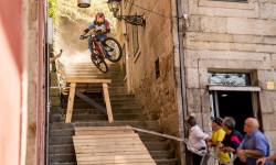
Event Preview: Stair Gaps & Alleyway Hucks Await at MTB Downtown Vigo
Jun 5, 2026 from pinkbike.com
Drop in from the historic O Castro fortress as the Marisquiño festival transforms Spain’s coastal corridors into a 135-vertical-meter urban...
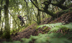
Video: Iago Garay Visits Vigo to Find World Class Trails
Jun 28, 2019 from pinkbike.com
Nacho Trueba and Iago Garay head to Vigo to film a short video in some of the cool spots around the area.
Sub Regions
-
A Risca
- 19
-
Baiona
- 1
- 11
- 2
-
Beade
- 2
- 4
-
Cedeira
- 24
-
Coruxo
- 32
- 5
- 1
-
Gondomar
- 4
- 4
-
Monte Monzón
- 3
-
Monteferro
- 7
- 6
- 2
-
Salceda de Caselas
- 14
- 3
-
Serra do Galleiro
- 3
- 4
-
Valadares
- 3
- 4
Popular Vigo Mountain Biking Trails
• 95 ★ 0.0 • 1 mile • 163 ft • 121 •
Popular white difficulty gravel path. This multi-use trail can be used both directions and has a easy overall physical rating with a 163 ft green climb. Trail visibility is always easy to follow. On average it takes 12 minutes to complete this trail.
• 95 ★ 0.0 • 3 miles • 339 ft • 115 •
Popular white difficulty gravel path. This multi-use trail can be used both directions and has a easy overall physical rating with a 339 ft green climb. Trail visibility is always easy to follow. On average it takes 21 minutes to complete this trail.
• 100 ★ 5.0 • 1,578 ft • 3 ft • 83 •
Bajada con peraltes muy compactados y saltos dobles con escapatorias, divertido y apto para todos los públicos.
• 100 ★ 5.0 • 814 ft • 0 ft • 60 •
Camino que triene el famoso cortado del oso.
• 100 ★ 0.0 • 564 ft • 3 ft • 57 •
Steep technical single track, lots of roots and rocks.
• 100 ★ 0.0 • 535 ft • 0 ft • 54 •
Popular blue difficulty singletrack. This multi-use trail can be used downhill only. On average it takes minutes to complete this trail.
• 100 ★ 0.0 • 636 ft • 0 ft • 53 •
Fun single track in the woods. Flowy loamy tral.
Vigo Mountain Bike Routes
23 miles • 2,616 ft • 9 • Point to Point •
La senda o camino del agua es una ruta natural de Vigo que discurre por diversos accesos y vías de...
10 miles • 2,339 ft • 16 • Loop •
Una bajada a la primera parte de Tobogán, 2 bajadas a y 1 a .
Cto España de Enduro 2015 Featured
23 miles • 5,138 ft • 0 • Loop • Race •
Recorrido del Campeonato de España de Enduro MTB 2015
14 miles • 2,727 ft • 1 • Point to Point • Race •
Ruta del campeonato gallego de enduro 2021.
★ 5.0 • 19 miles • 3,814 ft • 0 • Race •
Campionato de Galicia Enduro Serra do Galiñeiro 2019
Photos of Vigo Mountain Bike
Videos of Vigo Mountain Bike
trail: Mirador
2:07 |
189 |
Nov 12, 2016
trail: Vigo Downhill World Cup
12:52 |
61 |
Aug 11, 2025 , Vigo
trail: Vigo Downhill World Cup
7:35 |
38 |
Aug 11, 2025 , Vigo
trail: Vigo Downhill World Cup
2:59 |
49 |
Aug 11, 2025 , Vigo
trail: Vigo Downhill World Cup
2:50 |
49 |
Aug 11, 2025 , Vigo
trail: Vigo Downhill World Cup
19:17 |
58 |
Aug 11, 2025 , Vigo
trail: Vigo Downhill World Cup
2:06 |
61 |
Aug 11, 2025 , Vigo
trail: T7 - Tramo Alto
3:04 |
52 |
Apr 2, 2025 , Vigo
Current Trail Warnings
| status | trail | date | condition | user | info |
|---|---|---|---|---|---|
| Coyote - Tramo Bajo | Jun 7, 2026 @ 8:51pm (Europe/Madrid) Jun 7, 2026 | Unknown | JoelH8x9aQ | E-Bike Ya no existe, entraron a saco a cortar... |
Recent Trail Reports
| status | trail | date | condition | info | user |
|---|---|---|---|---|---|
| Matricula - Tramo Uno | May 18, 2026 @ 4:29pm (Europe/Madrid) May 18, 2026 | Ideal | Yerprox | ||
| Acceso Matricula | May 18, 2026 @ 4:29pm (Europe/Madrid) May 18, 2026 | Ideal | Yerprox | ||
| Matricula - Tramo Dos | May 18, 2026 @ 4:29pm (Europe/Madrid) May 18, 2026 | Ideal | Yerprox | ||
| Santabandeira - Tramo Tres | May 12, 2026 @ 5:50pm (Europe/Madrid) May 12, 2026 | Ideal | Yerprox | ||
| Santa Bandeira - Intro | May 12, 2026 @ 5:49pm (Europe/Madrid) May 12, 2026 | Ideal | Yerprox | ||
| Santabandeira - Tramo Dos | May 12, 2026 @ 5:49pm (Europe/Madrid) May 12, 2026 | Ideal | Yerprox | ||
| Santabandeira - Tramo Uno | May 12, 2026 @ 5:49pm (Europe/Madrid) May 12, 2026 | Ideal | Yerprox | ||
| Fukushima | May 11, 2026 @ 3:45pm (Europe/Madrid) May 11, 2026 | Unknown | KikefG7rqp | ||
| ByPark | Mar 29, 2026 @ 8:12pm (Europe/Madrid) Mar 29, 2026 | Ideal | Mikez14Naq | ||
| La Venganza De Manolo T3 | Mar 29, 2026 @ 6:49pm (Europe/Madrid) Mar 29, 2026 | Unknown | Mikez14Naq |
National Scenic Trails & Official Routes
-
GR 58 Sendeiro das Greas
- Mountain Bike
- E-Bike
- Hike
- Trail Running

Activity Feed
| username | action | type | title | date |
|---|---|---|---|---|
| JoelH8x9aQ | add | report | activity #96484464 | Jun 7, 2026 @ 11:51am Jun 7, 2026 |
| trailforks | add | article_links | activity #96308057 | Jun 5, 2026 @ 10:47am Jun 5, 2026 |
| Vengavenga | ridden | trail | activity #94999352 | May 18, 2026 @ 2:07pm May 18, 2026 |
| Yerprox | add | report | activity #94974664 and 2 more | May 18, 2026 @ 7:30am May 18, 2026 |
| Yerprox | add | report | activity #94561834 and 3 more | May 12, 2026 @ 8:49am May 12, 2026 |
Recent Comments
| username | type | title | comment | date |
|---|---|---|---|---|
| trail | Muy bonito | May 22, 2025 @ 2:40pm May 22, 2025 | ||
| trail | Comino limpio | May 22, 2025 @ 2:30pm May 22, 2025 | ||
| trail | Buen estado | Dec 29, 2024 @ 5:16pm Dec 29, 2024 | ||
| trail | Tramo algo roto por el paso de alguna moto | Dec 29, 2024 @ 5:10pm Dec 29, 2024 | ||
| trail | Tramo algo roto por la circulación de algún... | Dec 29, 2024 @ 5:01pm Dec 29, 2024 |
Local Badges
-

Completionist0 awarded -
Completionist0 awarded -
Completionist1 awarded -
Completionist0 awarded -
Completionist0 awarded -
Completionist0 awarded
Bike & Skill Parks
| name | type | city | rating |
|---|---|---|---|
| Pumptrack Vialia | skill park | Vigo | |
| Dirtpark Churraspark | skill park | Vigo | |
| Dirtpark O Torrón | skill park | Vigo | |
| Skatepark Navia | skill park | Vigo | |
| Pumptrack Oia | skill park | Vigo |
Activity Type Stats
| activitytype | trails | distance | descent | descent distance | total vertical | rating | global rank | state rank | photos | reports | routes | ridelogs |
|---|---|---|---|---|---|---|---|---|---|---|---|---|
| Mountain Bike | 340 | 187 miles | 44,741 ft | 96 miles | 2,493 ft | #701 | #79 | 44 | 665 | 5 | 5,927 | |
| E-Bike | 335 | 181 miles | 42,405 ft | 93 miles | 2,493 ft | #159 | #76 | 661 | 4 | 621 | ||
| Horse | 13 | 15 miles | 1,306 ft | 5 miles | 1,660 ft | #755 | #37 | 12 | ||||
| Hike | 334 | 187 miles | 44,505 ft | 96 miles | 2,493 ft | #619 | #96 | 662 | 1 | 304 | ||
| Trail Running | 334 | 187 miles | 44,505 ft | 96 miles | 2,493 ft | #432 | #89 | 662 | 1 | 175 |
Frequently Asked Questions About Vigo
▼
What are the best places to ride in Vigo?
Vigo has 10 areas to explore for mountain biking. The top rated areas are:
▼
What are the highest rated mountain biking trails in Vigo?
The highest rated mountain biking trails in Vigo are:
- Can Morto - Tramo Uno (4.2/5)
- Batería de Monteferro 1 (4.2/5)
- A Laxe (4.2/5)
- El Cometa (4.2/5)
- Monte dos Pozos T4 (4.1/5)
▼
What is the best time of the year to ride in Vigo?
Based on ride log data, the most popular months to ride in Vigo are:
- September (20 activities)
- December (20 activities)
- October (16 activities)
▼
Where can I park to ride in Vigo?
Activities
Trails
- By Gus-Vigo & contributors
- Admins: marcossantamaria
- #18611 - 9,077 views
- vigo activity log | embed map of Vigo mountain bike trails | vigo mountain biking points of interest
Downloading of trail gps tracks in kml & gpx formats is enabled for Vigo.
You must login to download files.