close
-
Layers w
- Weather Layers
- Pro
- Pro
- Pro
- Pro
- Pro
- Pro
- More Layers
- Pro
- Pro
- Pro
- Pro
-
Upgrade to

3D
Trail Conditions
- Unknown
- Snow Groomed
- Snow Packed
- Snow Covered
- Snow Cover Partial
- Freeze/thaw Cycle
- Icy
- Prevalent Mud
- Wet
- Variable
- Ideal
- Dry
- Very Dry
Trail Flow (Ridden Direction)
Trailforks scans users ridelogs to determine the most popular direction each trail is ridden. A good flowing trail network will have most trails flowing in a single direction according to their intension.
The colour categories are based on what percentage of riders are riding a trail in its intended direction.
The colour categories are based on what percentage of riders are riding a trail in its intended direction.
- > 96%
- > 90%
- > 80%
- > 70%
- > 50%
- < 50%
- bi-directional trail
- no data
Trail Last Ridden
Trailforks scans ridelogs to determine the last time a trail was ridden.
- < 2 days
- < 1 week
- < 2 weeks
- < 1 month
- < 6 months
- > 6 months
Trail Ridden Direction
The intended direction a trail should be ridden.
- Downhill Only
- Downhill Primary
- Both Directions
- Uphill Primary
- Uphill Only
- One Direction
Contribute Details
Colors indicate trail is missing specified detail.
- Description
- Photos
- Description & Photos
- Videos
Trail Popularity ?
Trailforks scans ridelogs to determine which trails are ridden the most in the last 9 months.
Trails are compared with nearby trails in the same city region with a possible 25 colour shades.
Think of this as a heatmap, more rides = more kinetic energy = warmer colors.
- most popular
- popular
- less popular
- not popular
ATV/ORV/OHV Filter
Max Vehicle Width
inches
US Cell Coverage
Legend

Radar Time
Activity Recordings
Trailforks uses anonymized public activity data.
?
Activity Recordings
Trailforks uses anonymized public activity data.
?
Personal Heatmap
▶
Activity Types
all
/
none
▶
Options
2
Date range
month
–
Winter Trails
Warning
A routing network for winter maps does not exist. Selecting trails using the winter trails layer has been disabled.
Missing Trails
Most Popular
Least Popular
Trails are colored based on popularity. The more popular a trail is, the more red. Less popular trails trend towards green.
Jump Magnitude Heatmap
Heatmap of where riders jump on trails. Zoom in to see individual jumps, click circles to view jump details.
BC Backroad Status
![map legend]()
Service Road Atlas is a free to use, community-driven service for viewing and creating reports on the numerous back-country service roads around B.C. and Alberta.

Slope Aspect
Direction the slope faces
Trails Deemphasized
Trails are shown in grey.
Only show trails with no bike usage.
Suggested Layers
Based on selected activity type
Save the current map location and zoom level as your default home location whenever this page is loaded.
Save
No description for Vilaller has been added yet!
Login or register to submit one.
This region uses the Uk/Euro style trail grading system.
Activities Click to view
- Mountain Bike
6 trails
- E-Bike
5 trails
- Adaptive Bike
0 trails
- Hike
6 trails
- Trail Running
6 trails
Region Details
- 3
- 2
- 1
Region Status
Open as of Jun 18, 2025Stats
- Avg Trail Rating
- Trails (view details)
- 6
- Trails Mountain Bike
- 6
- Trails E-Bike
- 5
- Trails Hike
- 6
- Trails Trail Running
- 6
- Total Distance
- 15 miles
- Total Descent
- 4,718 ft
- Total Vertical
- 3,633 ft
- Highest Trailhead
- 6,791 ft
- Reports
- 11
- Photos
- 5
- Ridden Counter
- 180
Popular Vilaller Mountain Biking Trails
• 35 ★ 5.0 • 3 miles • 19 ft • 12 •
Shared path with pedestrians. Be careful as they may use the trail for walking up to the Peak
• 50 ★ 3.0 • 2 miles • 160 ft • 9 •
Moderately popular green difficulty mixed. This multi-use trail can be used both directions and has a easy overall physical rating with a 160 ft green climb. On average it takes 9 minutes to complete this trail.
Vilaller Mountain Bike Routes
★ 4.5 • 12 miles • 2,568 ft • 3 • Loop •
Première montée sur piste pour rejoindre le Col de Sereres, la descente est bien variée, virolos,...
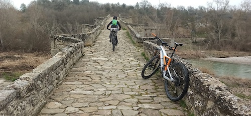
Photos of Vilaller Mountain Bike
Recent Trail Reports
| status | trail | date | condition | info | user |
|---|---|---|---|---|---|
| Port de Gelada to Senet | Jun 18, 2025 @ 10:15am Jun 18, 2025 | Ideal | Skiwie | ||
| Senet - Ginast | Aug 13, 2023 @ 12:20am Aug 13, 2023 | Dry | FranckG31 | ||
| Transenet | Jun 1, 2023 @ 10:55pm Jun 1, 2023 | Wet | montse-bp |
National Scenic Trails & Official Routes
-
GR 17 Vía Arán Pirineos
- Mountain Bike
- E-Bike
- Hike
- Trail Running
Activity Feed
| username | action | type | title | date |
|---|---|---|---|---|
| danilovic | wishlist | trail | activity #89372917 | Feb 22, 2026 @ 12:00pm Feb 22, 2026 |
| cascoblanco | ridden | trail | activity #88623529 | Feb 9, 2026 @ 6:31am Feb 9, 2026 |
| Tioholtzman | wishlist | trail | activity #83329869 | Oct 31, 2025 @ 12:32pm Oct 31, 2025 |
| vinzmtb | wishlist | trail | activity #77412488 | Aug 4, 2025 @ 2:13pm Aug 4, 2025 |
| Skiwie | ridden | trail | activity #74047272 | Jun 18, 2025 @ 10:17am Jun 18, 2025 |
Activity Type Stats
| activitytype | trails | distance | descent | descent distance | total vertical | rating | global rank | state rank | photos | reports | routes | ridelogs |
|---|---|---|---|---|---|---|---|---|---|---|---|---|
| Mountain Bike | 6 | 15 miles | 4,718 ft | 10 miles | 3,632 ft | #8,721 | #423 | 5 | 11 | 1 | 16 | |
| E-Bike | 5 | 12 miles | 2,218 ft | 7 miles | 1,959 ft | #6,498 | #490 | 8 | 1 | 2 | ||
| Hike | 6 | 15 miles | 4,718 ft | 10 miles | 3,632 ft | #8,718 | #453 | 11 | 75 | |||
| Trail Running | 6 | 15 miles | 4,718 ft | 10 miles | 3,632 ft | #8,237 | #449 | 11 | 3 |
Frequently Asked Questions About Vilaller
▼
What are the highest rated mountain biking trails in Vilaller?
The highest rated mountain biking trails in Vilaller are:
- Port de Gelada to Senet (4.2/5)
- Vilaller - Chinast (3.8/5)
- Sant Mamés (0/5)
▼
Where can I park to ride in Vilaller?
Check the Vilaller trail map for trailhead and parking information. Community members regularly update access and parking details for trails in the area.
▼
What is the longest trail in Vilaller?
The longest trail in Vilaller is Port de Gelada to Senet at 2.8 miles. View all trails sorted by distance.
▼
What are the best & highest rated hiking trails in Vilaller?
The best hiking trails in Vilaller are: View all hiking trails sorted by popularity score.
Activities
Trails
- By ivanmoner
 TFSPAIN & contributors
 - Admins: snaker4, kai-bcn, EdgarSoler
- #41942 - 768 views
- vilaller activity log | embed map of Vilaller mountain bike trails | vilaller mountain biking points of interest
Downloading of trail gps tracks in kml & gpx formats is enabled for Vilaller.
You must login to download files.