close
-
Layers w
- Weather Layers
- Pro
- Pro
- Pro
- Pro
- Pro
- Pro
- More Layers
- Pro
- Pro
- Pro
- Pro
-
Upgrade to

3D
Trail Conditions
- Unknown
- Snow Groomed
- Snow Packed
- Snow Covered
- Snow Cover Partial
- Freeze/thaw Cycle
- Icy
- Prevalent Mud
- Wet
- Variable
- Ideal
- Dry
- Very Dry
Trail Flow (Ridden Direction)
Trailforks scans users ridelogs to determine the most popular direction each trail is ridden. A good flowing trail network will have most trails flowing in a single direction according to their intension.
The colour categories are based on what percentage of riders are riding a trail in its intended direction.
The colour categories are based on what percentage of riders are riding a trail in its intended direction.
- > 96%
- > 90%
- > 80%
- > 70%
- > 50%
- < 50%
- bi-directional trail
- no data
Trail Last Ridden
Trailforks scans ridelogs to determine the last time a trail was ridden.
- < 2 days
- < 1 week
- < 2 weeks
- < 1 month
- < 6 months
- > 6 months
Trail Ridden Direction
The intended direction a trail should be ridden.
- Downhill Only
- Downhill Primary
- Both Directions
- Uphill Primary
- Uphill Only
- One Direction
Contribute Details
Colors indicate trail is missing specified detail.
- Description
- Photos
- Description & Photos
- Videos
Trail Popularity ?
Trailforks scans ridelogs to determine which trails are ridden the most in the last 9 months.
Trails are compared with nearby trails in the same city region with a possible 25 colour shades.
Think of this as a heatmap, more rides = more kinetic energy = warmer colors.
- most popular
- popular
- less popular
- not popular
ATV/ORV/OHV Filter
Max Vehicle Width
inches
US Cell Coverage
Legend

Radar Time
Activity Recordings
Trailforks uses anonymized public activity data.
?
Activity Recordings
Trailforks uses anonymized public activity data.
?
Personal Heatmap
▶
Activity Types
all
/
none
▶
Options
2
Date range
month
–
Winter Trails
Warning
A routing network for winter maps does not exist. Selecting trails using the winter trails layer has been disabled.
Missing Trails
Most Popular
Least Popular
Trails are colored based on popularity. The more popular a trail is, the more red. Less popular trails trend towards green.
Jump Magnitude Heatmap
Heatmap of where riders jump on trails. Zoom in to see individual jumps, click circles to view jump details.
BC Backroad Status
![map legend]()
Service Road Atlas is a free to use, community-driven service for viewing and creating reports on the numerous back-country service roads around B.C. and Alberta.

Slope Aspect
Direction the slope faces
Trails Deemphasized
Trails are shown in grey.
Only show trails with no bike usage.
Suggested Layers
Based on selected activity type
Save the current map location and zoom level as your default home location whenever this page is loaded.
Save
No description for Villach has been added yet!
Login or register to submit one.
This region uses the Uk/Euro style trail grading system.
Region Supporters & Maintainers
![]()
RegionVillachMTB
since 2018Sponsor
Activities Click to view
- Mountain Bike
78 trails
- E-Bike
79 trails
- Gravel Bike
0 trails
- Adaptive Bike
0 trails
- Winter Fat Bike
0 trails
- Hike
49 trails
- Trail Running
47 trails
Region Details
- 28
- 13
- 21
- 3
- 10
- 3
Region Status
Open as of 21 hoursStats
- Avg Trail Rating
- Trails (view details)
- 82
- Trails Mountain Bike
- 78
- Trails E-Bike
- 79
- Trails Hike
- 49
- Trails Trail Running
- 47
- Trails Backcountry Ski
- 1
- Total Distance
- 59 miles
- Total Descent
- 16,587 ft
- Total Vertical
- 3,952 ft
- Highest Trailhead
- 5,596 ft
- Reports
- 1,468
- Photos
- 571
- Ridden Counter
- 10,890
Sub Regions
-
Trailcenter Faaker See
- 4
- 11
- 1
- 7
- 2
-
Trailcenter Ossiacher See
- 8
- 5
- 3
- 1
-
Villach - City
- 1
- 5
- 2
Popular Villach Mountain Biking Trails
• 90 ★ 4.7 • 1 mile • 71 ft • 354 •
The Flowgartner Trail (T25) is a mountain bike trail for beginners, which is also a lot of fun for advanced bikers. It is characterized by its flowy design and the permanently fabulous views of the turquoise Lake Faaker See. The trail...
• 85 ★ 4.6 • 3,547 ft • 44 ft • 339 •
The Lowgartner Trail (T26) is a mountain bike trail for beginners, but which is also a lot of fun for advanced bikers. He is characterized by its flowy design and the diverese surrounding nature. The trail itself is 1 km long.
• 75 ★ 4.5 • 2,329 ft • 2 ft • 256 •
The Latschacher Trail section 1, is a hand-build mountainbike trail as its best. The Trail itself is difficult but well build and has some jumps in it, which are pretty sketchy.
• 100 ★ 4.2 • 476 ft • 31 ft • 239 •
The Linkgartner Trail is for more experienced riders the ideal connection between the via the forest road and the entrance of the Flowgartner Trail. The name Linkgartner was created because of the idea of connection. The trail itself...
• 100 ★ 4.2 • 686 ft • 10 ft • 236 •
The (T46) is a mountain bike trail for beginners, which, however, is also a lot of fun for more advanced bikers. It is characterized by its flowing design and the varied nature.
• 90 ★ 3.9 • 479 ft • 0 ft • 225 •
The is a short single trail built close to nature in the Trailcenter Faaker See.
• 95 ★ 4.8 • 2,467 ft • 165 ft • 213 •
The T20 is a specially created mountain bike uphill trail in the Trailcenter Faaker See. Here, especially families and eBikers have an easy variant to ride up the mountain. Accompanied by waves and fun turns over meadows and through...
• 100 ★ 4.0 • 1,033 ft • 3 ft • 210 •
Highly rated popular black difficulty singletrack. This mountain bike primary trail can be used downhill only. On average it takes 3 minutes to complete this trail.
Villach Mountain Bike Routes
18 miles • 3,661 ft • 1 • Out & Back •
A taxing ride up to the "Annahütte" (currently not active). From Faak you ride on a paved road towards...
★ 5.0 • 8 miles • 1,625 ft • 0 • Out & Back •
From the village center follow the cycle path towards Alt Ossiach and its elementary school, where you...
★ 3.5 • 7 miles • 920 ft • 0 • Loop •
This tour starts directly at Lake Vassach. From there it is only a short way to Vassach, a borough of...
★ 1.0 • 11 miles • 2,121 ft • 0 • Point to Point •
This e-bike and trekking bike tour connects two of the most beautiful lakes in Carinthia. From Ossiach you...
★ 3.0 • 13 miles • 1,213 ft • 0 • Loop •
A scenic bike ride on small paved roads or forest paths. Riding on narrow streets and forest paths, this...
27 miles • 4,936 ft • 47 •
some of the best trails at faaker see less altitude than given in the text
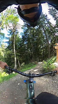
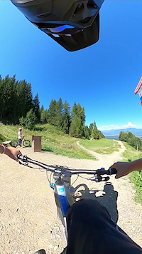
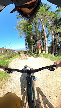
Photos of Villach Mountain Bike
Videos of Villach Mountain Bike
trail: VAN DURREN TRAIL
0:07 |
10 |
Sep 10, 2025
trail: ANDY TRAIL
3:24 |
39 |
Jul 25, 2025
trail: PROlitzen Trail
0:29 |
164 |
May 13, 2024
trail: Ffargartner Trail
2:36 |
340 |
Oct 5, 2023
trail: Ffargartner Trail
0:26 |
172 |
Sep 20, 2023
trail: Jumpgartner Trail
0:59 |
85 |
Sep 17, 2023
trail: Liftgartner Trail
0:26 |
98 |
Sep 15, 2023
trail: Sisgartner Trail
0:01 |
56 |
Sep 9, 2023
Recent Trail Reports
Activity Feed
| username | action | type | title | date |
|---|---|---|---|---|
| andrea-campaner | add | report | activity #97299671 and 1 more | Jun 18, 2026 @ 11:40pm 21 hours |
| boschko | ridden | trail | activity #97298738 | Jun 18, 2026 @ 11:07pm 22 hours |
| boschko | comment | trail | activity #97298557 | Jun 18, 2026 @ 11:01pm 22 hours |
| lakebiketrails | add | report | activity #97105873 | Jun 16, 2026 @ 6:42am Jun 16, 2026 |
| andrea-campaner | add | report | activity #97049142 | Jun 15, 2026 @ 10:00am Jun 15, 2026 |
Recent Comments
| username | type | title | comment | date |
|---|---|---|---|---|
| trail | Im unteren Teil hängen Dornenäste in den... | Jun 18, 2026 @ 11:01pm 22 hours | ||
| trail | cooler natürlicher single-trail. hat durchaus... | Jun 12, 2026 @ 2:42am Jun 12, 2026 | ||
| trail | Most difficult one in the park in my opinion,... | Aug 4, 2025 @ 10:32am Aug 4, 2025 | ||
| trail | I rode the lower 2/3rds, it's not as crazy as... | Aug 4, 2025 @ 10:29am Aug 4, 2025 | ||
| trail | Toller Flowtrail, sehr gut gebaut, lässt sich... | Jul 19, 2025 @ 4:05pm Jul 19, 2025 |
Local Badges
-

Baumgartner36 awarded -

lake.bike NORTH1 awarded -

lake.bike SOUTH1 awarded -

Top 10 Trails2 awarded -

Epic Ride 50k420 awarded -

Completionist0 awarded
Bike & Skill Parks
| name | type | city | rating |
|---|---|---|---|
| Kids Bikepark Gerlitzen Alpe | skill park | Villach | |
| lake.bike indoor mobile Pumptrack Drobollach | skill park | Villach | |
| lake.bike Pumptrack Afritz am See | skill park | Villach | |
| Pumptrack Drobollach | skill park | Villach |
Activity Type Stats
| activitytype | trails | distance | descent | descent distance | total vertical | rating | global rank | state rank | photos | reports | routes | ridelogs |
|---|---|---|---|---|---|---|---|---|---|---|---|---|
| Mountain Bike | 78 | 53 miles | 14,514 ft | 22 miles | 3,192 ft | #797 | #6 | 522 | 1,468 | 17 | 7,844 | |
| E-Bike | 79 | 59 miles | 16,401 ft | 24 miles | 3,953 ft | #329 | #7 | 9 | 1,386 | 5 | 1,374 | |
| Hike | 49 | 48 miles | 10,705 ft | 16 miles | 3,953 ft | #550 | #10 | 1 | 1,096 | 1 | 925 | |
| Trail Running | 47 | 47 miles | 10,682 ft | 16 miles | 3,953 ft | #909 | #9 | 1,075 | 1 | 136 | ||
| Backcountry Ski | 1 | 4 miles | 98 ft | 1,168 ft | 3,009 ft | 2 | 177 |
Frequently Asked Questions About Villach
▼
What are the best places to ride in Villach?
Villach has 3 areas to explore for mountain biking. The top rated areas are:
▼
What are the highest rated mountain biking trails in Villach?
The highest rated mountain biking trails in Villach are:
- Blackgartner Trail (4.6/5)
- Ffargartner Trail (4.6/5)
- PROlitzen Trail (4.5/5)
- Flowgartner Trail T25 (4.5/5)
- Sengartner Trail (4.5/5)
▼
What is the best time of the year to ride in Villach?
Based on ride log data, the most popular months to ride in Villach are:
- August (137 activities)
- July (107 activities)
- June (63 activities)
▼
Where can I park to ride in Villach?
Activities
Trails
- By NotDannyHart & contributors
- Admins: mpecsi, mpecsi, lakebiketrails
- #17021 - 15,266 views
- villach activity log | embed map of Villach mountain bike trails | villach mountain biking points of interest
Downloading of trail gps tracks in kml & gpx formats is enabled for Villach.
You must login to download files.