close
-
Layers w
- Weather Layers
- Pro
- Pro
- Pro
- Pro
- Pro
- Pro
- More Layers
- Pro
- Pro
- Pro
- Pro
-
Upgrade to

3D
Trail Conditions
- Unknown
- Snow Groomed
- Snow Packed
- Snow Covered
- Snow Cover Partial
- Freeze/thaw Cycle
- Icy
- Prevalent Mud
- Wet
- Variable
- Ideal
- Dry
- Very Dry
Trail Flow (Ridden Direction)
Trailforks scans users ridelogs to determine the most popular direction each trail is ridden. A good flowing trail network will have most trails flowing in a single direction according to their intension.
The colour categories are based on what percentage of riders are riding a trail in its intended direction.
The colour categories are based on what percentage of riders are riding a trail in its intended direction.
- > 96%
- > 90%
- > 80%
- > 70%
- > 50%
- < 50%
- bi-directional trail
- no data
Trail Last Ridden
Trailforks scans ridelogs to determine the last time a trail was ridden.
- < 2 days
- < 1 week
- < 2 weeks
- < 1 month
- < 6 months
- > 6 months
Trail Ridden Direction
The intended direction a trail should be ridden.
- Downhill Only
- Downhill Primary
- Both Directions
- Uphill Primary
- Uphill Only
- One Direction
Contribute Details
Colors indicate trail is missing specified detail.
- Description
- Photos
- Description & Photos
- Videos
Trail Popularity ?
Trailforks scans ridelogs to determine which trails are ridden the most in the last 9 months.
Trails are compared with nearby trails in the same city region with a possible 25 colour shades.
Think of this as a heatmap, more rides = more kinetic energy = warmer colors.
- most popular
- popular
- less popular
- not popular
ATV/ORV/OHV Filter
Max Vehicle Width
inches
US Cell Coverage
Legend

Radar Time
Activity Recordings
Trailforks uses anonymized public activity data.
?
Activity Recordings
Trailforks uses anonymized public activity data.
?
Personal Heatmap
▶
Activity Types
all
/
none
▶
Options
2
Date range
month
–
Winter Trails
Warning
A routing network for winter maps does not exist. Selecting trails using the winter trails layer has been disabled.
Missing Trails
Most Popular
Least Popular
Trails are colored based on popularity. The more popular a trail is, the more red. Less popular trails trend towards green.
Jump Magnitude Heatmap
Heatmap of where riders jump on trails. Zoom in to see individual jumps, click circles to view jump details.
BC Backroad Status
![map legend]()
Service Road Atlas is a free to use, community-driven service for viewing and creating reports on the numerous back-country service roads around B.C. and Alberta.

Slope Aspect
Direction the slope faces
Trails Deemphasized
Trails are shown in grey.
Only show trails with no bike usage.
Suggested Layers
Based on selected activity type
Save the current map location and zoom level as your default home location whenever this page is loaded.
Save
No description for Villard-de-Lans has been added yet!
Login or register to submit one.
This region uses the Uk/Euro style trail grading system.
Activities Click to view
- Mountain Bike
66 trails
- E-Bike
55 trails
- Adaptive Bike
0 trails
- Horse
22 trails
- Hike
47 trails
- Trail Running
50 trails
- Dirtbike/Moto
2 trails
- Observed Trials
1 trails
- ATV/ORV/OHV
1 trails
- Snowmobile
1 trails
- Snowshoe
11 trails
- Downhill Ski
1 trails
- Backcountry Ski
1 trails
- Nordic Ski
12 trails
Region Details
- 26
- 7
- 21
- 8
- 4
Region Status
Open as of Jun 11, 2026Stats
- Avg Trail Rating
- Trails (view details)
- 68
- Trails Mountain Bike
- 66
- Trails E-Bike
- 55
- Trails Gravel Bike
- 1
- Trails Horse
- 22
- Trails Hike
- 47
- Trails Trail Running
- 50
- Trails Dirtbike/Moto
- 2
- Trails Observed Trials
- 1
- Trails ATV/ORV/OHV
- 1
- Trails Snowmobile
- 1
- Trails Snowshoe
- 11
- Trails Downhill Ski
- 1
- Trails Backcountry Ski
- 1
- Trails Nordic Ski
- 12
- Total Distance
- 27 miles
- Total Descent
- 11,894 ft
- Total Vertical
- 3,973 ft
- Highest Trailhead
- 5,657 ft
- Reports
- 76
- Photos
- 3
- Ridden Counter
- 889
Sub Regions
-
Villard de Lans Bike Park
- 4
- 5
- 1
- 2
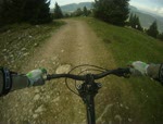
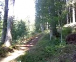
Popular Villard-de-Lans Mountain Biking Trails
• 95 ★ 3.5 • 2,392 ft • 4 ft • 72 •
Popular blue difficulty singletrack. This mountain bike primary trail can be used downhill only. It features berm, bridge, jump and roller coaster. On average it takes 4 minutes to complete this trail.
• 80 ★ 2.0 • 3 miles • 108 ft • 67 •
Popular green difficulty singletrack. This mountain bike primary trail can be used downhill only. It features berm, bridge, drop, jump and roller coaster. On average it takes 20 minutes to complete this trail.
• 85 ★ 4.5 • 3,163 ft • 0 ft • 52 •
Popular black difficulty singletrack. This mountain bike primary trail can be used downhill only. It features berm, bridge, drop and jump. On average it takes 3 minutes to complete this trail.
• 65 ★ 3.0 • 2,817 ft • 10 ft • 49 •
Moderately popular blue difficulty singletrack. This mountain bike primary trail can be used downhill only. It features berm, bridge and jump. On average it takes 3 minutes to complete this trail.
• 55 ★ 3.0 • 1 mile • 40 ft • 37 •
Moderately popular black difficulty singletrack. This mountain bike primary trail can be used downhill only. It features berm, bridge, drop, jump, gap jump and wallride. On average it takes 5 minutes to complete this trail.
• 90 ★ 4.5 • 2,923 ft • 0 ft • 34 •
Trail enduro assez naturel, un peu de pente au debut, ca slalom dans la foret avec des virages assez plat mais dans les quels il y a toujours un bonne ornières pour se caler entre les racines. EN : A fairly natural enduro trail, with a...
• 95 ★ 4.0 • 2,802 ft • 0 ft • 19 •
Trail enduro assez naturel mais qui a tout de même des bons appuis, ca slalom entre les sapins dans la bonne terre, pas mal de racines. Vers le milieu du trail il y a quelques virage assez serrés. Quelques petits sauts se cachent...
• 100 ★ 4.0 • 1 mile • 243 ft • 17 • • hike
Tres joueur, beaucoup de flow et quelques racines et cailloux.
Villard-de-Lans Mountain Bike Routes
33 miles • 6,385 ft • 0 •
Nice track around the Edge of la Moliere, in Vercors
28 miles • 5,010 ft • 0 •
Nice trail from Villard to Meaudre, with several nice enduro type downhill
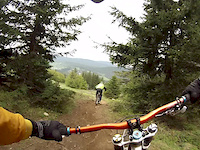
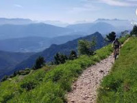
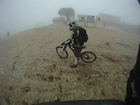
Videos of Villard-de-Lans Mountain Bike

Recent Trail Reports
| status | trail | date | condition | info | user |
|---|---|---|---|---|---|
| Les Geymonds | Jun 11, 2026 @ 10:43am (America/Vancouver) Jun 11, 2026 | Ideal | provencemb B MTB Co | ||
| Les Mourets | Jun 11, 2026 @ 10:38am (America/Vancouver) Jun 11, 2026 | Ideal | provencemb B MTB Co | ||
| Balcons de l'Amour | Jun 11, 2026 @ 10:29am (America/Vancouver) Jun 11, 2026 | Ideal | provencemb B MTB Co | ||
| Snakle | Jun 11, 2026 @ 10:18am (America/Vancouver) Jun 11, 2026 | Ideal | provencemb B MTB Co | ||
| Fontaine Aymard | Jun 11, 2026 @ 7:08pm (Europe/Paris) Jun 11, 2026 | Ideal | provencemb B MTB Co | ||
| Combe Du Bayle | Jun 11, 2026 @ 10:03am (America/Vancouver) Jun 11, 2026 | Ideal | provencemb B MTB Co | ||
| Les Cotes | Jun 11, 2026 @ 9:51am (America/Vancouver) Jun 11, 2026 | Ideal | provencemb B MTB Co | ||
| Roybon | Jun 11, 2026 @ 9:49am (America/Vancouver) Jun 11, 2026 | Ideal | provencemb B MTB Co | ||
| Les Gobelins | May 31, 2026 @ 10:06am (Europe/Monaco) May 31, 2026 | Ideal | JeremieZ | ||
| Les Gobelins Upper | May 31, 2026 @ 10:06am (Europe/Monaco) May 31, 2026 | Ideal | JeremieZ |
Activity Feed
| username | action | type | title | date |
|---|---|---|---|---|
| provencemb | add | trail | activity #96745057 and 7 more | Jun 11, 2026 @ 9:57am Jun 11, 2026 |
| provencemb | update | trail | activity #96744624 and 14 more | Jun 11, 2026 @ 9:50am Jun 11, 2026 |
| provencemb | comment | trail | activity #96744576 and 3 more | Jun 11, 2026 @ 9:50am Jun 11, 2026 |
| provencemb | checkin | trail | activity #96744537 and 6 more | Jun 11, 2026 @ 9:49am Jun 11, 2026 |
| provencemb | ridden | trail | activity #96744536 and 6 more | Jun 11, 2026 @ 9:49am Jun 11, 2026 |
Recent Comments
| username | type | title | comment | date |
|---|---|---|---|---|
| trail | Hiking trail, watch out for hikers !! | Jun 11, 2026 @ 10:43am Jun 11, 2026 | ||
| trail | Watch out for Hiker !!! | Jun 11, 2026 @ 10:39am Jun 11, 2026 | ||
| trail | Hiking trail, be care full ther is many hikers ! | Jun 11, 2026 @ 10:36am Jun 11, 2026 | ||
| trail | It's an Hiking trail | Jun 11, 2026 @ 9:50am Jun 11, 2026 | ||
| trail | Thanks guys | Aug 15, 2025 @ 12:15pm Aug 15, 2025 |
Local Badges
-

Epic Mountain Bike Climb 2k2 awarded -

Climbing 10k Badge0 awarded -

Mountain Biking 100k Badge0 awarded -

Epic Ride Descent 2k2 awarded -

Descent 10k Badge0 awarded -

Descent 100k Badge0 awarded
Bike & Skill Parks
| name | type | city | rating |
|---|---|---|---|
| Villard de Lans Bike Park | bike park | Villard-de-Lans | |
| Pumptrack villard-de-lans | skill park | Villard-de-Lans |
Activity Type Stats
| activitytype | trails | distance | descent | descent distance | total vertical | rating | global rank | state rank | photos | reports | routes | ridelogs |
|---|---|---|---|---|---|---|---|---|---|---|---|---|
| Mountain Bike | 66 | 26 miles | 11,847 ft | 14 miles | 3,973 ft | #5,956 | #245 | 2 | 76 | 3 | 1,132 | |
| E-Bike | 55 | 20 miles | 7,756 ft | 9 miles | 3,973 ft | #3,211 | #184 | 76 | 252 | |||
| Gravel Bike | 1 | #3,307 | #77 | 9 | ||||||||
| Horse | 22 | 2 miles | 39 ft | 951 ft | 997 ft | #1,241 | #53 | 10 | ||||
| Hike | 47 | 17 miles | 4,557 ft | 6 miles | 3,973 ft | #4,879 | #155 | 57 | 423 | |||
| Trail Running | 50 | 17 miles | 4,557 ft | 6 miles | 3,973 ft | #4,380 | #147 | 57 | 66 | |||
| Dirtbike/Moto | 2 | #607 | #25 | 7 | ||||||||
| Observed Trials | 1 | #107 | #15 | |||||||||
| ATV/ORV/OHV | 1 | #401 | #22 | 7 | ||||||||
| Snowmobile | 1 | #109 | #4 | |||||||||
| Snowshoe | 11 | #44 | #5 | 1 | 3 | |||||||
| Downhill Ski | 1 | #249 | #34 | 2 | ||||||||
| Backcountry Ski | 1 | #84 | #8 | 18 | ||||||||
| Nordic Ski | 12 | #90 | #9 | 153 |
Frequently Asked Questions About Villard-de-Lans
▼
What are the best places to ride in Villard-de-Lans?
Villard-de-Lans has 1 areas to explore for mountain biking. The top rated areas are:
▼
What are the highest rated mountain biking trails in Villard-de-Lans?
The highest rated mountain biking trails in Villard-de-Lans are:
- Crete des Platres (4.1/5)
- Les Cotes (4.1/5)
- Snakle (4.1/5)
- Guitoune (4.1/5)
- Combe Du Bayle (4/5)
▼
What is the best time of the year to ride in Villard-de-Lans?
Based on ride log data, the most popular months to ride in Villard-de-Lans are:
- July (10 activities)
- September (6 activities)
- May (3 activities)
▼
Where can I park to ride in Villard-de-Lans?
There are 7 parking locations listed in Villard-de-Lans. The most popular parking spots are: View all parking and trailhead locations on the map to plan your visit.
Activities
Trails
Points of Interest
- By canadaka
 Trailforks & contributors
 - Admins: B MTB Co, JordiBN, Whipperman, VMBC
- #22402 - 3,004 views
- villard-de-lans activity log | embed map of Villard-de-Lans mountain bike trails | villard-de-lans mountain biking points of interest
Downloading of trail gps tracks in kml & gpx formats is enabled for Villard-de-Lans.
You must login to download files.