close
-
Layers w
- Weather Layers
- Pro
- Pro
- Pro
- Pro
- Pro
- Pro
- More Layers
- Pro
- Pro
- Pro
- Pro
-
Upgrade to

3D
Trail Conditions
- Unknown
- Snow Groomed
- Snow Packed
- Snow Covered
- Snow Cover Partial
- Freeze/thaw Cycle
- Icy
- Prevalent Mud
- Wet
- Variable
- Ideal
- Dry
- Very Dry
Trail Flow (Ridden Direction)
Trailforks scans users ridelogs to determine the most popular direction each trail is ridden. A good flowing trail network will have most trails flowing in a single direction according to their intension.
The colour categories are based on what percentage of riders are riding a trail in its intended direction.
The colour categories are based on what percentage of riders are riding a trail in its intended direction.
- > 96%
- > 90%
- > 80%
- > 70%
- > 50%
- < 50%
- bi-directional trail
- no data
Trail Last Ridden
Trailforks scans ridelogs to determine the last time a trail was ridden.
- < 2 days
- < 1 week
- < 2 weeks
- < 1 month
- < 6 months
- > 6 months
Trail Ridden Direction
The intended direction a trail should be ridden.
- Downhill Only
- Downhill Primary
- Both Directions
- Uphill Primary
- Uphill Only
- One Direction
Contribute Details
Colors indicate trail is missing specified detail.
- Description
- Photos
- Description & Photos
- Videos
Trail Popularity ?
Trailforks scans ridelogs to determine which trails are ridden the most in the last 9 months.
Trails are compared with nearby trails in the same city region with a possible 25 colour shades.
Think of this as a heatmap, more rides = more kinetic energy = warmer colors.
- most popular
- popular
- less popular
- not popular
ATV/ORV/OHV Filter
Max Vehicle Width
inches
US Cell Coverage
Legend

Radar Time
Activity Recordings
Trailforks uses anonymized public activity data.
?
Activity Recordings
Trailforks uses anonymized public activity data.
?
Personal Heatmap
▶
Activity Types
all
/
none
▶
Options
2
Date range
month
–
Winter Trails
Warning
A routing network for winter maps does not exist. Selecting trails using the winter trails layer has been disabled.
Missing Trails
Most Popular
Least Popular
Trails are colored based on popularity. The more popular a trail is, the more red. Less popular trails trend towards green.
Jump Magnitude Heatmap
Heatmap of where riders jump on trails. Zoom in to see individual jumps, click circles to view jump details.
BC Backroad Status
![map legend]()
Service Road Atlas is a free to use, community-driven service for viewing and creating reports on the numerous back-country service roads around B.C. and Alberta.

Slope Aspect
Direction the slope faces
Trails Deemphasized
Trails are shown in grey.
Only show trails with no bike usage.
Suggested Layers
Based on selected activity type
Save the current map location and zoom level as your default home location whenever this page is loaded.
SaveVitosha is a mountain massif, on the outskirts of Sofia, the capital of Bulgaria. Vitosha is one of the tourists symbols of Sofia and the closest site for biking, hiking and skiing. Convenient bus lines and rope ways render the mountain easily accessible. Vitosha has the outlines of an enormous dome. The territory of the mountain includes Vitosha nature park that encompasses the best known and most frequently visited parts. Vitosha is the oldest nature park in the Balkans.
source: Wikipedia
Primary Trail Type: Cross-Country
Shuttleable: YES
Land Status: National Park
 google parking directions
 Activities Click to view
- Mountain Bike
62 trails
- E-Bike
54 trails
- Hike
60 trails
- Trail Running
59 trails
Region Details
- 16
- 1
- 9
- 19
- 12
Region Status
Open as of Jun 18, 2026Stats
- Avg Trail Rating
- Trails (view details)
- 58
- Trails Mountain Bike
- 62
- Trails E-Bike
- 54
- Trails Horse
- 1
- Trails Hike
- 60
- Trails Trail Running
- 59
- Total Distance
- 33 miles
- Total Descent
- 18,898 ft
- Total Vertical
- 4,087 ft
- Highest Trailhead
- 5,953 ft
- Reports
- 547
- Photos
- 179
- Ridden Counter
- 2,226
Popular Vitosha Mountain Biking Trails
• 65 ★ 4.5 • 2 miles • 0 ft • 78 •
Moderately popular blue difficulty singletrack. This mountain bike primary trail can be used downhill primary. Trail visibility is always easy to follow. On average it takes 31 minutes to complete this trail.
• 90 ★ 3.0 • 2 miles • 33 ft • 78 •
Popular blue difficulty family friendly singletrack. This mountain bike primary trail can be used downhill only and has a moderate overall physical rating. It features rock garden. Trail visibility is always easy to follow. On average it takes 9 minutes to complete this trail.
• 85 ★ 4.6 • 1 mile • 19 ft • 70 •
The upper part of the trail starts with rocky sections and steep switchbacks with loose rocks. In the middle, the switchbacks become easier and with less rocks. In the end, you can either cut the switchbacks with the many possible...
• 80 ★ 5.0 • 1 mile • 0 ft • 50 •
Popular blue difficulty singletrack. This mountain bike primary trail can be used downhill primary. It features berm, drop and jump. Trail visibility is always easy to follow. On average it takes 7 minutes to complete this trail.
• 65 ★ 5.0 • 1 mile • 0 ft • 49 •
Moderately popular black diamond difficulty singletrack. This mountain bike primary trail can be used downhill only and has a hard overall physical rating. On average it takes 18 minutes to complete this trail.
Vitosha Mountain Bike Routes
7 miles • 1,480 ft • 0 • Loop •
Marked HS routes in Vitosha Nature Park - Boyana Continuing with the marked routes in Vitosha National...
24 miles • 5,483 ft • 0 •
60 miles • 6,285 ft • 0 • Point to Point • Race •
In short - this is Bulgarian Race XCO, taking place every year at June. Below you can find the official...
• 5 miles • 1,080 ft • 3 •
• 19 miles • 4,342 ft • 4 •
Photos of Vitosha Mountain Bike
Videos of Vitosha Mountain Bike
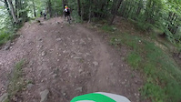
trail: Vitosha Goli Vrah
0:06 |
213 |
Nov 28, 2021
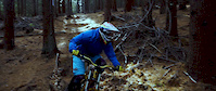
trail: Vitosha Goli Vrah
2:33 |
132 |
Mar 28, 2021
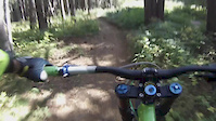
trail: Vitosha Goli Vrah
0:10 |
116 |
Jan 23, 2021
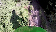
trail: Vitosha Goli Vrah
0:19 |
91 |
Aug 1, 2020
trail: Vitosha Goli Vrah
0:06 |
76 |
Jul 27, 2019
trail: Vitosha Goli Vrah
0:29 |
204 |
Oct 29, 2018
trail: Vitosha Goli Vrah
6:32 |
181 |
Sep 28, 2018
trail: Vitosha Goli Vrah
3:53 |
106 |
Sep 3, 2017
Recent Trail Reports
Activity Feed
| username | action | type | title | date |
|---|---|---|---|---|
| 1stamenov | add | report | activity #97321196 and 1 more | Jun 19, 2026 @ 8:50am Jun 19, 2026 |
| aplced | add | report | activity #96901228 and 1 more | Jun 13, 2026 @ 11:41am Jun 13, 2026 |
| DidoeeHdc0 | ridden | trail | activity #96792267 | Jun 12, 2026 @ 3:28am Jun 12, 2026 |
| DidoeeHdc0 | vote | trail | activity #96790578 | Jun 12, 2026 @ 2:12am Jun 12, 2026 |
| ViktorUVAlOY | wishlist | trail | activity #96519876 | Jun 7, 2026 @ 9:24pm Jun 7, 2026 |
Recent Comments
| username | type | title | comment | date |
|---|---|---|---|---|
| trail | There is a fallen tree somewhere in the middle... | Sep 25, 2023 @ 4:25am Sep 25, 2023 | ||
| trail | Be careful when riding, it is super slippery. | Sep 13, 2022 @ 3:06am Sep 13, 2022 | ||
| report | Кално | May 25, 2020 @ 1:36am May 25, 2020 | ||
| trail | Кално е (25.05) | May 25, 2020 @ 1:36am May 25, 2020 | ||
| trail | \m/ | Mar 11, 2020 @ 9:59pm Mar 11, 2020 |
Nearby Areas
| name | distance | ||||
|---|---|---|---|---|---|
| Pancharevo Gorge | 1 | 2 | 10.8 km | ||
| Borovets Mountain Bike Park | 1 | 5 | 3 | 1 | 32.3 km |
Local Badges
-

Completionist0 awarded
Activity Type Stats
| activitytype | trails | distance | descent | descent distance | total vertical | rating | global rank | state rank | photos | reports | routes | ridelogs |
|---|---|---|---|---|---|---|---|---|---|---|---|---|
| Mountain Bike | 62 | 33 miles | 18,898 ft | 22 miles | 4,088 ft | #1,011 | #2 | 176 | 547 | 3 | 6,817 | |
| E-Bike | 54 | 27 miles | 13,714 ft | 16 miles | 3,694 ft | #780 | #3 | 528 | 933 | |||
| Horse | 1 | 2 miles | 787 ft | 1 mile | 761 ft | 10 | ||||||
| Hike | 60 | 33 miles | 18,632 ft | 22 miles | 4,088 ft | #1,095 | #4 | 536 | 508 | |||
| Trail Running | 59 | 32 miles | 17,605 ft | 21 miles | 4,088 ft | #594 | #4 | 1 | 536 | 292 |
Frequently Asked Questions About Vitosha
▼
What are the highest rated mountain biking trails in Vitosha?
The highest rated mountain biking trails in Vitosha are:
- Krivata (4.3/5)
- Vitosha Goli Vrah (4.3/5)
- Kopitoto Enduro (4.2/5)
- Boyanskoto Ezero (lower part) (4.2/5)
- Hidden trail (4.2/5)
▼
What is the best time of the year to ride in Vitosha?
Based on ride log data, the most popular months to ride in Vitosha are:
- May (6 activities)
- October (5 activities)
- August (4 activities)
▼
Where can I park to ride in Vitosha?
There are 1 parking locations listed in Vitosha. The most popular parking spots are:
▼
What is the longest trail in Vitosha?
The longest trail in Vitosha is V100 Vladaya to Kladnitsa Single track at 11.1 km. View all trails sorted by distance.
Activities
Trails
Points of Interest
- By Telepatok & contributors
- Admins: apply
- #5493 - 15,545 views
- vitosha activity log | embed map of Vitosha mountain bike trails | vitosha mountain biking points of interest
Downloading of trail gps tracks in kml & gpx formats is enabled for Vitosha.
You must login to download files.