close
-
Layers w
- Weather Layers
- Pro
- Pro
- Pro
- Pro
- Pro
- Pro
- More Layers
- Pro
- Pro
- Pro
- Pro
-
Upgrade to

3D
Trail Conditions
- Unknown
- Snow Groomed
- Snow Packed
- Snow Covered
- Snow Cover Partial
- Freeze/thaw Cycle
- Icy
- Prevalent Mud
- Wet
- Variable
- Ideal
- Dry
- Very Dry
Trail Flow (Ridden Direction)
Trailforks scans users ridelogs to determine the most popular direction each trail is ridden. A good flowing trail network will have most trails flowing in a single direction according to their intension.
The colour categories are based on what percentage of riders are riding a trail in its intended direction.
The colour categories are based on what percentage of riders are riding a trail in its intended direction.
- > 96%
- > 90%
- > 80%
- > 70%
- > 50%
- < 50%
- bi-directional trail
- no data
Trail Last Ridden
Trailforks scans ridelogs to determine the last time a trail was ridden.
- < 2 days
- < 1 week
- < 2 weeks
- < 1 month
- < 6 months
- > 6 months
Trail Ridden Direction
The intended direction a trail should be ridden.
- Downhill Only
- Downhill Primary
- Both Directions
- Uphill Primary
- Uphill Only
- One Direction
Contribute Details
Colors indicate trail is missing specified detail.
- Description
- Photos
- Description & Photos
- Videos
Trail Popularity ?
Trailforks scans ridelogs to determine which trails are ridden the most in the last 9 months.
Trails are compared with nearby trails in the same city region with a possible 25 colour shades.
Think of this as a heatmap, more rides = more kinetic energy = warmer colors.
- most popular
- popular
- less popular
- not popular
ATV/ORV/OHV Filter
Max Vehicle Width
inches
US Cell Coverage
Legend

Radar Time
Activity Recordings
Trailforks uses anonymized public activity data.
?
Activity Recordings
Trailforks uses anonymized public activity data.
?
Personal Heatmap
▶
Activity Types
all
/
none
▶
Options
2
Date range
month
–
Winter Trails
Warning
A routing network for winter maps does not exist. Selecting trails using the winter trails layer has been disabled.
Missing Trails
Most Popular
Least Popular
Trails are colored based on popularity. The more popular a trail is, the more red. Less popular trails trend towards green.
Jump Magnitude Heatmap
Heatmap of where riders jump on trails. Zoom in to see individual jumps, click circles to view jump details.
BC Backroad Status
![map legend]()
Service Road Atlas is a free to use, community-driven service for viewing and creating reports on the numerous back-country service roads around B.C. and Alberta.

Slope Aspect
Direction the slope faces
Trails Deemphasized
Trails are shown in grey.
Only show trails with no bike usage.
Suggested Layers
Based on selected activity type
Save the current map location and zoom level as your default home location whenever this page is loaded.
Save
No description for Vlaardingen has been added yet!
Login or register to submit one.
Activities Click to view
- Mountain Bike
2 trails
- Adaptive Bike
0 trails
- Hike
1 trails
- Trail Running
1 trails
Region Details
- 1
- 1
Region Status
Open as of 1 dayStats
- Avg Trail Rating
- Trails (view details)
- 2
- Trails Mountain Bike
- 2
- Trails Hike
- 1
- Trails Trail Running
- 1
- Total Distance
- 6 miles
- Total Descent Distance
- 2 miles
- Total Descent
- 156 ft
- Total Vertical
- 42 ft
- Highest Trailhead
- 47 ft
- Reports
- 98
- Photos
- 9
- Ridden Counter
- 489
Sub Regions
-
Vlaardingen
- 1
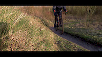
Popular Vlaardingen Mountain Biking Trails
• 50 ★ 3.6 • 6 miles • 150 ft • 272 •
High paced XC trail, 2 skillparks next to it. Contains some northshore and rockgardens etc.
Vlaardingen Mountain Bike Routes
Photos of Vlaardingen Mountain Bike
Videos of Vlaardingen Mountain Bike
trail: Vlaardingen
0:00 |
229 |
Feb 18, 2018
trail: Vlaardingen
6:21 |
682 |
Nov 21, 2014

trail: Vlaardingen
3:10 |
308 |
Oct 25, 2013
trail: Vlaardingen
2:50 |
1103 |
Sep 28, 2013
youtuber
![MTB Vlaardingen || Weer even kijken....]()

trail: Vlaardingen
11:05 |
73 |
Mar 6, 2025 , Vlaardingen
trail: Vlaardingen
5:29 |
235 |
Dec 21, 2010
trail: Vlaardingen
0:01 |
276 |
Dec 1, 2020 , Vlaardingen
Recent Trail Reports
| status | trail | date | condition | info | user |
|---|---|---|---|---|---|
| Vlaardingen | Jun 16, 2026 @ 7:03pm (Europe/Amsterdam) 1 day | Ideal | Remvel | ||
| Aanrijroute Vlaardingen Broekpolder | Jun 16, 2026 @ 7:03pm (Europe/Amsterdam) 1 day | Ideal | Remvel |
Activity Feed
| username | action | type | title | date |
|---|---|---|---|---|
| Remvel | add | report | activity #97133262 and 3 more | Jun 16, 2026 @ 1:01pm 1 day |
| RemV77 | wishlist | trail | activity #96084126 | Jun 2, 2026 @ 7:53am Jun 2, 2026 |
| Wilfrieds | add | report | activity #95926243 | May 31, 2026 @ 4:37am May 31, 2026 |
| 99steef99 | wishlist | trail | activity #95062770 | May 19, 2026 @ 1:26pm May 19, 2026 |
| NoMerCyNL | add | report | activity #94083060 | May 5, 2026 @ 5:17am May 5, 2026 |
Recent Comments
| username | type | title | comment | date |
|---|---|---|---|---|
| trail | Considering the fact that the elevation is... | Oct 1, 2015 @ 7:33am Oct 1, 2015 |
Bike & Skill Parks
| name | type | city | rating |
|---|---|---|---|
| Vlaardingen skillpark | skill park | Vlaardingen |
Local Mountain Biking Directory
-
Progravity.nlBike Shop
-
Cube Store VlaardingenBike Shop
Activity Type Stats
| activitytype | trails | distance | descent | descent distance | total vertical | rating | global rank | state rank | photos | reports | routes | ridelogs |
|---|---|---|---|---|---|---|---|---|---|---|---|---|
| Mountain Bike | 2 | 6 miles | 154 ft | 2 miles | 43 ft | #5,846 | #42 | 9 | 98 | 1 | 6,490 | |
| Hike | 1 | 965 ft | #3,326 | #37 | 91 | 23 | ||||||
| Trail Running | 1 | 965 ft | #2,789 | #37 | 91 | 134 |
- By schralpcc & contributors
- Admins: apply
- #4752 - 2,987 views
- vlaardingen activity log | embed map of Vlaardingen mountain bike trails | vlaardingen mountain biking points of interest
Downloading of trail gps tracks in kml & gpx formats is enabled for Vlaardingen.
You must login to download files.