close
-
Layers w
- Weather Layers
- Pro
- Pro
- Pro
- Pro
- Pro
- Pro
- More Layers
- Pro
- Pro
- Pro
- Pro
-
Upgrade to

3D
Trail Conditions
- Unknown
- Snow Groomed
- Snow Packed
- Snow Covered
- Snow Cover Partial
- Freeze/thaw Cycle
- Icy
- Prevalent Mud
- Wet
- Variable
- Ideal
- Dry
- Very Dry
Trail Flow (Ridden Direction)
Trailforks scans users ridelogs to determine the most popular direction each trail is ridden. A good flowing trail network will have most trails flowing in a single direction according to their intension.
The colour categories are based on what percentage of riders are riding a trail in its intended direction.
The colour categories are based on what percentage of riders are riding a trail in its intended direction.
- > 96%
- > 90%
- > 80%
- > 70%
- > 50%
- < 50%
- bi-directional trail
- no data
Trail Last Ridden
Trailforks scans ridelogs to determine the last time a trail was ridden.
- < 2 days
- < 1 week
- < 2 weeks
- < 1 month
- < 6 months
- > 6 months
Trail Ridden Direction
The intended direction a trail should be ridden.
- Downhill Only
- Downhill Primary
- Both Directions
- Uphill Primary
- Uphill Only
- One Direction
Contribute Details
Colors indicate trail is missing specified detail.
- Description
- Photos
- Description & Photos
- Videos
Trail Popularity ?
Trailforks scans ridelogs to determine which trails are ridden the most in the last 9 months.
Trails are compared with nearby trails in the same city region with a possible 25 colour shades.
Think of this as a heatmap, more rides = more kinetic energy = warmer colors.
- most popular
- popular
- less popular
- not popular
ATV/ORV/OHV Filter
Max Vehicle Width
inches
US Cell Coverage
Legend

Radar Time
Activity Recordings
Trailforks uses anonymized public activity data.
?
Activity Recordings
Trailforks uses anonymized public activity data.
?
Personal Heatmap
▶
Activity Types
all
/
none
▶
Options
2
Date range
month
–
Winter Trails
Warning
A routing network for winter maps does not exist. Selecting trails using the winter trails layer has been disabled.
Missing Trails
Most Popular
Least Popular
Trails are colored based on popularity. The more popular a trail is, the more red. Less popular trails trend towards green.
Jump Magnitude Heatmap
Heatmap of where riders jump on trails. Zoom in to see individual jumps, click circles to view jump details.
BC Backroad Status
![map legend]()
Service Road Atlas is a free to use, community-driven service for viewing and creating reports on the numerous back-country service roads around B.C. and Alberta.

Slope Aspect
Direction the slope faces
Trails Deemphasized
Trails are shown in grey.
Only show trails with no bike usage.
Suggested Layers
Based on selected activity type
Save the current map location and zoom level as your default home location whenever this page is loaded.
Save
No description for Vorarlberg has been added yet!
Login or register to submit one.
This region uses the Uk/Euro style trail grading system.
Region Details
- 22
- 40
- 92
- 28
- 13
Stats
- Avg Trail Rating
- Trails (view details)
- 272
- Trails Mountain Bike
- 196
- Trails E-Bike
- 69
- Trails Adaptive Bike
- 1
- Trails Horse
- 3
- Trails Hike
- 193
- Trails Trail Running
- 189
- Trails Snowmobile
- 2
- Trails Snowshoe
- 2
- Trails Downhill Ski
- 2
- Trails Backcountry Ski
- 72
- Trails Nordic Ski
- 2
- Total Distance
- 379 miles
- Total Descent
- 208,912 ft
- Total Vertical
- 7,929 ft
- Highest Trailhead
- 9,319 ft
- Reports
- 768
- Photos
- 297
- Ridden Counter
- 11,370
Sub Regions
- Bezirk Feldkirch (59)
- Bludenz (45)
- Bludenz (17)
- Dalaas (1)
- Lech (1)
- Zürs (3)
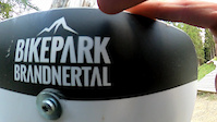
- Bikepark Brandnertal (19)
- Trailpark Hochjoch (3)
- Bludenz (17)
- Bregenz (40)
- Bregenz (23)
- Mittelberg (7)
- Warth (6)
- Bregenz (23)
- Dornbirn (46)
- Andelsbuch (4)
- Bürserberg (1)
Popular Vorarlberg Mountain Biking Trails
• 55 ★ 4.4 • 1 mile • 0 ft • 534 •
Freeride Line with berms, jumps, wallrides and a drop section.
• 85 ★ 4.2 • 1 mile • 0 ft • 533 •
Mit vielen Anliegern und Wellen ist sie eine ideale Spielwiese für Einsteiger. Optionale Wallrides, Northshores sowie kleine Sprünge machen sie zu einer Spaßstrecke für fortgeschrittene Rider! Machine groomed Flow Trail with berms,...
• 100 ★ 4.1 • 4,810 ft • 0 ft • 408 •
Die neue Flowline bei der in Brand schafft gemeinsam mit dem " " den Zusammenschluss von Bürserberg und Brand. Die verspielte Flowline richtet sich an Familien, Einsteiger und Fortgeschrittene.
• 65 ★ 4.1 • 4,416 ft • 0 ft • 400 •
Der naturbelassene Burtscha Trail ist die Verbindung vom Burtschasattel / Restaurant Frööd zur Tschengla.
• 20 ★ 4.5 • 676 ft • 0 ft • 386 •
"Short downhill passage with natural underground including hut fun! As a variant on the "Tschengla Unchained" flowline, the "Tschacklin" mini-downhill route is a little foretaste of her big brother "Tschack Norris"!" - Bikepark Brandnertal
• 80 ★ 3.8 • 2 miles • 82 ft • 386 •
Der Singletrail im einfachen Schwierigkeitsgrad schafft die Trail-Verbindung vom Gebiet des Loischkopfs nach Brand. Startpunkt ist der Parpfienzsattel, nur wenige Minuten und ein paar Höhenmeter vom Restaurant Frööd entfernt.
• 95 ★ 3.9 • 1 mile • 0 ft • 375 •
Die neue Flowline bei der in Brand schafft gemeinsam mit dem " " den Zusammenschluss von Bürserberg und Brand. Die verspielte Flowline richtet sich an Familien, Einsteiger und Fortgeschrittene.
• 35 ★ 4.0 • 3 miles • 28 ft • 314 •
Vom Parpfienzsattel, wo auch der "Parpfienz Trail" startet, führt dieser Singletrail durch wunderschöne Landschaften entlang des Mühlebachs bis zur Alpe Rona.
Vorarlberg Mountain Bike Routes
★ 3.0 • 12 miles • 2,135 ft • 1 • Loop •
easy route from Schwarzach. nice views over lake of constance. watch out in the wood sections for hikers....
★ 3.0 • 13 miles • 3,170 ft • 4 • Loop •
Classic with a longer round through Rudach, a small mountain mini village in the Ebnit/Gütle valley.
★ 5.0 • 10 miles • 2,128 ft • 0 •
Abwechslungsreiche MTB Rundfahrt. Knackiige Anstiege von Wolfurt in Richtung Buch, dann der alten Strasse...
9 miles • 1,871 ft • 5 • Loop •
Lorex Loops - After Work. Be Kind, don´t destroy the locals trails!
5 miles • 200 ft • 0 •
Start am höchsten Punkt (Buckenegg) mit traumhafter Aussicht auf den Bodensee und in Richtung Bregenzer...
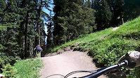
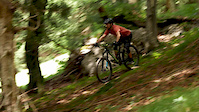
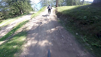
Photos of Vorarlberg Mountain Bike
Videos of Vorarlberg Mountain Bike

trail: Lug Trail
2:59 |
143 |
Apr 15, 2022

trail: Sattelberg Ridge
4:54 |
96 |
Apr 13, 2022

trail: Eichenberg Woods
2:29 |
295 |
Apr 13, 2022

trail: Känzeleweg
7:03 |
94 |
Apr 13, 2022
trail: Tschäck the Ripper
8:33 |
77 |
Nov 15, 2020
trail: Tscharlie Tschäplin
0:41 |
147 |
Aug 11, 2020
trail: Singletrail Muttersberg
2:12 |
316 |
Nov 2, 2019
trail: Tschack Norris
0:13 |
427 |
Aug 28, 2019
Current Trail Warnings
| status | trail | date | condition | user | info |
|---|---|---|---|---|---|
| Baumgarten Bregenz | Jun 17, 2026 @ 6:52pm (Europe/Vienna) 2 days | Unknown | JTfLba | Gibs nix | |
| Tscharlie Tschäplin Bikepark Brandnertal | Jun 2, 2026 @ 2:50pm (Europe/Vienna) Jun 2, 2026 | Ideal | jpd333 |
Recent Trail Reports
Activity Feed
| username | action | type | title | date |
|---|---|---|---|---|
| HerbertUgeBI0 | ridden | trail | activity #97267435 | Jun 18, 2026 @ 11:55am 15 hours |
| JTfLba | add | report | activity #97191443 | Jun 17, 2026 @ 9:52am 2 days |
| Trail-lord | add | report | activity #97128045 and 2 more | Jun 16, 2026 @ 11:48am 3 days |
| Patrickdrlr | ridden | trail | activity #97090547 | Jun 15, 2026 @ 11:49pm Jun 15, 2026 |
| 8tbAAY | wishlist | trail | activity #97050967 | Jun 15, 2026 @ 10:26am Jun 15, 2026 |
Recent Comments
| username | type | title | comment | date |
|---|---|---|---|---|
| report | How are there trails , 99% of trails here in... | May 10, 2026 @ 2:14am May 10, 2026 | ||
| trail | Oberster Teil eher blau und als Uphill nicht... | Oct 15, 2025 @ 1:43pm Oct 15, 2025 | ||
| trail | Einfacher ist der Trail hinten am See beim... | Oct 15, 2025 @ 1:38pm Oct 15, 2025 | ||
| trail | Zwei drei rote Stellen und sicherlich ein... | Oct 15, 2025 @ 1:35pm Oct 15, 2025 | ||
| trail | Einer der besten Trails. Muss man sich jedoch... | Oct 15, 2025 @ 1:32pm Oct 15, 2025 |
Local Badges
-

Epic Ride Descent 2k20 awarded -

Epic Mountain Bike Climb 2k20 awarded -

Climbing 10k Badge9 awarded -

Mountain Biking 100k Badge0 awarded -

Descent 10k Badge9 awarded -
Descent 10k Badge4 awarded
Bike & Skill Parks
| name | type | city | rating |
|---|---|---|---|
| Bikepark Brandnertal | bike park | ||
| Trailpark Hochjoch | bike park | ||
| Bike-Parcours Au-Schoppernau | skill park | Mellau | |
| Pumptrack Mellau | skill park | Mellau | |
| Möggers MX | skill park | Bregenz |
Activity Type Stats
| activitytype | trails | distance | descent | descent distance | total vertical | rating | global rank | state rank | photos | reports | routes | ridelogs |
|---|---|---|---|---|---|---|---|---|---|---|---|---|
| Mountain Bike | 196 | 200 miles | 111,332 ft | 132 miles | 5,935 ft | 291 | 767 | 6 | 17,160 | |||
| E-Bike | 69 | 82 miles | 36,102 ft | 48 miles | 5,935 ft | 7 | 597 | 2 | 1,655 | |||
| Adaptive Bike | 1 | 1 | ||||||||||
| Horse | 3 | 1 mile | 1,391 ft | 1 mile | 1,765 ft | 37 | 1 | |||||
| Hike | 193 | 178 miles | 103,901 ft | 119 miles | 6,263 ft | 717 | 2 | 4,403 | ||||
| Trail Running | 189 | 175 miles | 101,470 ft | 116 miles | 6,263 ft | 716 | 2 | 532 | ||||
| Snowmobile | 2 | 1 mile | 1,270 ft | 4,987 ft | 1,322 ft | 3 | ||||||
| Snowshoe | 2 | 1 mile | 1,270 ft | 4,987 ft | 1,322 ft | 6 | 37 | |||||
| Downhill Ski | 2 | 1 mile | 1,270 ft | 4,987 ft | 1,322 ft | 6 | 3,786 | |||||
| Backcountry Ski | 72 | 170 miles | 89,626 ft | 86 miles | 6,099 ft | 6 | 2,088 | |||||
| Nordic Ski | 2 | 1 mile | 1,270 ft | 4,987 ft | 1,322 ft | 6 | 682 |
Activities
Trails
Points of Interest
- Cableway Drop-Off (Muttersbergbahn) Other
- Schesaplana Summit
- Südl. Schafagall Summit
- Staufen Summit
- Lindauer Hütte Lodge
- Gondola Middle station Other
- Gondola Drop-Off Other
- Gondola Pick-Up Other
- Velosolutions Pumptrack Hard Other
- Cableway Pick-Up (Dorfbahn) Other
- Patteriol (9,678 ft)
- Karkopf (9,534 ft)
- Vollandspitze (9,429 ft)
- By brenthillier
 NSMBA TRAILFORKS & contributors
 - Admins: ktm-boy-69, mpecsi, lines, larry81541, troubletoni
- #9906 - 12,025 views
- vorarlberg activity log | embed map of Vorarlberg mountain bike trails | vorarlberg mountain biking points of interest
Downloading of trail gps tracks in kml & gpx formats is enabled for Vorarlberg.
You must login to download files.