close
-
Layers w
- Weather Layers
- Pro
- Pro
- Pro
- Pro
- Pro
- Pro
- More Layers
- Pro
- Pro
- Pro
- Pro
-
Upgrade to

3D
Trail Conditions
- Unknown
- Snow Groomed
- Snow Packed
- Snow Covered
- Snow Cover Partial
- Freeze/thaw Cycle
- Icy
- Prevalent Mud
- Wet
- Variable
- Ideal
- Dry
- Very Dry
Trail Flow (Ridden Direction)
Trailforks scans users ridelogs to determine the most popular direction each trail is ridden. A good flowing trail network will have most trails flowing in a single direction according to their intension.
The colour categories are based on what percentage of riders are riding a trail in its intended direction.
The colour categories are based on what percentage of riders are riding a trail in its intended direction.
- > 96%
- > 90%
- > 80%
- > 70%
- > 50%
- < 50%
- bi-directional trail
- no data
Trail Last Ridden
Trailforks scans ridelogs to determine the last time a trail was ridden.
- < 2 days
- < 1 week
- < 2 weeks
- < 1 month
- < 6 months
- > 6 months
Trail Ridden Direction
The intended direction a trail should be ridden.
- Downhill Only
- Downhill Primary
- Both Directions
- Uphill Primary
- Uphill Only
- One Direction
Contribute Details
Colors indicate trail is missing specified detail.
- Description
- Photos
- Description & Photos
- Videos
Trail Popularity ?
Trailforks scans ridelogs to determine which trails are ridden the most in the last 9 months.
Trails are compared with nearby trails in the same city region with a possible 25 colour shades.
Think of this as a heatmap, more rides = more kinetic energy = warmer colors.
- most popular
- popular
- less popular
- not popular
ATV/ORV/OHV Filter
Max Vehicle Width
inches
US Cell Coverage
Legend

Radar Time
Activity Recordings
Trailforks uses anonymized public activity data.
?
Activity Recordings
Trailforks uses anonymized public activity data.
?
Personal Heatmap
▶
Activity Types
all
/
none
▶
Options
2
Date range
month
–
Winter Trails
Warning
A routing network for winter maps does not exist. Selecting trails using the winter trails layer has been disabled.
Missing Trails
Most Popular
Least Popular
Trails are colored based on popularity. The more popular a trail is, the more red. Less popular trails trend towards green.
Jump Magnitude Heatmap
Heatmap of where riders jump on trails. Zoom in to see individual jumps, click circles to view jump details.
BC Backroad Status
![map legend]()
Service Road Atlas is a free to use, community-driven service for viewing and creating reports on the numerous back-country service roads around B.C. and Alberta.

Slope Aspect
Direction the slope faces
Trails Deemphasized
Trails are shown in grey.
Only show trails with no bike usage.
Suggested Layers
Based on selected activity type
Save the current map location and zoom level as your default home location whenever this page is loaded.
Save
No description for Vrede has been added yet!
Login or register to submit one.
Links
Activities Click to view
- Mountain Bike
36 trails
- E-Bike
36 trails
- Gravel Bike
- Hike
36 trails
- Trail Running
36 trails
Region Details
- 36
Region Status
Open as of Mar 6, 2021Stats
- Trails (view details)
- 36
- Trails Mountain Bike
- 36
- Trails E-Bike
- 36
- Trails Hike
- 36
- Trails Trail Running
- 36
- Total Distance
- 347 miles
- Total Descent Distance
- 162 miles
- Total Descent
- 7,325 ft
- Total Vertical
- 1,158 ft
- Highest Trailhead
- 6,100 ft
- Reports
- 1
- Photos
- 24
- Ridden Counter
- 52
Sub Regions
-
McFab Free State Farm Trails
Vrede Mountain Bike Routes
MacFab: Lion Man Featured
51 miles • 2,211 ft • 12 • Loop •
This route is for the serious competition rider and is an excellent training route. It covers very...
McFab: Easy as a Sunday morning Featured
32 miles • 945 ft • 8 • Out & Back •
Easy as a Sunday Morning is a 52 km route for a relaxing ride with some uphill challenges and a technical...
McFab: Road to Marsala Featured
73 miles • 2,575 ft • 8 • Out & Back •
Road to Marsala is a roller coaster blood pulsing ride. Packed with tough uphills, long downhills but...
McFab: Gravel Greatness Featured
55 miles • 1,780 ft • 10 • Out & Back •
Gravel Greatness is a fast and feisty route ideal for endurance and speed training. It has multiple long...
McFab: Night Rider Featured
20 miles • 563 ft • 6 • Loop •
Night Rider is ideal for a warm up to the weekend, riding with headlamps is both exciting and creating an...
McFab: Lionness Featured
42 miles • 1,436 ft • 10 • Out & Back •
Lioness is as hard as Lion Man but excludes the technical climb of 200m. The route is exhilarating and...
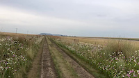
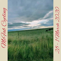
Photos of Vrede Mountain Bike
Recent Trail Reports
| status | trail | date | condition | info | user |
|---|---|---|---|---|---|
| McF206 | Mar 6, 2021 @ 8:18pm Mar 6, 2021 | Unknown | McFab McFab |
Activity Feed
| username | action | type | title | date |
|---|---|---|---|---|
| lge7DN | ridden | trail | activity #17863060 | Apr 4, 2021 @ 10:43pm Apr 4, 2021 |
| WillieJacobsz | update | trail | activity #17549307 | Mar 25, 2021 @ 6:55am Mar 25, 2021 |
| McFab | add | report | activity #17126585 | Mar 8, 2021 @ 10:47pm Mar 8, 2021 |
| McFab | checkin | trail | activity #17126524 | Mar 8, 2021 @ 10:43pm Mar 8, 2021 |
| McFab | add | video | activity #10167681 and 1 more | Jun 1, 2020 @ 6:54am Jun 1, 2020 |
Local Badges
-

Epic Mountain Bike Climb 2k4 awarded -

Climbing 10k Badge0 awarded -

Mountain Biking 100k Badge0 awarded -

Epic Ride Descent 2k4 awarded -

Descent 10k Badge0 awarded -

Descent 100k Badge0 awarded
Activity Type Stats
| activitytype | trails | distance | descent | descent distance | total vertical | rating | global rank | state rank | photos | reports | routes | ridelogs |
|---|---|---|---|---|---|---|---|---|---|---|---|---|
| Mountain Bike | 36 | 347 miles | 7,326 ft | 162 miles | 1,158 ft | #1,995 | #49 | 24 | 1 | 6 | 80 | |
| E-Bike | 36 | 347 miles | 7,326 ft | 162 miles | 1,158 ft | #343 | #40 | 1 | 6 | 2 | ||
| Hike | 36 | 347 miles | 7,326 ft | 162 miles | 1,158 ft | #622 | #19 | 1 | 5 | 3 | ||
| Trail Running | 36 | 347 miles | 7,326 ft | 162 miles | 1,158 ft | #433 | #18 | 1 | 6 |
Frequently Asked Questions About Vrede
▼
What are the best places to ride in Vrede?
Vrede has 1 areas to explore for mountain biking. The top rated areas are:
▼
What is the best time of the year to ride in Vrede?
Based on ride log data, the most popular months to ride in Vrede are:
- April (2 activities)
▼
Where can I park to ride in Vrede?
There are 1 parking locations listed in Vrede. The most popular parking spots are:
▼
How many trails are in Vrede?
Vrede has a total of 36 trails. Browse top mountain biking trails in Vrede to find detailed information including difficulty ratings, distances, and trail conditions.
Activities
Trails
Points of Interest
- By WillieJacobsz
 Trailforks SBP SWW & contributors
 - Admins: apply
- #37046 - 1,642 views
- vrede activity log | embed map of Vrede mountain bike trails | vrede mountain biking points of interest polygons
Downloading of trail gps tracks in kml & gpx formats is enabled for Vrede.
You must login to download files.