close
-
Layers w
- Weather Layers
- Pro
- Pro
- Pro
- Pro
- Pro
- Pro
- More Layers
- Pro
- Pro
- Pro
- Pro
-
Upgrade to

3D
Trail Conditions
- Unknown
- Snow Groomed
- Snow Packed
- Snow Covered
- Snow Cover Partial
- Freeze/thaw Cycle
- Icy
- Prevalent Mud
- Wet
- Variable
- Ideal
- Dry
- Very Dry
Trail Flow (Ridden Direction)
Trailforks scans users ridelogs to determine the most popular direction each trail is ridden. A good flowing trail network will have most trails flowing in a single direction according to their intension.
The colour categories are based on what percentage of riders are riding a trail in its intended direction.
The colour categories are based on what percentage of riders are riding a trail in its intended direction.
- > 96%
- > 90%
- > 80%
- > 70%
- > 50%
- < 50%
- bi-directional trail
- no data
Trail Last Ridden
Trailforks scans ridelogs to determine the last time a trail was ridden.
- < 2 days
- < 1 week
- < 2 weeks
- < 1 month
- < 6 months
- > 6 months
Trail Ridden Direction
The intended direction a trail should be ridden.
- Downhill Only
- Downhill Primary
- Both Directions
- Uphill Primary
- Uphill Only
- One Direction
Contribute Details
Colors indicate trail is missing specified detail.
- Description
- Photos
- Description & Photos
- Videos
Trail Popularity ?
Trailforks scans ridelogs to determine which trails are ridden the most in the last 9 months.
Trails are compared with nearby trails in the same city region with a possible 25 colour shades.
Think of this as a heatmap, more rides = more kinetic energy = warmer colors.
- most popular
- popular
- less popular
- not popular
ATV/ORV/OHV Filter
Max Vehicle Width
inches
US Cell Coverage
Legend

Radar Time
Activity Recordings
Trailforks uses anonymized public activity data.
?
Activity Recordings
Trailforks uses anonymized public activity data.
?
Personal Heatmap
▶
Activity Types
all
/
none
▶
Options
2
Date range
month
–
Winter Trails
Warning
A routing network for winter maps does not exist. Selecting trails using the winter trails layer has been disabled.
Missing Trails
Most Popular
Least Popular
Trails are colored based on popularity. The more popular a trail is, the more red. Less popular trails trend towards green.
Jump Magnitude Heatmap
Heatmap of where riders jump on trails. Zoom in to see individual jumps, click circles to view jump details.
BC Backroad Status
![map legend]()
Service Road Atlas is a free to use, community-driven service for viewing and creating reports on the numerous back-country service roads around B.C. and Alberta.

Slope Aspect
Direction the slope faces
Trails Deemphasized
Trails are shown in grey.
Only show trails with no bike usage.
Suggested Layers
Based on selected activity type
Save the current map location and zoom level as your default home location whenever this page is loaded.
Save
No description for Vysočina has been added yet!
Login or register to submit one.
This region uses the Uk/Euro style trail grading system.
Region Details
- 6
- 1
- 9
- 8
- 8
- 5
- 1
Stats
- Avg Trail Rating
- Trails (view details)
- 38
- Trails Mountain Bike
- 39
- Trails E-Bike
- 20
- Trails Hike
- 22
- Trails Trail Running
- 23
- Total Distance
- 36 miles
- Total Descent
- 8,071 ft
- Total Vertical
- 1,350 ft
- Highest Trailhead
- 2,530 ft
- Reports
- 104
- Photos
- 129
- Ridden Counter
- 1,601
Articles

5 Things We Learned from the XC World Cup Season
Oct 5, 2020 from pinkbike.com
A super-short, two race season still left us with plenty to mull over.

5 Positive COVID Tests Registered at Nove Mesto World Cup [Update: Two Members of Team USA Test Positive]
Oct 5, 2020 from pinkbike.com
The UCI has stepped up its testing protocol in Leogang.

Results: XCC Short Track - 2020 Nove Mesto World Cup #2
Oct 2, 2020 from pinkbike.com
Who has some strength still in their legs and who is a spent force in this intense week of racing?
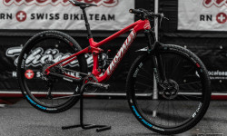
Bike Check: Mathias Flueckiger's Thomus Lightrider WC - Nove Mesto World Cup XC 2020
Sep 30, 2020 from pinkbike.com
The Swiss rider's Short Track, sprint set up.
Sub Regions
- Jihlava (9)
- Třebíč (2)
- Žďár nad Sázavou (23)
- Cyklo Aréna Vysočina (7)
- Traily Vír (15)
- Singletrailový areál Lipky (4)
Popular Vysočina Mountain Biking Trails
• 100 ★ 4.4 • 3 miles • 77 ft • 196 •
Před každým tréninkem se je potřeba rozjet. Proto jsme do sítě stezek zařadili modrý trail, kde nenajdete extrémní prudká stoupání nebo náročné kamenité pasáže. Tento trail je určen všem, kdo na kole rádi jezdí...
• 95 ★ 5.0 • 3,343 ft • 119 ft • 170 •
Trail pro ty nejmenší cyklisty. Spousta zatáček a spousta zábavy pro vaše děti. Sklon stezky jsme uzpůsobili tak, aby ji zvládly i děti na kolech s průměrem 16“. Na stezce nenajdete žádné záludnosti, snažili jsme se,...
• 90 ★ 4.0 • 2 miles • 188 ft • 140 •
Závody kategorie Hors Class jsou svým významem hned pod závody světového poháru. Závody nemívají televizní pokrytí, takže okruhy bývají tradičně delší a tratě se rozkládají na větší ploše. Jejich technická...
• 30 ★ 4.5 • 3 miles • 248 ft • 122 •
Závody kategorie Hors Class jsou svým významem hned pod závody světového poháru. Závody nemívají televizní pokrytí, takže okruhy bývají tradičně delší a tratě se rozkládají na větší ploše. Jejich technická...
• 85 ★ 4.0 • 2 miles • 340 ft • 109 •
Tento trail je koncipován jako imitace tratí světového poháru. Kompaktní okruh na malém prostoru s neustálými změnami směrů se spoustou zavřených zatáček, které vás donutí často řadit, jít ze sedla a kolo...
• 80 ★ 3.0 • 4,977 ft • 111 ft • 79 •
Trail je určen rodinám s dětmi, které si chtějí vyzkoušet jízdu v terénu na nenáročné široké stezce v mírně zvlněném profilu. Stejně tak je svým profilem vhodný pro handicapované sportovce, kteří si chtějí na...
• 60 ★ 4.0 • 2,339 ft • 6 ft • 58 •
Projektu Údolí Sportu se podařilo domluvit se soukromým vlastníkem lesa na zbudování kopaného úseku v prudším svahu vedle bývalé sjezdovky. Od listopadu 2019 tu vznikají první menší klopenky a terénní vlny. Záměrem...
Vysočina Mountain Bike Routes
33 miles • 4,517 ft • 0 • Loop •
Trasa Vír-Karasín-Štarkov-Bohdalec (53 km / 1.250 m) je myšlena pro aktivní XC bikery s romantickými...
9 miles • 1,554 ft • 0 • Loop •
A shorter, more intensive circuit climbs over the dam along the cycle path to the Horní les lookout...
19 miles • 1,943 ft • 0 • Loop •
Silniční a místy gravelový okruh vás zavede přívětivým stoupáním od Svratky do Rovečného a...
15 miles • 3,087 ft • 0 • Loop •
The demanding XC route - wilderness trails - starts at the dam, through the lookout of Klubačice it...
15 miles • 2,533 ft • 0 • Loop •
The circuit connects interesting tourist destinations with the Adrex Base Camp or camp. Ascended meters...
15 miles • 2,248 ft • 0 • Loop •
A leisurely route around the dam. The elevation gain is not small, ideal for e-bikes.
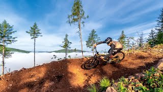
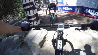
Photos of Vysočina Mountain Bike
Videos of Vysočina Mountain Bike

trail: Sokolí Trail EN3
0:28 |
236 |
Apr 7, 2022 , Žďár nad Sázavou
trail: Sokolí Trail
0:43 |
283 |
May 28, 2021 , Žďár nad Sázavou

trail: Warm-Up Trail
31:46 |
439 |
Aug 10, 2020 , Žďár nad Sázavou

trail: Hors Class Trail
31:46 |
506 |
Aug 10, 2020 , Žďár nad Sázavou

trail: Klubačice
0:13 |
329 |
May 8, 2020 , Žďár nad Sázavou
trail: Havlův Trail
385 |
May 8, 2020 , Žďár nad Sázavou
303 |
Jan 9, 2018
Recent Trail Reports
| status | trail | date | condition | info | user |
|---|---|---|---|---|---|
| Sokolí Trail Traily Vír | Apr 6, 2026 @ 12:50pm (Europe/Prague) Apr 6, 2026 | Dry | dethroned-cz | ||
| Sokolí Trail EN3 Traily Vír | Apr 6, 2026 @ 12:47pm (Europe/Prague) Apr 6, 2026 | Ideal | dethroned-cz | ||
| Sokolí Trail Traily Vír | Apr 6, 2026 @ 12:42pm (Europe/Prague) Apr 6, 2026 | Ideal | dethroned-cz | ||
| Trail Končiny Traily Vír | Apr 6, 2026 @ 12:39pm (Europe/Prague) Apr 6, 2026 | Ideal | dethroned-cz | ||
| Trail Končiny Traily Vír | Apr 6, 2026 @ 12:39pm (Europe/Prague) Apr 6, 2026 | Ideal | dethroned-cz | ||
| World Cup Cyklo Aréna Vysočina | Sep 20, 2025 @ 2:02pm (Europe/Prague) Sep 20, 2025 | Ideal | Dragomira | ||
| Access Road Cyklo Aréna Vysočina | Jul 24, 2025 @ 10:34am Jul 24, 2025 | Ideal | Daviddmd4K2 | ||
| Sokolí výjezd Traily Vír | Oct 23, 2024 @ 12:48pm Oct 23, 2024 | Ideal | dethroned-cz | ||
| Sokolí výjezd UP3 Traily Vír | Oct 23, 2024 @ 12:48pm Oct 23, 2024 | Ideal | dethroned-cz | ||
| Havlův Trail Traily Vír | Oct 20, 2024 @ 10:05am Oct 20, 2024 | Dry | Masha1 |
Activity Feed
| username | action | type | title | date |
|---|---|---|---|---|
| trailforks | add | event | activity #93498739 | Apr 26, 2026 @ 9:45pm Apr 26, 2026 |
| dethroned-cz | add | report | activity #92038003 and 4 more | Apr 6, 2026 @ 3:40am Apr 6, 2026 |
| PavelvC5FFv | wishlist | trail | activity #91763416 | Apr 2, 2026 @ 8:25am Apr 2, 2026 |
| Konterbunt | wishlist | region | activity #87990721 | Jan 29, 2026 @ 8:36am Jan 29, 2026 |
| Mskransz | ridden | trail | activity #86419518 | Dec 31, 2025 @ 5:39pm Dec 31, 2025 |
Recent Comments
| username | type | title | comment | date |
|---|---|---|---|---|
| trail | V poslední době celkem nepříjemný sjezd.... | Nov 8, 2023 @ 12:09pm Nov 8, 2023 | ||
| report | H 9,45 c | Aug 15, 2023 @ 12:01am Aug 15, 2023 | ||
| report | K | Aug 14, 2023 @ 11:58pm Aug 14, 2023 | ||
| trail | super nice trail, good flow, epic scenery.... | Jul 17, 2023 @ 1:05am Jul 17, 2023 | ||
| trail | this uphill is a bad joke. super straight and... | Jul 17, 2023 @ 12:53am Jul 17, 2023 |
Local Badges
-

Epic Mountain Bike Climb 2k40 awarded -

Climbing 10k Badge23 awarded -

Mountain Biking 100k Badge2 awarded -

Epic Ride Descent 2k40 awarded -

Descent 10k Badge23 awarded -

Descent 100k Badge2 awarded
Bike & Skill Parks
| name | type | city | rating |
|---|---|---|---|
| Pumptrack Nové Město na Moravě | skill park | Žďár nad Sázavou | |
| Pump track Luka nad Jihlavou | skill park | Jihlava |
Activity Type Stats
| activitytype | trails | distance | descent | descent distance | total vertical | rating | global rank | state rank | photos | reports | routes | ridelogs |
|---|---|---|---|---|---|---|---|---|---|---|---|---|
| Mountain Bike | 38 | 36 miles | 8,071 ft | 20 miles | 1,352 ft | 123 | 104 | 13 | 10,884 | |||
| E-Bike | 20 | 24 miles | 3,980 ft | 12 miles | 1,352 ft | 1 | 74 | 10 | 361 | |||
| Hike | 22 | 30 miles | 6,273 ft | 17 miles | 1,352 ft | 78 | 2 | 606 | ||||
| Trail Running | 23 | 30 miles | 6,273 ft | 17 miles | 1,352 ft | 74 | 278 |
Activities
Trails
Points of Interest
- Adrex Base Camp - info Information
- Dam Viewpoint
- Dalečín Sight
- Chudobínská borovice Viewpoint
- Rozhledna Karasín Viewpoint
- Vyhlídka Klubačice Viewpoint
- Zřícenina hradu Pyšolec Sight
- Sokolí skála Viewpoint
- Forest Resort Lodge
- Adrex Base Camp Information
- Křovina (2,753 ft)
- Křivý javor (2,717 ft)
- Devět skal (2,697 ft)
- By brenthillier
 NSMBA TRAILFORKS & contributors
 - Admins: ČeMBA, ČeMBA, ČeMBA, ČeMBA, ČeMBA, ČeMBA, ČeMBA, ČeMBA, ČeMBA, ČeMBA
- #9756 - 4,173 views
- vysočina activity log | embed map of Vysočina mountain bike trails | vysočina mountain biking points of interest
Downloading of trail gps tracks in kml & gpx formats is enabled for Vysočina.
You must login to download files.