close
-
Layers w
- Weather Layers
- Pro
- Pro
- Pro
- Pro
- Pro
- Pro
- More Layers
- Pro
- Pro
- Pro
- Pro
-
Upgrade to

3D
Trail Conditions
- Unknown
- Snow Groomed
- Snow Packed
- Snow Covered
- Snow Cover Partial
- Freeze/thaw Cycle
- Icy
- Prevalent Mud
- Wet
- Variable
- Ideal
- Dry
- Very Dry
Trail Flow (Ridden Direction)
Trailforks scans users ridelogs to determine the most popular direction each trail is ridden. A good flowing trail network will have most trails flowing in a single direction according to their intension.
The colour categories are based on what percentage of riders are riding a trail in its intended direction.
The colour categories are based on what percentage of riders are riding a trail in its intended direction.
- > 96%
- > 90%
- > 80%
- > 70%
- > 50%
- < 50%
- bi-directional trail
- no data
Trail Last Ridden
Trailforks scans ridelogs to determine the last time a trail was ridden.
- < 2 days
- < 1 week
- < 2 weeks
- < 1 month
- < 6 months
- > 6 months
Trail Ridden Direction
The intended direction a trail should be ridden.
- Downhill Only
- Downhill Primary
- Both Directions
- Uphill Primary
- Uphill Only
- One Direction
Contribute Details
Colors indicate trail is missing specified detail.
- Description
- Photos
- Description & Photos
- Videos
Trail Popularity ?
Trailforks scans ridelogs to determine which trails are ridden the most in the last 9 months.
Trails are compared with nearby trails in the same city region with a possible 25 colour shades.
Think of this as a heatmap, more rides = more kinetic energy = warmer colors.
- most popular
- popular
- less popular
- not popular
ATV/ORV/OHV Filter
Max Vehicle Width
inches
US Cell Coverage
Legend

Radar Time
Activity Recordings
Trailforks uses anonymized public activity data.
?
Activity Recordings
Trailforks uses anonymized public activity data.
?
Personal Heatmap
▶
Activity Types
all
/
none
▶
Options
2
Date range
month
–
Winter Trails
Warning
A routing network for winter maps does not exist. Selecting trails using the winter trails layer has been disabled.
Missing Trails
Most Popular
Least Popular
Trails are colored based on popularity. The more popular a trail is, the more red. Less popular trails trend towards green.
Jump Magnitude Heatmap
Heatmap of where riders jump on trails. Zoom in to see individual jumps, click circles to view jump details.
BC Backroad Status
![map legend]()
Service Road Atlas is a free to use, community-driven service for viewing and creating reports on the numerous back-country service roads around B.C. and Alberta.

Slope Aspect
Direction the slope faces
Trails Deemphasized
Trails are shown in grey.
Only show trails with no bike usage.
Suggested Layers
Based on selected activity type
Save the current map location and zoom level as your default home location whenever this page is loaded.
Save
No description for Wałbrzych has been added yet!
Login or register to submit one.
This region uses the Uk/Euro style trail grading system.
Activities Click to view
- Mountain Bike
78 trails
- E-Bike
79 trails
- Gravel Bike
0 trails
- Adaptive Bike
0 trails
- Hike
49 trails
- Trail Running
49 trails
Region Details
- 28
- 5
- 18
- 14
- 11
Region Status
Open as of May 24, 2026Stats
- Avg Trail Rating
- Trails (view details)
- 76
- Trails Mountain Bike
- 80
- Trails E-Bike
- 79
- Trails Hike
- 49
- Trails Trail Running
- 49
- Total Distance
- 37 miles
- Total Descent
- 11,985 ft
- Total Vertical
- 1,790 ft
- Highest Trailhead
- 2,806 ft
- Reports
- 620
- Photos
- 333
- Ridden Counter
- 1,934
Sub Regions
-
Góry Czarne
- 2
- 5
- 1
- 3
-
Książański Park Krajobrazowy
- 3
- 4
- 3
- 2
-
Masyw Chełmca
- 4
- 4
- 4
-
Park Sobieskiego
- 1
- 4
- 2
-
Ptasia Kopa
- 4
- 2
Popular Wałbrzych Mountain Biking Trails
• 90 ★ 4.7 • 4,475 ft • 137 ft • 182 •
Zjawiskowy singiel po zboczu Jałowca Małego. Może nie jest najszybszy, ale te widoki... Singletrack traversing Mały. May not be fast but offers phenomenal views.
• 75 ★ 4.3 • 3,681 ft • 68 ft • 110 •
Najnudniejszy fragment Rybnickiego Grzbietu. Singiel zamieniony na szeroką drogę do wywózki drewna.
• 60 ★ 1.0 • 873 ft • 0 ft • 52 • • hike
Czerwony i niebieski szlak turystyczny prowadzący z Przełęczy pod Wawrzyniakiem na północ w kierunku Jedliny-Zdrój. Szeroka, ale stroma ścieżka, trochę kamieni i korzeni.
• 95 ★ 5.0 • 2,234 ft • 0 ft • 52 •
Popular black difficulty singletrack. This mountain bike primary trail and has a hard overall physical rating. It features berm, drop, jump, gap jump and other. Trail visibility is always easy to follow. On average it takes 6 minutes to complete this trail.
• 50 ★ 4.0 • 1,112 ft • 0 ft • 38 • • hike
Zielony szlak turystyczny. Jazdę zaczynamy z Ptasiego Rozdroża. Świetny początek dla ścieżki Jałowcowe Zbocze, przechodzącej dalej w Rybnicki Grzbiet. Łącznie dostajemy chyba najfajniejszą trasę w Górach Wałbrzyskich.
Wałbrzych Mountain Bike Routes
2 miles • 449 ft • 1 • Loop • Race •
Trasa trzeciej edycji Pucharu Polski XCO, która odbędzie się w Wałbrzychu 1 czerwca 2025 roku.
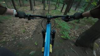
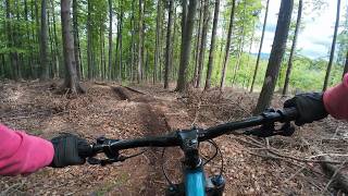
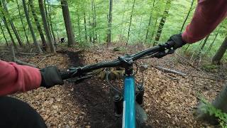
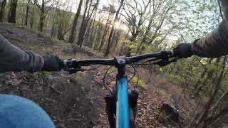
Photos of Wałbrzych Mountain Bike
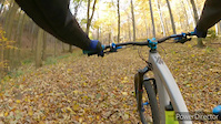
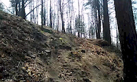
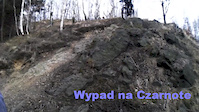
Videos of Wałbrzych Mountain Bike
trail: Różowy
4:31 |
167 |
Nov 21, 2021
trail: Czarnota
0:32 |
91 |
Apr 12, 2015
trail: Czarnota
0:23 |
91 |
Mar 23, 2014
trail: Czarnota
0:45 |
152 |
Feb 22, 2014
trail: Ptasia Intro
4:17 |
3 |
May 30, 2026 , Wałbrzych
trail: Borsucz
2:37 |
42 |
May 17, 2026 , Wałbrzych
trail: Dzik
5:08 |
49 |
May 17, 2026 , Wałbrzych
trail: Czarnota
0:54 |
58 |
Apr 23, 2026 , Wałbrzych
Recent Trail Reports
| status | trail | date | condition | info | user |
|---|---|---|---|---|---|
| Wąwóz Pełcznicy II | May 24, 2026 @ 1:22pm (Europe/Prague) May 24, 2026 | Ideal | RiFFu | ||
| Wąwóz Pełcznicy I | May 24, 2026 @ 1:22pm (Europe/Prague) May 24, 2026 | Ideal | RiFFu | ||
| Access Track | May 24, 2026 @ 1:22pm (Europe/Prague) May 24, 2026 | Ideal | RiFFu | ||
| Czerwonym na Zamek | May 24, 2026 @ 1:22pm (Europe/Prague) May 24, 2026 | Ideal | RiFFu | ||
| Chełmiec Access | May 20, 2026 @ 4:18pm (Europe/Prague) May 20, 2026 | Dry | Misiekm1 | ||
| Borsucz | May 17, 2026 @ 8:54pm (Europe/Warsaw) May 17, 2026 | Wet | majatravels | ||
| Bobek | May 17, 2026 @ 8:54pm (Europe/Warsaw) May 17, 2026 | Wet | majatravels | ||
| Różowy | May 17, 2026 @ 8:54pm (Europe/Warsaw) May 17, 2026 | Wet | majatravels | ||
| Różowy 2 | May 17, 2026 @ 8:54pm (Europe/Warsaw) May 17, 2026 | Wet | majatravels | ||
| Dzik | May 17, 2026 @ 8:54pm (Europe/Warsaw) May 17, 2026 | Wet | majatravels |
Activity Feed
| username | action | type | title | date |
|---|---|---|---|---|
| RiFFu | add | report | activity #97314840 and 3 more | Jun 19, 2026 @ 7:10am Jun 19, 2026 |
| RiFFu | vote | trail | activity #97314526 and 1 more | Jun 19, 2026 @ 7:05am Jun 19, 2026 |
| Misiekm1 | vote | trail | activity #96562940 and 3 more | Jun 8, 2026 @ 2:05pm Jun 8, 2026 |
| majatravels | difficultyvote | trail | activity #95833422 | May 30, 2026 @ 3:06am May 30, 2026 |
| majatravels | vote | trail | activity #95833411 | May 30, 2026 @ 3:05am May 30, 2026 |
Recent Comments
| username | type | title | comment | date |
|---|---|---|---|---|
| trail | Super robota Panowie! Piękne flow 👌 | Jun 2, 2025 @ 10:19pm Jun 2, 2025 | ||
| trail | Mega flow od skrzyżowania z zielonym... | May 24, 2025 @ 3:00pm May 24, 2025 | ||
| trail | Coś z innej beczki niż wszystkie czarne... | May 24, 2025 @ 2:54pm May 24, 2025 | ||
| trail | Potwierdzam na poczatku grudnia 2023 nadal... | Dec 12, 2023 @ 11:03am Dec 12, 2023 | ||
| trail | Nieprzejezdna. Najlepszy niegdyś odcinek... | Jul 15, 2023 @ 5:50am Jul 15, 2023 |
Local Badges
-

Epic Ride Climb 2k22 awarded -

Climbing 10k Badge18 awarded -

Climbing 100k Badge1 awarded -

Epic Ride Descent 2k22 awarded -

Descent 10k Badge18 awarded -

Descent 100k Badge1 awarded
Activity Type Stats
| activitytype | trails | distance | descent | descent distance | total vertical | rating | global rank | state rank | photos | reports | routes | ridelogs |
|---|---|---|---|---|---|---|---|---|---|---|---|---|
| Mountain Bike | 78 | 37 miles | 11,985 ft | 18 miles | 1,791 ft | #2,374 | #42 | 338 | 623 | 1 | 3,468 | |
| E-Bike | 79 | 37 miles | 11,985 ft | 18 miles | 1,791 ft | #2,434 | #289 | 486 | 315 | |||
| Hike | 49 | 27 miles | 8,219 ft | 12 miles | 1,775 ft | #1,048 | #36 | 581 | 666 | |||
| Trail Running | 49 | 27 miles | 8,219 ft | 12 miles | 1,775 ft | #4,225 | #76 | 577 | 61 |
Frequently Asked Questions About Wałbrzych
▼
What are the best places to ride in Wałbrzych?
Wałbrzych has 5 areas to explore for mountain biking. The top rated areas are:
▼
What are the highest rated mountain biking trails in Wałbrzych?
The highest rated mountain biking trails in Wałbrzych are:
- Rybnicki Grzbiet (4.4/5)
- Jałowcowe Zbocze (4.3/5)
- Różowy 2 (4.3/5)
- Chełmiec Blue Lower (4.3/5)
- Wąwóz Pełcznicy I (4.2/5)
▼
What is the best time of the year to ride in Wałbrzych?
Based on ride log data, the most popular months to ride in Wałbrzych are:
- July (41 activities)
- June (15 activities)
- August (12 activities)
▼
Where can I park to ride in Wałbrzych?
There are 5 parking locations listed in Wałbrzych. The most popular parking spots are: View all parking and trailhead locations on the map to plan your visit.
Activities
Trails
Points of Interest
- Stado Ogierów Książ Sight
- Platforma widokowa na Paluchu Viewpoint
- Platforma Widokowa na Jałowcu Viewpoint
- Korzenna Ścianka TTF
- Drop TTF
- Wysoka Banda TTF
- Skok Przez Korzenie TTF
- Stopień TTF
- Widok z Góry Parkowej Viewpoint
- Wieża widokowa Viewpoint
- Chełmiec (2,785 ft)
- Trójgarb (2,552 ft)
- Chełmiec Mały (2,539 ft)
- wałbrzych activity log | embed map of Wałbrzych mountain bike trails | wałbrzych mountain biking points of interest
Downloading of trail gps tracks in kml & gpx formats is enabled for Wałbrzych.
You must login to download files.