close
-
Layers w
- Weather Layers
- Pro
- Pro
- Pro
- Pro
- Pro
- Pro
- More Layers
- Pro
- Pro
- Pro
- Pro
-
Upgrade to

3D
Trail Conditions
- Unknown
- Snow Groomed
- Snow Packed
- Snow Covered
- Snow Cover Partial
- Freeze/thaw Cycle
- Icy
- Prevalent Mud
- Wet
- Variable
- Ideal
- Dry
- Very Dry
Trail Flow (Ridden Direction)
Trailforks scans users ridelogs to determine the most popular direction each trail is ridden. A good flowing trail network will have most trails flowing in a single direction according to their intension.
The colour categories are based on what percentage of riders are riding a trail in its intended direction.
The colour categories are based on what percentage of riders are riding a trail in its intended direction.
- > 96%
- > 90%
- > 80%
- > 70%
- > 50%
- < 50%
- bi-directional trail
- no data
Trail Last Ridden
Trailforks scans ridelogs to determine the last time a trail was ridden.
- < 2 days
- < 1 week
- < 2 weeks
- < 1 month
- < 6 months
- > 6 months
Trail Ridden Direction
The intended direction a trail should be ridden.
- Downhill Only
- Downhill Primary
- Both Directions
- Uphill Primary
- Uphill Only
- One Direction
Contribute Details
Colors indicate trail is missing specified detail.
- Description
- Photos
- Description & Photos
- Videos
Trail Popularity ?
Trailforks scans ridelogs to determine which trails are ridden the most in the last 9 months.
Trails are compared with nearby trails in the same city region with a possible 25 colour shades.
Think of this as a heatmap, more rides = more kinetic energy = warmer colors.
- most popular
- popular
- less popular
- not popular
ATV/ORV/OHV Filter
Max Vehicle Width
inches
US Cell Coverage
Legend

Radar Time
Activity Recordings
Trailforks uses anonymized public activity data.
?
Activity Recordings
Trailforks uses anonymized public activity data.
?
Personal Heatmap
▶
Activity Types
all
/
none
▶
Options
2
Date range
month
–
Winter Trails
Warning
A routing network for winter maps does not exist. Selecting trails using the winter trails layer has been disabled.
Missing Trails
Most Popular
Least Popular
Trails are colored based on popularity. The more popular a trail is, the more red. Less popular trails trend towards green.
Jump Magnitude Heatmap
Heatmap of where riders jump on trails. Zoom in to see individual jumps, click circles to view jump details.
BC Backroad Status
![map legend]()
Service Road Atlas is a free to use, community-driven service for viewing and creating reports on the numerous back-country service roads around B.C. and Alberta.

Slope Aspect
Direction the slope faces
Trails Deemphasized
Trails are shown in grey.
Only show trails with no bike usage.
Suggested Layers
Based on selected activity type
Save the current map location and zoom level as your default home location whenever this page is loaded.
Save
No description for Walhalla has been added yet!
Login or register to submit one.
Activities Click to view
- Mountain Bike
40 trails
- E-Bike
25 trails
- Adaptive Bike
0 trails
- Winter Fat Bike
0 trails
- Horse
2 trails
- Hike
52 trails
- Trail Running
51 trails
Region Details
- 5
- 5
- 11
- 1
- 1
Region Status
Open as of Jun 7, 2026Stats
- Avg Trail Rating
- Trails (view details)
- 44
- Trails Mountain Bike
- 40
- Trails E-Bike
- 25
- Trails Horse
- 2
- Trails Hike
- 52
- Trails Trail Running
- 51
- Trails Dirtbike/Moto
- 2
- Trails Observed Trials
- 1
- Trails ATV/ORV/OHV
- 3
- Total Distance
- 102 miles
- Total Descent Distance
- 48 miles
- Total Descent
- 15,407 ft
- Total Vertical
- 2,140 ft
- Highest Trailhead
- 3,150 ft
- Reports
- 136
- Photos
- 61
- Ridden Counter
- 3,841
Sub Regions
-
Devils Fork State Park
-
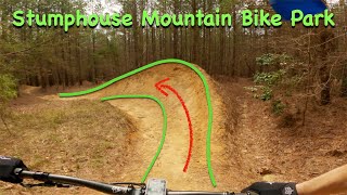
Stumphouse Mountain Bike Park
- 4
- 9
- 1
- 1
Popular Walhalla Mountain Biking Trails
• 85 ★ 4.4 • 2 miles • 218 ft • 481 •
Access trail to network via Palmetto Trail
• 50 ★ 4.7 • 3,563 ft • 3 ft • 287 •
Highly rated moderately popular black diamond difficulty singletrack. This mountain bike primary trail can be used downhill only. On average it takes 6 minutes to complete this trail.
• 70 ★ 4.0 • 6 miles • 408 ft • 261 •
Highly rated popular blue difficulty singletrack. This mountain bike primary trail can be used both directions and has a moderate overall physical rating with a 408 ft blue climb. On average it takes 59 minutes to complete this trail.
• 75 ★ 4.0 • 2 miles • 180 ft • 253 •
This is 2 loops both part of the Gold Loop. The first loop uses the and is called the Entry Loop. The Lower Loop combines to create the Lake loop.
• 100 ★ 4.7 • 2 miles • 67 ft • 221 •
Mostly downhill trail with several rock features, stepdowns and tabletops. All features have bypass options. The 2nd half gets a lot faster and the speed can get high
• 100 ★ 5.0 • 3,323 ft • 0 ft • 141 •
New intermediate Downhill /jump line. No gap jumps. big berms and some tabletop jumps and stepups.
• 90 ★ 4.0 • 4,281 ft • 8 ft • 141 •
Beginner downhill run with tons of berms, some small jumps and features
• 90 ★ 4.5 • 2 miles • 244 ft • 107 •
New unnamed trail #13. Can be ridden either direction. Several very steep pitches and switchbacks.
Walhalla Mountain Bike Routes
★ 5.0 • 7 miles • 976 ft • 2 • Out & Back •
Part of the Boudry Trail with added climbing from the parking lot of the parking lot. this is the...
7 miles • 516 ft • 0 • Point to Point •
Updated boundry trail 2024. ADA accessible.
5 miles • 483 ft • 0 • Loop • Race •
November 16, 2025, Explore Park, Stumphouse Mountain Bike Park, 105 Stumphouse Tunnel Rd, Walhalla, SC...
Photos of Walhalla Mountain Bike
Videos of Walhalla Mountain Bike

trail: Flow Trail
16:23 |
989 |
Aug 17, 2021 , Walhalla

trail: Boundary Trail
16:23 |
479 |
Aug 17, 2021 , Walhalla

16:23 |
383 |
Aug 17, 2021 , Walhalla
16:23 |
197 |
Aug 17, 2021

trail: Boundary Trail
38:27 |
779 |
Dec 21, 2020 , Walhalla

5:55 |
660 |
Nov 5, 2020

0:54 |
346 |
Nov 5, 2020

trail: Flow Trail
4:41 |
1346 |
Apr 22, 2020 , Walhalla
Recent Trail Reports
| status | trail | date | condition | info | user |
|---|---|---|---|---|---|
| Postage Due | Jun 7, 2026 @ 3:01pm (America/New_York) Jun 7, 2026 | Dry | Jmdrpi | ||
| FS Road | Jun 7, 2026 @ 3:01pm (America/New_York) Jun 7, 2026 | Ideal | Jmdrpi | ||
| Stump Hump | Jun 7, 2026 @ 3:01pm (America/New_York) Jun 7, 2026 | Ideal | Jmdrpi | ||
| Adaptive trail | Jun 7, 2026 @ 3:01pm (America/New_York) Jun 7, 2026 | Unknown | Jmdrpi | ||
| TunnelTown Express | Jan 7, 2026 @ 12:22pm (America/Kentucky/Monticello) Jan 7, 2026 | Ideal | the-grey-fox | ||
| Downcountry Trail #7 | Jan 7, 2026 @ 12:22pm (America/Kentucky/Monticello) Jan 7, 2026 | Ideal | the-grey-fox | ||
| Boundary Trail | Dec 26, 2025 @ 11:50am (America/Vancouver) Dec 26, 2025 | Dry | the-grey-fox | ||
| Best Intentions | Dec 21, 2025 @ 11:58am (America/Kentucky/Monticello) Dec 21, 2025 | Variable | the-grey-fox | ||
| Tunnel Hill Trail | Dec 16, 2025 @ 11:14am (America/Kentucky/Monticello) Dec 16, 2025 | Ideal | the-grey-fox | ||
| Cane Creek Trail | Dec 7, 2024 @ 2:52pm Dec 7, 2024 | Unknown | MoeSchlabach |
Activity Feed
| username | action | type | title | date |
|---|---|---|---|---|
| Barro50 | wishlist | region | activity #97192021 | Jun 17, 2026 @ 9:59am 10 hours |
| Jmdrpi | add | report | activity #96801937 and 3 more | Jun 12, 2026 @ 7:17am Jun 12, 2026 |
| riptide772 | wishlist | region | activity #96367558 | Jun 6, 2026 @ 7:18am Jun 6, 2026 |
| SeanDfTSW8 | wishlist | region | activity #95904942 | May 30, 2026 @ 7:09pm May 30, 2026 |
| lakepad | wishlist | route | activity #95686750 | May 27, 2026 @ 10:21pm May 27, 2026 |
Recent Comments
| username | type | title | comment | date |
|---|---|---|---|---|
| trail | Trail does not actually connect to the public... | Feb 28, 2026 @ 8:34pm Feb 28, 2026 | ||
| trail | I think the whole area could use more signs /... | Oct 31, 2025 @ 5:19pm Oct 31, 2025 | ||
| trail | This trail is a fantastic hub for the trails... | Sep 18, 2025 @ 4:02pm Sep 18, 2025 | ||
| trail | Fun trail with some awesome switchback. Nice... | Sep 18, 2025 @ 3:57pm Sep 18, 2025 | ||
| trail | Fun flowy trail. Can ride either direction, we... | Sep 18, 2025 @ 3:40pm Sep 18, 2025 |
Local Badges
-

Epic Ride Descent 2k82 awarded -

Descent 10k Badge9 awarded -

Descent 100k Badge0 awarded -

10 Blue Trails3 awarded -

Epic Mountain Bike Climb 2k1 awarded -

Climbing 10k Badge1 awarded
Activity Type Stats
| activitytype | trails | distance | descent | descent distance | total vertical | rating | global rank | state rank | photos | reports | routes | ridelogs |
|---|---|---|---|---|---|---|---|---|---|---|---|---|
| Mountain Bike | 40 | 49 miles | 7,287 ft | 23 miles | 1,247 ft | #3,256 | #1,120 | 57 | 136 | 3 | 3,079 | |
| E-Bike | 25 | 22 miles | 3,970 ft | 11 miles | 1,247 ft | #4,675 | #1,496 | 1 | 123 | 2 | 393 | |
| Horse | 2 | 8 miles | 906 ft | 3 miles | 1,854 ft | #2,793 | #1,554 | 5 | 2 | |||
| Hike | 52 | 99 miles | 14,554 ft | 46 miles | 2,139 ft | #2,591 | #1,010 | 1 | 133 | 1 | 491 | |
| Trail Running | 51 | 97 miles | 14,373 ft | 44 miles | 2,139 ft | #2,756 | #788 | 2 | 133 | 1 | 37 | |
| Dirtbike/Moto | 2 | 15 miles | 2,162 ft | 6 miles | 1,132 ft | 5 | 4 | |||||
| Observed Trials | 1 | 3 miles | 16 ft | 1,437 ft | 735 ft | 2 | ||||||
| ATV/ORV/OHV | 3 | 19 miles | 3,333 ft | 10 miles | 1,247 ft | 5 | 1 |
Frequently Asked Questions About Walhalla
▼
What are the best places to ride in Walhalla?
Walhalla has 3 areas to explore for mountain biking. The top rated areas are:
▼
What are the highest rated mountain biking trails in Walhalla?
The highest rated mountain biking trails in Walhalla are:
- Flow Trail (4.4/5)
- Downcountry Trail #7 (4.2/5)
- Palmetto Trail: Stumphouse Passage (4.2/5)
- Cane Creek Trail (4.1/5)
- TunnelTown Express (4.1/5)
▼
What is the best time of the year to ride in Walhalla?
Based on ride log data, the most popular months to ride in Walhalla are:
- November (27 activities)
- December (25 activities)
- September (21 activities)
▼
Where can I park to ride in Walhalla?
There are 16 parking locations listed in Walhalla. The most popular parking spots are: View all parking and trailhead locations on the map to plan your visit.
Activities
Trails
Points of Interest
- Station Cove Falls Sight
- Saddle Tunnel Viewpoint
- Middle Tunnel Viewpoint
- Upper Yellow Branch Falls Viewpoint
- Lower Yellow Branch Falls Viewpoint
- Stumphouse Tunnel Viewpoint
- Wright Creek Falls Viewpoint
- Medlin Mountain Summit
- Opossum Creek Falls Sight
- Chauga Narrows Falls Sight
- Terrapin Mountain (4,469 ft)
- Blackrock Mountain (4,347 ft)
- Osage Mountain (4,180 ft)
- By Waylonwaylonwaylon
 & contributors
 - Admins: apply
- #28986 - 2,223 views
- walhalla activity log | embed map of Walhalla mountain bike trails | walhalla mountain biking points of interest
Downloading of trail gps tracks in kml & gpx formats is enabled for Walhalla.
You must login to download files.