close
-
Layers w
- Weather Layers
- Pro
- Pro
- Pro
- Pro
- Pro
- Pro
- More Layers
- Pro
- Pro
- Pro
- Pro
-
Upgrade to

3D
Trail Conditions
- Unknown
- Snow Groomed
- Snow Packed
- Snow Covered
- Snow Cover Partial
- Freeze/thaw Cycle
- Icy
- Prevalent Mud
- Wet
- Variable
- Ideal
- Dry
- Very Dry
Trail Flow (Ridden Direction)
Trailforks scans users ridelogs to determine the most popular direction each trail is ridden. A good flowing trail network will have most trails flowing in a single direction according to their intension.
The colour categories are based on what percentage of riders are riding a trail in its intended direction.
The colour categories are based on what percentage of riders are riding a trail in its intended direction.
- > 96%
- > 90%
- > 80%
- > 70%
- > 50%
- < 50%
- bi-directional trail
- no data
Trail Last Ridden
Trailforks scans ridelogs to determine the last time a trail was ridden.
- < 2 days
- < 1 week
- < 2 weeks
- < 1 month
- < 6 months
- > 6 months
Trail Ridden Direction
The intended direction a trail should be ridden.
- Downhill Only
- Downhill Primary
- Both Directions
- Uphill Primary
- Uphill Only
- One Direction
Contribute Details
Colors indicate trail is missing specified detail.
- Description
- Photos
- Description & Photos
- Videos
Trail Popularity ?
Trailforks scans ridelogs to determine which trails are ridden the most in the last 9 months.
Trails are compared with nearby trails in the same city region with a possible 25 colour shades.
Think of this as a heatmap, more rides = more kinetic energy = warmer colors.
- most popular
- popular
- less popular
- not popular
ATV/ORV/OHV Filter
Max Vehicle Width
inches
US Cell Coverage
Legend

Radar Time
Activity Recordings
Trailforks uses anonymized public activity data.
?
Activity Recordings
Trailforks uses anonymized public activity data.
?
Personal Heatmap
▶
Activity Types
all
/
none
▶
Options
2
Date range
month
–
Winter Trails
Warning
A routing network for winter maps does not exist. Selecting trails using the winter trails layer has been disabled.
Missing Trails
Most Popular
Least Popular
Trails are colored based on popularity. The more popular a trail is, the more red. Less popular trails trend towards green.
Jump Magnitude Heatmap
Heatmap of where riders jump on trails. Zoom in to see individual jumps, click circles to view jump details.
BC Backroad Status
![map legend]()
Service Road Atlas is a free to use, community-driven service for viewing and creating reports on the numerous back-country service roads around B.C. and Alberta.

Slope Aspect
Direction the slope faces
Trails Deemphasized
Trails are shown in grey.
Only show trails with no bike usage.
Suggested Layers
Based on selected activity type
Save the current map location and zoom level as your default home location whenever this page is loaded.
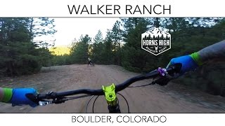
SaveWalker Ranch is one of the rides that every Boulder-based mountain biker has ridden. It's a great ride for someone visiting, offering fun singletrack and great scenery. And it's located up Flagstaff road, which is worth the drive on its own
This is a fairly challenging ride despite its somewhat short distance. There's a mix of fast flowy singletrack, technical rocky sections, and even a somewhat difficult hike-a-bike down steep steps to a creek.
This is a fairly challenging ride despite its somewhat short distance. There's a mix of fast flowy singletrack, technical rocky sections, and even a somewhat difficult hike-a-bike down steep steps to a creek.
Primary Trail Type: Cross-Country
 google parking directions
 Activities Click to view
- Mountain Bike
5 trails
- Hike
5 trails
- Trail Running
5 trails
Region Details
- 1
- 1
- 1
- 2
Region Status
Open as of Jun 15, 2026Stats
- Avg Trail Rating
- Trails (view details)
- 5
- Trails Mountain Bike
- 5
- Trails Horse
- 1
- Trails Hike
- 5
- Trails Trail Running
- 5
- Total Distance
- 12 miles
- Total Descent
- 3,065 ft
- Total Vertical
- 1,575 ft
- Highest Trailhead
- 8,011 ft
- Reports
- 191
- Photos
- 60
- Ridden Counter
- 1,917
Popular Walker Ranch Mountain Biking Trails
• 60 ★ 4.1 • 8 miles • 1,559 ft • 852 •
A ride with some of the more rewarding descents in the area although be prepared to work for them. is most notable for fast loose descents followed by steep leg and lung busting climbs. Be prepared for a mandatory hike-a-bike section as...
• 60 ★ 4.0 • 1 mile • 60 ft • 256 •
Not enough miles in Walker Ranch for you? Take this nice connector trail to Trail and get 7 more easy miles on your ride. This trail is an easy intermediate or advanced beginner trail that winds through a burned forest, then crosses the...
• 25 ★ 3.7 • 3 miles • 55 ft • 85 •
This trail is an old farm road. It's a bit steep and rocky to be considered a good beginner trail. Usually much less busy than the main Walker Ranch loop, it lacks the views of that area too.
Walker Ranch Mountain Bike Routes
Walker Out-and-Back to Stairs Featured
★ 3.5 • 11 miles • 2,465 ft • 3 • Out & Back •
This is an advanced ride, due to steep climbs and lots (and lots and lots) of rocks. Walker Ranch can be...
No Walker Walker Featured
15 miles • 3,131 ft • 1 • Out & Back •
The "No Walker Walker" takes the 8 mile long and makes it twice as hard! Instead of doing the full loop,...
★ 2.0 • 29 miles • 4,875 ft • 7 • Out & Back •
Oh, Super Walker. Oh Boulder. Walker is an amazing loop! First rate. Black diamond trails with some great...
★ 1.0 • 3 miles • 258 ft • 0 •
8 miles • 1,517 ft • 0 • Loop •
Photos of Walker Ranch Mountain Bike
Videos of Walker Ranch Mountain Bike
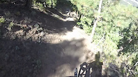
trail: Walker Ranch Loop
0:48 |
100 |
Sep 26, 2016
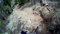
trail: Walker Ranch Loop
0:34 |
2842 |
Dec 1, 2011
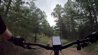
trail: Meyers Homestead
2:55 |
290 |
Sep 6, 2023 , Boulder

trail: Walker Ranch Loop
0:06 |
291 |
Nov 15, 2022 , Boulder

trail: Walker Ranch Loop
0:13 |
296 |
Nov 11, 2022 , Boulder

trail: Walker Ranch Loop
5:33 |
518 |
Sep 3, 2021 , Boulder
youtuber
![Mountain Biking Walker Ranch | Boulder, Colorado]()
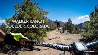
trail: Walker Ranch Loop
6:40 |
1566 |
Apr 27, 2018 , Boulder
youtuber
![Walker Ranch | Boulder, Colorado | May 2017]()
trail: Walker Ranch Loop
1247 |
May 18, 2017 , Boulder
Recent Trail Reports
| status | trail | date | condition | info | user |
|---|---|---|---|---|---|
| Walker Ranch Connector | Jun 15, 2026 @ 11:56am (America/Denver) Jun 15, 2026 | Dry | darkcloud | ||
| Walker Ranch Loop | Jun 15, 2026 @ 11:56am (America/Denver) Jun 15, 2026 | Dry | darkcloud | ||
| Walker Ranch Road | Dec 20, 2025 @ 11:47am (America/Denver) Dec 20, 2025 | Unknown | WendyBMA BMA | ||
| Walker Ranch Alt Line | Dec 20, 2025 @ 11:47am (America/Denver) Dec 20, 2025 | Unknown | WendyBMA BMA | ||
| Meyers Homestead | Dec 20, 2025 @ 11:47am (America/Denver) Dec 20, 2025 | Unknown | WendyBMA BMA | ||
| Josie Heath Trail | Dec 20, 2025 @ 11:47am (America/Denver) Dec 20, 2025 | Unknown | WendyBMA BMA | ||
| Ethel Harrold | Dec 20, 2025 @ 11:47am (America/Denver) Dec 20, 2025 | Unknown | WendyBMA BMA |
Activity Feed
| username | action | type | title | date |
|---|---|---|---|---|
| darkcloud | add | report | activity #97114195 and 1 more | Jun 16, 2026 @ 8:54am Jun 16, 2026 |
| realkatakat | wishlist | trail | activity #95157130 | May 20, 2026 @ 10:49pm May 20, 2026 |
| Jchalcas | wishlist | trail | activity #95014098 | May 18, 2026 @ 6:14pm May 18, 2026 |
| CucheckGravity | wishlist | trail | activity #94985718 | May 18, 2026 @ 10:32am May 18, 2026 |
| wiemokly | wishlist | trail | activity #94691583 | May 14, 2026 @ 8:23am May 14, 2026 |
Recent Comments
| username | type | title | comment | date |
|---|---|---|---|---|
| trail | Did it counter clockwise. Nice views, great... | Apr 12, 2026 @ 2:33pm Apr 12, 2026 | ||
| trail | There's a trail split near the top of the... | Sep 2, 2024 @ 4:15pm Sep 2, 2024 | ||
| trail | **We did this in the counter clockwise direction** | Jul 27, 2024 @ 1:29am Jul 27, 2024 | ||
| trail | Beginner/Intermediate rider. Did this trail... | Jul 27, 2024 @ 1:14am Jul 27, 2024 | ||
| trail | This is a blue trail at best. Not worth the... | May 16, 2023 @ 5:35am May 16, 2023 |
Nearby Areas
| name | distance | ||||
|---|---|---|---|---|---|
| Eldorado Canyon State Park | 2 | 2.3 km | |||
| Boulder Open Space | 1 | 3.2 km | |||
| The People's Crossing Park | 4.9 km | ||||
| Betasso Preserve | 4 | 1 | 5 km | ||
| CU South Campus | 5 | 1 | 5.9 km |
Activity Type Stats
| activitytype | trails | distance | descent | descent distance | total vertical | rating | global rank | state rank | photos | reports | routes | ridelogs |
|---|---|---|---|---|---|---|---|---|---|---|---|---|
| Mountain Bike | 5 | 12 miles | 3,064 ft | 7 miles | 1,575 ft | #6,143 | #2,299 | 55 | 177 | 5 | 2,659 | |
| Horse | 1 | 748 ft | 10 ft | 459 ft | 10 ft | 40 | 3 | |||||
| Hike | 5 | 12 miles | 3,064 ft | 7 miles | 1,575 ft | #11,050 | #4,424 | 6 | 177 | 4 | 479 | |
| Trail Running | 5 | 12 miles | 3,064 ft | 7 miles | 1,575 ft | #10,376 | #3,864 | 177 | 3 | 213 |
- By WendyBMA
 BMA & contributors
 - Admins: BMA, IMBA, WendyBMA, BMA, amrosen, getvert, mpopetz, Pumpntrail, andrewbikeboulder, Skyryk
- #27840 - 9,980 views
- walker ranch activity log | embed map of Walker Ranch mountain bike trails | walker ranch mountain biking points of interest
Downloading of trail gps tracks in kml & gpx formats is enabled for Walker Ranch.
You must login to download files.