close
-
Layers w
- Weather Layers
- Pro
- Pro
- Pro
- Pro
- Pro
- Pro
- More Layers
- Pro
- Pro
- Pro
- Pro
-
Upgrade to

3D
Trail Conditions
- Unknown
- Snow Groomed
- Snow Packed
- Snow Covered
- Snow Cover Partial
- Freeze/thaw Cycle
- Icy
- Prevalent Mud
- Wet
- Variable
- Ideal
- Dry
- Very Dry
Trail Flow (Ridden Direction)
Trailforks scans users ridelogs to determine the most popular direction each trail is ridden. A good flowing trail network will have most trails flowing in a single direction according to their intension.
The colour categories are based on what percentage of riders are riding a trail in its intended direction.
The colour categories are based on what percentage of riders are riding a trail in its intended direction.
- > 96%
- > 90%
- > 80%
- > 70%
- > 50%
- < 50%
- bi-directional trail
- no data
Trail Last Ridden
Trailforks scans ridelogs to determine the last time a trail was ridden.
- < 2 days
- < 1 week
- < 2 weeks
- < 1 month
- < 6 months
- > 6 months
Trail Ridden Direction
The intended direction a trail should be ridden.
- Downhill Only
- Downhill Primary
- Both Directions
- Uphill Primary
- Uphill Only
- One Direction
Contribute Details
Colors indicate trail is missing specified detail.
- Description
- Photos
- Description & Photos
- Videos
Trail Popularity ?
Trailforks scans ridelogs to determine which trails are ridden the most in the last 9 months.
Trails are compared with nearby trails in the same city region with a possible 25 colour shades.
Think of this as a heatmap, more rides = more kinetic energy = warmer colors.
- most popular
- popular
- less popular
- not popular
ATV/ORV/OHV Filter
Max Vehicle Width
inches
US Cell Coverage
Legend

Radar Time
Activity Recordings
Trailforks uses anonymized public activity data.
?
Activity Recordings
Trailforks uses anonymized public activity data.
?
Personal Heatmap
▶
Activity Types
all
/
none
▶
Options
2
Date range
month
–
Winter Trails
Warning
A routing network for winter maps does not exist. Selecting trails using the winter trails layer has been disabled.
Missing Trails
Most Popular
Least Popular
Trails are colored based on popularity. The more popular a trail is, the more red. Less popular trails trend towards green.
Jump Magnitude Heatmap
Heatmap of where riders jump on trails. Zoom in to see individual jumps, click circles to view jump details.
BC Backroad Status
![map legend]()
Service Road Atlas is a free to use, community-driven service for viewing and creating reports on the numerous back-country service roads around B.C. and Alberta.

Slope Aspect
Direction the slope faces
Trails Deemphasized
Trails are shown in grey.
Only show trails with no bike usage.
Suggested Layers
Based on selected activity type
Save the current map location and zoom level as your default home location whenever this page is loaded.
Save
No description for Walpole has been added yet!
Login or register to submit one.
Activities Click to view
- Mountain Bike
295 trails
- E-Bike
23 trails
- Adaptive Bike
0 trails
- Hike
294 trails
- Trail Running
288 trails
- Snowshoe
69 trails
- Nordic Ski
47 trails
Region Details
- 49
- 28
- 153
- 57
- 8
Region Status
Open as of 2 daysStats
- Avg Trail Rating
- Trails (view details)
- 296
- Trails Mountain Bike
- 295
- Trails E-Bike
- 23
- Trails Hike
- 294
- Trails Trail Running
- 288
- Trails Snowshoe
- 69
- Trails Backcountry Ski
- 3
- Trails Nordic Ski
- 47
- Total Distance
- 60 miles
- Total Descent
- 2,873 ft
- Total Vertical
- 169 ft
- Highest Trailhead
- 285 ft
- Reports
- 727
- Photos
- 70
- Ridden Counter
- 19,243
Sub Regions
-
Adams Farm
- 7
- 40
- 36
- 2
-
Francis William Bird Park
- 17
- 2
- 1
-
Spring Brook Conservation Area
- 4
- 9
-
Walpole Town Forest
- 14
- 51
- 7
- 3
-
Walpole Waterworks
- 1
- 15
- 5
- 3
Popular Walpole Mountain Biking Trails
• 100 ★ 4.9 • 1 mile • 112 ft • 684 •
Highly rated popular blue difficulty singletrack. This multi-use trail can be used both directions. On average it takes 12 minutes to complete this trail.
• 100 ★ 4.4 • 390 ft • 0 ft • 598 •
Popular green difficulty singletrack. This multi-use trail can be used both directions. On average it takes 7 minutes to complete this trail.
• 95 ★ 5.0 • 436 ft • 0 ft • 468 •
Popular green difficulty singletrack. This multi-use trail can be used both directions and has a easy overall physical rating with a 0 ft green climb. Trail visibility is sometimes hard to follow. On average it takes minutes to complete this trail.
• 100 ★ 0.0 • 623 ft • 5 ft • 461 •
Popular green difficulty singletrack. This multi-use trail can be used both directions and has a easy overall physical rating with a 5 ft green climb. Trail visibility is always easy to follow. On average it takes minutes to complete this trail.
• 100 ★ 4.0 • 2 miles • 92 ft • 456 •
Two punchy climbs, with a grade of nearly 12%, earn this trail the "black" rating. However, locals know that this is a stretch as it isn't much harder than the other trails in the area and it doesn't have the unavoidable obstacles of 8"...
• 95 ★ 0.0 • 371 ft • 15 ft • 452 •
Popular green difficulty singletrack. This multi-use trail can be used both directions and has a easy overall physical rating with a 15 ft green climb. Trail visibility is always easy to follow. On average it takes 1 minutes to complete this trail.
• 100 ★ 0.0 • 2,493 ft • 16 ft • 438 •
Add a bit more to your ride by including this fast, twisty loop to your ride.
Walpole Mountain Bike Routes
12 miles • 647 ft • 22 •
12-mile “Whole Enchilada” Loop from 2023 SE Mass Season Opener. Brought to you by George Lester.
6 miles • 352 ft • 12 • Loop •
2024 SEMass NEMBA Fun Ride South route including , Water Tower area, Frontier Dr area
3 miles • 123 ft • 4 • Loop •
2024 SE Mass Fun Ride Novice route 3 miles
2 miles • 83 ft • 1 • Loop •
2024 SE Mass NEMBA Fun Ride Beginner + Family Route
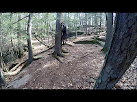
Photos of Walpole Mountain Bike


Current Trail Warnings
| status | trail | date | condition | user | info |
|---|---|---|---|---|---|
| Enough with the Turns | Jun 20, 2026 @ 12:38pm (America/New_York) 2 days | Unknown | jkelly-545 | tree down, blocking trail at bottom of... | |
| Main Adams Farm Loop (Blue Markers) | Jun 15, 2026 @ 7:36pm (America/New_York) Jun 15, 2026 | Unknown | smpratt02030 | Large tree down across trail, blocking trail |
Recent Trail Reports
| status | trail | date | condition | info | user |
|---|---|---|---|---|---|
| Over the Bridges Through the Swamp | Apr 14, 2026 @ 3:23pm (America/New_York) Apr 14, 2026 | Variable | smpratt02030 | ||
| Red Trail and Loop (Red Markers) | Mar 26, 2026 @ 6:44pm (America/New_York) Mar 26, 2026 | Unknown | drummstick | ||
| What's Old Is New Again | Mar 21, 2026 @ 11:18am (America/New_York) Mar 21, 2026 | Ideal | Tuffmofo | ||
| Lost Woods Loop | Mar 21, 2026 @ 11:18am (America/New_York) Mar 21, 2026 | Ideal | Tuffmofo | ||
| Vernal Pool Trail | Mar 21, 2026 @ 11:18am (America/New_York) Mar 21, 2026 | Ideal | Tuffmofo | ||
| Extra Loop | Mar 21, 2026 @ 11:18am (America/New_York) Mar 21, 2026 | Ideal | Tuffmofo | ||
| Old Scout Land | Mar 21, 2026 @ 11:18am (America/New_York) Mar 21, 2026 | Ideal | Tuffmofo | ||
| East Ridge Link | Jan 22, 2026 @ 4:12pm (America/New_York) Jan 22, 2026 | Snow Covered | mappermook TRAILFORKS | ||
| Upper Richardson Trail | Jan 22, 2026 @ 4:12pm (America/New_York) Jan 22, 2026 | Variable | mappermook TRAILFORKS | ||
| East Corner BCT Cutoff | Jan 22, 2026 @ 4:12pm (America/New_York) Jan 22, 2026 | Snow Covered | mappermook TRAILFORKS |
Activity Feed
| username | action | type | title | date |
|---|---|---|---|---|
| jkelly-545 | add | report | activity #97405569 | Jun 20, 2026 @ 9:38am 2 days |
| P3harrington | add | report | activity #97145449 | Jun 16, 2026 @ 4:28pm Jun 16, 2026 |
| smpratt02030 | add | report | activity #97073306 | Jun 15, 2026 @ 4:36pm Jun 15, 2026 |
| MatthewaJuxxj | wishlist | region | activity #95995514 | May 31, 2026 @ 7:43pm May 31, 2026 |
| BikeRegCom | add | event | activity #94999032 | May 18, 2026 @ 2:02pm May 18, 2026 |
Recent Comments
| username | type | title | comment | date |
|---|---|---|---|---|
| trail | One of the more tech trails at Adams. Actually... | Aug 25, 2025 @ 8:32am Aug 25, 2025 | ||
| trail | There is now significant trail braiding with... | Aug 20, 2024 @ 7:46pm Aug 20, 2024 | ||
| trail | The BCT in this area is not accurately mapped,... | Jul 18, 2024 @ 7:46pm Jul 18, 2024 | ||
| trail | In the summer, there is no trailhead on the... | Jun 26, 2024 @ 2:41pm Jun 26, 2024 | ||
| trail | If you are approaching this trail from the... | Jun 2, 2024 @ 5:41pm Jun 2, 2024 |
Local Badges
-

Epic Ride Climb 2k0 awarded -

Climbing 10k Badge13 awarded -

Climbing 100k Badge0 awarded -

Epic Ride Descent 2k0 awarded -

Descent 10k Badge14 awarded -

Descent 100k Badge0 awarded
Activity Type Stats
| activitytype | trails | distance | descent | descent distance | total vertical | rating | global rank | state rank | photos | reports | routes | ridelogs |
|---|---|---|---|---|---|---|---|---|---|---|---|---|
| Mountain Bike | 295 | 60 miles | 2,871 ft | 20 miles | 171 ft | #1,082 | #420 | 64 | 727 | 13 | 7,624 | |
| E-Bike | 23 | 2 miles | 180 ft | 5,085 ft | 128 ft | #8,331 | #2,533 | 646 | 46 | |||
| Hike | 294 | 60 miles | 2,874 ft | 20 miles | 171 ft | #2,247 | #909 | 713 | 2 | 115 | ||
| Trail Running | 288 | 59 miles | 2,822 ft | 20 miles | 171 ft | #1,745 | #580 | 713 | 626 | |||
| Snowshoe | 69 | 10 miles | 430 ft | 3 miles | 128 ft | #929 | #444 | 2 | 12 | |||
| Backcountry Ski | 3 | 1,119 ft | 36 ft | 135 ft | 46 ft | 1 | ||||||
| Nordic Ski | 47 | 8 miles | 325 ft | 2 miles | 128 ft | #1,195 | #530 | 2 | 41 |
Frequently Asked Questions About Walpole
▼
What are the best places to ride in Walpole?
Walpole has 5 areas to explore for mountain biking. The top rated areas are:
▼
What are the highest rated mountain biking trails in Walpole?
The highest rated mountain biking trails in Walpole are:
- Enough with the Turns (4.4/5)
- AF Connector 2 (4.1/5)
- Adams Farm Road (part 1) (4.1/5)
- AFR Connector 1 (4.1/5)
- Connector (4.1/5)
▼
What is the best time of the year to ride in Walpole?
Based on ride log data, the most popular months to ride in Walpole are:
- July (171 activities)
- August (159 activities)
- September (157 activities)
▼
Where can I park to ride in Walpole?
There are 9 parking locations listed in Walpole. The most popular parking spots are:
- Parking
- Small Red Gate Farm Parking Area
- Roadside Lot Parking
- Eleanor N. Johnson Parking Lot
- Walpole Town Forest West Parking Area
Activities
Trails
Points of Interest
- By markholloway
 Trailforks Map Team & contributors
 - Admins: SEMASS NEMBA
- #18201 - 3,378 views
- walpole activity log | embed map of Walpole mountain bike trails | walpole mountain biking points of interest
Downloading of trail gps tracks in kml & gpx formats is enabled for Walpole.
You must login to download files.