close
-
Layers w
- Weather Layers
- Pro
- Pro
- Pro
- Pro
- Pro
- Pro
- More Layers
- Pro
- Pro
- Pro
- Pro
-
Upgrade to

3D
Trail Conditions
- Unknown
- Snow Groomed
- Snow Packed
- Snow Covered
- Snow Cover Partial
- Freeze/thaw Cycle
- Icy
- Prevalent Mud
- Wet
- Variable
- Ideal
- Dry
- Very Dry
Trail Flow (Ridden Direction)
Trailforks scans users ridelogs to determine the most popular direction each trail is ridden. A good flowing trail network will have most trails flowing in a single direction according to their intension.
The colour categories are based on what percentage of riders are riding a trail in its intended direction.
The colour categories are based on what percentage of riders are riding a trail in its intended direction.
- > 96%
- > 90%
- > 80%
- > 70%
- > 50%
- < 50%
- bi-directional trail
- no data
Trail Last Ridden
Trailforks scans ridelogs to determine the last time a trail was ridden.
- < 2 days
- < 1 week
- < 2 weeks
- < 1 month
- < 6 months
- > 6 months
Trail Ridden Direction
The intended direction a trail should be ridden.
- Downhill Only
- Downhill Primary
- Both Directions
- Uphill Primary
- Uphill Only
- One Direction
Contribute Details
Colors indicate trail is missing specified detail.
- Description
- Photos
- Description & Photos
- Videos
Trail Popularity ?
Trailforks scans ridelogs to determine which trails are ridden the most in the last 9 months.
Trails are compared with nearby trails in the same city region with a possible 25 colour shades.
Think of this as a heatmap, more rides = more kinetic energy = warmer colors.
- most popular
- popular
- less popular
- not popular
ATV/ORV/OHV Filter
Max Vehicle Width
inches
US Cell Coverage
Legend

Radar Time
Activity Recordings
Trailforks uses anonymized public activity data.
?
Activity Recordings
Trailforks uses anonymized public activity data.
?
Personal Heatmap
▶
Activity Types
all
/
none
▶
Options
2
Date range
month
–
Winter Trails
Warning
A routing network for winter maps does not exist. Selecting trails using the winter trails layer has been disabled.
Missing Trails
Most Popular
Least Popular
Trails are colored based on popularity. The more popular a trail is, the more red. Less popular trails trend towards green.
Jump Magnitude Heatmap
Heatmap of where riders jump on trails. Zoom in to see individual jumps, click circles to view jump details.
BC Backroad Status
![map legend]()
Service Road Atlas is a free to use, community-driven service for viewing and creating reports on the numerous back-country service roads around B.C. and Alberta.

Slope Aspect
Direction the slope faces
Trails Deemphasized
Trails are shown in grey.
Only show trails with no bike usage.
Suggested Layers
Based on selected activity type
Save the current map location and zoom level as your default home location whenever this page is loaded.
SaveWard Mountain Recreation Area North and South trailheads are separately administered by the BLM and the U.S. Forest Service. A developed and newly renovated campground is located at the US Forest Service Trailhead on the South side of the Highway. Trails (20 miles) are available for hikers, bikers, cross-country skiers, and horses. Warming/rest shelters are available along several of the trails. Restrooms are available at both trailheads. For more information on the Forest Service campground and trailhead, you can contact the U.S.F.S., Ely Ranger District (775) 289-3031. Things to note: At the North trailhead there are 4 trail loops of various lengths: 10 miles total that meander through the sagebrush and pinyon-juniper forests of Ward Mountain. These trails are available for hikers, bikers, cross-country skiers, and horses. Warming huts/rest shelters are available along these trails. There is an interpretive hike (0.4 miles) “Weeds of the Great Basin” with 12 interpretive signs placed at various intervals. Other amenities: Picnic tables, shade structures, trash cans and restrooms at trailhead. No potable water at North trailhead. Restrictions: Motorized use is prohibited on the signed trail system. Shooting is not allowed within developed recreation sites.
Primary Trail Type: Cross-Country
Shuttleable: YES
Land Status: National Forest
 google parking directions
 Access Info:
Trails can be accessed from the Ward Mountain Recreation Area, 10 miles west of Ely on Hwy 6. The Ice Plant trails can be accessed from 80th West on Hwy 6, where the speed limit reaches 55 mph. Follow this road to the power line road and park at the 3rd turn on the right. You can also ride to this area direct from the White Pine Courthouse or Great Basin Community College. NF Road 440 allows access to the top for shuttling purposes. Please, be respectful of established roads and parking areas, as well as the privacy of homes in the area.
Activities Click to view
- Mountain Bike
49 trails
- E-Bike
41 trails
- Hike
49 trails
- Trail Running
49 trails
- ATV/ORV/OHV
6 trails
- Snowshoe
9 trails
Region Details
- 12
- 1
- 25
- 8
- 1
- 1
Region Status
Open as of Jun 6, 2026Local Trail Association
Stats
- Avg Trail Rating
- Trails (view details)
- 48
- Trails Mountain Bike
- 51
- Trails E-Bike
- 41
- Trails Winter Fat Bike
- 3
- Trails Horse
- 3
- Trails Hike
- 49
- Trails Trail Running
- 49
- Trails Dirtbike/Moto
- 3
- Trails ATV/ORV/OHV
- 6
- Trails Snowmobile
- 1
- Trails Snowshoe
- 9
- Trails Backcountry Ski
- 3
- Trails Nordic Ski
- 1
- Total Distance
- 50 miles
- Total Descent
- 8,278 ft
- Total Vertical
- 1,678 ft
- Highest Trailhead
- 8,344 ft
- Reports
- 276
- Photos
- 116
- Ridden Counter
- 4,960
Articles
Mountain Bike News, Photos, Videos & Events | Pinkbike
Apr 13, 2026 from betamtb.com
Pinkbike is the homepage of mountain biking. Stay updated with the latest news, reviews, videos, buyer's guides and racing results. Join the...
Popular Ward Mountain Mountain Biking Trails
• 100 ★ 4.8 • 4,961 ft • 0 ft • 326 •
This is a downhill option around the jump section of . It is very fast and flowy, but don't overshoot the !
• 85 ★ 3.9 • 4 miles • 5 ft • 278 •
This is the main trail above Canyon. There are various options and side trails for riding this, including a shuttle from the top. The trail is mostly smooth downhill with some rocky areas, a few features, and optional jumps at the...
• 100 ★ 2.0 • 2 miles • 34 ft • 278 •
This is typically the downhill side of the system. It features a fast, narrow trail through meadows and a winding descent through a wash to the bottom. Riders can follow the power line road back to the lower parking area for .
• 90 ★ 4.0 • 2,661 ft • 46 ft • 267 •
This is a narrow cross trail, often used for a loop option.
• 90 ★ 5.0 • 1 mile • 91 ft • 267 •
New Trail built by Great Basin Trail Alliance to avoid ATV/ Quad/ Moto traffic
• 90 ★ 5.0 • 1,411 ft • 106 ft • 240 •
Flow Trail built by Great Basin Trails Alliance working with USFS. Non motorized.
• 75 ★ 4.0 • 1,962 ft • 6 ft • 225 •
Popular green difficulty singletrack. This mountain bike primary trail and has a easy overall physical rating with a 6 ft green climb. On average it takes 3 minutes to complete this trail.
Ward Mountain Mountain Bike Routes
★ 5.0 • 6 miles • 694 ft • 5 •
Ensure all intersection are clearly marked.
4 miles • 642 ft • 3 •
Shown on the map is the section that we don't use in the race, I just built it as a loop because that is...
5 miles • 935 ft • 3 •
The intersection at the beginning of has been confusing for some riders.
2 miles • 243 ft • 2 •
4 miles • 588 ft • 7 •
A great variety of trails to showcase what the area has to offer. Takes 1 to 1 1/2 hours total to enjoy....
8 miles • 1,071 ft • 3 •
Start at Mt Recreation Area Campground South Trailhead
Photos of Ward Mountain Mountain Bike
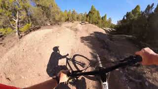
Videos of Ward Mountain Mountain Bike

trail: Duck Hill
4:25 |
179 |
May 20, 2024 , Ely
trail: The Whoops
4:25 |
211 |
May 20, 2024 , Ely

trail: Lower Total BS
14:43 |
146 |
Nov 5, 2023 , Ely

trail: Total BS
14:43 |
161 |
Nov 5, 2023 , Ely

trail: Powderberry Divide
15:32 |
256 |
Oct 9, 2023 , Ely

trail: The Whoops
12:55 |
139 |
Oct 5, 2023 , Ely

trail: Duck Hill
12:55 |
110 |
Oct 5, 2023 , Ely

trail: Tokie Dokie
12:55 |
171 |
Oct 5, 2023 , Ely
Recent Trail Reports
| status | trail | date | condition | info | user |
|---|---|---|---|---|---|
| Birkebeiner Loop D | Jun 6, 2026 @ 2:38pm (America/Los_Angeles) Jun 6, 2026 | Unknown | tobypalmer1 | ||
| Powderberry Divide | Jun 4, 2026 @ 4:38pm (America/Los_Angeles) Jun 4, 2026 | Dry | aobbard | ||
| FreeWheeler | Jun 4, 2026 @ 4:36pm (America/Los_Angeles) Jun 4, 2026 | Ideal | aobbard | ||
| Total BS | May 24, 2026 @ 9:22am (America/Boise) May 24, 2026 | Ideal | ride-singletrack23 | ||
| Lower Total BS | May 24, 2026 @ 9:22am (America/Boise) May 24, 2026 | Very Dry | ride-singletrack23 | ||
| Senior Moment | May 24, 2026 @ 9:22am (America/Boise) May 24, 2026 | Ideal | ride-singletrack23 | ||
| G Loop | Jun 16, 2025 @ 7:18am Jun 16, 2025 | Dry | oppesaddle3 | ||
| G Loop Connector | Jun 16, 2025 @ 7:18am Jun 16, 2025 | Dry | oppesaddle3 | ||
| Tokie Dokie | Aug 10, 2024 @ 7:12pm Aug 10, 2024 | Dry | Etinlv | ||
| Tin Pan Alley | Apr 11, 2024 @ 6:18pm Apr 11, 2024 | Ideal | Paorton |
Activity Feed
| username | action | type | title | date |
|---|---|---|---|---|
| brasian | rsvp | event | activity #96837946 | Jun 12, 2026 @ 5:20pm Jun 12, 2026 |
| Ethanoutside | rsvp | event | activity #96778553 | Jun 11, 2026 @ 7:20pm Jun 11, 2026 |
| Runnerguy65 | wishlist | trail | activity #96670946 | Jun 10, 2026 @ 7:17am Jun 10, 2026 |
| kelernest | update | event | activity #96574549 | Jun 8, 2026 @ 5:23pm Jun 8, 2026 |
| G8jLGgLw | vote | route | activity #96429544 | Jun 6, 2026 @ 9:26pm Jun 6, 2026 |
Recent Comments
| username | type | title | comment | date |
|---|---|---|---|---|
| trail | Really cool descent. Old school, twisty, loose... | Jun 4, 2026 @ 4:39pm Jun 4, 2026 | ||
| trail | Mellow easy climb through pretty hills with... | Jun 4, 2026 @ 4:36pm Jun 4, 2026 | ||
| trail | Definitely glad I listened to the people... | Jun 10, 2025 @ 1:13pm Jun 10, 2025 | ||
| trail | Overgrown, and kind of sandy double track. ... | Jun 9, 2025 @ 12:03pm Jun 9, 2025 | ||
| trail | This is a double track. Don’t waste ur time. | Apr 21, 2025 @ 9:09pm Apr 21, 2025 |
Nearby Areas
| name | distance | ||||
|---|---|---|---|---|---|
| Squaw Peak | 2 | 1 | 4.8 km | ||
| Ward Charcoal Ovens State Park | 4 | 3 | 12.1 km | ||
| Cave Lake State Park | 3 | 6 | 12.8 km | ||
| Northern Schell Creek Range | 33.5 km |
Local Badges
-

Completionist0 awarded
Local Mountain Biking Directory
-
SportsWorld
-
Great Basin Trails StewardshipTrail Association
![Great Basin Trails Stewardship]()
Activity Type Stats
| activitytype | trails | distance | descent | descent distance | total vertical | rating | global rank | state rank | photos | reports | routes | ridelogs |
|---|---|---|---|---|---|---|---|---|---|---|---|---|
| Mountain Bike | 49 | 50 miles | 8,278 ft | 22 miles | 1,677 ft | #3,001 | #1,040 | 121 | 284 | 11 | 3,362 | |
| E-Bike | 41 | 32 miles | 4,065 ft | 12 miles | 1,627 ft | #3,409 | #1,007 | 258 | 348 | |||
| Winter Fat Bike | 3 | #3,029 | #1,418 | 2 | 1 | |||||||
| Horse | 3 | 5 miles | 220 ft | 3,241 ft | 1,509 ft | 6 | ||||||
| Hike | 49 | 49 miles | 7,913 ft | 21 miles | 1,677 ft | #4,533 | #1,619 | 3 | 284 | 1 | 92 | |
| Trail Running | 49 | 49 miles | 7,913 ft | 21 miles | 1,677 ft | #3,667 | #1,007 | 284 | 1 | 51 | ||
| Dirtbike/Moto | 3 | 5 miles | 220 ft | 3,241 ft | 1,509 ft | 6 | ||||||
| ATV/ORV/OHV | 6 | 7 miles | 259 ft | 4,216 ft | 1,509 ft | #679 | #324 | 6 | ||||
| Snowmobile | 1 | 1 mile | 138 ft | 52 ft | 1 | |||||||
| Snowshoe | 9 | 6 miles | 1,552 ft | 4 miles | 1,430 ft | #1,270 | #664 | 3 | 3 | |||
| Backcountry Ski | 3 | 5 miles | 1,552 ft | 4 miles | 1,358 ft | 2 | 1 | |||||
| Nordic Ski | 1 | 2 | 5 |
Frequently Asked Questions About Ward Mountain
▼
What are the highest rated mountain biking trails in Ward Mountain?
The highest rated mountain biking trails in Ward Mountain are:
- The Whoops (4.4/5)
- Rope Tow (4.2/5)
- Making Pancakes (4.2/5)
- Total BS (4.1/5)
- Upper Iceplant (4.1/5)
▼
What is the best time of the year to ride in Ward Mountain?
Based on ride log data, the most popular months to ride in Ward Mountain are:
- June (36 activities)
- September (34 activities)
- May (27 activities)
▼
Where can I park to ride in Ward Mountain?
There are 6 parking locations listed in Ward Mountain. The most popular parking spots are: View all parking and trailhead locations on the map to plan your visit.
▼
What is the longest trail in Ward Mountain?
The longest trail in Ward Mountain is G Loop at 4.7 miles. View all trails sorted by distance.
Activities
Trails
- By natenbake & contributors
- Admins: GBTS
- #3387 - 9,416 views
- ward mountain activity log | embed map of Ward Mountain mountain bike trails | ward mountain mountain biking points of interest
Downloading of trail gps tracks in kml & gpx formats is enabled for Ward Mountain.
You must login to download files.