close
-
Layers w
- Weather Layers
- Pro
- Pro
- Pro
- Pro
- Pro
- Pro
- More Layers
- Pro
- Pro
- Pro
- Pro
-
Upgrade to

3D
Trail Conditions
- Unknown
- Snow Groomed
- Snow Packed
- Snow Covered
- Snow Cover Partial
- Freeze/thaw Cycle
- Icy
- Prevalent Mud
- Wet
- Variable
- Ideal
- Dry
- Very Dry
Trail Flow (Ridden Direction)
Trailforks scans users ridelogs to determine the most popular direction each trail is ridden. A good flowing trail network will have most trails flowing in a single direction according to their intension.
The colour categories are based on what percentage of riders are riding a trail in its intended direction.
The colour categories are based on what percentage of riders are riding a trail in its intended direction.
- > 96%
- > 90%
- > 80%
- > 70%
- > 50%
- < 50%
- bi-directional trail
- no data
Trail Last Ridden
Trailforks scans ridelogs to determine the last time a trail was ridden.
- < 2 days
- < 1 week
- < 2 weeks
- < 1 month
- < 6 months
- > 6 months
Trail Ridden Direction
The intended direction a trail should be ridden.
- Downhill Only
- Downhill Primary
- Both Directions
- Uphill Primary
- Uphill Only
- One Direction
Contribute Details
Colors indicate trail is missing specified detail.
- Description
- Photos
- Description & Photos
- Videos
Trail Popularity ?
Trailforks scans ridelogs to determine which trails are ridden the most in the last 9 months.
Trails are compared with nearby trails in the same city region with a possible 25 colour shades.
Think of this as a heatmap, more rides = more kinetic energy = warmer colors.
- most popular
- popular
- less popular
- not popular
ATV/ORV/OHV Filter
Max Vehicle Width
inches
US Cell Coverage
Legend

Radar Time
Activity Recordings
Trailforks uses anonymized public activity data.
?
Activity Recordings
Trailforks uses anonymized public activity data.
?
Personal Heatmap
▶
Activity Types
all
/
none
▶
Options
2
Date range
month
–
Winter Trails
Warning
A routing network for winter maps does not exist. Selecting trails using the winter trails layer has been disabled.
Missing Trails
Most Popular
Least Popular
Trails are colored based on popularity. The more popular a trail is, the more red. Less popular trails trend towards green.
Jump Magnitude Heatmap
Heatmap of where riders jump on trails. Zoom in to see individual jumps, click circles to view jump details.
BC Backroad Status
![map legend]()
Service Road Atlas is a free to use, community-driven service for viewing and creating reports on the numerous back-country service roads around B.C. and Alberta.

Slope Aspect
Direction the slope faces
Trails Deemphasized
Trails are shown in grey.
Only show trails with no bike usage.
Suggested Layers
Based on selected activity type
Save the current map location and zoom level as your default home location whenever this page is loaded.
Save
No description for Warda has been added yet!
Login or register to submit one.
Activities Click to view
- Mountain Bike
18 trails
- Adaptive Bike
0 trails
- Hike
1 trails
- Trail Running
1 trails
Region Details
- 9
- 9
Region Status
Open as of Apr 12, 2025Stats
- Avg Trail Rating
- Trails (view details)
- 18
- Trails Mountain Bike
- 18
- Trails Hike
- 1
- Trails Trail Running
- 1
- Total Distance
- 9 miles
- Total Descent
- 461 ft
- Total Vertical
- 81 ft
- Highest Trailhead
- 391 ft
- Reports
- 270
- Photos
- 14
- Ridden Counter
- 8,923
Sub Regions
-
Bluff Creek Ranch
- 9
- 9
Popular Warda Mountain Biking Trails
• 85 ★ 3.7 • 2,422 ft • 25 ft • 560 •
Popular green difficulty singletrack. This mountain bike primary trail can be used one direction. On average it takes 2 minutes to complete this trail.
• 80 ★ 3.5 • 1 mile • 46 ft • 550 •
Popular blue difficulty singletrack. This mountain bike primary trail can be used one direction. On average it takes 5 minutes to complete this trail.
• 100 ★ 4.0 • 981 ft • 0 ft • 548 •
Popular green difficulty singletrack. This mountain bike primary trail can be used one direction. On average it takes minutes to complete this trail.
• 90 ★ 4.4 • 692 ft • 5 ft • 542 •
Popular blue difficulty singletrack. This mountain bike primary trail can be used one direction. On average it takes 1 minutes to complete this trail.
• 75 ★ 4.5 • 1 mile • 122 ft • 539 •
Popular blue difficulty singletrack. This mountain bike primary trail can be used one direction. On average it takes 5 minutes to complete this trail.
• 35 ★ 4.5 • 1,509 ft • 36 ft • 535 •
Less popular blue difficulty singletrack. This mountain bike primary trail can be used one direction. On average it takes 3 minutes to complete this trail.
• 60 ★ 4.0 • 1,030 ft • 10 ft • 529 •
Moderately popular blue difficulty singletrack. This mountain bike primary trail can be used one direction. It features bridge. On average it takes 1 minutes to complete this trail.
• 95 ★ 3.0 • 420 ft • 31 ft • 519 •
Popular blue difficulty singletrack. This mountain bike primary trail can be used one direction. On average it takes minutes to complete this trail.
Warda Mountain Bike Routes
5 miles • 199 ft • 6 • Loop • Race •
The Lake Travis MTB NICA (National Interscholastic Cycling Association) Coaches have put together this...
8 miles • 413 ft • 19 • Race •
The Final Race of the Trek Texas 2024 XC MTB Texas State Championship Series
★ 2.0 • 6 miles • 205 ft • 7 • Loop • Race •
Official 12 and Under race loop for The Warda Race
★ 5.0 • 8 miles • 413 ft • 19 • Race •
The Final Race of the TMBRA XC MTB State Championship Series p/b NBLS Trailworks
★ 5.0 • 7 miles • 304 ft • 15 • Loop • Race •
Blazing Saddles Fueled by Crankbox. Event Timeline: • Pre-riding – anytime leading up to the event...
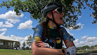
Photos of Warda Mountain Bike
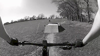
Videos of Warda Mountain Bike
trail: Gas Pass
4:31 |
52 |
Apr 11, 2023
trail: Gas Pass
6:43 |
256 |
Feb 17, 2015
trail: The Pass
4:29 |
597 |
Jul 31, 2013

43:46 |
189 |
Jan 6, 2025

trail: Roller Coasters
26:09 |
136 |
Jan 15, 2024 , Warda

trail: Fairlane Pasture
26:09 |
129 |
Jan 15, 2024 , Warda

trail: Pay Dirt Bridge
26:09 |
127 |
Jan 15, 2024 , Warda

trail: The Palisades
26:09 |
210 |
Jan 15, 2024 , Warda
Recent Trail Reports
| status | trail | date | condition | info | user |
|---|---|---|---|---|---|
| Fairlane Pasture | Apr 12, 2025 @ 9:59am Apr 12, 2025 | Ideal | LDJBaxter | ||
| 30 Aker Woods | Apr 12, 2025 @ 9:59am Apr 12, 2025 | Ideal | LDJBaxter | ||
| Deer Park Tank | Apr 12, 2025 @ 9:59am Apr 12, 2025 | Ideal | LDJBaxter | ||
| Roller Coasters | Apr 12, 2025 @ 9:59am Apr 12, 2025 | Ideal | LDJBaxter | ||
| BMX | Apr 12, 2025 @ 9:59am Apr 12, 2025 | Ideal | LDJBaxter | ||
| The Palisades | Apr 12, 2025 @ 9:59am Apr 12, 2025 | Ideal | LDJBaxter | ||
| Pay Dirt Bridge | Apr 12, 2025 @ 9:59am Apr 12, 2025 | Ideal | LDJBaxter | ||
| Mule Trace | Apr 12, 2025 @ 9:59am Apr 12, 2025 | Ideal | LDJBaxter | ||
| Turkey Tank | Feb 1, 2025 @ 10:15am Feb 1, 2025 | Ideal | Fipogg | ||
| Bike Jump | Feb 1, 2025 @ 10:15am Feb 1, 2025 | Ideal | Fipogg |
Activity Feed
| username | action | type | title | date |
|---|---|---|---|---|
| JasoniKD4Vn | ridden | route | activity #94748334 | May 15, 2026 @ 7:04am May 15, 2026 |
| BenxYhQIw | wishlist | route | activity #94473207 | May 10, 2026 @ 6:34pm May 10, 2026 |
| davebellante | update | route | activity #93716122 | Apr 30, 2026 @ 8:56am Apr 30, 2026 |
| JasoniKD4Vn | wishlist | region | activity #92247077 | Apr 9, 2026 @ 5:42am Apr 9, 2026 |
| davebellante | update | route | activity #91603458 | Mar 30, 2026 @ 1:03pm Mar 30, 2026 |
Local Badges
-

Epic Ride Climb 2k4 awarded -

Climbing 10k Badge3 awarded -

Climbing 100k Badge0 awarded -

Epic Ride Descent 2k4 awarded -

Descent 10k Badge3 awarded -

Descent 100k Badge0 awarded
Bike & Skill Parks
| name | type | city | rating |
|---|---|---|---|
| Bluff Creek Ranch | bike park | Warda |
Activity Type Stats
| activitytype | trails | distance | descent | descent distance | total vertical | rating | global rank | state rank | photos | reports | routes | ridelogs |
|---|---|---|---|---|---|---|---|---|---|---|---|---|
| Mountain Bike | 18 | 9 miles | 459 ft | 3 miles | 82 ft | #2,078 | #745 | 14 | 270 | 6 | 3,126 | |
| Hike | 1 | 3,845 ft | 20 ft | 945 ft | 16 ft | #13,457 | #4,877 | 269 | 9 | |||
| Trail Running | 1 | 3,845 ft | 20 ft | 945 ft | 16 ft | #13,010 | #4,590 | 269 | 17 |
Frequently Asked Questions About Warda
▼
What are the best places to ride in Warda?
Warda has 1 areas to explore for mountain biking. The top rated areas are:
▼
What are the highest rated mountain biking trails in Warda?
The highest rated mountain biking trails in Warda are:
- Gas Pass (4.2/5)
- Fairlane Pasture (4.2/5)
- Roller Coasters (4.2/5)
- Short Cut (4.1/5)
- The Palisades (4.1/5)
▼
What is the best time of the year to ride in Warda?
Based on ride log data, the most popular months to ride in Warda are:
- October (17 activities)
- May (16 activities)
- April (15 activities)
▼
Where can I park to ride in Warda?
Check the Warda trail map for trailhead and parking information. Community members regularly update access and parking details for trails in the area.
- By Larsacus
 TRAILFORKS & contributors
 - Admins: apply
- #19828 - 3,177 views
- warda activity log | embed map of Warda mountain bike trails | warda mountain biking points of interest
Downloading of trail gps tracks in kml & gpx formats is enabled for Warda.
You must login to download files.