close
-
Layers w
- Weather Layers
- Pro
- Pro
- Pro
- Pro
- Pro
- Pro
- More Layers
- Pro
- Pro
- Pro
- Pro
-
Upgrade to

3D
Trail Conditions
- Unknown
- Snow Groomed
- Snow Packed
- Snow Covered
- Snow Cover Partial
- Freeze/thaw Cycle
- Icy
- Prevalent Mud
- Wet
- Variable
- Ideal
- Dry
- Very Dry
Trail Flow (Ridden Direction)
Trailforks scans users ridelogs to determine the most popular direction each trail is ridden. A good flowing trail network will have most trails flowing in a single direction according to their intension.
The colour categories are based on what percentage of riders are riding a trail in its intended direction.
The colour categories are based on what percentage of riders are riding a trail in its intended direction.
- > 96%
- > 90%
- > 80%
- > 70%
- > 50%
- < 50%
- bi-directional trail
- no data
Trail Last Ridden
Trailforks scans ridelogs to determine the last time a trail was ridden.
- < 2 days
- < 1 week
- < 2 weeks
- < 1 month
- < 6 months
- > 6 months
Trail Ridden Direction
The intended direction a trail should be ridden.
- Downhill Only
- Downhill Primary
- Both Directions
- Uphill Primary
- Uphill Only
- One Direction
Contribute Details
Colors indicate trail is missing specified detail.
- Description
- Photos
- Description & Photos
- Videos
Trail Popularity ?
Trailforks scans ridelogs to determine which trails are ridden the most in the last 9 months.
Trails are compared with nearby trails in the same city region with a possible 25 colour shades.
Think of this as a heatmap, more rides = more kinetic energy = warmer colors.
- most popular
- popular
- less popular
- not popular
ATV/ORV/OHV Filter
Max Vehicle Width
inches
US Cell Coverage
Legend

Radar Time
Activity Recordings
Trailforks uses anonymized public activity data.
?
Activity Recordings
Trailforks uses anonymized public activity data.
?
Personal Heatmap
▶
Activity Types
all
/
none
▶
Options
2
Date range
month
–
Winter Trails
Warning
A routing network for winter maps does not exist. Selecting trails using the winter trails layer has been disabled.
Missing Trails
Most Popular
Least Popular
Trails are colored based on popularity. The more popular a trail is, the more red. Less popular trails trend towards green.
Jump Magnitude Heatmap
Heatmap of where riders jump on trails. Zoom in to see individual jumps, click circles to view jump details.
BC Backroad Status
![map legend]()
Service Road Atlas is a free to use, community-driven service for viewing and creating reports on the numerous back-country service roads around B.C. and Alberta.

Slope Aspect
Direction the slope faces
Trails Deemphasized
Trails are shown in grey.
Only show trails with no bike usage.
Suggested Layers
Based on selected activity type
Save the current map location and zoom level as your default home location whenever this page is loaded.
Save
No description for Wasaga Beach has been added yet!
Login or register to submit one.
Activities Click to view
- Mountain Bike
171 trails
- E-Bike
15 trails
- Adaptive Bike
10 trails
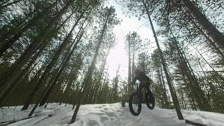
- Winter Fat Bike
10 trails
- Hike
173 trails
- Trail Running
173 trails
- Snowmobile
9 trails
- Snowshoe
108 trails
- Nordic Ski
87 trails
Region Details
- 46
- 8
- 47
- 37
- 6
Region Status
Caution as of Jun 9, 2026Stats
- Avg Trail Rating
- Trails (view details)
- 155
- Trails Mountain Bike
- 171
- Trails E-Bike
- 15
- Trails Adaptive Bike
- 10
- Trails Winter Fat Bike
- 10
- Trails Hike
- 174
- Trails Trail Running
- 173
- Trails ATV/ORV/OHV
- 1
- Trails Snowmobile
- 9
- Trails Snowshoe
- 108
- Trails Backcountry Ski
- 2
- Trails Nordic Ski
- 87
- Total Distance
- 64 miles
- Total Descent Distance
- 19 miles
- Total Descent
- 1,711 ft
- Total Vertical
- 116 ft
- Highest Trailhead
- 706 ft
- Reports
- 61
- Photos
- 60
- Ridden Counter
- 6,072
Sub Regions
-
Wasaga Beach Provincial Park
- 3
- 39
- 35
- 6
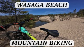
Popular Wasaga Beach Mountain Biking Trails
• 100 ★ 2.8 • 2 miles • 35 ft • 104 •
Popular blue difficulty mixed. This multi-use trail can be used both directions and has a moderate overall physical rating with a 35 ft blue climb. On average it takes 57 minutes to complete this trail.
Wasaga Beach Mountain Bike Routes
★ 3.0 • 9 miles • 139 ft • 0 • Loop •
Easy 14k loop through Wasaga Beach Provincial Park.
Photos of Wasaga Beach Mountain Bike
Videos of Wasaga Beach Mountain Bike

trail: 2nd Bluff Trail
0:29 |
|
Mar 23, 2024
14:56 |
235 |
May 26, 2024
trail: Fox Run
17:45 |
154 |
May 10, 2023 , Wasaga Beach
Current Trail Warnings
| status | trail | date | condition | user | info |
|---|---|---|---|---|---|
| Blue Fat Bike Trail | Jun 9, 2026 @ 3:51pm (America/Toronto) Jun 9, 2026 | Prevalent Mud | pkofman |
Recent Trail Reports
| status | trail | date | condition | info | user |
|---|---|---|---|---|---|
| Klondike | Oct 13, 2025 @ 2:56pm (America/Toronto) Oct 13, 2025 | Unknown | trailforksKevin | ||
| Advanced Snowshoe Trail | Sep 27, 2025 @ 11:02am (America/Toronto) Sep 27, 2025 | Ideal | Jimmyp39 | ||
| Black Fat Bike Trail | Sep 27, 2025 @ 11:02am (America/Toronto) Sep 27, 2025 | Ideal | Jimmyp39 | ||
| Black Fat Bike Trail | Sep 27, 2025 @ 11:02am (America/Toronto) Sep 27, 2025 | Ideal | Jimmyp39 | ||
| Black Fat Bike Trail | Sep 27, 2025 @ 11:02am (America/Toronto) Sep 27, 2025 | Ideal | Jimmyp39 | ||
| Howland | Sep 27, 2025 @ 11:02am (America/Toronto) Sep 27, 2025 | Ideal | Jimmyp39 | ||
| Schrei Ski | Sep 27, 2025 @ 11:02am (America/Toronto) Sep 27, 2025 | Ideal | Jimmyp39 | ||
| Connector Trail | Aug 17, 2025 @ 9:37am Aug 17, 2025 | Ideal | Jimmyp39 | ||
| Snowshoe Trail | Aug 17, 2025 @ 9:37am Aug 17, 2025 | Ideal | Jimmyp39 | ||
| Ganaraska Trail | Aug 17, 2025 @ 9:37am Aug 17, 2025 | Ideal | Jimmyp39 |
Activity Feed
| username | action | type | title | date |
|---|---|---|---|---|
| AdamChedIs3z9u | add | trail | activity #97309401 and 6 more | Jun 19, 2026 @ 5:19am 1 day |
| 4s7ILK | wishlist | route | activity #97274868 | Jun 18, 2026 @ 1:59pm 2 days |
| AdamChedIs3z9u | add | trail | activity #97263599 and 3 more | Jun 18, 2026 @ 11:00am 2 days |
| pkofman | add | report | activity #96631976 | Jun 9, 2026 @ 3:10pm Jun 9, 2026 |
| GHKlh5W | wishlist | trail | activity #95940879 | May 31, 2026 @ 8:04am May 31, 2026 |
Recent Comments
| username | type | title | comment | date |
|---|---|---|---|---|
| trail | Gpa + Sons Vetrans review...An Excelent warm... | Oct 10, 2025 @ 8:28am Oct 10, 2025 | ||
| trail | GPa fave Flow with side view fauna enhanced vibe. | Oct 10, 2025 @ 8:02am Oct 10, 2025 | ||
| trail | Nice flowy open ridge side views with dappled... | Oct 10, 2025 @ 7:53am Oct 10, 2025 | ||
| trail | No Flow To many super steep trails of sand... | Oct 10, 2025 @ 7:44am Oct 10, 2025 | ||
| trail | East of veterans drive is a green, west of... | May 2, 2021 @ 6:21am May 2, 2021 |
Local Badges
-

Completionist0 awarded -

10 Blue Trails49 awarded -

10 Green Trails44 awarded -

Epic Mountain Bike Climb 2k0 awarded -

Climbing 10k Badge2 awarded -

Mountain Biking 100k Badge0 awarded
Bike & Skill Parks
| name | type | city | rating |
|---|---|---|---|
| Wasaga Beach Bike Park | skill park | Wasaga Beach |
Activity Type Stats
| activitytype | trails | distance | descent | descent distance | total vertical | rating | global rank | state rank | photos | reports | routes | ridelogs |
|---|---|---|---|---|---|---|---|---|---|---|---|---|
| Mountain Bike | 171 | 50 miles | 1,342 ft | 15 miles | 115 ft | #2,632 | #52 | 59 | 60 | 2 | 4,363 | |
| E-Bike | 15 | 1 mile | 33 ft | 1,883 ft | 102 ft | #7,437 | #117 | 40 | 1 | 97 | ||
| Adaptive Bike | 10 | #4,852 | #64 | |||||||||
| Winter Fat Bike | 10 | #4,837 | #58 | 5 | ||||||||
| Hike | 173 | 51 miles | 1,394 ft | 15 miles | 115 ft | #3,081 | #62 | 1 | 59 | 617 | ||
| Trail Running | 173 | 50 miles | 1,385 ft | 15 miles | 115 ft | #2,872 | #48 | 59 | 366 | |||
| ATV/ORV/OHV | 1 | 4 | 2 | |||||||||
| Snowmobile | 9 | 3 miles | 138 ft | 2 miles | 72 ft | #318 | #27 | 1 | ||||
| Snowshoe | 108 | 25 miles | 784 ft | 7 miles | 115 ft | #507 | #53 | 10 | 13 | |||
| Backcountry Ski | 2 | 3,041 ft | 33 ft | 1,883 ft | 30 ft | 1 | 22 | |||||
| Nordic Ski | 87 | 43 miles | 1,247 ft | 14 miles | 115 ft | #461 | #22 | 3 | 224 |
Frequently Asked Questions About Wasaga Beach
▼
What are the best places to ride in Wasaga Beach?
Wasaga Beach has 1 areas to explore for mountain biking. The top rated areas are:
▼
What are the highest rated mountain biking trails in Wasaga Beach?
The highest rated mountain biking trails in Wasaga Beach are:
- Ganaraska Trail (3.5/5)
- Veterans Way Bypass (0/5)
- Blue Fat Bike Trail (0/5)
- Ganaraska Ridge Connector (0/5)
- Snowshoe Trail (0/5)
▼
What is the best time of the year to ride in Wasaga Beach?
Based on ride log data, the most popular months to ride in Wasaga Beach are:
- July (72 activities)
- August (68 activities)
- June (63 activities)
▼
Where can I park to ride in Wasaga Beach?
There are 4 parking locations listed in Wasaga Beach. The most popular parking spots are: View all parking and trailhead locations on the map to plan your visit.
Activities
Trails
Points of Interest
- By markholloway
 Trailforks Map Team & contributors
 - Admins: apply
- #24550 - 8,839 views
- wasaga beach activity log | embed map of Wasaga Beach mountain bike trails | wasaga beach mountain biking points of interest
Downloading of trail gps tracks in kml & gpx formats is enabled for Wasaga Beach.
You must login to download files.