close
-
Layers w
- Weather Layers
- Pro
- Pro
- Pro
- Pro
- Pro
- Pro
- More Layers
- Pro
- Pro
- Pro
- Pro
-
Upgrade to

3D
Trail Conditions
- Unknown
- Snow Groomed
- Snow Packed
- Snow Covered
- Snow Cover Partial
- Freeze/thaw Cycle
- Icy
- Prevalent Mud
- Wet
- Variable
- Ideal
- Dry
- Very Dry
Trail Flow (Ridden Direction)
Trailforks scans users ridelogs to determine the most popular direction each trail is ridden. A good flowing trail network will have most trails flowing in a single direction according to their intension.
The colour categories are based on what percentage of riders are riding a trail in its intended direction.
The colour categories are based on what percentage of riders are riding a trail in its intended direction.
- > 96%
- > 90%
- > 80%
- > 70%
- > 50%
- < 50%
- bi-directional trail
- no data
Trail Last Ridden
Trailforks scans ridelogs to determine the last time a trail was ridden.
- < 2 days
- < 1 week
- < 2 weeks
- < 1 month
- < 6 months
- > 6 months
Trail Ridden Direction
The intended direction a trail should be ridden.
- Downhill Only
- Downhill Primary
- Both Directions
- Uphill Primary
- Uphill Only
- One Direction
Contribute Details
Colors indicate trail is missing specified detail.
- Description
- Photos
- Description & Photos
- Videos
Trail Popularity ?
Trailforks scans ridelogs to determine which trails are ridden the most in the last 9 months.
Trails are compared with nearby trails in the same city region with a possible 25 colour shades.
Think of this as a heatmap, more rides = more kinetic energy = warmer colors.
- most popular
- popular
- less popular
- not popular
ATV/ORV/OHV Filter
Max Vehicle Width
inches
US Cell Coverage
Legend

Radar Time
Activity Recordings
Trailforks uses anonymized public activity data.
?
Activity Recordings
Trailforks uses anonymized public activity data.
?
Personal Heatmap
▶
Activity Types
all
/
none
▶
Options
2
Date range
month
–
Winter Trails
Warning
A routing network for winter maps does not exist. Selecting trails using the winter trails layer has been disabled.
Missing Trails
Most Popular
Least Popular
Trails are colored based on popularity. The more popular a trail is, the more red. Less popular trails trend towards green.
Jump Magnitude Heatmap
Heatmap of where riders jump on trails. Zoom in to see individual jumps, click circles to view jump details.
BC Backroad Status
![map legend]()
Service Road Atlas is a free to use, community-driven service for viewing and creating reports on the numerous back-country service roads around B.C. and Alberta.

Slope Aspect
Direction the slope faces
Trails Deemphasized
Trails are shown in grey.
Only show trails with no bike usage.
Suggested Layers
Based on selected activity type
Save the current map location and zoom level as your default home location whenever this page is loaded.
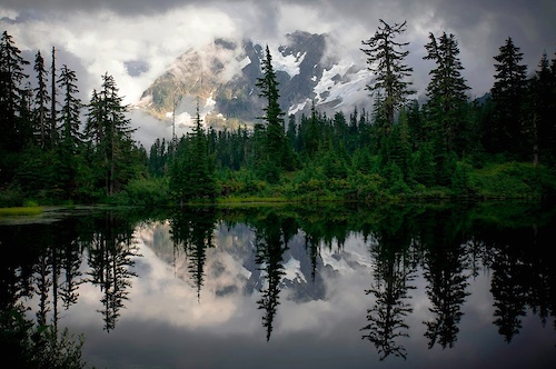
SaveWashington State has one of the most diverse climates of all of the fifty states. Within a relatively short amount of time, one can roll down trails lined with thousands of wildflowers, open fields of grass, or through pine scented forests of the central cascades. Year round riding occurs throughout the state, but perhaps there's nothing like the transition from the daily winter deluge in Western Washington to the day when the right amount of sunshine and moisture in the soil comes into equilibrium and the term "Hero dirt" or "Velcro" comes out of the mouth of every mountain biker.
Washington is an outstanding place to bring your mountain bike with and visit as much as it is to live here. With well developed trail networks like Galbraith, Duthie Hill, Leavenworth, Black Diamond Open Space and Beacon Hill to areas being developed by the Evergreen Mountain Bike Alliance and volunteers like the Raging River Network, Squilchuck, Towns to Teanaway and beyond, Washington welcomes mountain bikers
Washington Trail Areas: https://www.trailforks.com/region/washington/ridingareas/
Washington's Favorite Trails: https://www.trailforks.com/region/washington/trails/
Fantastic camping, mountain climbing, fishing, bike packing and of course fine brewery's can be found throughout Washington. Come and explore the great Pacific Northwest!
Stats
- Avg Trail Rating
- Trails (view details)
- 14,269
- Trails Mountain Bike
- 8,916
- Trails E-Bike
- 4,105
- Trails Gravel Bike
- 3,517
- Trails Adaptive Bike
- 1,235
- Trails Winter Fat Bike
- 507
- Trails Horse
- 2,575
- Trails Hike
- 12,045
- Trails Trail Running
- 11,860
- Trails Dirtbike/Moto
- 1,185
- Trails Observed Trials
- 314
- Trails ATV/ORV/OHV
- 581
- Trails Snowmobile
- 64
- Trails Snowshoe
- 671
- Trails Downhill Ski
- 904
- Trails Backcountry Ski
- 548
- Trails Nordic Ski
- 439
- Total Distance
- 20,077 miles
- Total Descent
- 664 miles
- Total Vertical
- 14,407 ft
- Highest Trailhead
- 14,407 ft
- Reports
- 122,949
- Photos
- 34,285
- Ridden Counter
- 2,507,535
Articles
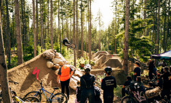
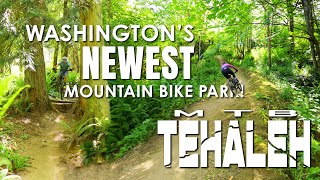
Hot Laps 2026: The Ultimate "No Bad Times" MTB Festival Returns to Port Gamble
May 20, 2026 from pinkbike.com
Created by Jill Kintner and Matt Orlando, this unique weekend features a "Best of 3" Enduro, a Red Bull Best Whip contest, and a Pro Slalom...
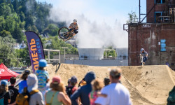
2026 Northwest Tune-Up: More Demos, New FMB Events, & Souls of Mischief
May 5, 2026 from pinkbike.com
Dropping into downtown Bellingham for its 5th year, NW Tune-Up expands its reach with a new Trailforks challenge and the FMB Bronze-Level...
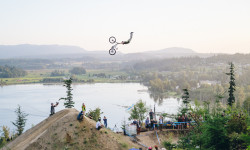
Video & Photo Highlights: Woolley Fest 2025
Sep 4, 2025 from pinkbike.com
Woolley Fest 2025 proved that FEST is alive and thriving in the Pacific Northwest.
Popular Trail Networks
view all areas »Sub Regions
- North Central Region - WA (860)
- Chelan County (519)
- Douglas County (1)
- Grant County (118)
- Okanogan County (251)
- Northeast Region - WA (704)
- Ferry County (72)
- Lincoln County (1)
- Pend Oreille County (108)
- Spokane County (436)
- Stevens County (60)
- Northwest Region - WA (941)
- San Juan County (168)
- Skagit County (181)
- Whatcom County (599)
- Olympic Region (1,134)
- Clallam County (477)
- Grays Harbor County (142)
- Jefferson County (95)
- Kitsap County (386)
- Mason County (34)
- Puget Sound Region - WA (3,171)
- Island County (245)
- King County (1,708)
- Pierce County (392)
- Snohomish County (436)
- Thurston County (239)
- South Central Region - WA (997)
- Kilckitat County (85)
- Kittitas County (708)
- Yakima County (207)
- Southeast Region - WA (381)
- Adams County (2)
- Asotin County (7)
- Benton County (184)
- Columbia County (19)
- Franklin County (3)
- Garfield County (1)
- Walla Walla County (124)
- Whitman County (8)
- Southwest Region - WA (745)
- Clark County (257)
- Cowlitz County (56)
- Lewis County (62)
- Pacific County (14)
- Skamania County (353)
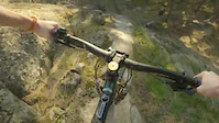
Popular Washington Mountain Biking Trails
• 100 ★ 4.6 • 4,078 ft • 0 ft • 9,029 •
One of Galbraith's premiere trails, is a machine built intermediate/advanced jump trail. Large park berms and over forty jumps make this an exhilarating ride. This trail features doubles, booters, and tables showcasing the dedication...
• 100 ★ 3.4 • 2,756 ft • 73 ft • 7,916 •
Popular green difficulty singletrack. This mountain bike primary trail can be used both directions and has a easy overall physical rating with a 73 ft green climb. It features bridge and skinny. Trail visibility is always easy to follow. On average it takes 5 minutes to complete this trail.
• 95 ★ 4.7 • 2,231 ft • 0 ft • 7,064 •
lution (or ) dishes up a sophisticated blend of jumps, ladders, and drops during the half mile between the summit and RD 3000. kicks things off with a series of doubles before winding towards a long log ride feature called the Stinger...
• 100 ★ 4.3 • 2,438 ft • 85 ft • 7,038 •
is a great way to transition from to all the trails on the Southside of Galbraith. The primary feature of note is a bridge crossing - the bridge is plenty wide but does require a little caution when wet. This trail is shaded by trees...
• 95 ★ 4.6 • 2 miles • 1,026 ft • 6,963 •
The main way to access the upper mountain trails now. This is an uphill-only trail, and is a great option to avoid grinding up the East Summit road. Be alert for hikers on this multi-use trail. Finally climbing singletrack at Tiger, you...
• 100 ★ 4.5 • 4,154 ft • 0 ft • 6,448 •
Fun, fast, flowy trail with jumps that can be rolled and optional gaps. Nothing overly dangerous for people who don't want to hit big jumps. Easy access off of . On your left as you climb up . One of the best at Galby.
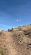
Washington Mountain Bike Routes
Climb from Lower to Upper Lot Featured
★ 5.0 • 4 miles • 1,553 ft • 2 • Point to Point •
This is the easiest route to climb from the Yacolt TH parking lot to the Larch Mountain TH parking.
Tarbell Loop Featured
★ 3.4 • 23 miles • 4,332 ft • 5 •
The loop is that actual continuous trail. It's a varied route with lots of different types of terrain and...
Shuttle Zone Climb Featured
★ 3.0 • 5 miles • 2,307 ft • 2 • Point to Point •
Preferred bike/e-bike climbing route from bottom of the shuttle zone to the lookout. Don't miss the right...
★ 3.0 • 11 miles • 3,290 ft • 11 • Point to Point •
Biking route from Darrington to the North Mtn Lookout/Summit.
3 miles • 67 ft • 5 • Point to Point •
Route from town using the Whitehorse Trail, Powerline Road and Trail to get to the Skills Park Kiosk
Shuttle Road Driving Route Featured
8 miles • 1,795 ft • 1 • Point to Point •
Shuttle road route from lower mountain parking lot to upper mountain parking and the gate. Pedal up...
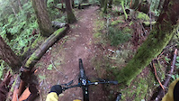
Photos of Washington Mountain Bike
Videos of Washington Mountain Bike
featured
![MTB Tehaleh | Grand Opening Party June 22!]()
0:43 |
283 |
Jun 8, 2024
featured
![Tres Hombres Part I]()
0:35 |
295 |
Apr 28, 2011
trail: Switchback Alley
3:15 |
15 |
May 27, 2026
trail: Panta Rhei
0:17 |
5 |
May 25, 2026
trail: Hair Line
0:25 |
5 |
May 25, 2026
trail: Candy Mountain Jump Line
0:05 |
23 |
May 20, 2026
trail: Logger
0:57 |
16 |
May 16, 2026

trail: Stalingrab
0:11 |
25 |
May 10, 2026
National Scenic Trails & Official Routes
-
Pacific Northwest Trail
- Mountain Bike
- Horse
- Hike
- Trail Running
Activity Feed
| username | action | type | title | date |
|---|---|---|---|---|
| valhallas | wishlist | route | activity #97366874 | Jun 19, 2026 @ 10:24pm 6 mins |
| valhallas | wishlist | trail | activity #97366788 | Jun 19, 2026 @ 10:20pm 10 mins |
| Bfurch | ridden | trail | activity #97366497 | Jun 19, 2026 @ 10:06pm 24 mins |
| JustinFyL1Xk | wishlist | trail | activity #97366190 | Jun 19, 2026 @ 9:53pm 37 mins |
| garretts | add | report | activity #97366067 and 3 more | Jun 19, 2026 @ 9:48pm 42 mins |
Recent Comments
| username | type | title | comment | date |
|---|---|---|---|---|
| trail | Love this trail! Excellent way to commute to... | Jun 19, 2026 @ 8:47pm 2 hours | ||
| trail | Completely and hopelessly overgrown. | Jun 19, 2026 @ 8:01pm 2 hours | ||
| trail | do not attempt the western portion of thisnl... | Jun 19, 2026 @ 8:35am 14 hours | ||
| trail | Gigantic tree down in the first 1000 feet or so. | Jun 18, 2026 @ 5:55pm 1 day | ||
| trail | Not a blue on a dirt bike. Also, don't even... | Jun 18, 2026 @ 5:53pm 1 day |
Local Badges
-

Evergreen Six Pack East 20260 awarded -

Evergreen Six Pack West 20260 awarded -

Evergreen Dirty Dozen 20260 awarded -

Ride Local: Demo Lap1,759 awarded -

Thrillium Evergreen SW Flash Membership7 awarded -

Sixth Sense Evergreen SW Flash Membership16 awarded
Bike & Skill Parks
| name | type | city | rating |
|---|---|---|---|
| Stevens Pass Resort | bike park | Leavenworth | |
| Snoqualmie Pass Bike Park | bike park | North Bend | |
| Crystal Mountain Resort | bike park | Greenwater | |
| 49 Degrees North Mountain Resort | bike park | Chewelah | |
| Mission Ridge Ski Area | bike park | Wenatchee |
Upcoming Local Events
-
-
-
-
-
-
-
-
Activity Type Stats
| activitytype | trails | distance | descent | descent distance | total vertical | rating | global rank | state rank | photos | reports | routes | ridelogs |
|---|---|---|---|---|---|---|---|---|---|---|---|---|
| Mountain Bike | 8,915 | 12,702 miles | 1,934,987 ft | 5,278 miles | 8,261 ft | #5 | 32,584 | 122,241 | 1,210 | 1,692,760 | ||
| E-Bike | 4,105 | 7,048 miles | 1,062,687 ft | 2,978 miles | 8,107 ft | #3 | 102 | 91,936 | 135 | 104,009 | ||
| Gravel Bike | 3,517 | 7,555 miles | 676,955 ft | 2,757 miles | 7,425 ft | #4 | 26 | 11,319 | 51 | 9,959 | ||
| Adaptive Bike | 1,235 | 2,936 miles | 234,902 ft | 1,028 miles | 6,739 ft | #3 | 4 | 12,447 | 9 | 147 | ||
| Winter Fat Bike | 507 | 769 miles | 88,675 ft | 300 miles | 7,257 ft | #13 | 4 | 8,813 | 1 | 128 | ||
| Horse | 2,575 | 6,095 miles | 905,125 ft | 2,447 miles | 9,656 ft | #7 | 1 | 27,970 | 30 | 423 | ||
| Hike | 12,045 | 18,840 miles | 2,999,357 ft | 7,464 miles | 14,406 ft | #4 | 1,168 | 113,842 | 682 | 179,982 | ||
| Trail Running | 11,860 | 18,578 miles | 2,964,219 ft | 7,394 miles | 12,290 ft | #3 | 108 | 113,831 | 274 | 145,503 | ||
| Dirtbike/Moto | 1,185 | 3,873 miles | 622,802 ft | 1,669 miles | 7,454 ft | #5 | 120 | 23,718 | 26 | 4,204 | ||
| Observed Trials | 314 | 1,068 miles | 169,360 ft | 511 miles | 7,031 ft | #3 | 21 | 1,594 | 3 | 275 | ||
| ATV/ORV/OHV | 581 | 1,511 miles | 197,841 ft | 647 miles | 6,785 ft | #11 | 26 | 22,069 | 6 | 563 | ||
| Snowmobile | 64 | 248 miles | 32,192 ft | 99 miles | 6,798 ft | #16 | 10 | 1,362 | 2 | 251 | ||
| Snowshoe | 671 | 1,062 miles | 137,247 ft | 347 miles | 12,218 ft | #15 | 2,510 | 8 | 2,554 | |||
| Downhill Ski | 904 | 290 miles | 296,683 ft | 262 miles | 6,785 ft | #9 | 15 | 492 | 43,355 | |||
| Backcountry Ski | 548 | 717 miles | 165,778 ft | 243 miles | 14,209 ft | #7 | 1 | 1,038 | 2 | 21,197 | ||
| Nordic Ski | 439 | 451 miles | 42,205 ft | 180 miles | 4,934 ft | #18 | 29 | 1,165 | 3 | 18,623 |
Activities
- Washington Mountain Biking Trails
- Washington E-Biking Trails
- Washington Gravel Biking Trails
- Washington Adaptive Biking Trails
- Washington Winter Fat Biking Trails
- Washington Horseback Trails
- Washington Hiking Trails
- Washington Trail Running Trails
- Washington Dirtbiking Trails
- Washington Observed Trials Trails
- Washington ATVing/Offroading Trails
- Washington Snowmobiling Trails
- Washington Snowshoeing Trails
- Washington Skiing Trails
- Washington Backcountry Skiing Trails
- Washington Nordic Skiing Trails
Trails
Points of Interest
- Check Point J Information
- Fall Creek Campground Camping
- Margaret McKenny Campground Camping
- Mima Falls Campground Camping
- Anaconda Second Bridge TTF
- Summit of Copper Butte Viewpoint
- Check Point M Information
- Check Point N Information
- Check Point L Information
- Check Point G Information
- Jack Mountain (9,078 ft)
- North Gardner Mountain (8,914 ft)
- Gardner Mountain (8,911 ft)
- By canadaka
 Trailforks & contributors
 - Admins: Map Team, IMBA, chuktA, msmcfate, WillieJacobsz, PlumbBobM, ReckitRolley, colinreuter, NMA, EMBA-Staff
- #3051 - 236,161 views
- washington activity log | embed map of Washington mountain bike trails | washington mountain biking points of interest polygons
Downloading of trail gps tracks in kml & gpx formats is enabled for Washington.
You must login to download files.