close
-
Layers w
- Weather Layers
- Pro
- Pro
- Pro
- Pro
- Pro
- Pro
- More Layers
- Pro
- Pro
- Pro
- Pro
-
Upgrade to

3D
Trail Conditions
- Unknown
- Snow Groomed
- Snow Packed
- Snow Covered
- Snow Cover Partial
- Freeze/thaw Cycle
- Icy
- Prevalent Mud
- Wet
- Variable
- Ideal
- Dry
- Very Dry
Trail Flow (Ridden Direction)
Trailforks scans users ridelogs to determine the most popular direction each trail is ridden. A good flowing trail network will have most trails flowing in a single direction according to their intension.
The colour categories are based on what percentage of riders are riding a trail in its intended direction.
The colour categories are based on what percentage of riders are riding a trail in its intended direction.
- > 96%
- > 90%
- > 80%
- > 70%
- > 50%
- < 50%
- bi-directional trail
- no data
Trail Last Ridden
Trailforks scans ridelogs to determine the last time a trail was ridden.
- < 2 days
- < 1 week
- < 2 weeks
- < 1 month
- < 6 months
- > 6 months
Trail Ridden Direction
The intended direction a trail should be ridden.
- Downhill Only
- Downhill Primary
- Both Directions
- Uphill Primary
- Uphill Only
- One Direction
Contribute Details
Colors indicate trail is missing specified detail.
- Description
- Photos
- Description & Photos
- Videos
Trail Popularity ?
Trailforks scans ridelogs to determine which trails are ridden the most in the last 9 months.
Trails are compared with nearby trails in the same city region with a possible 25 colour shades.
Think of this as a heatmap, more rides = more kinetic energy = warmer colors.
- most popular
- popular
- less popular
- not popular
ATV/ORV/OHV Filter
Max Vehicle Width
inches
US Cell Coverage
Legend

Radar Time
Activity Recordings
Trailforks uses anonymized public activity data.
?
Activity Recordings
Trailforks uses anonymized public activity data.
?
Personal Heatmap
▶
Activity Types
all
/
none
▶
Options
2
Date range
month
–
Winter Trails
Warning
A routing network for winter maps does not exist. Selecting trails using the winter trails layer has been disabled.
Missing Trails
Most Popular
Least Popular
Trails are colored based on popularity. The more popular a trail is, the more red. Less popular trails trend towards green.
Jump Magnitude Heatmap
Heatmap of where riders jump on trails. Zoom in to see individual jumps, click circles to view jump details.
BC Backroad Status
![map legend]()
Service Road Atlas is a free to use, community-driven service for viewing and creating reports on the numerous back-country service roads around B.C. and Alberta.

Slope Aspect
Direction the slope faces
Trails Deemphasized
Trails are shown in grey.
Only show trails with no bike usage.
Suggested Layers
Based on selected activity type
Save the current map location and zoom level as your default home location whenever this page is loaded.
Save
No description for District of Columbia has been added yet!
Login or register to submit one.
AKA: Washington DC
Stats
- Avg Trail Rating
- Trails (view details)
- 18
- Trails Mountain Bike
- 18
- Trails Hike
- 31
- Trails Trail Running
- 31
- Total Distance
- 35 miles
- Total Descent
- 1,626 ft
- Total Vertical
- 269 ft
- Highest Trailhead
- 271 ft
- Reports
- 18
- Photos
- 9
- Ridden Counter
- 1,224
Sub Regions
Popular District of Columbia Mountain Biking Trails
• 100 ★ 0.0 • 6 miles • 76 ft • 244 •
Popular white difficulty paved path. This multi-use trail can be used both directions. On average it takes 29 minutes to complete this trail.
• 95 ★ 5.0 • 5 miles • 21 ft • 88 •
Popular white difficulty family friendly paved path. This multi-use trail can be used both directions and has a easy overall physical rating with a 21 ft green climb. Trail visibility is always easy to follow. On average it takes 26 minutes to complete this trail.
• 90 ★ 2.6 • 4 miles • 388 ft • 42 •
Popular blue difficulty doubletrack. This multi-use trail. On average it takes 54 minutes to complete this trail.
• 90 ★ 3.0 • 3,474 ft • 0 ft • 21 •
Popular green difficulty mixed. This multi-use trail can be used both directions. On average it takes 2 minutes to complete this trail.
• 80 ★ 0.0 • 796 ft • 11 ft • 18 •
Popular green difficulty singletrack. This multi-use trail can be used both directions. On average it takes 1 minutes to complete this trail.
• 70 ★ 0.0 • 702 ft • 24 ft • 10 •
Popular green difficulty singletrack. This multi-use trail can be used both directions. On average it takes 1 minutes to complete this trail.
• 5 ★ 0.0 • 1,929 ft • 0 ft • 10 •
Less popular green difficulty mixed. This multi-use trail can be used both directions. On average it takes 1 minutes to complete this trail.
• 75 ★ 0.0 • 1,625 ft • 74 ft • 10 •
Popular green difficulty paved path. This multi-use trail can be used both directions. On average it takes 3 minutes to complete this trail.
District of Columbia Mountain Bike Routes
25 miles • 1,309 ft • 1 • Out & Back •
Expectations need to be tempered with this trail. This is not a great mountain . What it is, is a nice...
6 miles • 544 ft • 0 •
Just a nice mile and a half of metro DC...great trail to keep your heart rate up and go fast. Beginners...
• 20 miles • 231 ft • 0 •
• 12 miles • 117 ft • 0 •
Kudos to who ever absolutely RIPPED the first 3-4 laps. Good fking LAWD did I have to dig deep to stay on....
• 10 miles • 26 ft • 0 •
Photos of District of Columbia Mountain Bike
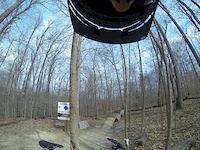
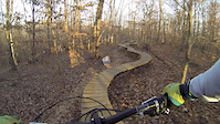
Videos of District of Columbia Mountain Bike

0:15 |
37 |
Aug 12, 2021
0:41 |
118 |
Mar 11, 2016
0:09 |
96 |
Nov 25, 2015

3:25 |
336 |
Jun 23, 2015
0:34 |
425 |
Apr 3, 2011

4:49 |
697 |
Jul 23, 2020 , Washington DC

8:22 |
276 |
Feb 12, 2020 , Washington DC
Activity Feed
| username | action | type | title | date |
|---|---|---|---|---|
| kylem557 | update | region | activity #96740715 | Jun 11, 2026 @ 8:49am Jun 11, 2026 |
| WillieJacobsz | update | trail | activity #96740670 | Jun 11, 2026 @ 8:47am Jun 11, 2026 |
| WillieJacobsz | add | region | activity #96740640 | Jun 11, 2026 @ 8:47am Jun 11, 2026 |
| kylem557 | update | trail | activity #96740058 | Jun 11, 2026 @ 8:37am Jun 11, 2026 |
| WillieJacobsz | update | directory | activity #96739226 | Jun 11, 2026 @ 8:23am Jun 11, 2026 |
Recent Comments
| username | type | title | comment | date |
|---|---|---|---|---|
| trail | 90% of it is rideable, but the west side was... | Oct 10, 2025 @ 8:14am Oct 10, 2025 | ||
| trail | Basically impassable. Totally overgrown. | Aug 23, 2025 @ 8:47am Aug 23, 2025 | ||
| trail | Good for fast rides | Feb 6, 2024 @ 4:16am Feb 6, 2024 | ||
| trail | Not well maintained | Jul 21, 2021 @ 4:46am Jul 21, 2021 | ||
| trail | Urban singletrack that drains well. Love that... | Jul 11, 2018 @ 3:26am Jul 11, 2018 |
Local Badges
-

10 Green Trails13 awarded -

Epic Ride Climb 2k8 awarded -

Climbing 10k Badge53 awarded -

Climbing 100k Badge1 awarded -

Epic Ride Descent 2k8 awarded -

Descent 10k Badge51 awarded
Activity Type Stats
| activitytype | trails | distance | descent | descent distance | total vertical | rating | global rank | state rank | photos | reports | routes | ridelogs |
|---|---|---|---|---|---|---|---|---|---|---|---|---|
| Mountain Bike | 18 | 34 miles | 1,594 ft | 11 miles | 269 ft | #65 | 8 | 18 | 2 | 27,690 | ||
| Hike | 31 | 35 miles | 1,627 ft | 12 miles | 269 ft | #65 | 18 | 755 | ||||
| Trail Running | 31 | 35 miles | 1,627 ft | 12 miles | 269 ft | #64 | 1 | 18 | 469 |
Activities
- By canadaka
 Trailforks & contributors
 - Admins: Map Team, IMBA, chuktA, msmcfate, WillieJacobsz, PlumbBobM, ReckitRolley, colinreuter, MORE - FR
- #3212 - 16,906 views
- district of columbia activity log | embed map of District of Columbia mountain bike trails | district of columbia mountain biking points of interest
Downloading of trail gps tracks in kml & gpx formats is enabled for District of Columbia.
You must login to download files.