close
-
Layers w
- Weather Layers
- Pro
- Pro
- Pro
- Pro
- Pro
- Pro
- More Layers
- Pro
- Pro
- Pro
- Pro
-
Upgrade to

3D
Trail Conditions
- Unknown
- Snow Groomed
- Snow Packed
- Snow Covered
- Snow Cover Partial
- Freeze/thaw Cycle
- Icy
- Prevalent Mud
- Wet
- Variable
- Ideal
- Dry
- Very Dry
Trail Flow (Ridden Direction)
Trailforks scans users ridelogs to determine the most popular direction each trail is ridden. A good flowing trail network will have most trails flowing in a single direction according to their intension.
The colour categories are based on what percentage of riders are riding a trail in its intended direction.
The colour categories are based on what percentage of riders are riding a trail in its intended direction.
- > 96%
- > 90%
- > 80%
- > 70%
- > 50%
- < 50%
- bi-directional trail
- no data
Trail Last Ridden
Trailforks scans ridelogs to determine the last time a trail was ridden.
- < 2 days
- < 1 week
- < 2 weeks
- < 1 month
- < 6 months
- > 6 months
Trail Ridden Direction
The intended direction a trail should be ridden.
- Downhill Only
- Downhill Primary
- Both Directions
- Uphill Primary
- Uphill Only
- One Direction
Contribute Details
Colors indicate trail is missing specified detail.
- Description
- Photos
- Description & Photos
- Videos
Trail Popularity ?
Trailforks scans ridelogs to determine which trails are ridden the most in the last 9 months.
Trails are compared with nearby trails in the same city region with a possible 25 colour shades.
Think of this as a heatmap, more rides = more kinetic energy = warmer colors.
- most popular
- popular
- less popular
- not popular
ATV/ORV/OHV Filter
Max Vehicle Width
inches
US Cell Coverage
Legend

Radar Time
Activity Recordings
Trailforks uses anonymized public activity data.
?
Activity Recordings
Trailforks uses anonymized public activity data.
?
Personal Heatmap
▶
Activity Types
all
/
none
▶
Options
2
Date range
month
–
Winter Trails
Warning
A routing network for winter maps does not exist. Selecting trails using the winter trails layer has been disabled.
Missing Trails
Most Popular
Least Popular
Trails are colored based on popularity. The more popular a trail is, the more red. Less popular trails trend towards green.
Jump Magnitude Heatmap
Heatmap of where riders jump on trails. Zoom in to see individual jumps, click circles to view jump details.
BC Backroad Status
![map legend]()
Service Road Atlas is a free to use, community-driven service for viewing and creating reports on the numerous back-country service roads around B.C. and Alberta.

Slope Aspect
Direction the slope faces
Trails Deemphasized
Trails are shown in grey.
Only show trails with no bike usage.
Suggested Layers
Based on selected activity type
Save the current map location and zoom level as your default home location whenever this page is loaded.
SaveWaterbury is the Recreational Heart of Vermont - great biking in all directions (including Perry Hill right in town), skiing nearby in the winter, and a vibrant small-town America downtown with great beer. Seriously - there's way too much good beer for one small town. It's an embarrassment of riches.
Activities Click to view
- Mountain Bike
14 trails
- Gravel Bike
0 trails
- Adaptive Bike
0 trails
- Winter Fat Bike
0 trails
- Horse
4 trails
- Hike
56 trails
- Trail Running
57 trails
- ATV/ORV/OHV
2 trails
- Snowmobile
8 trails
- Snowshoe
32 trails
- Backcountry Ski
26 trails
- Nordic Ski
18 trails
Region Details
- 2
- 3
- 7
- 2
Region Status
Caution as of 2 daysStats
- Avg Trail Rating
- Trails (view details)
- 42
- Trails Mountain Bike
- 29
- Trails Horse
- 4
- Trails Hike
- 57
- Trails Trail Running
- 57
- Trails ATV/ORV/OHV
- 2
- Trails Snowmobile
- 8
- Trails Snowshoe
- 32
- Trails Backcountry Ski
- 26
- Trails Nordic Ski
- 18
- Total Distance
- 75 miles
- Total Descent
- 22,542 ft
- Total Vertical
- 3,669 ft
- Highest Trailhead
- 4,033 ft
- Reports
- 4,243
- Photos
- 195
- Ridden Counter
- 43,592
Articles
The 12 Most Stunning Trails in the U.S.
May 29, 2025 from outsideonline.com
In celebration of National Trails Day, discover some of the best hikes in the U.S.—from slot canyons to grasslands, waterfalls, and secluded...
Sub Regions
-
Cotton Brook
-
Dowsville
-
Little River State Park
- 1
- 4
-
Little River to Perry
- 1
-
Perry Hill
- 4
- 5
- 3
- 3
Popular Waterbury Mountain Biking Trails
• 100 ★ 3.0 • 3,858 ft • 328 ft • 2,488 •
Popular green difficulty singletrack. This multi-use trail can be used both directions and has a moderate overall physical rating with a 328 ft blue climb. Trail visibility is always easy to follow. On average it takes 1 minutes to complete this trail.
• 95 ★ 4.8 • 1,929 ft • 0 ft • 2,224 •
Why is it called ? Cause it's wicked tasty and goes great with a . We're clever, aren't we? This trail is literally the cat's a**. It's got berms! It's got jumps! It's got flow! It's got features that'll keep you on your toes. Built by...
• 100 ★ 0.0 • 551 ft • 11 ft • 2,207 •
Popular blue difficulty singletrack. This mountain bike primary trail. It features bridge. On average it takes 2 minutes to complete this trail.
• 90 ★ 4.0 • 2,156 ft • 143 ft • 1,811 •
Popular black diamond difficulty singletrack. This mountain bike primary trail can be used both directions. On average it takes 5 minutes to complete this trail.
• 85 ★ 4.2 • 1 mile • 49 ft • 1,768 •
If you want to ride your bike fast, or you don't have a lot of time, trail is for you. Descending through a pine forest on sandy/loamy soil, is all about flow. There are a couple of technical features near the top, but expect to work on...
• 90 ★ 4.8 • 2,710 ft • 28 ft • 1,762 •
This trail descends a series of large ledges down to the exit of Rastaman. At times steep and technical, land is a good bonus loop, especially when combined with .
Waterbury Mountain Bike Routes
★ 5.0 • 7 miles • 1,171 ft • 12 • Loop •
Hit Hill Farmer and High Bridge twice when you make your ride in to a figure eight utilizing the Daley...
★ 3.8 • 11 miles • 2,294 ft • 11 • Loop •
The best that Perry Hill as to offer. Hit all the classics on this loop.
7 miles • 1,511 ft • 11 •
Perry Hill Upper Trails Group ride, Elevate MTB Festival
★ 4.5 • 14 miles • 2,005 ft • 4 •
Great location for a variety of usergroups. From the challenge of the grueling 9 mile climb, history...
3,323 ft • 1 • Point to Point •
This local favorite is pure old-school tech, with steep rock rolls and tight corners. A new extension...
5 miles • 1,073 ft • 10 •
Elevate MTB Festival Perry Lower Trails Route
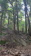
Photos of Waterbury Mountain Bike
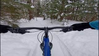
Videos of Waterbury Mountain Bike
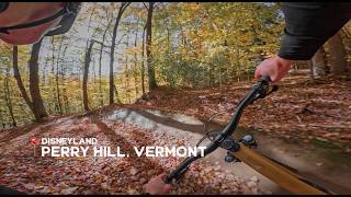
trail: Disneyland
0:07 |
834 |
Jun 17, 2020

trail: Hillfarmer
0:21 |
343 |
Oct 22, 2018

trail: Highbridge
2:33 |
6046 |
Dec 26, 2016
trail: S'Mores
12:12 |
26 |
Apr 11, 2026 , Waterbury
trail: Burning Spear
5:00 |
1249 |
Jun 20, 2012
trail: Disneyland
2:23 |
98 |
Sep 25, 2025 , Waterbury

trail: S'Mores
0:49 |
62 |
Sep 25, 2025 , Waterbury

trail: Six Flags
3:03 |
122 |
Sep 25, 2025 , Waterbury
Current Trail Warnings
| status | trail | date | condition | user | info |
|---|---|---|---|---|---|
| Burning Spear | Jun 18, 2026 @ 4:10pm (America/New_York) 2 days | Variable | alexshowerman802 WATA | Hard rains today please give time to dry | |
| Red Tape | Jun 18, 2026 @ 4:10pm (America/New_York) 2 days | Variable | alexshowerman802 WATA | Hard rains today please give time to dry | |
| Joe's Original Line - The Chute | Jun 18, 2026 @ 4:10pm (America/New_York) 2 days | Variable | alexshowerman802 WATA | Hard rains today please give time to dry |
Recent Trail Reports
| status | trail | date | condition | info | user |
|---|---|---|---|---|---|
| Scotch Tape | Jun 18, 2026 @ 4:10pm (America/New_York) 2 days | Variable | alexshowerman802 WATA | ||
| Permission | Jun 18, 2026 @ 4:10pm (America/New_York) 2 days | Variable | alexshowerman802 WATA | ||
| Joe's | Jun 18, 2026 @ 4:10pm (America/New_York) 2 days | Variable | alexshowerman802 WATA | ||
| Dalley Loop | Jun 17, 2026 @ 1:38pm (America/Los_Angeles) Jun 17, 2026 | Ideal | Buckncoal | ||
| Highbridge | Jun 13, 2026 @ 5:13pm (America/New_York) Jun 13, 2026 | Ideal | Philjoe | ||
| Hillfarmer | Jun 13, 2026 @ 5:13pm (America/New_York) Jun 13, 2026 | Ideal | Philjoe | ||
| Climb from Small Axe | Jun 5, 2026 @ 8:55am (America/New_York) Jun 5, 2026 | Dry | RonaldBolamCd3 | ||
| Disneyland | Jun 5, 2026 @ 8:55am (America/New_York) Jun 5, 2026 | Dry | RonaldBolamCd3 | ||
| Campfire | Jun 5, 2026 @ 8:55am (America/New_York) Jun 5, 2026 | Dry | RonaldBolamCd3 | ||
| *NEW Campfire Climb | Jun 5, 2026 @ 8:55am (America/New_York) Jun 5, 2026 | Dry | RonaldBolamCd3 |
Activity Feed
| username | action | type | title | date |
|---|---|---|---|---|
| Jshaggs99 | wishlist | trail | activity #97306417 | Jun 19, 2026 @ 3:54am 1 day |
| alexshowerman802 | add | report | activity #97272202 and 11 more | Jun 18, 2026 @ 1:09pm 2 days |
| Buckncoal | add | report | activity #97207214 and 2 more | Jun 17, 2026 @ 1:39pm Jun 17, 2026 |
| RachaelHemW2Q | ridden | trail | activity #97169568 | Jun 17, 2026 @ 2:14am Jun 17, 2026 |
| robinamoyer | add | report | activity #97142308 | Jun 16, 2026 @ 3:43pm Jun 16, 2026 |
Recent Comments
| username | type | title | comment | date |
|---|---|---|---|---|
| report | I cleared the tree today. | Jun 5, 2026 @ 7:00pm Jun 5, 2026 | ||
| report | In 16 days nobody could help get this one... | Jun 5, 2026 @ 6:59pm Jun 5, 2026 | ||
| trail | Tree down | Jun 3, 2026 @ 4:55pm Jun 3, 2026 | ||
| report | Sorry that happened to you! The tree has been... | Oct 10, 2025 @ 8:14am Oct 10, 2025 | ||
| trail | Great beginner or XC trail. If you’re having... | Sep 16, 2025 @ 4:01pm Sep 16, 2025 |
Local Badges
-

10 Blue Trails579 awarded -

Epic Ride Climb 2k18 awarded -

Climbing 10k Badge116 awarded -

Climbing 100k Badge1 awarded -

Epic Ride Descent 2k20 awarded -

Descent 10k Badge119 awarded
Bike & Skill Parks
| name | type | city | rating |
|---|---|---|---|
| Waterbury Pump Track | skill park | Waterbury |
Activity Type Stats
| activitytype | trails | distance | descent | descent distance | total vertical | rating | global rank | state rank | photos | reports | routes | ridelogs |
|---|---|---|---|---|---|---|---|---|---|---|---|---|
| Mountain Bike | 14 | 23 miles | 4,774 ft | 13 miles | 1,063 ft | #786 | #304 | 207 | 5,135 | 11 | 24,438 | |
| Horse | 4 | 3 miles | 528 ft | 1 mile | 1,135 ft | #2,322 | #1,283 | 1,288 | 1 | |||
| Hike | 56 | 72 miles | 21,729 ft | 36 miles | 3,668 ft | #2,487 | #986 | 5 | 5,128 | 1 | 2,545 | |
| Trail Running | 57 | 72 miles | 21,729 ft | 36 miles | 3,668 ft | #2,838 | #817 | 5,128 | 1 | 565 | ||
| ATV/ORV/OHV | 2 | 5 miles | 1,155 ft | 2 miles | 1,040 ft | #753 | #317 | 1,331 | 4 | |||
| Snowmobile | 8 | 7 miles | 1,194 ft | 3 miles | 1,168 ft | #217 | #99 | 282 | 1 | 3 | ||
| Snowshoe | 32 | 53 miles | 16,572 ft | 24 miles | 3,668 ft | #350 | #95 | 414 | 1 | 81 | ||
| Backcountry Ski | 26 | 48 miles | 17,582 ft | 25 miles | 3,668 ft | #73 | #15 | 156 | 636 | |||
| Nordic Ski | 18 | 16 miles | 4,180 ft | 9 miles | 2,349 ft | #689 | #247 | 531 | 1 | 358 |
Frequently Asked Questions About Waterbury
▼
What are the best places to ride in Waterbury?
Waterbury has 6 areas to explore for mountain biking. The top rated areas are:
▼
What are the highest rated mountain biking trails in Waterbury?
The highest rated mountain biking trails in Waterbury are:
- Six Flags (4.7/5)
- S'Mores (4.7/5)
- Burning Spear (4.5/5)
- Joe's (4.5/5)
- Disneyland (4.5/5)
▼
What is the best time of the year to ride in Waterbury?
Based on ride log data, the most popular months to ride in Waterbury are:
- July (471 activities)
- August (462 activities)
- June (404 activities)
▼
Where can I park to ride in Waterbury?
There are 18 parking locations listed in Waterbury. The most popular parking spots are:
- Parking
- History Hike Parking Lot
- Nature Trail Parking Lot
- Cottonbrook Trailhead Parking
- Cottonbrook Gate Parking
Activities
Trails
Points of Interest
- By danathemainah
 WATA & contributors
 - Admins: VMBA, Velomont, Jwduston, WATA, cbrunner9
- #12145 - 21,265 views
- waterbury activity log | embed map of Waterbury mountain bike trails | waterbury mountain biking points of interest
Downloading of trail gps tracks in kml & gpx formats is enabled for Waterbury.
You must login to download files.