close
-
Layers w
- Weather Layers
- Pro
- Pro
- Pro
- Pro
- Pro
- Pro
- More Layers
- Pro
- Pro
- Pro
- Pro
-
Upgrade to

3D
Trail Conditions
- Unknown
- Snow Groomed
- Snow Packed
- Snow Covered
- Snow Cover Partial
- Freeze/thaw Cycle
- Icy
- Prevalent Mud
- Wet
- Variable
- Ideal
- Dry
- Very Dry
Trail Flow (Ridden Direction)
Trailforks scans users ridelogs to determine the most popular direction each trail is ridden. A good flowing trail network will have most trails flowing in a single direction according to their intension.
The colour categories are based on what percentage of riders are riding a trail in its intended direction.
The colour categories are based on what percentage of riders are riding a trail in its intended direction.
- > 96%
- > 90%
- > 80%
- > 70%
- > 50%
- < 50%
- bi-directional trail
- no data
Trail Last Ridden
Trailforks scans ridelogs to determine the last time a trail was ridden.
- < 2 days
- < 1 week
- < 2 weeks
- < 1 month
- < 6 months
- > 6 months
Trail Ridden Direction
The intended direction a trail should be ridden.
- Downhill Only
- Downhill Primary
- Both Directions
- Uphill Primary
- Uphill Only
- One Direction
Contribute Details
Colors indicate trail is missing specified detail.
- Description
- Photos
- Description & Photos
- Videos
Trail Popularity ?
Trailforks scans ridelogs to determine which trails are ridden the most in the last 9 months.
Trails are compared with nearby trails in the same city region with a possible 25 colour shades.
Think of this as a heatmap, more rides = more kinetic energy = warmer colors.
- most popular
- popular
- less popular
- not popular
ATV/ORV/OHV Filter
Max Vehicle Width
inches
US Cell Coverage
Legend

Radar Time
Activity Recordings
Trailforks uses anonymized public activity data.
?
Activity Recordings
Trailforks uses anonymized public activity data.
?
Personal Heatmap
▶
Activity Types
all
/
none
▶
Options
2
Date range
month
–
Winter Trails
Warning
A routing network for winter maps does not exist. Selecting trails using the winter trails layer has been disabled.
Missing Trails
Most Popular
Least Popular
Trails are colored based on popularity. The more popular a trail is, the more red. Less popular trails trend towards green.
Jump Magnitude Heatmap
Heatmap of where riders jump on trails. Zoom in to see individual jumps, click circles to view jump details.
BC Backroad Status
![map legend]()
Service Road Atlas is a free to use, community-driven service for viewing and creating reports on the numerous back-country service roads around B.C. and Alberta.

Slope Aspect
Direction the slope faces
Trails Deemphasized
Trails are shown in grey.
Only show trails with no bike usage.
Suggested Layers
Based on selected activity type
Save the current map location and zoom level as your default home location whenever this page is loaded.
Save
No description for Waterworks has been added yet!
Login or register to submit one.
Primary Trail Type: All-Mountain & Downhill
Shuttleable: YES
AKA: Waterworks
Land Status: County Park
Land Manager: OC Parks
Access Info:
Multiple entry points.
Popular one is to park at Santa Margarita Water District* on Antonio and take Waterworks or Spitfire down into the trail system.
* the District allows MTB parking
Popular one is to park at Santa Margarita Water District* on Antonio and take Waterworks or Spitfire down into the trail system.
* the District allows MTB parking
Links
Activities Click to view
- Mountain Bike
2 trails
- E-Bike
2 trails
- Horse
0 trails
- Hike
2 trails
- Trail Running
1 trails
Stats
- Avg Trail Rating
- Trails (view details)
- 2
- Trails Mountain Bike
- 2
- Trails E-Bike
- 2
- Trails Hike
- 2
- Trails Trail Running
- 1
- Total Distance
- 1 mile
- Total Descent Distance
- 1,768 ft
- Total Descent
- 82 ft
- Total Vertical
- 106 ft
- Highest Trailhead
- 388 ft
- Reports
- 12
- Photos
- 2
- Ridden Counter
- 434
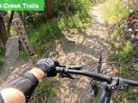
Popular Waterworks Mountain Biking Trails
• 80 ★ 0.0 • 4,035 ft • 124 ft • 91 •
Popular blue difficulty singletrack. This mountain bike primary trail can be used both directions and has a moderate overall physical rating with a 124 ft blue climb. Trail visibility is always easy to follow.


Recent Trail Reports
| status | trail | date | condition | info | user |
|---|---|---|---|---|---|
| Plan B | Apr 5, 2026 @ 7:24am (America/Los_Angeles) Apr 5, 2026 | Unknown | Stephen0PpnYm | ||
| Highline | Mar 15, 2026 @ 4:04pm (America/Los_Angeles) Mar 15, 2026 | Dry | Stephen0PpnYm |
Activity Feed
| username | action | type | title | date |
|---|---|---|---|---|
| Stephen0PpnYm | add | report | activity #91976528 | Apr 5, 2026 @ 7:24am Apr 5, 2026 |
| Stephen0PpnYm | add | report | activity #90675249 and 1 more | Mar 15, 2026 @ 8:06pm Mar 15, 2026 |
| gw1991 | wishlist | region | activity #89441851 | Feb 23, 2026 @ 5:45pm Feb 23, 2026 |
| ilovemesomepie | add | report | activity #89388396 | Feb 22, 2026 @ 3:30pm Feb 22, 2026 |
| desertpunk | ridden | trail | activity #82774461 and 1 more | Oct 21, 2025 @ 11:51am Oct 21, 2025 |
Nearby Areas
| name | distance | ||||
|---|---|---|---|---|---|
| Tijeras Creek Trails | 18 | 43 | 5 | 2.5 km | |
| Oso Viejo Community Park | 6 | 3 km | |||
| Northwest Open Space | 5 | 6 | 1 | 1 | 3.4 km |
| Thomas Riley Wilderness Park | 7 | 3 | 3.7 km | ||
| Aliso and Wood Canyons Wilderness Park | 8 | 12 | 15 | 6 | 5.3 km |
Activity Type Stats
| activitytype | trails | distance | descent | descent distance | total vertical | rating | global rank | state rank | photos | reports | routes | ridelogs |
|---|---|---|---|---|---|---|---|---|---|---|---|---|
| Mountain Bike | 2 | 1 mile | 82 ft | 1,768 ft | 105 ft | #12,566 | #5,122 | 2 | 12 | 215 | ||
| E-Bike | 2 | 1 mile | 82 ft | 1,768 ft | 105 ft | #10,430 | #3,727 | 12 | 54 | |||
| Hike | 2 | 1 mile | 82 ft | 1,768 ft | 105 ft | #21,364 | #10,989 | 12 | 32 | |||
| Trail Running | 1 | 4,035 ft | 52 ft | 1,135 ft | 105 ft | #21,043 | #10,582 | 10 | 2 |
- By mtb949
 & contributors
 - Admins: OCMTBA
- #52468 - 2,389 views
- waterworks activity log | embed map of Waterworks mountain bike trails |
Downloading of trail gps tracks in kml & gpx formats is enabled for Waterworks.
You must login to download files.