close
-
Layers w
- Weather Layers
- Pro
- Pro
- Pro
- Pro
- Pro
- Pro
- More Layers
- Pro
- Pro
- Pro
- Pro
-
Upgrade to

3D
Trail Conditions
- Unknown
- Snow Groomed
- Snow Packed
- Snow Covered
- Snow Cover Partial
- Freeze/thaw Cycle
- Icy
- Prevalent Mud
- Wet
- Variable
- Ideal
- Dry
- Very Dry
Trail Flow (Ridden Direction)
Trailforks scans users ridelogs to determine the most popular direction each trail is ridden. A good flowing trail network will have most trails flowing in a single direction according to their intension.
The colour categories are based on what percentage of riders are riding a trail in its intended direction.
The colour categories are based on what percentage of riders are riding a trail in its intended direction.
- > 96%
- > 90%
- > 80%
- > 70%
- > 50%
- < 50%
- bi-directional trail
- no data
Trail Last Ridden
Trailforks scans ridelogs to determine the last time a trail was ridden.
- < 2 days
- < 1 week
- < 2 weeks
- < 1 month
- < 6 months
- > 6 months
Trail Ridden Direction
The intended direction a trail should be ridden.
- Downhill Only
- Downhill Primary
- Both Directions
- Uphill Primary
- Uphill Only
- One Direction
Contribute Details
Colors indicate trail is missing specified detail.
- Description
- Photos
- Description & Photos
- Videos
Trail Popularity ?
Trailforks scans ridelogs to determine which trails are ridden the most in the last 9 months.
Trails are compared with nearby trails in the same city region with a possible 25 colour shades.
Think of this as a heatmap, more rides = more kinetic energy = warmer colors.
- most popular
- popular
- less popular
- not popular
ATV/ORV/OHV Filter
Max Vehicle Width
inches
US Cell Coverage
Legend

Radar Time
Activity Recordings
Trailforks uses anonymized public activity data.
?
Activity Recordings
Trailforks uses anonymized public activity data.
?
Personal Heatmap
▶
Activity Types
all
/
none
▶
Options
2
Date range
month
–
Winter Trails
Warning
A routing network for winter maps does not exist. Selecting trails using the winter trails layer has been disabled.
Missing Trails
Most Popular
Least Popular
Trails are colored based on popularity. The more popular a trail is, the more red. Less popular trails trend towards green.
Jump Magnitude Heatmap
Heatmap of where riders jump on trails. Zoom in to see individual jumps, click circles to view jump details.
BC Backroad Status
![map legend]()
Service Road Atlas is a free to use, community-driven service for viewing and creating reports on the numerous back-country service roads around B.C. and Alberta.

Slope Aspect
Direction the slope faces
Trails Deemphasized
Trails are shown in grey.
Only show trails with no bike usage.
Suggested Layers
Based on selected activity type
Save the current map location and zoom level as your default home location whenever this page is loaded.
SavePopular Trail Networks
view all areas »
No description for Wayne County has been added yet!
Login or register to submit one.
Activities Click to view
- Mountain Bike
136 trails
- E-Bike
48 trails
- Horse
70 trails
- Hike
344 trails
- Trail Running
344 trails
- Observed Trials
1 trails
- Snowmobile
1 trails
- Snowshoe
61 trails
- Downhill Ski
1 trails
- Backcountry Ski
31 trails
- Nordic Ski
37 trails
Region Details
- 23
- 15
- 56
- 15
- 5
Stats
- Avg Trail Rating
- Trails (view details)
- 302
- Trails Mountain Bike
- 137
- Trails E-Bike
- 48
- Trails Winter Fat Bike
- 1
- Trails Horse
- 70
- Trails Hike
- 344
- Trails Trail Running
- 344
- Trails Observed Trials
- 1
- Trails Snowmobile
- 1
- Trails Snowshoe
- 61
- Trails Downhill Ski
- 1
- Trails Backcountry Ski
- 31
- Trails Nordic Ski
- 37
- Total Distance
- 211 miles
- Total Descent
- 4,164 ft
- Total Vertical
- 416 ft
- Highest Trailhead
- 987 ft
- Reports
- 1,517
- Photos
- 181
- Ridden Counter
- 5,960
Sub Regions
- Canton (19)
- Morton-Taylor Trails (14)
- Dearborn (7)
- Dearborn Heights (3)
- Detroit (23)
- Rouge Park (13)
- Huron Township (9)
- Huroc Park (1)
- Lower Huron Park (0)
- Oakwoods Metro Park (2)
- Willow Metro Park (4)
- Livonia (17)
- Northville (36)
- Plymouth (3)
- Rockwood (6)
- Waynedott (3)
- Westland (4)
- Hines Park (22)
Popular Wayne County Mountain Biking Trails
• 95 ★ 4.7 • 2 miles • 140 ft • 300 •
The follows the south shoreline of Newburgh lake. This segment is highlighted by breathtaking views of the lake as the trail winds, climbs and descends along the steep overlooking bluffs. Mostly One Way, with small section of 2-way...
• 75 ★ 4.8 • 1 mile • 48 ft • 280 •
Riverview Trail was the first of the Hines Parkway trails. A little over a Mile each way. As of September 2024 it is all One Way Traffic.
• 85 ★ 4.0 • 1 mile • 61 ft • 274 •
Popular green difficulty singletrack. This mountain bike primary trail can be used one direction. On average it takes 7 minutes to complete this trail.
• 100 ★ 4.0 • 1,591 ft • 18 ft • 265 •
Popular green difficulty singletrack. This mountain bike primary trail can be used one direction. It features bridge. On average it takes 3 minutes to complete this trail.
• 100 ★ 5.0 • 3,399 ft • 53 ft • 247 •
Together, the Bell Branch north and south trails feature approximately 2 miles of awesome flow trail. The tread is generally groomed and relatively free of roots and rocks, making for a great adaptive cycling experience. The terrain is...
• 90 ★ 5.0 • 3,921 ft • 30 ft • 245 •
has a new 1-way section added April 2023. This is at the very east end, and returns to (2-Way) two way traffic, at El Patio. More 1-way is in process as well for 2023
• 100 ★ 4.7 • 3,858 ft • 18 ft • 194 •
Popular green difficulty family friendly singletrack. This mountain bike primary trail can be used one direction and has a easy overall physical rating with a 18 ft green climb. It features berm, bridge, jump and roller coaster. Adaptive MTB rating: amtb green. Trail visibility is always easy to follow.
• 70 ★ 4.0 • 3,360 ft • 9 ft • 174 •
Oak Grove MTB trail segment Eastbound - One way bike traffic. A flowing easy section with very little climbing. A few tight turns and optional tech features and lots of fun. This section starts at Stark Road just south of the foot...
Wayne County Mountain Bike Routes
6 miles • 433 ft • 1 • Loop •
Marbury park is classic single-track XC trail. It is great very well marked 6 miles of single-track. This...
6 miles • 426 ft • 1 • Loop •
4 miles • 46 ft • 10 • Point to Point •
These are easy fun cross country trails that are spread out where you need to take some gravel roads to...
0 • Point to Point •
This is for planning of future trail along the river for Levan Knoll to accomplish two 1-way section for...
Photos of Wayne County Mountain Bike
Videos of Wayne County Mountain Bike
0:31 |
45 |
Aug 30, 2023

trail: Bell Branch North MTB Trail
4:09 |
47 |
Feb 23, 2026 , Northville

trail: Bell Branch South MTB Trail
4:09 |
32 |
Feb 23, 2026 , Northville
youtuber
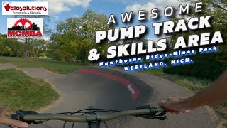
![New bike park or what is this?]()
3:25 |
52 |
Oct 28, 2025

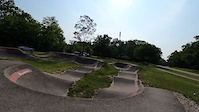
trail: Pump Track
0:54 |
213 |
Apr 18, 2012

4:09 |
334 |
Oct 5, 2024

trail: Maybury Trail
8:08 |
209 |
Apr 29, 2024 , Northville
6:14 |
123 |
Nov 19, 2023
Current Trail Warnings
| status | trail | date | condition | user | info |
|---|---|---|---|---|---|
| Phase 3 North MTB Legacy Park Trails | Jun 10, 2026 @ 8:55am (America/Detroit) Jun 10, 2026 | Ideal | bender313 | The trail received significant rain on... | |
| Winter Loop Shortcut Maybury State Park | Jun 3, 2026 @ 1:42pm (America/Detroit) Jun 3, 2026 | Unknown | lorenk3 MCMBA | Closed for renovation Spring through Fall... |
Recent Trail Reports
Activity Feed
| username | action | type | title | date |
|---|---|---|---|---|
| ftgeib | add | trail | activity #97139917 and 1 more | Jun 16, 2026 @ 3:03pm 1 day |
| ftgeib | add | polygon | activity #97031158 | Jun 15, 2026 @ 3:56am 3 days |
| ftgeib | add | poi | activity #96985051 | Jun 14, 2026 @ 10:39am Jun 14, 2026 |
| DiscountedSalt | add | report | activity #96862815 and 1 more | Jun 13, 2026 @ 4:38am Jun 13, 2026 |
| bender313 | add | report | activity #96757538 and 14 more | Jun 11, 2026 @ 1:08pm Jun 11, 2026 |
Recent Comments
| username | type | title | comment | date |
|---|---|---|---|---|
| report | Closed for Renovation | May 14, 2026 @ 7:46pm May 14, 2026 | ||
| report | Closed | May 3, 2026 @ 7:56am May 3, 2026 | ||
| trail | Great ride | May 3, 2026 @ 7:52am May 3, 2026 | ||
| trail | Not much of a trail left remaining. It looks... | May 2, 2026 @ 3:06pm May 2, 2026 | ||
| trail | Oops, this is in reference to the section just... | Sep 4, 2024 @ 10:41am Sep 4, 2024 |
Local Badges
-

Completionist0 awarded -

Epic Ride 50k133 awarded -
Epic Ride 50k11 awarded -
Epic Ride 50k157 awarded -

Epic Mountain Bike Climb 2k0 awarded -

Climbing 10k Badge0 awarded
Bike & Skill Parks
| name | type | city | rating |
|---|---|---|---|
| Hawthorne Ridge Bike Park | skill park | Westland | |
| Rosie's Park BMX Loop. | skill park | Detroit | |
| Morton-Taylor Pump Track | skill park | Canton |
Activity Type Stats
| activitytype | trails | distance | descent | descent distance | total vertical | rating | global rank | state rank | photos | reports | routes | ridelogs |
|---|---|---|---|---|---|---|---|---|---|---|---|---|
| Mountain Bike | 136 | 134 miles | 2,959 ft | 39 miles | 413 ft | 182 | 1,546 | 7 | 35,626 | |||
| E-Bike | 48 | 76 miles | 902 ft | 21 miles | 269 ft | 1 | 964 | 1 | 373 | |||
| Winter Fat Bike | 1 | 75 | ||||||||||
| Horse | 70 | 40 miles | 551 ft | 4 miles | 407 ft | 61 | 49 | |||||
| Hike | 344 | 211 miles | 4,163 ft | 51 miles | 417 ft | 3 | 1,559 | 2 | 2,526 | |||
| Trail Running | 344 | 211 miles | 4,163 ft | 51 miles | 417 ft | 1,559 | 1,303 | |||||
| Observed Trials | 1 | 2 | 2 | |||||||||
| Snowmobile | 1 | 3,812 ft | 13 ft | 495 ft | 13 ft | 15 | 4 | |||||
| Snowshoe | 61 | 28 miles | 705 ft | 6 miles | 410 ft | 328 | 26 | |||||
| Downhill Ski | 1 | 1 | 5 | |||||||||
| Backcountry Ski | 31 | 9 miles | 528 ft | 3 miles | 341 ft | 156 | 6 | |||||
| Nordic Ski | 37 | 18 miles | 180 ft | 3 miles | 381 ft | 147 | 93 |
Frequently Asked Questions About Wayne County
▼
What are the best places to ride in Wayne County?
Wayne County has 17 areas to explore for mountain biking. The top rated areas are:
▼
What are the highest rated mountain biking trails in Wayne County?
The highest rated mountain biking trails in Wayne County are:
- Lakeview Trail Westbound (4.3/5)
- Bell Branch South MTB Trail (4.3/5)
- Maybury Trail (4.3/5)
- Riverview Trail - Eastbound (4.3/5)
- Bell Branch North MTB Trail (4.2/5)
▼
What is the best time of the year to ride in Wayne County?
Based on ride log data, the most popular months to ride in Wayne County are:
- July (194 activities)
- August (173 activities)
- September (136 activities)
▼
What is the longest trail in Wayne County?
The longest trail in Wayne County is Hines Park Paved Pathway at 18.2 miles. View all trails sorted by distance.
Activities
Trails
- By WillieJacobsz
 Trailforks SBP SWW & contributors
 - Admins: M MOTO, truebleve, MCMBA
- #56503 - 3,768 views
- wayne county activity log | embed map of Wayne County mountain bike trails | wayne county mountain biking points of interest polygons
Downloading of trail gps tracks in kml & gpx formats is enabled for Wayne County.
You must login to download files.