close
-
Layers w
- Weather Layers
- Pro
- Pro
- Pro
- Pro
- Pro
- Pro
- More Layers
- Pro
- Pro
- Pro
- Pro
-
Upgrade to

3D
Trail Conditions
- Unknown
- Snow Groomed
- Snow Packed
- Snow Covered
- Snow Cover Partial
- Freeze/thaw Cycle
- Icy
- Prevalent Mud
- Wet
- Variable
- Ideal
- Dry
- Very Dry
Trail Flow (Ridden Direction)
Trailforks scans users ridelogs to determine the most popular direction each trail is ridden. A good flowing trail network will have most trails flowing in a single direction according to their intension.
The colour categories are based on what percentage of riders are riding a trail in its intended direction.
The colour categories are based on what percentage of riders are riding a trail in its intended direction.
- > 96%
- > 90%
- > 80%
- > 70%
- > 50%
- < 50%
- bi-directional trail
- no data
Trail Last Ridden
Trailforks scans ridelogs to determine the last time a trail was ridden.
- < 2 days
- < 1 week
- < 2 weeks
- < 1 month
- < 6 months
- > 6 months
Trail Ridden Direction
The intended direction a trail should be ridden.
- Downhill Only
- Downhill Primary
- Both Directions
- Uphill Primary
- Uphill Only
- One Direction
Contribute Details
Colors indicate trail is missing specified detail.
- Description
- Photos
- Description & Photos
- Videos
Trail Popularity ?
Trailforks scans ridelogs to determine which trails are ridden the most in the last 9 months.
Trails are compared with nearby trails in the same city region with a possible 25 colour shades.
Think of this as a heatmap, more rides = more kinetic energy = warmer colors.
- most popular
- popular
- less popular
- not popular
ATV/ORV/OHV Filter
Max Vehicle Width
inches
US Cell Coverage
Legend

Radar Time
Activity Recordings
Trailforks uses anonymized public activity data.
?
Activity Recordings
Trailforks uses anonymized public activity data.
?
Personal Heatmap
▶
Activity Types
all
/
none
▶
Options
2
Date range
month
–
Winter Trails
Warning
A routing network for winter maps does not exist. Selecting trails using the winter trails layer has been disabled.
Missing Trails
Most Popular
Least Popular
Trails are colored based on popularity. The more popular a trail is, the more red. Less popular trails trend towards green.
Jump Magnitude Heatmap
Heatmap of where riders jump on trails. Zoom in to see individual jumps, click circles to view jump details.
BC Backroad Status
![map legend]()
Service Road Atlas is a free to use, community-driven service for viewing and creating reports on the numerous back-country service roads around B.C. and Alberta.

Slope Aspect
Direction the slope faces
Trails Deemphasized
Trails are shown in grey.
Only show trails with no bike usage.
Suggested Layers
Based on selected activity type
Save the current map location and zoom level as your default home location whenever this page is loaded.
SaveThe trail system features 6.7 miles of narrow, single-track trail accessible from two points: the parking lot of WCU’s new Health and Human Sciences Building on Little Savannah Road and the pedestrian tunnel under Highway 107 near WCU’s softball complex. The access point through the tunnel connects users to the trail via property of the North Carolina Center for the Advancement of Teaching.
Primary Trail Type: Cross-Country
 google parking directions
Links
Activities Click to view
- Mountain Bike
8 trails
- Hike
8 trails
- Trail Running
8 trails
Region Details
- 1
- 4
- 3
Region Status
Open as of Jul 2, 2025Stats
- Avg Trail Rating
- Trails (view details)
- 8
- Trails Mountain Bike
- 8
- Trails Hike
- 8
- Trails Trail Running
- 8
- Total Distance
- 6 miles
- Total Descent
- 1,551 ft
- Total Vertical
- 521 ft
- Highest Trailhead
- 2,613 ft
- Reports
- 39
- Photos
- 35
- Ridden Counter
- 753
Popular WCU Trail System Mountain Biking Trails
• 65 ★ 5.0 • 2 miles • 217 ft • 119 •
Moderately popular blue difficulty singletrack. This mountain bike primary trail can be used both directions. On average it takes 17 minutes to complete this trail.
• 85 ★ 4.3 • 1 mile • 282 ft • 118 •
Popular blue difficulty singletrack. This mountain bike primary trail can be used both directions. On average it takes 19 minutes to complete this trail.
• 75 ★ 5.0 • 1,978 ft • 51 ft • 99 •
Popular green difficulty singletrack. This mountain bike primary trail can be used both directions. On average it takes 2 minutes to complete this trail.
• 95 ★ 4.7 • 1 mile • 164 ft • 96 •
Popular blue difficulty singletrack. This mountain bike primary trail can be used downhill primary. On average it takes 11 minutes to complete this trail.
• 45 ★ 5.0 • 1,440 ft • 152 ft • 79 •
Moderately popular green difficulty singletrack. This mountain bike primary trail can be used both directions. On average it takes 3 minutes to complete this trail.
• 55 ★ 3.9 • 2 miles • 486 ft • 78 •
Moderately popular green difficulty singletrack. This mountain bike primary trail can be used both directions. On average it takes 19 minutes to complete this trail.
WCU Trail System Mountain Bike Routes
45 miles • 6,540 ft • 0 • Loop •
Start at East Laporte Park in Jackson County. Cross Highway 107 and turn onto Caney Fork Road. Turn left...
18 miles • 4,022 ft • 0 • Point to Point •
This route takes you from campus all the way up to the parkway.
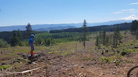
Photos of WCU Trail System Mountain Bike
Videos of WCU Trail System Mountain Bike
trail: Parking Lot
0:15 |
59 |
Aug 27, 2017

trail: Parking Lot
0:29 |
784 |
Mar 6, 2016

trail: Parking Lot
0:06 |
283 |
Oct 11, 2009

trail: Parking Lot
0:08 |
165 |
Oct 11, 2009

trail: Parking Lot
0:12 |
89 |
Oct 11, 2009
Recent Trail Reports
| status | trail | date | condition | info | user |
|---|---|---|---|---|---|
| Upper Long Branch Loop | Jun 10, 2024 @ 8:28am Jun 10, 2024 | Ideal | Jeremy122776 EBCI | ||
| Gribble Gap Loop | Jun 10, 2024 @ 8:28am Jun 10, 2024 | Ideal | Jeremy122776 EBCI | ||
| Little Savannah Connector | Jun 10, 2024 @ 8:28am Jun 10, 2024 | Ideal | Jeremy122776 EBCI | ||
| Lower Long Branch Loop | Jun 10, 2024 @ 8:28am Jun 10, 2024 | Ideal | Jeremy122776 EBCI | ||
| Cullowhee Connector | Jun 10, 2024 @ 8:28am Jun 10, 2024 | Ideal | Jeremy122776 EBCI | ||
| HHS Connector | Aug 17, 2022 @ 11:43am Aug 17, 2022 | Ideal | ottprime | ||
| Corkscrew | Aug 27, 2018 @ 3:14pm Aug 27, 2018 | Dry | hpiguy |
Activity Feed
| username | action | type | title | date |
|---|---|---|---|---|
| srhull | wishlist | region | activity #86469488 | Jan 1, 2026 @ 2:28pm Jan 1, 2026 |
| ChrisUKRvYZ | wishlist | region | activity #82715969 | Oct 20, 2025 @ 9:41am Oct 20, 2025 |
| CarbonCrackhead | ridden | trail | activity #82363860 and 4 more | Oct 14, 2025 @ 5:57pm Oct 14, 2025 |
| Pineapplll | vote | trail | activity #79363757 and 6 more | Aug 31, 2025 @ 1:16pm Aug 31, 2025 |
| Pineapplll | ridden | trail | activity #79363744 and 6 more | Aug 31, 2025 @ 1:16pm Aug 31, 2025 |
Recent Comments
| username | type | title | comment | date |
|---|---|---|---|---|
| trail | Recommend the connector trail be upgraded from... | May 20, 2024 @ 1:45pm May 20, 2024 | ||
| trail | A well-maintained XC trail. Riding the branch... | Jul 13, 2021 @ 6:07am Jul 13, 2021 | ||
| trail | A well-maintained and fun XC trail. Riding the... | Jul 13, 2021 @ 6:05am Jul 13, 2021 | ||
| trail | A great trail. Riding | Jul 13, 2021 @ 6:03am Jul 13, 2021 | ||
| trail | Highly recommend these trails. Lots of fun... | Oct 1, 2017 @ 10:29am Oct 1, 2017 |
Nearby Areas
| name | distance | ||||
|---|---|---|---|---|---|
| Caney Fork | 4.2 km | ||||
| Wayehuta ORV Park | 1 | 5.1 km | |||
| Panthertown Valley | 1 | 10 | 13.8 km | ||
| Fire Mountain Trails | 4 | 5 | 14.1 km | ||
| Middle Prong Wilderness | 14.8 km |
Activity Type Stats
| activitytype | trails | distance | descent | descent distance | total vertical | rating | global rank | state rank | photos | reports | routes | ridelogs |
|---|---|---|---|---|---|---|---|---|---|---|---|---|
| Mountain Bike | 8 | 6 miles | 1,552 ft | 3 miles | 522 ft | #5,699 | #2,095 | 35 | 39 | 2 | 1,602 | |
| Hike | 8 | 6 miles | 1,552 ft | 3 miles | 522 ft | #15,332 | #6,890 | 39 | 1 | 43 | ||
| Trail Running | 8 | 6 miles | 1,552 ft | 3 miles | 522 ft | #14,205 | #6,035 | 39 | 1 | 19 |
Frequently Asked Questions About WCU Trail System
▼
What are the highest rated mountain biking trails in WCU Trail System?
The highest rated mountain biking trails in WCU Trail System are:
- Little Savannah Connector (4.2/5)
- Upper Long Branch Loop (4.2/5)
- HHS Connector (4.2/5)
- Gribble Gap Loop (4.2/5)
- Lower Long Branch Loop (4.1/5)
▼
What is the best time of the year to ride in WCU Trail System?
Based on ride log data, the most popular months to ride in WCU Trail System are:
- October (29 activities)
- July (23 activities)
- August (13 activities)
▼
Where can I park to ride in WCU Trail System?
There are 1 parking locations listed in WCU Trail System. The most popular parking spots are:
▼
What is the longest trail in WCU Trail System?
The longest trail in WCU Trail System is Cullowhee Connector at 1.8 miles. View all trails sorted by distance.
- By markholloway
 Trailforks Map Team & contributors
 - Admins: apply
- #10888 - 7,549 views
- wcu trail system activity log | embed map of WCU Trail System mountain bike trails | wcu trail system mountain biking points of interest polygons
Downloading of trail gps tracks in kml & gpx formats is enabled for WCU Trail System.
You must login to download files.