close
-
Layers w
- Weather Layers
- Pro
- Pro
- Pro
- Pro
- Pro
- Pro
- More Layers
- Pro
- Pro
- Pro
- Pro
-
Upgrade to

3D
Trail Conditions
- Unknown
- Snow Groomed
- Snow Packed
- Snow Covered
- Snow Cover Partial
- Freeze/thaw Cycle
- Icy
- Prevalent Mud
- Wet
- Variable
- Ideal
- Dry
- Very Dry
Trail Flow (Ridden Direction)
Trailforks scans users ridelogs to determine the most popular direction each trail is ridden. A good flowing trail network will have most trails flowing in a single direction according to their intension.
The colour categories are based on what percentage of riders are riding a trail in its intended direction.
The colour categories are based on what percentage of riders are riding a trail in its intended direction.
- > 96%
- > 90%
- > 80%
- > 70%
- > 50%
- < 50%
- bi-directional trail
- no data
Trail Last Ridden
Trailforks scans ridelogs to determine the last time a trail was ridden.
- < 2 days
- < 1 week
- < 2 weeks
- < 1 month
- < 6 months
- > 6 months
Trail Ridden Direction
The intended direction a trail should be ridden.
- Downhill Only
- Downhill Primary
- Both Directions
- Uphill Primary
- Uphill Only
- One Direction
Contribute Details
Colors indicate trail is missing specified detail.
- Description
- Photos
- Description & Photos
- Videos
Trail Popularity ?
Trailforks scans ridelogs to determine which trails are ridden the most in the last 9 months.
Trails are compared with nearby trails in the same city region with a possible 25 colour shades.
Think of this as a heatmap, more rides = more kinetic energy = warmer colors.
- most popular
- popular
- less popular
- not popular
ATV/ORV/OHV Filter
Max Vehicle Width
inches
US Cell Coverage
Legend

Radar Time
Activity Recordings
Trailforks uses anonymized public activity data.
?
Activity Recordings
Trailforks uses anonymized public activity data.
?
Personal Heatmap
▶
Activity Types
all
/
none
▶
Options
2
Date range
month
–
Winter Trails
Warning
A routing network for winter maps does not exist. Selecting trails using the winter trails layer has been disabled.
Missing Trails
Most Popular
Least Popular
Trails are colored based on popularity. The more popular a trail is, the more red. Less popular trails trend towards green.
Jump Magnitude Heatmap
Heatmap of where riders jump on trails. Zoom in to see individual jumps, click circles to view jump details.
BC Backroad Status
![map legend]()
Service Road Atlas is a free to use, community-driven service for viewing and creating reports on the numerous back-country service roads around B.C. and Alberta.

Slope Aspect
Direction the slope faces
Trails Deemphasized
Trails are shown in grey.
Only show trails with no bike usage.
Suggested Layers
Based on selected activity type
Save the current map location and zoom level as your default home location whenever this page is loaded.
Save
No description for West Chester has been added yet!
Login or register to submit one.
Activities Click to view
- Mountain Bike
15 trails
- Gravel Bike
0 trails
- Adaptive Bike
0 trails
- Hike
30 trails
- Trail Running
29 trails
Region Details
- 3
- 6
- 2
Region Status
Caution as of Apr 30, 2026Stats
- Avg Trail Rating
- Trails (view details)
- 26
- Trails Mountain Bike
- 15
- Trails E-Bike
- 3
- Trails Hike
- 30
- Trails Trail Running
- 29
- Total Distance
- 17 miles
- Total Descent Distance
- 7 miles
- Total Descent
- 1,586 ft
- Total Vertical
- 307 ft
- Highest Trailhead
- 494 ft
- Reports
- 147
- Photos
- 11
- Ridden Counter
- 6,508
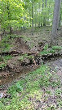
Popular West Chester Mountain Biking Trails
• 75 ★ 5.0 • 1,621 ft • 3 ft • 355 •
Popular blue difficulty singletrack. This mountain bike primary trail can be used downhill primary. It features roller coaster. On average it takes 1 minutes to complete this trail.
• 95 ★ 5.0 • 1,673 ft • 65 ft • 349 •
This trail connects the bowl area to the road. Runs through the middle of a gully, and a sidewinder-type trail runs through the gully. Some jumps and drops lower down. Very fun.
• 85 ★ 5.0 • 2,313 ft • 22 ft • 325 •
the old railroad bed has numerous options. climb up some steeps to be rewarded with a narrow ridge line ride, and super steep downhill, and a good kicker. dirt bikes and four wheelers hang out here, so dont expect much for mtb. but some...
• 70 ★ 5.0 • 3,720 ft • 96 ft • 316 •
This combination of exposed rocks, roots, and steep climbing makes the trail more technically demanding and suitable for experienced riders. There are a few very tough moves on exposed lines that make riding always exciting.
• 60 ★ 4.4 • 1 mile • 215 ft • 294 •
The southern half of this trail, located off the gravel Saw Mill Road, is a gradual climb or descent along a creek bed. It can get narrow at times. Once arrived at Romig Road, climb up the sidewalk to Bradford Elementary and ride along...
• 50 ★ 5.0 • 2,487 ft • 41 ft • 201 •
Moderately popular blue difficulty singletrack. This mountain bike primary trail can be used both directions. On average it takes 3 minutes to complete this trail.
• 45 ★ 3.4 • 2 miles • 268 ft • 177 •
A unique trail unlike anything else in the Philadelphia area, with magnificent forests and very shaley soil. Very difficult, tight and rooty trail with lots of switchbacks and short punchy uphills. A very hard trail. For comparison,...
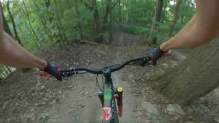
Videos of West Chester Mountain Bike
trail: Downingtown White Trail
0:08 |
|
May 7, 2025
trail: Downingtown White Trail
0:55 |
172 |
Sep 13, 2024 , West Chester
youtuber
![Support Your Local Trails]()

trail: Connector (Sidewinder Trail)
9:21 |
534 |
Oct 25, 2019 , West Chester
youtuber
![Harmony Hill Sidewinder]()

trail: Connector (Sidewinder Trail)
4:57 |
675 |
Jul 26, 2019 , West Chester
Recent Trail Reports
| status | trail | date | condition | info | user |
|---|---|---|---|---|---|
| Wang Tangler | Apr 30, 2026 @ 9:10am (America/New_York) Apr 30, 2026 | Wet | rdnatale | ||
| Deuz Sawmill | Mar 8, 2026 @ 3:00pm (America/New_York) Mar 8, 2026 | Ideal | Timmy1977 | ||
| Sméagol | Mar 8, 2026 @ 3:52pm (America/New_York) Mar 8, 2026 | Variable | Vert1go1 | ||
| Connector (Sidewinder Trail) | Apr 30, 2025 @ 6:03pm Apr 30, 2025 | Dry | Mustang289 | ||
| Miller time | Nov 15, 2024 @ 1:21pm Nov 15, 2024 | Dry | geronimok BTW | ||
| Powerline | Dec 30, 2023 @ 7:44am Dec 30, 2023 | Snow Covered | SF093 | ||
| Pick a card, any card | Dec 30, 2023 @ 7:44am Dec 30, 2023 | Variable | SF093 | ||
| Ridge Ride | Aug 1, 2023 @ 4:56pm Aug 1, 2023 | Dry | schmobob | ||
| Alt | Jul 25, 2021 @ 3:00pm Jul 25, 2021 | Ideal | Squirt7 |
Activity Feed
| username | action | type | title | date |
|---|---|---|---|---|
| Adam99DLbr | wishlist | trail | activity #97452142 | Jun 20, 2026 @ 8:05pm Jun 20, 2026 |
| abradley77 | ridden | trail | activity #94953938 | May 17, 2026 @ 6:11pm May 17, 2026 |
| rdnatale | add | report | activity #93707760 | Apr 30, 2026 @ 6:10am Apr 30, 2026 |
| rdnatale | add | report | activity #93624722 | Apr 28, 2026 @ 7:43pm Apr 28, 2026 |
| Timmy1977 | add | report | activity #90238679 | Mar 8, 2026 @ 3:58pm Mar 8, 2026 |
Recent Comments
| username | type | title | comment | date |
|---|---|---|---|---|
| trail | Very technical with short steep climbs over... | Mar 27, 2024 @ 7:12am Mar 27, 2024 | ||
| trail | Challenging but rewarding technical trail,... | Mar 26, 2024 @ 6:15pm Mar 26, 2024 | ||
| trail | The HOA on top of the hill put up no... | Dec 18, 2023 @ 3:17pm Dec 18, 2023 | ||
| report | Sorry wrong trail. Tree is down on connector trail | Aug 1, 2023 @ 8:16pm Aug 1, 2023 | ||
| trail | Sign says; Private property no trespassing... | Dec 30, 2022 @ 8:39am Dec 30, 2022 |
Local Badges
-

10 Blue Trails155 awarded -

Epic Ride Climb 2k19 awarded -

Climbing 10k Badge58 awarded -

Climbing 100k Badge2 awarded -

Epic Ride Descent 2k19 awarded -

Descent 10k Badge58 awarded
Local Mountain Biking Directory
-
JFW's MTB
![JFW's MTB]()
-
West Chester Bicycle CenterBike Shop
-
Bike Line - West ChesterBike Shop
-
Bike Line Of West ChesterBike Shop
Activity Type Stats
| activitytype | trails | distance | descent | descent distance | total vertical | rating | global rank | state rank | photos | reports | routes | ridelogs |
|---|---|---|---|---|---|---|---|---|---|---|---|---|
| Mountain Bike | 15 | 9 miles | 1,093 ft | 5 miles | 282 ft | #3,400 | #1,164 | 11 | 147 | 3,346 | ||
| E-Bike | 3 | 1 mile | 66 ft | 1,470 ft | 154 ft | 135 | 90 | |||||
| Hike | 30 | 17 miles | 1,585 ft | 7 miles | 308 ft | #7,050 | #2,498 | 147 | 504 | |||
| Trail Running | 29 | 16 miles | 1,519 ft | 7 miles | 308 ft | #7,791 | #2,585 | 147 | 164 |
Frequently Asked Questions About West Chester
▼
What are the best places to ride in West Chester?
West Chester has 1 areas to explore for mountain biking.
▼
What are the highest rated mountain biking trails in West Chester?
The highest rated mountain biking trails in West Chester are:
- Miller time (4.3/5)
- Alt (4.1/5)
- Wang Tangler (4.1/5)
- Connector (Sidewinder Trail) (4.1/5)
- Pick a card, any card (4.1/5)
▼
What is the best time of the year to ride in West Chester?
Based on ride log data, the most popular months to ride in West Chester are:
- May (12 activities)
- July (10 activities)
- October (9 activities)
▼
Where can I park to ride in West Chester?
There are 3 parking locations listed in West Chester. The most popular parking spots are: View all parking and trailhead locations on the map to plan your visit.
Activities
- By brenthillier
 NSMBA TRAILFORKS & contributors
 - Admins: brettpalumbo
- #3599 - 8,873 views
- west chester activity log | embed map of West Chester mountain bike trails | west chester mountain biking points of interest
Downloading of trail gps tracks in kml & gpx formats is enabled for West Chester.
You must login to download files.