close
-
Layers w
- Weather Layers
- Pro
- Pro
- Pro
- Pro
- Pro
- Pro
- More Layers
- Pro
- Pro
- Pro
- Pro
-
Upgrade to

3D
Trail Conditions
- Unknown
- Snow Groomed
- Snow Packed
- Snow Covered
- Snow Cover Partial
- Freeze/thaw Cycle
- Icy
- Prevalent Mud
- Wet
- Variable
- Ideal
- Dry
- Very Dry
Trail Flow (Ridden Direction)
Trailforks scans users ridelogs to determine the most popular direction each trail is ridden. A good flowing trail network will have most trails flowing in a single direction according to their intension.
The colour categories are based on what percentage of riders are riding a trail in its intended direction.
The colour categories are based on what percentage of riders are riding a trail in its intended direction.
- > 96%
- > 90%
- > 80%
- > 70%
- > 50%
- < 50%
- bi-directional trail
- no data
Trail Last Ridden
Trailforks scans ridelogs to determine the last time a trail was ridden.
- < 2 days
- < 1 week
- < 2 weeks
- < 1 month
- < 6 months
- > 6 months
Trail Ridden Direction
The intended direction a trail should be ridden.
- Downhill Only
- Downhill Primary
- Both Directions
- Uphill Primary
- Uphill Only
- One Direction
Contribute Details
Colors indicate trail is missing specified detail.
- Description
- Photos
- Description & Photos
- Videos
Trail Popularity ?
Trailforks scans ridelogs to determine which trails are ridden the most in the last 9 months.
Trails are compared with nearby trails in the same city region with a possible 25 colour shades.
Think of this as a heatmap, more rides = more kinetic energy = warmer colors.
- most popular
- popular
- less popular
- not popular
ATV/ORV/OHV Filter
Max Vehicle Width
inches
US Cell Coverage
Legend

Radar Time
Activity Recordings
Trailforks uses anonymized public activity data.
?
Activity Recordings
Trailforks uses anonymized public activity data.
?
Personal Heatmap
▶
Activity Types
all
/
none
▶
Options
2
Date range
month
–
Winter Trails
Warning
A routing network for winter maps does not exist. Selecting trails using the winter trails layer has been disabled.
Missing Trails
Most Popular
Least Popular
Trails are colored based on popularity. The more popular a trail is, the more red. Less popular trails trend towards green.
Jump Magnitude Heatmap
Heatmap of where riders jump on trails. Zoom in to see individual jumps, click circles to view jump details.
BC Backroad Status
![map legend]()
Service Road Atlas is a free to use, community-driven service for viewing and creating reports on the numerous back-country service roads around B.C. and Alberta.

Slope Aspect
Direction the slope faces
Trails Deemphasized
Trails are shown in grey.
Only show trails with no bike usage.
Suggested Layers
Based on selected activity type
Save the current map location and zoom level as your default home location whenever this page is loaded.
Save
No description for West Coast has been added yet!
Login or register to submit one.
Activities Click to view
- Mountain Bike
136 trails
- E-Bike
25 trails
- Hike
167 trails
- Trail Running
179 trails
Region Details
- 24
- 3
- 32
- 35
- 13
- 11
- 1
Stats
- Avg Trail Rating
- Trails (view details)
- 134
- Trails Mountain Bike
- 136
- Trails E-Bike
- 25
- Trails Gravel Bike
- 1
- Trails Hike
- 183
- Trails Trail Running
- 179
- Total Distance
- 284 miles
- Total Descent
- 51,886 ft
- Total Vertical
- 4,416 ft
- Highest Trailhead
- 4,417 ft
- Reports
- 372
- Photos
- 763
- Ridden Counter
- 16,647
Sub Regions
- Franz Josef (1)
- Greymouth (1)
- Hokitika (74)
- Blue Spur Forest (44)
- Reefton (13)
- Blacks Point (12)
- Ross (2)
- Westport (16)
- Denniston Plateau (20)
- Fox Glacier (1)
- Lake Kaniere Scenic Reserve (0)
- Ōkārito Area (0)
- Paparoa National Park (6)
- Westland Tai Poutini National Park (1)
Popular West Coast Mountain Biking Trails
• 100 ★ 4.5 • 47 miles • 9,359 ft • 566 •
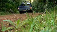
In the North West corner of the South Island of New Zealand a ghost is awakening. A long-forgotten gold miners’ road is being revived as a mountain biking and tramping trail – connecting the old dray road in the Lyell (Upper Buller...
• 100 ★ 5.0 • 2 miles • 116 ft • 535 •
A stunning section of easy singletrack, along the historic . This section, from The Landing (Lake Kaniere) to Ward Road, has been upgraded and incorporated into the West Coast Wilderness Trail. Continue along the 'Water Line' section to...
• 95 ★ 0.0 • 3 miles • 79 ft • 515 •
A stunning section of easy riding; in conjunction with the Grade 2 section of the Kaniere Water Race, this is one of the best easy rides near Hokitika.
• 100 ★ 0.0 • 1,740 ft • 10 ft • 488 •
Cycle Trail (West Coast Wilderness Trail) section of Ward Road. This links the Grade 2 section of the Kaniere Water Race, with the Water Line piece of trail.
• 100 ★ 0.0 • 4,117 ft • 0 ft • 448 •
This is the recently completed section of the WCWT that once again links Hokitika with Kaniere Township - new bridges and surfacing have brought this key community linkage to life again! Originally built in 1866 by the Hokitika and...
• 75 ★ 5.0 • 2 miles • 86 ft • 377 •
Another stunning section of newly constructed easy riding, linking the historic Mahinapua Rail Bridge with the . In conjunction with the , this is one of the best easy rides near Hokitika.
• 80 ★ 0.0 • 686 ft • 3 ft • 374 •
Short gravel link track from the Golf Course (end of Golf Links Road) to the Information Kiosk on the side of the Highway.
• 75 ★ 4.0 • 1 mile • 16 ft • 327 •
This section of trail forms part of the Heritage Trail loop around Hokitika, and the WCWT.
West Coast Mountain Bike Routes
16 miles • 542 ft • 7 • Point to Point •
West Coast Wilderness Trail - Lake Kaniere to Scenic Waterways in Hokitika
81 miles • 3,190 ft • 12 • Point to Point •
West Coast Wilderness Trail. Lovely ride through historic west coast with echoes of the forestry and gold...
22 miles • 690 ft • 2 • Point to Point •
West Coast Wilderness Trail - Ross to Hokitika Section
309 miles • 34,899 ft • 0 • Point to Point •
leg distance climb descent 1 50km 1069m 1193m Trail Head —> Heaphy hut 2 15km 138m 133m Heaphy Hut...
24 miles • 1,657 ft • 1 • Point to Point •
West Coast Wilderness Trail - Milltown to Kumara section
18 miles • 286 ft • 0 • Point to Point •
West Coast Wilderness Trail - Kumara to Greymouth section
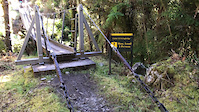
Photos of West Coast Mountain Bike
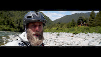
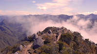
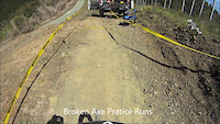
Videos of West Coast Mountain Bike
trail: Te Ara Paparoa
0:22 |
397 |
Nov 2, 2020
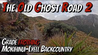
trail: Old Ghost Road
11:45 |
2 |
Jun 27, 2019
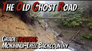
trail: Old Ghost Road
0:40 |
102 |
Apr 20, 2019
trail: Rocky
4:01 |
461 |
Nov 2, 2014

trail: Logarithm Link
4:10 |
8449 |
Apr 2, 2013
trail: Logarithm Link
2:48 |
25489 |
Sep 20, 2012
trail: Old Ghost Road
9:07 |
5 |
Jun 14, 2026 , Westport
trail: Old Ghost Road
4:31 |
2 |
Jun 14, 2026 , Westport
Recent Trail Reports
Activity Feed
| username | action | type | title | date |
|---|---|---|---|---|
| ianteller | wishlist | trail | activity #97435283 | Jun 20, 2026 @ 2:52pm 2 days |
| LinzG | wishlist | route | activity #97369671 | Jun 20, 2026 @ 12:14am 2 days |
| LinzG | wishlist | trail | activity #97369456 and 1 more | Jun 20, 2026 @ 12:08am 2 days |
| spectacularspectacles | wishlist | trail | activity #97179611 | Jun 17, 2026 @ 6:46am Jun 17, 2026 |
| frichardt | wishlist | route | activity #97010998 | Jun 14, 2026 @ 4:04pm Jun 14, 2026 |
Recent Comments
| username | type | title | comment | date |
|---|---|---|---|---|
| trail | Nice old rail trail. They blocked the bridge,... | Apr 26, 2026 @ 3:45am Apr 26, 2026 | ||
| trail | Name doesn’t do it justice ! Great fun . In... | Apr 6, 2026 @ 5:53pm Apr 6, 2026 | ||
| trail | A wee bit short as I just got into the flow... | Apr 6, 2026 @ 5:53pm Apr 6, 2026 | ||
| trail | Great up hill track , tree roots have been... | Apr 6, 2026 @ 5:51pm Apr 6, 2026 | ||
| trail | My favourite run here , good flow and just a... | Apr 6, 2026 @ 5:49pm Apr 6, 2026 |
Local Badges
-

Big Ride 30k151 awarded -

Descent 10k Badge2 awarded -

Descent 100k Badge1 awarded -
Descent 100k Badge0 awarded -
Big Ride 30k667 awarded -

Epic Ride 50k114 awarded
Activity Type Stats
| activitytype | trails | distance | descent | descent distance | total vertical | rating | global rank | state rank | photos | reports | routes | ridelogs |
|---|---|---|---|---|---|---|---|---|---|---|---|---|
| Mountain Bike | 136 | 258 miles | 46,096 ft | 107 miles | 4,416 ft | 591 | 370 | 6 | 11,846 | |||
| E-Bike | 25 | 62 miles | 4,203 ft | 16 miles | 2,956 ft | 7 | 228 | 4 | 879 | |||
| Gravel Bike | 1 | 1 | 3 | 111 | ||||||||
| Hike | 167 | 282 miles | 50,495 ft | 118 miles | 4,416 ft | 151 | 355 | 3 | 2,703 | |||
| Trail Running | 179 | 276 miles | 50,256 ft | 117 miles | 4,416 ft | 355 | 4 | 929 |
Frequently Asked Questions About West Coast
▼
What are the best places to ride in West Coast?
West Coast has 5 areas to explore for mountain biking. The top rated areas are:
▼
What are the highest rated mountain biking trails in West Coast?
The highest rated mountain biking trails in West Coast are:
- Old Ghost Road (4.4/5)
- Pike29 Memorial Track (4.4/5)
- Logarithm (4.4/5)
- Moss Piglet (4.3/5)
- Wutang (4.2/5)
▼
What is the best time of the year to ride in West Coast?
Based on ride log data, the most popular months to ride in West Coast are:
- December (82 activities)
- November (68 activities)
- January (68 activities)
▼
What is the longest trail in West Coast?
The longest trail in West Coast is Old Ghost Road at 47.4 miles. View all trails sorted by distance.
Activities
Trails
Points of Interest
- Ōkārito Trig Summit
- Point Elisabeth Walkway Lookout Viewpoint
- [falls] Coastal Walk Waterfall Other
- [falls] Coastal Walk Waterfall Other
- [falls] Coastal Walk Waterfall Other
- [falls] Coastal Walk Waterfall Other
- [falls] Coastal Walk Waterfall Other
- Tatare Tunnels Walk Viewpoint
- Tatare Tunnels Walk Viewpoint
- [cave] Tatare Tunnels Other
- Minarets (9,731 ft)
- De La Beche (9,619 ft)
- Mount Walter (9,478 ft)
- By brenthillier
 NSMBA TRAILFORKS & contributors
 - Admins: TFNZ, lintbagger, Alps2Ocean-Cycle-Trail, WestlandMTB
- #3654 - 11,861 views
- west coast activity log | embed map of West Coast mountain bike trails | west coast mountain biking points of interest
Downloading of trail gps tracks in kml & gpx formats is enabled for West Coast.
You must login to download files.