close
-
Layers w
- Weather Layers
- Pro
- Pro
- Pro
- Pro
- Pro
- Pro
- More Layers
- Pro
- Pro
- Pro
- Pro
-
Upgrade to

3D
Trail Conditions
- Unknown
- Snow Groomed
- Snow Packed
- Snow Covered
- Snow Cover Partial
- Freeze/thaw Cycle
- Icy
- Prevalent Mud
- Wet
- Variable
- Ideal
- Dry
- Very Dry
Trail Flow (Ridden Direction)
Trailforks scans users ridelogs to determine the most popular direction each trail is ridden. A good flowing trail network will have most trails flowing in a single direction according to their intension.
The colour categories are based on what percentage of riders are riding a trail in its intended direction.
The colour categories are based on what percentage of riders are riding a trail in its intended direction.
- > 96%
- > 90%
- > 80%
- > 70%
- > 50%
- < 50%
- bi-directional trail
- no data
Trail Last Ridden
Trailforks scans ridelogs to determine the last time a trail was ridden.
- < 2 days
- < 1 week
- < 2 weeks
- < 1 month
- < 6 months
- > 6 months
Trail Ridden Direction
The intended direction a trail should be ridden.
- Downhill Only
- Downhill Primary
- Both Directions
- Uphill Primary
- Uphill Only
- One Direction
Contribute Details
Colors indicate trail is missing specified detail.
- Description
- Photos
- Description & Photos
- Videos
Trail Popularity ?
Trailforks scans ridelogs to determine which trails are ridden the most in the last 9 months.
Trails are compared with nearby trails in the same city region with a possible 25 colour shades.
Think of this as a heatmap, more rides = more kinetic energy = warmer colors.
- most popular
- popular
- less popular
- not popular
ATV/ORV/OHV Filter
Max Vehicle Width
inches
US Cell Coverage
Legend

Radar Time
Activity Recordings
Trailforks uses anonymized public activity data.
?
Activity Recordings
Trailforks uses anonymized public activity data.
?
Personal Heatmap
▶
Activity Types
all
/
none
▶
Options
2
Date range
month
–
Winter Trails
Warning
A routing network for winter maps does not exist. Selecting trails using the winter trails layer has been disabled.
Missing Trails
Most Popular
Least Popular
Trails are colored based on popularity. The more popular a trail is, the more red. Less popular trails trend towards green.
Jump Magnitude Heatmap
Heatmap of where riders jump on trails. Zoom in to see individual jumps, click circles to view jump details.
BC Backroad Status
![map legend]()
Service Road Atlas is a free to use, community-driven service for viewing and creating reports on the numerous back-country service roads around B.C. and Alberta.

Slope Aspect
Direction the slope faces
Trails Deemphasized
Trails are shown in grey.
Only show trails with no bike usage.
Suggested Layers
Based on selected activity type
Save the current map location and zoom level as your default home location whenever this page is loaded.
Save
No description for West Midlands has been added yet!
Login or register to submit one.
This region uses the Uk/Euro style trail grading system.
Activities Click to view
- Mountain Bike
16 trails
- E-Bike
7 trails
- Hike
9 trails
- Trail Running
9 trails
Region Details
- 2
- 4
- 7
- 2
- 1
Stats
- Avg Trail Rating
- Trails (view details)
- 17
- Trails Mountain Bike
- 16
- Trails E-Bike
- 7
- Trails Hike
- 9
- Trails Trail Running
- 9
- Total Distance
- 6 miles
- Total Descent
- 1,266 ft
- Total Vertical
- 777 ft
- Highest Trailhead
- 1,027 ft
- Reports
- 43
- Photos
- 13
- Ridden Counter
- 416
Sub Regions
- Clent (5)
- Clent Hills (5)
- Coventry (5)
- Rugby (4)
- Stourbridge (2)
- Sandwell Valley (0)
Popular West Midlands Mountain Biking Trails
• 100 ★ 0.0 • 1,306 ft • 0 ft • 70 •
Popular blue difficulty singletrack. This mountain bike primary trail can be used downhill only. It features berm, drop and jump. On average it takes 5 minutes to complete this trail.
• 80 ★ 0.0 • 1,257 ft • 0 ft • 40 •
Popular blue difficulty singletrack. This mountain bike primary trail can be used both directions. It features berm and jump. On average it takes 3 minutes to complete this trail.
• 60 ★ 0.0 • 728 ft • 0 ft • 36 •
Moderately popular blue difficulty singletrack. This mountain bike primary trail can be used downhill only. It features berm, drop and jump. On average it takes 1 minutes to complete this trail.
• 100 ★ 0.0 • 1,791 ft • 4 ft • 34 •
Popular green difficulty singletrack. This mountain bike primary trail can be used downhill primary. It features berm. On average it takes 1 minutes to complete this trail.
• 40 ★ 0.0 • 827 ft • 0 ft • 20 •
Moderately popular green difficulty singletrack. This mountain bike primary trail can be used downhill primary. It features berm. On average it takes 1 minutes to complete this trail.
• 60 ★ 0.0 • 1,565 ft • 17 ft • 14 •
Moderately popular blue difficulty family friendly machine groomed. This mountain bike primary trail can be used one direction with a 17 ft blue climb. It features berm. Trail visibility is always easy to follow. On average it takes 3 minutes to complete this trail.
• 100 ★ 0.0 • 679 ft • 3 ft • 14 •
Popular blue difficulty machine groomed. This mountain bike primary trail can be used one direction and has a moderate overall physical rating. It features berm. Trail visibility is always easy to follow. On average it takes 1 minutes to complete this trail.
• 40 ★ 0.0 • 2,379 ft • 17 ft • 13 •
Moderately popular green difficulty family friendly machine groomed. This mountain bike primary trail can be used one direction and has a easy overall physical rating with a 17 ft green climb. On average it takes 5 minutes to complete this trail.
West Midlands Mountain Bike Routes
23 miles • 722 ft • 0 • Loop •
Route using bridleways, construction at Houlton means bridleway between Hillmorton Locks and A5 Watling...
21 miles • 619 ft • 0 • Loop •
A pleasant circular route from Wednesbury to Birmingham mainly along canal towpaths. Note: The GPS track...
Photos of West Midlands Mountain Bike
Videos of West Midlands Mountain Bike
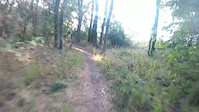
trail: Szop Pracz Trail
0:13 |
322 |
Aug 10, 2020
Recent Trail Reports
| status | trail | date | condition | info | user |
|---|---|---|---|---|---|
| Woodlands Trail Coventry | Jul 13, 2025 @ 2:16pm Jul 13, 2025 | Unknown | ParksConservation | ||
| Szop Pracz Trail Rugby | May 21, 2025 @ 7:55am May 21, 2025 | Dry | heheheok | ||
| Pump-Trail Miners Welfare MTB Trails | Mar 29, 2023 @ 12:24am Mar 29, 2023 | Ideal | Rattie | ||
| Hawkesbury Trail Miners Welfare MTB Trails | Mar 29, 2023 @ 7:24am Mar 29, 2023 | Dry | Rattie | ||
| Newdigate Trail Miners Welfare MTB Trails | Mar 5, 2023 @ 4:23am Mar 5, 2023 | Dry | lewiscraik | ||
| Deep Dark Wood Clent Hills | May 15, 2022 @ 5:25pm May 15, 2022 | Ideal | twade76 | ||
| NWP Parallel Line New Wood & Ashwood | Sep 25, 2021 @ 12:56am Sep 25, 2021 | Very Dry | wmnick1405 | ||
| New Wood Main Line New Wood & Ashwood | Apr 5, 2020 @ 2:46am Apr 5, 2020 | Unknown | twade76 |
Activity Feed
| username | action | type | title | date |
|---|---|---|---|---|
| heheheok | ridden | trail | activity #96915387 and 1 more | Jun 13, 2026 @ 2:11pm Jun 13, 2026 |
| GreyStokedMTB | wishlist | region | activity #93567757 | Apr 28, 2026 @ 2:15am Apr 28, 2026 |
| MS11 | wishlist | route | activity #92249588 | Apr 9, 2026 @ 6:45am Apr 9, 2026 |
| Stephen2vUfwS | wishlist | route | activity #90903154 | Mar 20, 2026 @ 12:11am Mar 20, 2026 |
| MarkUBvw2m | wishlist | route | activity #80192878 | Sep 12, 2025 @ 12:23pm Sep 12, 2025 |
Recent Comments
| username | type | title | comment | date |
|---|---|---|---|---|
| report | This trail is still usable and fun I recommend | May 13, 2025 @ 10:59pm May 13, 2025 | ||
| trail | Still OK | Dec 4, 2020 @ 5:11am Dec 4, 2020 | ||
| trail | Is this still OK to ride? | Dec 1, 2020 @ 5:28pm Dec 1, 2020 | ||
| trail | Looks like fun, I must give it a go...easy to... | Aug 16, 2020 @ 1:34am Aug 16, 2020 | ||
| report | Its usable, im working on that trail every week. | Aug 10, 2020 @ 2:29pm Aug 10, 2020 |
Bike & Skill Parks
| name | type | city | rating |
|---|---|---|---|
| Sandwell Valley Bike Park | skill park | Smethwick | |
| Miners Welfare MTB Trails Skills Area | skill park | Coventry |
Local Mountain Biking Directory
-
Race Co Cycles UK
-
Bache Brothers Cycles
-
Albany CyclesBike Shop
-
Bike Pro RacingBike Shop
-
Venture BikesBike Shop
-
Daves Cycles SuperstoreBike Shop
Activity Type Stats
| activitytype | trails | distance | descent | descent distance | total vertical | rating | global rank | state rank | photos | reports | routes | ridelogs |
|---|---|---|---|---|---|---|---|---|---|---|---|---|
| Mountain Bike | 16 | 5 miles | 1,125 ft | 3 miles | 774 ft | 13 | 43 | 4 | 32,764 | |||
| E-Bike | 7 | 3 miles | 197 ft | 1 mile | 102 ft | 24 | 3 | 1,975 | ||||
| Hike | 9 | 5 miles | 1,135 ft | 2 miles | 778 ft | 31 | 1 | 911 | ||||
| Trail Running | 9 | 5 miles | 1,135 ft | 2 miles | 778 ft | 31 | 1 | 272 |
Frequently Asked Questions About West Midlands
▼
What are the best places to ride in West Midlands?
West Midlands has 4 areas to explore for mountain biking. The top rated areas are:
▼
What are the highest rated mountain biking trails in West Midlands?
The highest rated mountain biking trails in West Midlands are:
- Szop Pracz Trail (4.1/5)
- Woodlands Trail (4/5)
- Deep Dark Wood (0/5)
- NWP Parallel Line (0/5)
- Pump-Trail (0/5)
▼
What is the best time of the year to ride in West Midlands?
Based on ride log data, the most popular months to ride in West Midlands are:
- November (106 activities)
- August (97 activities)
- September (86 activities)
▼
What is the longest trail in West Midlands?
The longest trail in West Midlands is Side-lining Walton at 861.0 m. View all trails sorted by distance.
Activities
- By brenthillier
 NSMBA TRAILFORKS & contributors
 - Admins: UKTP, 20twenty-p, wisey, MathieuC, cemoorelife
- #6803 - 6,424 views
- west midlands activity log | embed map of West Midlands mountain bike trails |
Downloading of trail gps tracks in kml & gpx formats is enabled for West Midlands.
You must login to download files.