close
-
Layers w
- Weather Layers
- Pro
- Pro
- Pro
- Pro
- Pro
- Pro
- More Layers
- Pro
- Pro
- Pro
- Pro
-
Upgrade to

3D
Trail Conditions
- Unknown
- Snow Groomed
- Snow Packed
- Snow Covered
- Snow Cover Partial
- Freeze/thaw Cycle
- Icy
- Prevalent Mud
- Wet
- Variable
- Ideal
- Dry
- Very Dry
Trail Flow (Ridden Direction)
Trailforks scans users ridelogs to determine the most popular direction each trail is ridden. A good flowing trail network will have most trails flowing in a single direction according to their intension.
The colour categories are based on what percentage of riders are riding a trail in its intended direction.
The colour categories are based on what percentage of riders are riding a trail in its intended direction.
- > 96%
- > 90%
- > 80%
- > 70%
- > 50%
- < 50%
- bi-directional trail
- no data
Trail Last Ridden
Trailforks scans ridelogs to determine the last time a trail was ridden.
- < 2 days
- < 1 week
- < 2 weeks
- < 1 month
- < 6 months
- > 6 months
Trail Ridden Direction
The intended direction a trail should be ridden.
- Downhill Only
- Downhill Primary
- Both Directions
- Uphill Primary
- Uphill Only
- One Direction
Contribute Details
Colors indicate trail is missing specified detail.
- Description
- Photos
- Description & Photos
- Videos
Trail Popularity ?
Trailforks scans ridelogs to determine which trails are ridden the most in the last 9 months.
Trails are compared with nearby trails in the same city region with a possible 25 colour shades.
Think of this as a heatmap, more rides = more kinetic energy = warmer colors.
- most popular
- popular
- less popular
- not popular
ATV/ORV/OHV Filter
Max Vehicle Width
inches
US Cell Coverage
Legend

Radar Time
Activity Recordings
Trailforks uses anonymized public activity data.
?
Activity Recordings
Trailforks uses anonymized public activity data.
?
Personal Heatmap
▶
Activity Types
all
/
none
▶
Options
2
Date range
month
–
Winter Trails
Warning
A routing network for winter maps does not exist. Selecting trails using the winter trails layer has been disabled.
Missing Trails
Most Popular
Least Popular
Trails are colored based on popularity. The more popular a trail is, the more red. Less popular trails trend towards green.
Jump Magnitude Heatmap
Heatmap of where riders jump on trails. Zoom in to see individual jumps, click circles to view jump details.
BC Backroad Status
![map legend]()
Service Road Atlas is a free to use, community-driven service for viewing and creating reports on the numerous back-country service roads around B.C. and Alberta.

Slope Aspect
Direction the slope faces
Trails Deemphasized
Trails are shown in grey.
Only show trails with no bike usage.
Suggested Layers
Based on selected activity type
Save the current map location and zoom level as your default home location whenever this page is loaded.
SaveWest Sechelt Trails is just off Mason Road. Primarily cross country mountain bike trails with a diversity of trails from technical ups/downs trails to all mountain trails including knarly rock rolls. Many trails are named after the old logger who build the original roads - i.e.
Parbac, Brokebac.
Parbac, Brokebac.
Primary Trail Type: Cross-Country
Land Status: Crown Land
 google parking directions
 Access Info:
The majority of these trails can be accessed from a number of locations - off Mason Road and Heritage Road, head up the dirt road towards the old mine site, hang a left on the old logging road and follow it all the way over to Reeves Rd. and then up into Big Tree,
Files
- west-sechelt-map-large.pdf (174 KB)
Activities Click to view
- Mountain Bike
199 trails
- E-Bike
199 trails
- Horse
11 trails
- Hike
153 trails
- Trail Running
137 trails
- Dirtbike/Moto
154 trails
- Observed Trials
141 trails
- ATV/ORV/OHV
46 trails
Region Details
- 69
- 1
- 19
- 58
- 45
- 3
Region Status
Caution as of Jun 15, 2026Stats
- Avg Trail Rating
- Trails (view details)
- 205
- Trails Mountain Bike
- 199
- Trails E-Bike
- 199
- Trails Horse
- 11
- Trails Hike
- 153
- Trails Trail Running
- 137
- Trails Dirtbike/Moto
- 154
- Trails Observed Trials
- 141
- Trails ATV/ORV/OHV
- 46
- Total Distance
- 137 miles
- Total Descent
- 23,819 ft
- Total Vertical
- 2,571 ft
- Highest Trailhead
- 2,615 ft
- Reports
- 5,824
- Photos
- 741
- Ridden Counter
- 28,121
Popular West Sechelt Mountain Biking Trails
• 100 ★ 4.2 • 1 mile • 299 ft • 741 •
Nice climbing trail to the Matrix/Big Tree trail system
• 95 ★ 4.0 • 1,686 ft • 42 ft • 737 •
Singletrack connecting to the and Crowston Lake
• 100 ★ 4.1 • 1 mile • 91 ft • 707 •
Part of the matrix trails within the Big Tree reserve. A newer trail with bridges and la ers. Good flow and best ri en from West to East. Can be climbed (East to West) but watch out for riders coming down.
• 70 ★ 3.0 • 1 mile • 436 ft • 617 •
New Frogger was rebuilt by Sunshine Coast Community Forest after harvesting in 2015. Built by our local mountain bikers, Frogger is a climbing trail to the famous BRAT trail.
• 95 ★ 3.7 • 1,134 ft • 13 ft • 570 •
Rooty, technical trail. Ri en primarily west to east
West Sechelt Mountain Bike Routes
★ 5.0 • 7 miles • 965 ft • 29 • Loop •
This fun, little, route takes approximately an hour and 15 minutes. Great for beginners or above beginner...
17 miles • 2,156 ft • 15 • Loop •
Medium distance ride from Oceanview Airbnb to West Sechelt Trails. Highest point is top of Neimja trail...
7 miles • 1,146 ft • 5 •
Great west Sechelt loop to get the most out of the area, optional extension up & down Miles Away (not...
★ 4.0 • 30 miles • 4,073 ft • 0 •
From the start line, you will roll out a short distance before beginning your climb up a steep paved road...
8 miles • 1,081 ft • 28 • Loop •
This beginner friendly route has no sections that are not walkable, little technical terrain, and no steep...
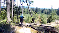
Photos of West Sechelt Mountain Bike
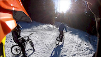
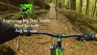
Videos of West Sechelt Mountain Bike
trail: Sniper
4:57 |
552 |
Jul 2, 2018
trail: Access Road
3:51 |
285 |
May 15, 2014

trail: 4D
14:14 |
74 |
Jan 23, 2026 , Sechelt

trail: 3D
14:14 |
34 |
Jan 23, 2026 , Sechelt

trail: DD
14:14 |
79 |
Jan 23, 2026 , Sechelt

trail: Dropbac
14:14 |
68 |
Jan 23, 2026 , Sechelt
trail: Brokebac
14:14 |
72 |
Jan 23, 2026 , Sechelt
trail: VFR
7:50 |
626 |
Jan 17, 2012
Current Trail Warnings
| status | trail | date | condition | user | info |
|---|---|---|---|---|---|
| Rock'a'Billy Bypass | Jun 15, 2026 @ 7:31pm (America/Vancouver) Jun 15, 2026 | Unknown | riderenew72 | Badly Motocross blown up | |
| Skullduggery | Jun 15, 2026 @ 6:45pm (America/Vancouver) Jun 15, 2026 | Unknown | riderenew72 | Active logging. Trail no longer exists. ... |
Recent Trail Reports
| status | trail | date | condition | info | user |
|---|---|---|---|---|---|
| Killer Squirrel | Jun 15, 2026 @ 6:40pm (America/Vancouver) Jun 15, 2026 | Ideal | riderenew72 | ||
| Rock'a'Billy | Jun 15, 2026 @ 7:31am (America/Vancouver) Jun 15, 2026 | Variable | riderenew72 | ||
| Lots of Duff (no motos) | Jun 15, 2026 @ 7:31am (America/Vancouver) Jun 15, 2026 | Ideal | riderenew72 | ||
| New Frogger | Jun 15, 2026 @ 7:31am (America/Vancouver) Jun 15, 2026 | Dry | riderenew72 | ||
| De-Worm-Me | Jun 15, 2026 @ 7:31am (America/Vancouver) Jun 15, 2026 | Ideal | riderenew72 | ||
| Phareline | Jun 15, 2026 @ 7:31am (America/Vancouver) Jun 15, 2026 | Ideal | riderenew72 | ||
| Wormy Lake Road | Jun 15, 2026 @ 7:31am (America/Vancouver) Jun 15, 2026 | Ideal | riderenew72 | ||
| Access Road | Jun 15, 2026 @ 7:31am (America/Vancouver) Jun 15, 2026 | Dry | riderenew72 | ||
| Lee's Big Easy | Jun 15, 2026 @ 9:52am (America/Vancouver) Jun 15, 2026 | Unknown | Proflex4ever CMBTA | ||
| 3D | Jun 4, 2026 @ 2:47pm (America/Vancouver) Jun 4, 2026 | Ideal | 421coast |
Activity Feed
| username | action | type | title | date |
|---|---|---|---|---|
| Bob1870 | comment | trail | activity #97340515 | Jun 19, 2026 @ 1:15pm 21 hours |
| riderenew72 | comment | report | activity #97112183 | Jun 16, 2026 @ 8:23am Jun 16, 2026 |
| nodignoridemtb | update | trail | activity #97112013 | Jun 16, 2026 @ 8:20am Jun 16, 2026 |
| Proflex4ever | comment | report | activity #97107727 | Jun 16, 2026 @ 7:13am Jun 16, 2026 |
| Proflex4ever | like | report | activity #97107657 | Jun 16, 2026 @ 7:11am Jun 16, 2026 |
Recent Comments
| username | type | title | comment | date |
|---|---|---|---|---|
| trail | Active forest fire being held. Avoid the area. | Jun 19, 2026 @ 1:15pm 21 hours | ||
| report | When I rode it, it looked MTBr built but it... | Jun 16, 2026 @ 8:23am Jun 16, 2026 | ||
| report | FYI. Killer Squirrel was 100% built by... | Jun 16, 2026 @ 7:13am Jun 16, 2026 | ||
| trail | Unfortunately badly Motocross tracked. Many... | Jun 15, 2026 @ 7:29pm Jun 15, 2026 | ||
| trail | Unfortunately badly Motocross tracked. Many... | Jun 15, 2026 @ 6:55pm Jun 15, 2026 |
Nearby Areas
| name | distance | ||||
|---|---|---|---|---|---|
| Kinnikinnick Park | 15 | 1 | 2.4 km | ||
| Halfmoon Bay | 10 | 36 | 2 | 2.6 km | |
| Connor Park | 13 | 11 | 3.2 km | ||
| Porpoise Bay | 2 | 8 | 5 | 4 | 4.8 km |
| Coast Gravity Park | 1 | 5 | 1 | 5 km |
Local Badges
-

Completionist0 awarded
Activity Type Stats
| activitytype | trails | distance | descent | descent distance | total vertical | rating | global rank | state rank | photos | reports | routes | ridelogs |
|---|---|---|---|---|---|---|---|---|---|---|---|---|
| Mountain Bike | 199 | 130 miles | 22,014 ft | 48 miles | 2,572 ft | #440 | #50 | 687 | 5,793 | 16 | 9,146 | |
| E-Bike | 199 | 130 miles | 22,014 ft | 48 miles | 2,572 ft | #536 | #30 | 1 | 5,346 | 2 | 652 | |
| Horse | 11 | 9 miles | 1,604 ft | 4 miles | 1,407 ft | #857 | #23 | 3,227 | 5 | |||
| Hike | 153 | 107 miles | 19,419 ft | 41 miles | 2,208 ft | #1,207 | #72 | 3 | 5,771 | 1 | 673 | |
| Trail Running | 137 | 99 miles | 17,326 ft | 37 miles | 2,201 ft | #768 | #36 | 5,769 | 1 | 677 | ||
| Dirtbike/Moto | 154 | 97 miles | 15,059 ft | 36 miles | 2,572 ft | #34 | #18 | 48 | 3,004 | 1 | 225 | |
| Observed Trials | 141 | 95 miles | 14,948 ft | 36 miles | 2,572 ft | #6 | #3 | 113 | 1 | 5 | ||
| ATV/ORV/OHV | 46 | 48 miles | 6,955 ft | 20 miles | 2,572 ft | #36 | #4 | 2,884 | 35 |
Frequently Asked Questions About West Sechelt
▼
What are the highest rated mountain biking trails in West Sechelt?
The highest rated mountain biking trails in West Sechelt are:
- Killer Squirrel (4.5/5)
- E-line (4.4/5)
- Beyond Easy (4.4/5)
- Sniper (4.4/5)
- Cheap Thrill (4.3/5)
▼
What is the best time of the year to ride in West Sechelt?
Based on ride log data, the most popular months to ride in West Sechelt are:
- July (251 activities)
- August (194 activities)
- September (137 activities)
▼
Where can I park to ride in West Sechelt?
There are 4 parking locations listed in West Sechelt. The most popular parking spots are: View all parking and trailhead locations on the map to plan your visit.
▼
What is the longest trail in West Sechelt?
The longest trail in West Sechelt is Pender Bender at 2.2 miles. View all trails sorted by distance.
Activities
Trails
- By canadaka
 Trailforks & contributors
 - Admins: Mattwashereonce, CMBTA, SCDBA, Wabmatrix
- #1719 - 29,606 views
- west sechelt activity log | embed map of West Sechelt mountain bike trails | west sechelt mountain biking points of interest
Downloading of trail gps tracks in kml & gpx formats is enabled for West Sechelt.
You must login to download files.