close
-
Layers w
- Weather Layers
- Pro
- Pro
- Pro
- Pro
- Pro
- Pro
- More Layers
- Pro
- Pro
- Pro
- Pro
-
Upgrade to

3D
Trail Conditions
- Unknown
- Snow Groomed
- Snow Packed
- Snow Covered
- Snow Cover Partial
- Freeze/thaw Cycle
- Icy
- Prevalent Mud
- Wet
- Variable
- Ideal
- Dry
- Very Dry
Trail Flow (Ridden Direction)
Trailforks scans users ridelogs to determine the most popular direction each trail is ridden. A good flowing trail network will have most trails flowing in a single direction according to their intension.
The colour categories are based on what percentage of riders are riding a trail in its intended direction.
The colour categories are based on what percentage of riders are riding a trail in its intended direction.
- > 96%
- > 90%
- > 80%
- > 70%
- > 50%
- < 50%
- bi-directional trail
- no data
Trail Last Ridden
Trailforks scans ridelogs to determine the last time a trail was ridden.
- < 2 days
- < 1 week
- < 2 weeks
- < 1 month
- < 6 months
- > 6 months
Trail Ridden Direction
The intended direction a trail should be ridden.
- Downhill Only
- Downhill Primary
- Both Directions
- Uphill Primary
- Uphill Only
- One Direction
Contribute Details
Colors indicate trail is missing specified detail.
- Description
- Photos
- Description & Photos
- Videos
Trail Popularity ?
Trailforks scans ridelogs to determine which trails are ridden the most in the last 9 months.
Trails are compared with nearby trails in the same city region with a possible 25 colour shades.
Think of this as a heatmap, more rides = more kinetic energy = warmer colors.
- most popular
- popular
- less popular
- not popular
ATV/ORV/OHV Filter
Max Vehicle Width
inches
US Cell Coverage
Legend

Radar Time
Activity Recordings
Trailforks uses anonymized public activity data.
?
Activity Recordings
Trailforks uses anonymized public activity data.
?
Personal Heatmap
▶
Activity Types
all
/
none
▶
Options
2
Date range
month
–
Winter Trails
Warning
A routing network for winter maps does not exist. Selecting trails using the winter trails layer has been disabled.
Missing Trails
Most Popular
Least Popular
Trails are colored based on popularity. The more popular a trail is, the more red. Less popular trails trend towards green.
Jump Magnitude Heatmap
Heatmap of where riders jump on trails. Zoom in to see individual jumps, click circles to view jump details.
BC Backroad Status
![map legend]()
Service Road Atlas is a free to use, community-driven service for viewing and creating reports on the numerous back-country service roads around B.C. and Alberta.

Slope Aspect
Direction the slope faces
Trails Deemphasized
Trails are shown in grey.
Only show trails with no bike usage.
Suggested Layers
Based on selected activity type
Save the current map location and zoom level as your default home location whenever this page is loaded.
Save
No description for West Springfield has been added yet!
Login or register to submit one.
Activities Click to view
- Mountain Bike
60 trails
- E-Bike
6 trails
- Gravel Bike
0 trails
- Adaptive Bike
0 trails
- Winter Fat Bike
0 trails
- Hike
66 trails
- Trail Running
66 trails
Region Details
- 12
- 1
- 27
- 15
- 2
Region Status
Open as of Mar 18, 2026Stats
- Avg Trail Rating
- Trails (view details)
- 62
- Trails Mountain Bike
- 61
- Trails E-Bike
- 6
- Trails Hike
- 66
- Trails Trail Running
- 66
- Trails Dirtbike/Moto
- 1
- Trails ATV/ORV/OHV
- 1
- Total Distance
- 34 miles
- Total Descent
- 1,818 ft
- Total Vertical
- 562 ft
- Highest Trailhead
- 670 ft
- Reports
- 244
- Photos
- 50
- Ridden Counter
- 11,665
Sub Regions
-
Bear Hole
- 23
- 15
- 2
Popular West Springfield Mountain Biking Trails
• 100 ★ 0.0 • 1,985 ft • 15 ft • 477 •
Soft with some tights trees a tight log hop to a roller over a dirt mound to a left turn over a tree which acts as a berm
• 95 ★ 4.2 • 2,687 ft • 37 ft • 462 •
Popular blue difficulty singletrack. This multi-use trail can be used both directions and has a moderate overall physical rating with a 37 ft blue climb. On average it takes 5 minutes to complete this trail.
• 100 ★ 4.8 • 1 mile • 175 ft • 437 •
Fun flowy trail that rides along the edge of the ravine overlooking the reservoir. It's signed as the "Gully Trail". It's one of the DON'T MISS trail at Bear Hole.
• 90 ★ 3.4 • 2,904 ft • 5 ft • 425 •
Popular green difficulty singletrack. This mountain bike primary trail can be used both directions and has a easy overall physical rating with a 5 ft green climb. On average it takes 5 minutes to complete this trail.
• 85 ★ 0.0 • 1,673 ft • 6 ft • 408 •
Popular blue difficulty singletrack. This mountain bike primary trail. On average it takes 3 minutes to complete this trail.
• 85 ★ 3.0 • 1,726 ft • 9 ft • 371 •
Popular blue difficulty singletrack. This mountain bike primary trail can be used both directions. On average it takes 3 minutes to complete this trail.
West Springfield Mountain Bike Routes
★ 4.0 • 8 miles • 569 ft • 12 • Loop •
This is a fun loop through Bear Hole and a great introduction to mountain biking. There are a couple of...
12 miles • 939 ft • 19 •
This is a long run through Bear Hole exploring most of the developed trails.
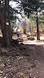
Photos of West Springfield Mountain Bike
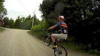
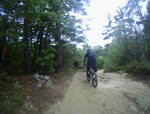
Videos of West Springfield Mountain Bike
trail: WSXC
0:04 |
8 |
May 1, 2026

trail: Dirt Jumps
0:40 |
183 |
Oct 22, 2016

trail: Dirt Jumps
0:12 |
562 |
Mar 16, 2014

trail: Dirt Jumps
0:40 |
769 |
Nov 8, 2013
trail: Dirt Jumps
2:34 |
373 |
Oct 14, 2013

trail: Dirt Jumps
0:32 |
281 |
Sep 1, 2011
trail: Dirt Jumps
6:19 |
255 |
Sep 27, 2010

trail: Dirt Jumps
0:10 |
651 |
Aug 22, 2010
Recent Trail Reports
| status | trail | date | condition | info | user |
|---|---|---|---|---|---|
| Mass Pike | Mar 18, 2026 @ 12:21pm (America/New_York) Mar 18, 2026 | Freeze/thaw Cycle | boudy | ||
| Tempest Connector | Mar 17, 2026 @ 3:09pm (America/New_York) Mar 17, 2026 | Ideal | patrickAC18 | ||
| Lyme Time | Mar 17, 2026 @ 3:07pm (America/New_York) Mar 17, 2026 | Ideal | patrickAC18 | ||
| Upper Rapid Demise | Mar 17, 2026 @ 3:07pm (America/New_York) Mar 17, 2026 | Variable | patrickAC18 | ||
| Birds of Prey | Mar 17, 2026 @ 3:05pm (America/New_York) Mar 17, 2026 | Ideal | patrickAC18 | ||
| Yak Attack | Nov 30, 2025 @ 1:16pm (America/New_York) Nov 30, 2025 | Variable | BethZOxEiS | ||
| Seecee Beecee | Sep 27, 2025 @ 9:06am (America/New_York) Sep 27, 2025 | Ideal | BethZOxEiS | ||
| Grinch | Sep 27, 2025 @ 9:06am (America/New_York) Sep 27, 2025 | Ideal | BethZOxEiS | ||
| Tin Can | Sep 27, 2025 @ 9:06am (America/New_York) Sep 27, 2025 | Ideal | BethZOxEiS | ||
| Hoosker Du | Sep 27, 2025 @ 9:06am (America/New_York) Sep 27, 2025 | Ideal | BethZOxEiS |
Activity Feed
| username | action | type | title | date |
|---|---|---|---|---|
| Jacksterr | add | photo | activity #97259218 | Jun 18, 2026 @ 9:53am Jun 18, 2026 |
| Uo2Zmo | ridden | trail | activity #96907649 | Jun 13, 2026 @ 12:47pm Jun 13, 2026 |
| TheBurman | vote | trail | activity #95171819 and 4 more | May 21, 2026 @ 6:48am May 21, 2026 |
| RachellmXTli | wishlist | route | activity #94896001 | May 17, 2026 @ 6:27am May 17, 2026 |
| RachellmXTli | wishlist | route | activity #94895964 and 1 more | May 17, 2026 @ 6:26am May 17, 2026 |
Recent Comments
| username | type | title | comment | date |
|---|---|---|---|---|
| trail | Shortish tech trail with lots of smooth off... | Mar 24, 2026 @ 8:58am Mar 24, 2026 | ||
| report | If you add a photo to your trail report, it... | May 31, 2024 @ 5:30am May 31, 2024 | ||
| trail | The dirt there kinda sucks. We used to dig... | Sep 20, 2020 @ 6:14pm Sep 20, 2020 | ||
| trail | Why is this a blue square? | Sep 20, 2020 @ 6:11pm Sep 20, 2020 | ||
| trail | New to the area, just checked these out. Not... | Jul 25, 2020 @ 10:31am Jul 25, 2020 |
Local Badges
-

Completionist0 awarded -

10 Blue Trails166 awarded -

Epic Mountain Bike Climb 2k1 awarded -

Climbing 10k Badge10 awarded -

Mountain Biking 100k Badge0 awarded -

Epic Ride Descent 2k1 awarded
Activity Type Stats
| activitytype | trails | distance | descent | descent distance | total vertical | rating | global rank | state rank | photos | reports | routes | ridelogs |
|---|---|---|---|---|---|---|---|---|---|---|---|---|
| Mountain Bike | 60 | 30 miles | 1,552 ft | 11 miles | 515 ft | #1,896 | #693 | 50 | 244 | 5 | 7,360 | |
| E-Bike | 6 | 5 miles | 72 ft | 2 miles | 180 ft | #8,784 | #2,683 | 198 | 118 | |||
| Hike | 66 | 33 miles | 1,791 ft | 12 miles | 561 ft | #5,376 | #1,895 | 2 | 243 | 1 | 247 | |
| Trail Running | 66 | 33 miles | 1,791 ft | 12 miles | 561 ft | #4,810 | #1,496 | 243 | 476 | |||
| Dirtbike/Moto | 1 | 2,326 ft | 16 ft | 197 ft | 1 | 1 | ||||||
| ATV/ORV/OHV | 1 | 2,326 ft | 16 ft | 197 ft | 1 |
Frequently Asked Questions About West Springfield
▼
What are the best places to ride in West Springfield?
West Springfield has 1 areas to explore for mountain biking. The top rated areas are:
▼
What are the highest rated mountain biking trails in West Springfield?
The highest rated mountain biking trails in West Springfield are:
- Green Eggs (4.2/5)
- Texas Tiger (4.1/5)
- Gibb "Surprise" (4.1/5)
- Birds of Prey (4/5)
- Hoosker Du (4/5)
▼
What is the best time of the year to ride in West Springfield?
Based on ride log data, the most popular months to ride in West Springfield are:
- September (103 activities)
- July (102 activities)
- May (100 activities)
▼
Where can I park to ride in West Springfield?
There are 3 parking locations listed in West Springfield. The most popular parking spots are: View all parking and trailhead locations on the map to plan your visit.
Activities
Trails
Points of Interest
- By Profiler74 & contributors
- Admins: WMass NEMBA, PVH
- #26001 - 2,982 views
- west springfield activity log | embed map of West Springfield mountain bike trails | west springfield mountain biking points of interest
Downloading of trail gps tracks in kml & gpx formats is enabled for West Springfield.
You must login to download files.