close
-
Layers w
- Weather Layers
- Pro
- Pro
- Pro
- Pro
- Pro
- Pro
- More Layers
- Pro
- Pro
- Pro
- Pro
-
Upgrade to

3D
Trail Conditions
- Unknown
- Snow Groomed
- Snow Packed
- Snow Covered
- Snow Cover Partial
- Freeze/thaw Cycle
- Icy
- Prevalent Mud
- Wet
- Variable
- Ideal
- Dry
- Very Dry
Trail Flow (Ridden Direction)
Trailforks scans users ridelogs to determine the most popular direction each trail is ridden. A good flowing trail network will have most trails flowing in a single direction according to their intension.
The colour categories are based on what percentage of riders are riding a trail in its intended direction.
The colour categories are based on what percentage of riders are riding a trail in its intended direction.
- > 96%
- > 90%
- > 80%
- > 70%
- > 50%
- < 50%
- bi-directional trail
- no data
Trail Last Ridden
Trailforks scans ridelogs to determine the last time a trail was ridden.
- < 2 days
- < 1 week
- < 2 weeks
- < 1 month
- < 6 months
- > 6 months
Trail Ridden Direction
The intended direction a trail should be ridden.
- Downhill Only
- Downhill Primary
- Both Directions
- Uphill Primary
- Uphill Only
- One Direction
Contribute Details
Colors indicate trail is missing specified detail.
- Description
- Photos
- Description & Photos
- Videos
Trail Popularity ?
Trailforks scans ridelogs to determine which trails are ridden the most in the last 9 months.
Trails are compared with nearby trails in the same city region with a possible 25 colour shades.
Think of this as a heatmap, more rides = more kinetic energy = warmer colors.
- most popular
- popular
- less popular
- not popular
ATV/ORV/OHV Filter
Max Vehicle Width
inches
US Cell Coverage
Legend

Radar Time
Activity Recordings
Trailforks uses anonymized public activity data.
?
Activity Recordings
Trailforks uses anonymized public activity data.
?
Personal Heatmap
▶
Activity Types
all
/
none
▶
Options
2
Date range
month
–
Winter Trails
Warning
A routing network for winter maps does not exist. Selecting trails using the winter trails layer has been disabled.
Missing Trails
Most Popular
Least Popular
Trails are colored based on popularity. The more popular a trail is, the more red. Less popular trails trend towards green.
Jump Magnitude Heatmap
Heatmap of where riders jump on trails. Zoom in to see individual jumps, click circles to view jump details.
BC Backroad Status
![map legend]()
Service Road Atlas is a free to use, community-driven service for viewing and creating reports on the numerous back-country service roads around B.C. and Alberta.

Slope Aspect
Direction the slope faces
Trails Deemphasized
Trails are shown in grey.
Only show trails with no bike usage.
Suggested Layers
Based on selected activity type
Save the current map location and zoom level as your default home location whenever this page is loaded.
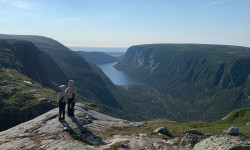
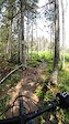
SaveWestern Newfoundland contains a fairly large amount of mountain biking trails and some pretty big descents and ascents. As opposed to the East Coast of Newfoundland, Western Newfoundland contains a mix of old-growth forest, logging roads and some very impressive fjords. The primary network of trails exist within the Corner Brook area however mountain bike opportunities exist throughout the entirety of Western Newfoundland.
Links
Region Details
- 85
- 4
- 134
- 90
- 13
- 5
- 1
Local Trail Association
Stats
- Avg Trail Rating
- Trails (view details)
- 572
- Trails Mountain Bike
- 322
- Trails E-Bike
- 118
- Trails Gravel Bike
- 9
- Trails Adaptive Bike
- 2
- Trails Winter Fat Bike
- 1
- Trails Horse
- 57
- Trails Hike
- 396
- Trails Trail Running
- 391
- Trails Dirtbike/Moto
- 114
- Trails Observed Trials
- 2
- Trails ATV/ORV/OHV
- 94
- Trails Snowmobile
- 79
- Trails Snowshoe
- 134
- Trails Downhill Ski
- 63
- Trails Backcountry Ski
- 31
- Trails Nordic Ski
- 85
- Total Distance
- 1,169 miles
- Total Descent
- 147,093 ft
- Total Vertical
- 2,659 ft
- Highest Trailhead
- 2,659 ft
- Reports
- 1,311
- Photos
- 824
- Ridden Counter
- 17,645
Articles
Why We Explore
Mar 25, 2025 from ool-test.outsideonline.com
In an excerpt from his new book, Outside’s Sweat Science columnist digs into the emerging science of why we’re drawn to the unknown and what...
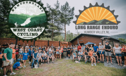
Long Range Enduro Announces 2025 Event Details
Mar 19, 2025 from pinkbike.com
Prior to 2022, the LRE was part of the St. John's Enduro series until it grew large enough to stand on its own.
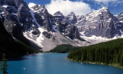
The 10 Most Beautiful National Parks in Canada
Jun 17, 2024 from outsideonline.com
Spectacular mountains and deep fjords, powder-blue lakes and sea stacks: here’s your bucket list of national parks to visit up north
Popular Trail Networks
view all areas »Sub Regions
- Bay St. George (15)
- Stephenville (14)
- Gros Morne National Park (39)
- Bonne Bay Pond (1)
- Cow Head (4)
- Broom Point (0)
- Shallow Bay (4)
- Lomond (5)
- Norris Point (4)
- Rocky Harbour (18)
- Sally's Cove (2)
- Green Point (1)
- Western Brook Pond (1)
- Trout River (3)
- Trout River Pond (2)
- Woody Point (1)
- Bonne Bay Pond (1)
- Badger (2)
- Baie verte (1)
- Benoit's Cove (3)
- Corner Brook (179)
- Corner Brook Gorge (14)
- Cub Mountain (52)
- Duncan's Gulch (10)
- Lady Slipper (28)
- Prince Edward Park (0)
- Deer Lake (6)
- Pasadena (42)
- Robert's Arm (8)
- St. Anthony (22)
- York Harbour (4)
- Lark Harbour (3)
- Steady Brook (6)
Popular Western Mountain Biking Trails
• 100 ★ 4.4 • 2,343 ft • 0 ft • 217 •
Popular blue difficulty singletrack. This mountain bike primary trail and has a easy overall physical rating with a 0 ft blue climb. It features drop and jump. Trail visibility is always easy to follow. On average it takes 9 minutes to complete this trail.
• 100 ★ 4.5 • 1,713 ft • 0 ft • 217 •
The trail is composed of some pretty flowy berms and hard pack singletrack. It's a short but pretty awesome descent and can be ridden bidirectionally to complete the entire network which totals about 6km.
• 90 ★ 4.1 • 1 mile • 128 ft • 202 •
is a biking-primary multi-use trail designed for the beginner to advanced rider. The trail has several narrow sections and steep switchbacks near the end that can make a challenging climb for the beginner rider.
• 90 ★ 4.4 • 1,873 ft • 3 ft • 188 •
Popular blue difficulty singletrack. This mountain bike primary trail and has a moderate overall physical rating with a 3 ft blue climb. On average it takes 3 minutes to complete this trail.
• 95 ★ 3.8 • 1,424 ft • 0 ft • 170 •
Short single track to the water supply.
• 90 ★ 4.9 • 2 miles • 483 ft • 161 •
is a steady climb to the top over some pretty awesome single track. The descent is fast with a couple small jumps and some pretty flowy berms and singletrack.
• 95 ★ 4.9 • 1 mile • 30 ft • 159 •
is a new downhill mountain bike trail that passes through Duncan's Gulch. It starts at the transmission line, and enters Duncan's Gulch through a series of tight switchbacks and out through some old growth forest. The trail has several...
Western Mountain Bike Routes
★ 5.0 • 4 miles • 584 ft • 8 •
Updated lap of the network. Parking at PSNP, ride up down then proceed up the ATV trail / groomed trail to...
★ 4.0 • 5 miles • 378 ft • 6 • Point to Point •
Solid loop for a hike or run, can be completed in either direction. A portion of this route takes you...
7 miles • 1,122 ft • 4 •
Ready to see what the West Coast Cycling Association has been building? Come explore the route for our...
23 miles • 4,512 ft • 13 • Loop •
Looking to bag a big one in Humber Valley? This spicy local classic hits all six major descents in the...
40 miles • 5,310 ft • 34 •
The longest ride on the longest day! This ride aims to tackle all of the trails within the Corner Brook...
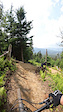
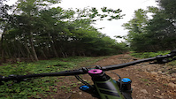
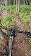
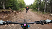
Photos of Western Mountain Bike
Videos of Western Mountain Bike
trail: Howler
4:54 |
139 |
Jul 21, 2025
trail: Swedish Fire Torch
0:00 |
43 |
Jul 20, 2025
trail: Clumsy Thumbs
0:31 |
|
Aug 27, 2023
trail: Grumpy Stump
5:43 |
67 |
Jul 24, 2023

trail: Chuck It
2:54 |
196 |
Jul 24, 2023
trail: Hazel Hollow
0:05 |
59 |
Nov 4, 2022
trail: Moose Knuckle
0:12 |
308 |
Jun 7, 2022
trail: Moose Knuckle
0:15 |
213 |
Jun 7, 2022
Current Trail Warnings
| status | trail | date | condition | user | info |
|---|---|---|---|---|---|
| Mercury Hill Cub Mountain | May 28, 2026 @ 4:16pm (America/Miquelon) May 28, 2026 | Snow Cover Partial | Josho91 | ||
| Mudslide Cub Mountain | May 28, 2026 @ 4:16pm (America/Miquelon) May 28, 2026 | Snow Cover Partial | Josho91 | ||
| Long Time Listener South Brook Valley | May 27, 2026 @ 1:38pm (America/St_Johns) May 27, 2026 | Variable | nlinstinct | Moose still present. Some blowdowns.... |
Recent Trail Reports
| status | trail | date | condition | info | user |
|---|---|---|---|---|---|
| Moose Knuckle Duncan's Gulch | Jun 17, 2026 @ 3:34pm (America/St_Johns) 2 days | Variable | tigars53 | ||
| Tales from the Tarp Duncan's Gulch | Jun 17, 2026 @ 3:34pm (America/St_Johns) 2 days | Ideal | tigars53 | ||
| Goldmine Duncan's Gulch | Jun 17, 2026 @ 3:34pm (America/St_Johns) 2 days | Variable | tigars53 | ||
| Cuttin' Corners Corner Brook | Jun 17, 2026 @ 3:34pm (America/St_Johns) 2 days | Ideal | tigars53 | ||
| Spider Crawl Cub Mountain | Jun 17, 2026 @ 3:34pm (America/St_Johns) 2 days | Dry | tigars53 | ||
| Lower Academy Hill Academy Hill | Jun 15, 2026 @ 12:49pm (America/Miquelon) Jun 15, 2026 | Very Dry | nlinstinct | ||
| Jam Jam Academy Hill | Jun 15, 2026 @ 12:49pm (America/Miquelon) Jun 15, 2026 | Variable | nlinstinct | ||
| Swedish Fire Torch Academy Hill | Jun 15, 2026 @ 12:49pm (America/Miquelon) Jun 15, 2026 | Ideal | nlinstinct | ||
| Nar Spruce Academy Hill | Jun 15, 2026 @ 12:49pm (America/Miquelon) Jun 15, 2026 | Wet | nlinstinct | ||
| Howler Academy Hill | Jun 5, 2026 @ 3:26pm (America/St_Johns) Jun 5, 2026 | Dry | brydoncooper |
Activity Feed
| username | action | type | title | date |
|---|---|---|---|---|
| viewsofjdr | add | trail | activity #97264787 and 9 more | Jun 18, 2026 @ 11:18am 16 hours |
| ErikaUqi9Af | ridden | trail | activity #97258300 | Jun 18, 2026 @ 9:39am 17 hours |
| tigars53 | add | report | activity #97230500 and 2 more | Jun 17, 2026 @ 8:56pm 1 day |
| tigars53 | add | report | activity #97230499 | Jun 17, 2026 @ 8:56pm 1 day |
| tigars53 | add | report | activity #97230407 and 1 more | Jun 17, 2026 @ 8:53pm 1 day |
Recent Comments
| username | type | title | comment | date |
|---|---|---|---|---|
| trail | You have to hike a bike through cutovers to... | Mar 18, 2026 @ 3:05pm Mar 18, 2026 | ||
| trail | I’m excited for black draft it will be... | Mar 18, 2026 @ 2:56pm Mar 18, 2026 | ||
| trail | Trail is closed and still under construction. | Sep 4, 2025 @ 10:40am Sep 4, 2025 | ||
| trail | This trail should not be rated as a blue, as... | Jul 29, 2025 @ 5:41pm Jul 29, 2025 | ||
| report | Yes definitely. | Jul 26, 2025 @ 3:40pm Jul 26, 2025 |
Local Badges
-

Top of the Class1 awarded -

Extra Credit3 awarded -

Advanced Placement3 awarded -

Epic Mountain Bike Climb 2k0 awarded -

Epic Ride 50k50 awarded -

Big Ride 30k82 awarded
Bike & Skill Parks
| name | type | city | rating |
|---|---|---|---|
| Steady Brook Pump Track | skill park | Steady Brook | |
| The Bowl | skill park | Corner Brook |
Local Trail Supporters
![]()
![]()
- Doug Miller
Activity Type Stats
| activitytype | trails | distance | descent | descent distance | total vertical | rating | global rank | state rank | photos | reports | routes | ridelogs |
|---|---|---|---|---|---|---|---|---|---|---|---|---|
| Mountain Bike | 322 | 755 miles | 70,666 ft | 342 miles | 2,110 ft | 640 | 1,295 | 19 | 23,830 | |||
| E-Bike | 118 | 472 miles | 36,362 ft | 210 miles | 1,565 ft | 516 | 7 | 696 | ||||
| Gravel Bike | 9 | 13 miles | 2,628 ft | 8 miles | 1,155 ft | 54 | 1 | 59 | ||||
| Adaptive Bike | 1 | 1 | ||||||||||
| Winter Fat Bike | 1 | 14 | 1 | 5 | ||||||||
| Horse | 57 | 457 miles | 31,391 ft | 207 miles | 1,585 ft | 131 | ||||||
| Hike | 396 | 1,026 miles | 113,058 ft | 437 miles | 2,657 ft | 145 | 1,076 | 7 | 4,260 | |||
| Trail Running | 391 | 997 miles | 109,852 ft | 427 miles | 2,657 ft | 2 | 1,050 | 10 | 2,089 | |||
| Dirtbike/Moto | 114 | 563 miles | 43,140 ft | 256 miles | 1,585 ft | 12 | 482 | 128 | ||||
| Observed Trials | 2 | 13 miles | 1,302 ft | 5 miles | 961 ft | 15 | 1 | |||||
| ATV/ORV/OHV | 94 | 563 miles | 42,395 ft | 255 miles | 1,585 ft | 7 | 485 | 52 | ||||
| Snowmobile | 79 | 515 miles | 38,494 ft | 239 miles | 1,581 ft | 363 | 22 | |||||
| Snowshoe | 134 | 557 miles | 40,666 ft | 247 miles | 1,831 ft | 389 | 2 | 749 | ||||
| Downhill Ski | 63 | 23 miles | 17,096 ft | 20 miles | 1,470 ft | 5 | 1,253 | |||||
| Backcountry Ski | 31 | 97 miles | 9,498 ft | 40 miles | 2,077 ft | 16 | 558 | |||||
| Nordic Ski | 85 | 217 miles | 13,340 ft | 98 miles | 1,558 ft | 234 | 4 | 2,866 |
Activities
- Western Mountain Biking Trails
- Western E-Biking Trails
- Western Gravel Biking Trails
- Western Horseback Trails
- Western Hiking Trails
- Western Trail Running Trails
- Western Dirtbiking Trails
- Western ATVing/Offroading Trails
- Western Snowmobiling Trails
- Western Snowshoeing Trails
- Western Skiing Trails
- Western Backcountry Skiing Trails
- Western Nordic Skiing Trails
Trails
Points of Interest
- Three Drops TTF
- 3 Bear Mountain Lookout Viewpoint
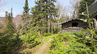
- Touton Hill Cabin
- Holy Falls Sight
- [Lift] Magic Carpet Surface Lift Other
- [Lift] Black Mariah Chairlift Other
- [Lift] Newfie Bullet Quad Chairlift Other
- [Lift] Lightning Express High Speed Quad Chairlift Other
- Marble Mountain Lodge
- Marble Mountain Chalet Lodge
- Patuersuoq (8,196 ft)
- Aputaiuitsoq (6,470 ft)
- Tiningnertok (6,240 ft)
- By adrianricketts
 & contributors
 - Admins: adrianricketts, wbruce
- #19782 - 6,717 views
- western activity log | embed map of Western mountain bike trails | western mountain biking points of interest
Downloading of trail gps tracks in kml & gpx formats is enabled for Western.
You must login to download files.