close
-
Layers w
- Weather Layers
- Pro
- Pro
- Pro
- Pro
- Pro
- Pro
- More Layers
- Pro
- Pro
- Pro
- Pro
-
Upgrade to

3D
Trail Conditions
- Unknown
- Snow Groomed
- Snow Packed
- Snow Covered
- Snow Cover Partial
- Freeze/thaw Cycle
- Icy
- Prevalent Mud
- Wet
- Variable
- Ideal
- Dry
- Very Dry
Trail Flow (Ridden Direction)
Trailforks scans users ridelogs to determine the most popular direction each trail is ridden. A good flowing trail network will have most trails flowing in a single direction according to their intension.
The colour categories are based on what percentage of riders are riding a trail in its intended direction.
The colour categories are based on what percentage of riders are riding a trail in its intended direction.
- > 96%
- > 90%
- > 80%
- > 70%
- > 50%
- < 50%
- bi-directional trail
- no data
Trail Last Ridden
Trailforks scans ridelogs to determine the last time a trail was ridden.
- < 2 days
- < 1 week
- < 2 weeks
- < 1 month
- < 6 months
- > 6 months
Trail Ridden Direction
The intended direction a trail should be ridden.
- Downhill Only
- Downhill Primary
- Both Directions
- Uphill Primary
- Uphill Only
- One Direction
Contribute Details
Colors indicate trail is missing specified detail.
- Description
- Photos
- Description & Photos
- Videos
Trail Popularity ?
Trailforks scans ridelogs to determine which trails are ridden the most in the last 9 months.
Trails are compared with nearby trails in the same city region with a possible 25 colour shades.
Think of this as a heatmap, more rides = more kinetic energy = warmer colors.
- most popular
- popular
- less popular
- not popular
ATV/ORV/OHV Filter
Max Vehicle Width
inches
US Cell Coverage
Legend

Radar Time
Activity Recordings
Trailforks uses anonymized public activity data.
?
Activity Recordings
Trailforks uses anonymized public activity data.
?
Personal Heatmap
▶
Activity Types
all
/
none
▶
Options
2
Date range
month
–
Winter Trails
Warning
A routing network for winter maps does not exist. Selecting trails using the winter trails layer has been disabled.
Missing Trails
Most Popular
Least Popular
Trails are colored based on popularity. The more popular a trail is, the more red. Less popular trails trend towards green.
Jump Magnitude Heatmap
Heatmap of where riders jump on trails. Zoom in to see individual jumps, click circles to view jump details.
BC Backroad Status
![map legend]()
Service Road Atlas is a free to use, community-driven service for viewing and creating reports on the numerous back-country service roads around B.C. and Alberta.

Slope Aspect
Direction the slope faces
Trails Deemphasized
Trails are shown in grey.
Only show trails with no bike usage.
Suggested Layers
Based on selected activity type
Save the current map location and zoom level as your default home location whenever this page is loaded.
SavePopular Trail Networks
view all areas »
No description for Western has been added yet!
Login or register to submit one.
Region Details
- 723
- 459
- 1,202
- 757
- 252
- 49
- 2
Local Trail Association
Stats
- Avg Trail Rating
- Trails (view details)
- 4,555
- Trails Mountain Bike
- 3,455
- Trails E-Bike
- 829
- Trails Gravel Bike
- 333
- Trails Adaptive Bike
- 326
- Trails Winter Fat Bike
- 352
- Trails Horse
- 257
- Trails Hike
- 3,954
- Trails Trail Running
- 3,902
- Trails Dirtbike/Moto
- 28
- Trails ATV/ORV/OHV
- 30
- Trails Snowmobile
- 105
- Trails Snowshoe
- 1,833
- Trails Downhill Ski
- 246
- Trails Backcountry Ski
- 136
- Trails Nordic Ski
- 1,002
- Total Distance
- 3,062 miles
- Total Descent
- 236,995 ft
- Total Vertical
- 1,529 ft
- Highest Trailhead
- 1,769 ft
- Reports
- 32,547
- Photos
- 7,866
- Ridden Counter
- 656,491
Articles
The 10 Most Beautiful National Parks in Canada
Jun 17, 2024 from outsideonline.com
Spectacular mountains and deep fjords, powder-blue lakes and sea stacks: here’s your bucket list of national parks to visit up north
Race Report: Sea Otter Canada EWS Qualifier - Blue Mountain Resort
Jul 11, 2019 from pinkbike.com
Relive all the action from the Sea Otter Canada EWS Qualifier at Blue Mountain Resort.
Race Preview: Canadian Enduro Series EWS Qualifier at Sea Otter Canada
Jul 5, 2019 from pinkbike.com
Norco Canadian Enduro Series is back with round four serving as an EWS Qualifier at the Blue Mountain Resort in Ontario.
Sub Regions
- Bruce County (135)
- Brockton Municipality (22)
- Brant Tract (16)
- Huron-Kinloss Township (5)
- Kinloss Tract (6)
- Kincardine (9)
- Northern Bruce Peninsula Municipality (24)
- Saugeen Shores (25)
- South Bruce Peninsula (37)
- Brockton Municipality (22)
- Chatham-Kent County (36)
- County of Brant (49)
- Brantford (41)
- Grande Trails (21)
- Waterworks Park (8)
- Paris (8)
- Lions Park (2)
- Nith River Open Space (3)
- St. George (2)
- Jacob's Woods (2)
- Brantford (41)
- Dufferin County (186)
- Grand Valley (1)
- Mono (51)
- Mulmur (115)
- Orangeville (10)
- Shelburne (1)
- Grand Valley (1)
- Elgin County (130)
- Alymer (5)
- Malahide Township (10)
- Municipality Of Bayham (2)
- Municipality Of Central Elgin (11)
- Municipality Of Dutton/Dunwich (0)
- St. Thomas (102)
- Alymer (5)
- Essex County (110)
- Amherstburg (19)
- Libro Centre Trails (12)
- Vienna Woods (2)
- LaSalle (1)
- Leamington (12)
- Windsor (77)
- Amherstburg (19)
- Grey County (617)
- Blue Mountain Resort (12)
- Blue Mountain DH (1)
- Chatsworth (25)
- Dornoch (0)
- Durham (14)
- Eugenia (0)
- Georgian Bluffs Township (38)
- Cobble Beach (4)
- Grey County Forest - Copper Kettle (2)
- Grey County Forest - Derby Tract (4)
- Grey County Forest - Quarry Tract (4)
- GSCA - Bass Lake Management Area (2)
- GSCA - Kemble Mountain Management Area (2)
- GSCA - Skinner Marsh McNab Lake Management Area (3)
- GSCA - Skinners Bluff Management Area (4)
- GSCA - Slough of Despond Management Area (2)
- GSCA - The Glen Management Area (1)
- Grey Highlands (27)
- Beaver Valley (12)
- Grey County Forest - Harkaway (1)
- Grey County Forest - Osprey Wetland (0)
- Grey County Forest - The Wickens (0)
- GSCA - Epping - John Muir Lookout (0)
- GSCA - Feversham Management Area (4)
- GSCA - Flesherton Management Area (2)
- GSCA - Griersville Management Area (1)
- GSCA - Rocklyn Creek Management Area (3)
- Hanover (3)
- Kimberley (56)
- Meaford (9)
- Owen Sound (45)
- The Blue Mountains (343)
- Thornbury (0)
- West Grey (30)
- Blue Mountain Resort (12)
- Haldimand County (50)
- Caledonia (33)
- LaFortune Park (31)
- Caledonia (33)
- Huron County (123)
- Lambton County (23)
- Lambton Shores (20)
- Sarnia (3)
- Canatara Park (2)
- Middlesex County (153)
- Dorchester (3)
- London (149)
- Boler Mountain (35)
- Fanshawe Conservation Area (33)
- Komoka Provincial Park (23)
- Meadowlily Trails (4)
- Medway Creek (6)
- Springbank Park (1)
- Stoney Creek Meadows (12)
- Warbler Woods (17)
- Middlesex Centre (1)
- North Middlesex (0)
- Dorchester (3)
- Niagara Region (313)
- Fort Erie (1)
- Grimsby (13)
- Lincoln (54)
- Niagara Falls (49)
- Firemen's Park (31)
- Queenston Heights Park (4)
- Walker Park (2)
- Niagara-on-the-Lake (6)
- Port Colborne (52)
- Limestone Hill (27)
- The Hood (20)
- St. Catharines (101)
- Vineland (32)
- Welland (3)
- Fort Erie (1)
- Norfolk County (172)
- Oxford County (63)
- Norwich Township (2)
- Tillsonburg (2)
- Woodstock (60)
- The Pines (56)
- Norwich Township (2)
- Perth County (44)
- Municipality Of North Perth (1)
- St. Marys (10)
- Stratford (33)
- Municipality Of North Perth (1)
- Region of Hamilton-Wentworth (358)
- Ancaster (67)
- Dundas (75)
- Flamborough Township (39)
- Christie Lake (17)
- Clappison Woods (89)
- Hyde Tract (18)
- Glanbrook Township (3)
- Hamilton (122)
- Stoney Creek (41)
- Waterloo Region (601)
- Cambridge (32)
- Shade's Mills (2)
- Kitchener-Waterloo (509)
- Bechtel Park (14)
- Chicopee Ski Hill (24)
- Columbia Forest/Vista Hills (105)
- Deerfoot Reserve (8)
- Huron Natural Area (31)
- Laurel Creek Conservation (32)
- McLennan Park (15)
- Monarch Woods (6)
- Natchez Woods (12)
- Stamm Woodlot (5)
- The Hydrocut (56)
- North Dumfries Township (40)
- Dryden Tract (21)
- Drynan Regional Forest (6)
- Sudden Regional Forest (11)
- Wilmot Township (23)
- Woolwich Township (1)
- Snyder's Flats (1)
- Woolwich Reservoir (2)
- Cambridge (32)
- Wellington County (356)
- Centre Wellington Township (31)
- Erin (22)
- Erin Trails (22)
- Guelph (213)
- Guelph Lake (87)
- Hanlon Creek (26)
- Guelph/Eramosa Township (17)
- Mapleton Township (12)
- Minto (1)
- Puslinch Township (140)
- Wellington North Township (6)
- Arthur Trails (6)
Popular Western Mountain Biking Trails
• 100 ★ 4.5 • 2,136 ft • 0 ft • 2,919 •
Great down hill from the Map Kiosk. Loads of flow with a great sweeping corner at the end. Keep the flow going all the way back to the Glasgow Lot.
• 100 ★ 3.9 • 1,827 ft • 85 ft • 2,887 •
Mostly uphill with a few quick descents where it pays to carry speed into the next uphill. has 2 steeper sections that will challenge newer riders. There is an optional rock rollover to the right of the trail on an uphill and an...
• 95 ★ 3.3 • 2,093 ft • 25 ft • 2,796 •
Popular blue difficulty singletrack. This mountain bike primary trail and has a easy overall physical rating with a 25 ft green climb. On average it takes 3 minutes to complete this trail.
• 80 ★ 3.7 • 2,720 ft • 54 ft • 2,770 •
Popular blue difficulty singletrack. This mountain bike primary trail can be used one direction and has a easy overall physical rating with a 54 ft blue climb. On average it takes 1 minutes to complete this trail.
• 95 ★ 3.6 • 3,133 ft • 86 ft • 2,754 •
Popular blue difficulty singletrack. This mountain bike primary trail and has a hard overall physical rating with a 86 ft black diamond climb. On average it takes 6 minutes to complete this trail.
• 100 ★ 4.2 • 3,035 ft • 96 ft • 2,726 •
Return Trail with a steady climb up a hill back to the start where you can either go back to the East Parking Lot via , ride , or go back down via or .
Western Mountain Bike Routes
G2G Rail Trail Featured
90 miles • 640 ft • 3 • Point to Point •
The fully accessible 132 KM Rail Trail Experience that is a multi-use green space from the 401 corridor at...
Maitland Trail Featured
31 miles • 1,817 ft • 10 • Point to Point •
The follows the north of the River Valley. Varied terrain from flat sections, gentle slopes, to steep...
★ 3.0 • 13 miles • 1,233 ft • 22 • Loop •
The most popular loop that hits all of the singletrack trails available at the Hydrocut. Frankenstein,...
★ 5.0 • 13 miles • 1,222 ft • 35 • Loop •
The Hydrocut is running an official Time Trial this year using Strava. The course has been set. It was...
★ 3.8 • 5 miles • 342 ft • 17 • Point to Point •
A good place to start for experienced riders who are new to Three Stage. This route will lead you through...
★ 3.5 • 11 miles • 681 ft • 21 • Loop •
The full loop to hit all of the singletrack trails in one ride. Recommended direction is clockwise, but...
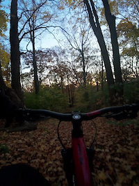
Photos of Western Mountain Bike
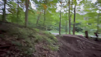
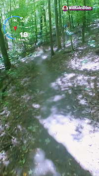
Videos of Western Mountain Bike
trail: Firepit
0:17 |
2 |
Jun 14, 2026

trail: Firepit
0:17 |
1 |
Jun 12, 2026
trail: Single track with jump
0:12 |
6 |
Nov 2, 2025

0:06 |
18 |
Oct 2, 2025
0:14 |
4 |
Oct 2, 2025

0:14 |
13 |
Oct 2, 2025
0:26 |
11 |
Oct 2, 2025
trail: Happy Hour
2:01 |
|
Sep 16, 2025
Current Trail Warnings
| status | trail | date | condition | user | info |
|---|---|---|---|---|---|
| Dead Camel Bend The Hydrocut | Jun 20, 2026 @ 10:49am (America/Toronto) 5 hours | Ideal | Joel123456 KWTA | ||
| DoubleTrack A Puslinch Tract / Twin Ponds | Jun 17, 2026 @ 2:56pm (America/Toronto) Jun 17, 2026 | Ideal | phatcat | ||
| Sheffield Shuffle Hyde Tract | Jun 8, 2026 @ 11:44am (America/Toronto) Jun 8, 2026 | Variable | konaadventures | overgrown impassable |
Recent Trail Reports
| status | trail | date | condition | info | user |
|---|---|---|---|---|---|
| Crazy Carter The Hydrocut | Jun 20, 2026 @ 10:49am (America/Toronto) 5 hours | Ideal | Joel123456 KWTA | ||
| Sweet Street Expert section The Hydrocut | Jun 20, 2026 @ 10:49am (America/Toronto) 5 hours | Ideal | Joel123456 KWTA | ||
| Jake's Breakaway The Hydrocut | Jun 20, 2026 @ 10:49am (America/Toronto) 5 hours | Ideal | Joel123456 KWTA | ||
| Mountain Goat Loop The Hydrocut | Jun 20, 2026 @ 10:49am (America/Toronto) 5 hours | Ideal | Joel123456 KWTA | ||
| Jake's Attack The Hydrocut | Jun 20, 2026 @ 10:49am (America/Toronto) 5 hours | Ideal | Joel123456 KWTA | ||
| Sweet Street The Hydrocut | Jun 20, 2026 @ 10:49am (America/Toronto) 5 hours | Ideal | Joel123456 KWTA | ||
| Scrambler The Hydrocut | Jun 20, 2026 @ 10:49am (America/Toronto) 5 hours | Ideal | Joel123456 KWTA | ||
| Dirty Donna's Downhill The Hydrocut | Jun 20, 2026 @ 10:49am (America/Toronto) 5 hours | Ideal | Joel123456 KWTA | ||
| Up Schmidts Creek The Hydrocut | Jun 20, 2026 @ 10:49am (America/Toronto) 5 hours | Ideal | Joel123456 KWTA | ||
| Ridgeline The Hydrocut | Jun 20, 2026 @ 10:49am (America/Toronto) 5 hours | Ideal | Joel123456 KWTA |
Activity Feed
| username | action | type | title | date |
|---|---|---|---|---|
| Joel123456 | add | report | activity #97419799 and 31 more | Jun 20, 2026 @ 11:55am 29 mins |
| GuelphOffRoadBikeAssoc | update | poi | activity #97409893 and 1 more | Jun 20, 2026 @ 10:19am 2 hours |
| GuelphOffRoadBikeAssoc | update | trail | activity #97409307 and 2 more | Jun 20, 2026 @ 10:14am 2 hours |
| jakeboyer | wishlist | route | activity #97387629 | Jun 20, 2026 @ 6:19am 6 hours |
| chasingjoy | wishlist | trail | activity #97366368 | Jun 19, 2026 @ 10:00pm 14 hours |
Recent Comments
| username | type | title | comment | date |
|---|---|---|---|---|
| report | Tree cleared | Jun 8, 2026 @ 10:15pm Jun 8, 2026 | ||
| trail | Blue connector | Jun 8, 2026 @ 11:41am Jun 8, 2026 | ||
| trail | Great trail. A little wet, appears blocked... | May 31, 2026 @ 8:56am May 31, 2026 | ||
| trail | Rode it yesterday always a challenge, was in... | May 19, 2026 @ 9:22am May 19, 2026 | ||
| trail | It’s a paved trail running from the... | May 13, 2026 @ 6:42am May 13, 2026 |
Local Badges
-

Completionist4 awarded -

10 Green Trails634 awarded -

10 Black Trails97 awarded -

10 Blue Trails275 awarded -

Epic Ride Climb 2k2 awarded -

Top 10 Trails0 awarded
Bike & Skill Parks
| name | type | city | rating |
|---|---|---|---|
| Boler Mountain | bike park | London | |
| Riverside Dirt Jumps | skill park | Cambridge | |
| McLennan Park | skill park | Kitchener-Waterloo | |
| Brantford Rotary Bike Park | skill park | Brantford | |
| Lincoln Skatepark & Pump Track | skill park | Beamsville |
Local Products
Local Trail Supporters
![]()
- @theofficialboverr
- TPMBC
![]()
![]()
Activity Type Stats
| activitytype | trails | distance | descent | descent distance | total vertical | rating | global rank | state rank | photos | reports | routes | ridelogs |
|---|---|---|---|---|---|---|---|---|---|---|---|---|
| Mountain Bike | 3,455 | 2,284 miles | 114,446 ft | 788 miles | 1,529 ft | 6,367 | 32,107 | 174 | 423,303 | |||
| E-Bike | 829 | 710 miles | 32,474 ft | 289 miles | 1,506 ft | 20 | 28,225 | 22 | 8,568 | |||
| Gravel Bike | 333 | 313 miles | 10,167 ft | 110 miles | 1,493 ft | 2 | 2,251 | 18 | 4,672 | |||
| Adaptive Bike | 326 | 500 miles | 11,266 ft | 199 miles | 1,493 ft | 2,030 | 1 | 14 | ||||
| Winter Fat Bike | 352 | 179 miles | 11,686 ft | 58 miles | 1,470 ft | 5 | 6,390 | 4 | 552 | |||
| Horse | 257 | 303 miles | 11,755 ft | 120 miles | 1,437 ft | 6,967 | 3 | 89 | ||||
| Hike | 3,954 | 2,854 miles | 157,228 ft | 1,017 miles | 1,529 ft | 1,340 | 31,525 | 21 | 33,996 | |||
| Trail Running | 3,902 | 2,833 miles | 155,167 ft | 1,010 miles | 1,529 ft | 21 | 31,510 | 26 | 22,625 | |||
| Dirtbike/Moto | 28 | 39 miles | 1,401 ft | 19 miles | 1,020 ft | 6,665 | 2 | 212 | ||||
| ATV/ORV/OHV | 30 | 109 miles | 2,339 ft | 51 miles | 1,115 ft | 6,659 | 1 | 55 | ||||
| Snowmobile | 105 | 182 miles | 5,046 ft | 81 miles | 1,152 ft | 242 | 2 | 35 | ||||
| Snowshoe | 1,833 | 1,337 miles | 76,686 ft | 510 miles | 1,526 ft | 1 | 1,198 | 16 | 1,544 | |||
| Downhill Ski | 246 | 74 miles | 66,581 ft | 69 miles | 1,043 ft | 1 | 357 | 13,302 | ||||
| Backcountry Ski | 136 | 71 miles | 10,968 ft | 33 miles | 906 ft | 2 | 946 | 2 | 1,368 | |||
| Nordic Ski | 1,002 | 759 miles | 28,812 ft | 285 miles | 1,490 ft | 9 | 1,339 | 9 | 5,112 |
Activities
- Western Mountain Biking Trails
- Western E-Biking Trails
- Western Gravel Biking Trails
- Western Adaptive Biking Trails
- Western Winter Fat Biking Trails
- Western Horseback Trails
- Western Hiking Trails
- Western Trail Running Trails
- Western Dirtbiking Trails
- Western ATVing/Offroading Trails
- Western Snowmobiling Trails
- Western Snowshoeing Trails
- Western Skiing Trails
- Western Backcountry Skiing Trails
- Western Nordic Skiing Trails
Trails
- By markholloway
 Trailforks Map Team & contributors
 - Admins: Canadmos
- #9945 - 14,591 views
- western activity log | embed map of Western mountain bike trails | western mountain biking points of interest polygons
Downloading of trail gps tracks in kml & gpx formats is enabled for Western.
You must login to download files.